Santa Ana, California

Last updated

Santa Ana, California
California - Santora Building - 20180915152902 (cropped).jpg
Santa Ana Station (cropped).jpg
Santa Ana City Hall (cropped).jpg
Walkers Orange County Theater (cropped).JPG
Skyline at MacArthur Place - panoramio (cropped) (cropped).jpg
Orange County (26544810855) (cropped).jpg
20191209 OldOrangeCoCourthouseSantaAnaCA2 (cropped).jpg
Top: Santora Building (left) and Santa Ana Regional Transportation Center (right); middle: Santa Ana City Hall (left), West Coast Theatre (center), and high rises (right); bottom: Bowers Museum (left) and Old Santa Ana Courthouse.
Flag of Santa Ana, California.svg
Seal of Santa Ana, California.svg
Logo of Santa Ana, California.png
Motto: 
Education First
Orange County California Incorporated and Unincorporated areas Santa Ana Highlighted.svg
Location of Santa Ana within Orange County, California
U.S. - Los Angeles Metropolitan Area location map.svg
Red pog.svg
Santa Ana
Relief map of California.png
Red pog.svg
Santa Ana
Location in California
Usa edcp relief location map.png
Red pog.svg
Santa Ana
Location in the United States
North America laea relief location map with borders.jpg
Red pog.svg
Santa Ana
Location in North America
Coordinates: 33°44′27″N117°52′53″W / 33.74083°N 117.88139°W / 33.74083; -117.88139
CountryUnited States
State California
County Orange
Founded1869 [1]
Incorporated June 1, 1886 [2]
Named for Saint Anne
Government
  MayorValerie Amezcua [3]
  Mayor pro tem Jessie Lopez
  City councilThai Viet Phan
Benjamin Vazquez
Phil Bacerra
Johnathan Ryan Hernandez
David Penaloza
  City managerKristine Ridge
Area
[4]
  Total27.37 sq mi (70.89 km2)
  Land27.34 sq mi (70.81 km2)
  Water0.03 sq mi (0.08 km2)  0.90%
Elevation
[5]
115 ft (35 m)
Population
 (2020) [6]
  Total306,457
  Rank 2nd in Orange County
13th in California
64th in the United States
  Density11,000/sq mi (4,300/km2)
Demonyms
  • Santanero (Spanish colloquial)
  • Santanera (Spanish colloquial)
Time zone UTC−8 (Pacific)
  Summer (DST) UTC−7 (PDT)
ZIP Codes [7]
92701–92708, 92711, 92712, 92728, 92735, 92799
Area code 657/714, 949
FIPS code 06-69000
GNIS feature IDs 1652790, [5] 2411814
Website santa-ana.org

Santa Ana (Spanish for ' Saint Anne ') is a city in and the county seat of Orange County, California, United States. Located in the Greater Los Angeles region of Southern California, the city's population was 310,227 at the 2020 census, making Santa Ana the second most populous city in Orange County (after Anaheim), the 13th-most populous city in California, and the 64th densest large city in the United States. Santa Ana is a major regional economic and cultural hub for the Orange Coast.

Contents

In 1810, the Spanish governor of California granted Rancho Santiago de Santa Ana to José Antonio Yorba. Following the Mexican War of Independence, the Yorba family rancho was enlarged, becoming one of the largest and most valuable in the region and home to a diverse Californio community. Following the American Conquest of California, the rancho was sold to the Sepúlveda family, who subsequently lost their land claim. In 1869, William H. Spurgeon then purchased the rancho and formally founded the modern city of Santa Ana.

Approximately four-fifths Hispanic or Latino, Santa Ana has been characterized by The New York Times as the "face of a new California, a state where Latinos have more influence in everyday life—electorally, culturally and demographically—than almost anywhere else in the country." [8]

History

Don Bernardo Yorba, a Californio ranchero, owned all of Santa Ana and served as its alcalde (mayor). Portrait of Don Bernardo Yorba by an unknown artist.jpg
Don Bernardo Yorba, a Californio ranchero, owned all of Santa Ana and served as its alcalde (mayor).

Members of the Tongva and Juaneño/Luiseño are indigenous to the area. The Tongva called the Santa Ana area "Hotuuk." [9] [10] The village of Pajbenga was located at modern day Santa Ana along the Santa Ana River. [11] [12]

Spanish and Mexican eras

Jose Andres Sepulveda, a famed Californio vaquero, purchased most Rancho Santiago de Santa Ana, but lost his land claim after the U.S. Conquest of California. Andres Sepulveda.png
José Andrés Sepúlveda, a famed Californio vaquero, purchased most Rancho Santiago de Santa Ana, but lost his land claim after the U.S. Conquest of California.

After the 1769 expedition of Gaspar de Portolá out of Mexico City, then capital of New Spain, Friar Junípero Serra named the area Vallejo de Santa Ana (Valley of Saint Anne, or Santa Ana Valley). On November 1, 1776, Mission San Juan Capistrano was established within this valley.

In 1810, the first year of the Mexican War of Independence, Jose Antonio Yorba, a sergeant of the Spanish army, was granted land that he called Rancho Santiago de Santa Ana. Yorba's rancho included the lands where the cities of Olive, Orange, Irvine, Yorba Linda, Villa Park, Santa Ana, Tustin, Costa Mesa and unincorporated El Modena, and Santa Ana Heights, are today. This rancho was the only land grant in Orange County granted under Spanish Rule. Surrounding land grants in Orange County were granted after Mexican Independence by the new government.

After the Mexican-American War ended in 1848, Alta California became part of the United States and American settlers arrived in this area. [13]

Post-Conquest era

Santa Ana was listed as a township of Los Angeles County in the 1860 and 1870 census, with an area encompassing most of what is now northern and central Orange County. It had a population of 756 in 1860 and 880 in 1870. The Anaheim district was enumerated separately from Santa Ana in 1870. [14] [15]

Claimed in 1869 by Kentuckian William H. Spurgeon on land obtained from the descendants of Jose Antonio Yorba, Santa Ana was incorporated as a city in 1886 with a population of 2000 and in 1889 became the seat of the newly formed Orange County.

In 1877, the Southern Pacific Railroad built a branch line from Los Angeles to Santa Ana, which offered free right of way, land for a depot, and $10,000 in cash to the railroad in exchange for terminating the line in Santa Ana and not neighboring Tustin. In 1887, the California Central Railway (which became a subsidiary of the Atchison, Topeka and Santa Fe Railway the following year) broke the Southern Pacific's local monopoly on rail travel, offering service between Los Angeles and San Diego by way of Santa Ana as a major intermediate station.

In 1890, whites made up 71 percent of the city's population, most of whom migrated to Santa Ana from confederate states following the American Civil War in search of real estate ventures and other economic opportunities. [16]

20th century

The original Mission Revival style Santa Ana Public Library, built 1901-05. Santa Ana Public Library, circa 1910 (40476672173).jpg
The original Mission Revival style Santa Ana Public Library, built 1901–05.
A city poster, c. 1932. Santa Ana promotional booklet (cover), circa 1932 (51898275593).jpg
A city poster, c.1932.

By 1905, the Los Angeles Interurban Railway, a predecessor to the Pacific Electric Railway, extended from Los Angeles to Santa Ana, running along Fourth Street downtown. [17] Firestone Boulevard, the first direct automobile route between Los Angeles and Santa Ana, opened in 1935; it was enlarged into the Santa Ana Freeway in 1953. [18] The Pacific Electric Santa Ana Line ran from 1905 to 1958.

Santa Ana was the home of the original Glenn L. Martin aviation company, founded in 1912 before merging with the Wright Company in 1916. Later, Glenn Luther Martin created a second company of the same name in Cleveland, Ohio which eventually merged with the Lockheed Corporation to form the largest defense contractor in the world, Lockheed Martin. [19]

Although there was a significant wave of Mexican migration to the city following the 1910 Mexican Revolution, the city remained majority white in 1939. [16]

During World War II, the Santa Ana Army Air Base was built as a training center for the United States Army Air Forces. The base was responsible for continued population growth in Santa Ana and the rest of Orange County as many veterans moved to the area to raise families after the end of the war. [20] [21]

Santa Ana was at the center of Orange County's economic boom in the 1950s with its agricultural and defense industries. However, most of this prosperity was only experienced by the city's white residents, while Latinos did not similarly benefit. Instead, economic inequality between the two groups rapidly increased during this time. [16]

In 1958, the Honer Plaza and Bullock's Fashion Square malls opened and would supplant Downtown Santa Ana, with its department stores such as Rankin's, Ward's, Penney's and Buffums. Fashion Square was completely renovated and became MainPlace Mall in 1987.

Latino city

The Spanish Revival style Lathrop Jr. High School, demolished 1970. Julia Lathrop Junior High School, Santa Ana, Nov. 1932 (cropped).jpg
The Spanish Revival style Lathrop Jr. High School, demolished 1970.

By the 1970s, Santa Ana was becoming an increasingly Latino city, with white flight to surrounding suburbs coinciding with the city's downtown becoming increasingly frequented by Latinos. This changed perceptions of the city and its economic value, with property values dropping significantly by 1974, while surrounding cities of Laguna Beach, Newport Beach, and Villa Park increased in value. [16]

Santa Ana entered the 1980s as a city of equal numbers of whites and Latinos. What had been the white commercial center of the city, Fourth Street, was now a street of Latino businesses and character. Latino immigrant and working-class families could now be found in every neighborhood of the city, rather than in just a few ethnic enclaves, as they were previously. Santa Ana became more often referred to as Santana and Fourth Street as La Cuatro. [16]

Having been a charter city since November 11, 1952, the citizens of Santa Ana amended the charter in November 1988 to provide for the direct election of the Mayor who until that point had been appointed from the council membership. Miguel A. Pulido was the first mayor of Latino descent in the city's history and the first Mayor directly elected by the voters. [22]

Since the 1980s, Santa Ana has been characterized by an effort to revitalize the downtown area which had declined in influence, even as it had become a dynamic commercial and entertainment center for working-class Latinos. The Santa Ana Artist's Village was created around Cal State Fullerton's Grand Central Art Center to attract artists and young professionals to live-work lofts and new businesses. The process continued into 2009 with the reopening of the historic Yost Theater. [23]

Downtown Santa Ana (2003). 4th St. at Main St., Santa Ana, Dec. 1, 2003 (25357598018) (cropped).jpg
Downtown Santa Ana (2003).

In the 2010s, gentrification became a larger concern of Santa Ana residents, with its roots starting in the 1990s. Despite strong Latino political representation, gentrification efforts have increasingly displaced the Mexican immigrant presence in the downtown area of the city in favor of outsiders. Primarily Spanish-speaking businesses that served immigrant populations have been demolished in favor of arts projects to draw in outside investment, which bring clientele who further question why Spanish-speaking businesses are present, leading to a cycle of displacement. [24]

Residents formed a social movement to address lead concentrations in lower-income areas of the city. A 2020 study found that areas of Santa Ana with a median income below $50,000 had five times higher lead concentrations than higher-income areas of the city, which is particularly a concern for children. [25] Residents continue to advocate for environmental justice in the city. [26]

Geography

Santa Ana's location within the Orange County watershed. Orange County watershed map.png
Santa Ana's location within the Orange County watershed.

Santa Ana is located at 33°44′27″N117°52′53″W / 33.74083°N 117.88139°W / 33.74083; -117.88139 (33.740717, -117.881408). [27]

According to the United States Census Bureau, the city has a total area of 27.5 square miles (71 km2). 27.3 square miles (71 km2) of it is land and 0.2 square miles (0.52 km2) of it (0.90%) is water. With 12,471.5 people per sq. mile, it is the fourth-most densely populated city in the United States with a population of 300,000 or more. [28]

Santa Ana is nested on flat, low-lying plains with little land elevation change. Running through the west end of the city is the mostly channelized Santa Ana River, which is also largely seasonal due to the construction of the Prado Dam and Seven Oaks Dam. The river has caused several severe floods in the 20th century, and is a continued threat despite the existence of the dams.

Cityscape

Now fully developed, Santa Ana has several distinct districts. The core of the city is the downtown area, which contains both retail and housing, as well as the Santa Ana Civic Center, which is a dense campus of administrative buildings for both the city and the county of Orange. The civic center is also home to the Ronald Reagan Federal Building and Courthouse. Several historic homes dating from the late 1800s can be found as well, and their preservation is a key issue as development of the downtown area continues. [29]

North of downtown is the "Midtown" district along Main St., home to entertainment destinations such as the Bowers Museum, MainPlace Mall, and the Discovery Science Center.

Approaching John Wayne International Airport, Santa Ana, California (6575821593) (cropped).jpg
View of the skyline of the South Coast Metro district within Santa Ana.

Near the intersection of the Santa Ana Freeway and the Costa Mesa Freeway is the newly designated "Metro East" area, which the city council has envisioned as a secondary mixed-use development district. [30] Currently the area is occupied by several office towers, but little retail or housing. Also on the east side of the city is the Santa Ana Zoo, notable for its collection of monkeys and species from South and Central America.

The southeast end of the city is part of the South Coast Metro area, which is shared with the city of Costa Mesa. South Coast Plaza, a major shopping center, is the primary destination of this area, which also contains several high-rise office and apartment buildings. Yokohama Tire Corporation's United States headquarters are located at 1 MacArthur Place in the South Coast Metro area of Santa Ana, and Banc of California's headquarters relocated from the neighboring city of Irvine. [31] [32]

Climate

Centennial Regional Park. Santa Ana, CA, USA - panoramio.jpg
Centennial Regional Park.

Santa Ana experiences a hot semi-arid climate (Köppen: BSh), with hot, dry summers and mild winters with moderate rainfall. [33] Rainfall averages about 12.54 in (318.5 mm) per year, most of which falls from November through April. There are an average of 35 days with measurable precipitation annually. [34]

The record high temperature for Santa Ana was 112 °F (44 °C) on June 14, 1917. [35] The record low temperature was 16 °F (−9 °C) on January 12, 1989. [35] There are an average of 30.1 days with highs of 90 °F (32 °C) or higher. [34]

The wettest "rain year" in Santa Ana was from July 1940 to June 1941 with 34.34 inches (872.2 mm), and the driest was from July 2017 to June 2018 with a mere 2.73 inches (69.3 mm). [35] The most rainfall in one month was 13.99 inches (355.3 mm) in February 1998. [35] The most rainfall in 24 hours was 4.69 inches (119.1 mm) on February 16, 1927. [35]

Climate data for Santa Ana, California (normals 1991–2020, extremes 1916–present)
MonthJanFebMarAprMayJunJulAugSepOctNovDecYear
Record high °F (°C)96
(36)
95
(35)
98
(37)
104
(40)
105
(41)
112
(44)
110
(43)
106
(41)
111
(44)
106
(41)
101
(38)
95
(35)
112
(44)
Mean maximum °F (°C)84.6
(29.2)
85.0
(29.4)
86.5
(30.3)
90.8
(32.7)
89.7
(32.1)
90.1
(32.3)
93.0
(33.9)
96.1
(35.6)
99.6
(37.6)
96.0
(35.6)
89.8
(32.1)
81.3
(27.4)
101.6
(38.7)
Mean daily maximum °F (°C)69.3
(20.7)
69.3
(20.7)
71.2
(21.8)
73.2
(22.9)
74.7
(23.7)
77.7
(25.4)
82.5
(28.1)
84.6
(29.2)
83.8
(28.8)
79.4
(26.3)
74.0
(23.3)
68.4
(20.2)
75.7
(24.3)
Daily mean °F (°C)59.0
(15.0)
59.4
(15.2)
61.5
(16.4)
63.7
(17.6)
66.4
(19.1)
69.5
(20.8)
73.6
(23.1)
75.0
(23.9)
73.8
(23.2)
69.4
(20.8)
63.4
(17.4)
58.2
(14.6)
66.1
(18.9)
Mean daily minimum °F (°C)48.7
(9.3)
49.5
(9.7)
51.8
(11.0)
54.2
(12.3)
58.1
(14.5)
61.3
(16.3)
64.7
(18.2)
65.3
(18.5)
63.9
(17.7)
59.4
(15.2)
52.8
(11.6)
48.1
(8.9)
56.5
(13.6)
Mean minimum °F (°C)39.5
(4.2)
40.7
(4.8)
42.8
(6.0)
46.0
(7.8)
51.5
(10.8)
55.2
(12.9)
59.2
(15.1)
59.7
(15.4)
57.2
(14.0)
53.5
(11.9)
43.6
(6.4)
38.5
(3.6)
36.7
(2.6)
Record low °F (°C)16
(−9)
22
(−6)
28
(−2)
31
(−1)
35
(2)
39
(4)
42
(6)
45
(7)
40
(4)
34
(1)
24
(−4)
22
(−6)
16
(−9)
Average precipitation inches (mm)2.88
(73)
3.16
(80)
1.71
(43)
0.82
(21)
0.29
(7.4)
0.08
(2.0)
0.03
(0.76)
0.00
(0.00)
0.12
(3.0)
0.50
(13)
0.79
(20)
2.16
(55)
12.54
(319)
Average precipitation days (≥ 0.01 in.)6.36.64.92.91.70.60.50.10.62.12.85.935.0
Source: NOAA [35] [34]

Demographics

The most common Hispanic ancestries in Santa Ana are Mexican, Salvadorian and Guatemalan. The most common European ancestries are German, Irish, English and Italian. [36] By the late 1970s, African-American families began to move out of Santa Ana. [20]

Historical population
CensusPop.Note
1880 711
1890 3,628410.3%
1900 4,93336.0%
1910 8,42970.9%
1920 15,48583.7%
1930 30,32295.8%
1940 31,9215.3%
1950 45,53342.6%
1960 100,350120.4%
1970 155,71055.2%
1980 204,02331.0%
1990 293,74244.0%
2000 337,97715.1%
2010 324,528−4.0%
2020 310,227−4.4%
2023 (est.)299,630 [37] −3.4%
U.S. Decennial Census [38]
2010 [39] 2020 [40]

2020

The 2020 United States Census [41] reported that Santa Ana had a population of 310,227. The racial makeup of Santa Ana was 8.5% Non-Hispanic White, 1.1% African American, 3.7% Native American, 12.3% Asian, 0.3% Pacific islander, 45.1% Other, 19.1% two or more races, and 76.7% Hispanic or Latino.

Santa Ana, California – Racial and ethnic composition
Note: the US Census treats Hispanic/Latino as an ethnic category. This table excludes Latinos from the racial categories and assigns them to a separate category. Hispanics/Latinos may be of any race.
Race / Ethnicity (NH = Non-Hispanic)Pop 2000 [42] Pop 2010 [39] Pop 2020 [40] % 2000% 2010% 2020
White alone (NH)41,98429,95026,42812.42%9.23%8.52%
Black or African American alone (NH)4,3093,1772,7451.27%0.98%0.88%
Native American or Alaska Native alone (NH)8865074850.26%0.16%0.16%
Asian alone (NH)29,41233,61837,4408.70%10.36%12.07%
Pacific Islander alone (NH)9938266350.29%0.25%0.20%
Other race alone (NH)2733759210.08%0.12%0.30%
Mixed race or Multiracial (NH)3,0232,1473,5410.89%0.66%1.14%
Hispanic or Latino (any race)257,097253,928238,02276.07%78.25%76.73%
Total337,977324,528310,227100.00%100.00%100.00%

2010

Historic California Churrigueresque style Santora Building. Santora Building, Santa Ana, California (cropped).jpg
Historic California Churrigueresque style Santora Building.
The Pacific Symphony Center. United Presbyterian Church (now Pacific Symphony Center) (cropped).JPG
The Pacific Symphony Center.

The 2010 United States Census [43] reported that Santa Ana had a population of 324,528. The population density was 11,793.3 inhabitants per square mile (4,553.4/km2). The racial makeup of Santa Ana was 148,838 (45.9%) White (9.2% Non-Hispanic White), 4,856 (1.5%) African American, 3,260 (1.0%) Native American, 34,138 (10.5%) Asian, 976 (0.3%) Pacific Islander, 120,789 (37.2%) from other races, and 11,671 (3.6%) from two or more races. Hispanic or Latino people of any race were 253,928 persons (78.2%).

The census reported that 319,870 people (98.6% of the population) lived in households, 1,415 (0.4%) lived in non-institutionalized group quarters, and 3,243 (1.0%) were institutionalized.

There were 73,174 households, out of which 41,181 (56.3%) had children under the age of 18 living in them, 41,389 (56.6%) were opposite-sex married couples living together, 11,808 (16.1%) had a female householder with no husband present, 6,451 (8.8%) had a male householder with no wife present. There were 4,933 (6.7%) unmarried opposite-sex partnerships, and 556 (0.8%) same-sex married couples or partnerships. 9,254 households (12.6%) were made up of individuals, and 3,378 (4.6%) had someone living alone who was 65 years of age or older. The average household size was 4.37. There were 59,648 families (81.5% of all households); the average family size was 4.54.

The age distribution of the population was as follows: 99,678 people (30.7%) under the age of 18, 39,165 people (12.1%) aged 18 to 24, 102,399 people (31.6%) aged 25 to 44, 61,375 people (18.9%) aged 45 to 64, and 21,911 people (6.8%) who were 65 years of age or older. The median age was 29.1 years. For every 100 females, there were 104.4 males. For every 100 females age 18 and over, there were 104.6 males.

There were 76,896 dwelling units at an average density of 2,794.4 per square mile (1,078.9/km2), of which 34,756 (47.5%) were owner-occupied, and 38,418 (52.5%) were occupied by renters. The homeowner vacancy rate was 1.9%; the rental vacancy rate was 4.9%. 154,045 people (47.5% of the population) lived in owner-occupied dwelling units and 165,825 people (51.1%) lived in rental dwelling units.

During 20092013, Santa Ana had a median household income of $53,335, with 21.5% of the population living below the federal poverty line. [44]

2000

The historic Casa del Rey. Orange County (25939770174) (cropped).jpg
The historic Casa del Rey.
The Ebell Society of Santa Ana. Ebell Society of Santa Ana (cropped).jpg
The Ebell Society of Santa Ana.

As of the census [45] of 2000, there were 337,977 people, 73,002 households, and 59,788 families residing in the city. The population density was 4,808.2/km2 (12,451.9/mi2). There were 74,588 housing units at an average density of 1,061.1/km2 (2,748.0/mi2). The racial makeup of the city was 42.73% White, 1.70% African American, 1.19% Native American, 8.81% Asian, 0.34% Pacific Islander, 40.64% from other races, and 4.58% from two or more races. 76.07% of the population were Hispanic or Latino of any race.

There were 73,002 households, out of which 53.2% had children under the age of 18 living with them, 60.6% were married couples living together, 13.5% had a female householder with no husband present, and 18.1% were non-families. 12.7% of all households were made up of individuals, and 4.6% had someone living alone who was 65 years of age or older. The average household size was 4.55 and the average family size was 4.72.

In the city, the population was spread out, with 34.2% under the age of 18, 12.8% from 18 to 24, 34.1% from 25 to 44, 13.5% from 45 to 64, and 5.5% who were 65 years of age or older. The median age was 26 years. For every 100 females, there were 107.7 males. For every 100 females age 18 and over, there were 108.7 males.

The median income for a household from 2005 to 2009 was $54,521. [46] The median income for a household in the city was $43,412, and the median income for a family was $41,050. Males had a median income of $23,342 versus $21,637 for females. The per capita income for the city was $12,152. 19.8% of the population and 16.1% of families were below the poverty line. Out of the total population, 24.1% of those under the age of 18 and 10.4% of those 65 and older were living below the poverty line.

Economy

Historic Downtown Santa Ana. Artist Village en Santa Ana.JPG
Historic Downtown Santa Ana.
Downtown Santa Ana. 4th Street at Dusk -- January 7th, 2021 (cropped).jpg
Downtown Santa Ana.

Santa Ana is the corporate headquarters of several companies, including Behr Paint, First American Corporation, Greenwood & Hall, Ingram Micro, SchoolsFirst Federal Credit Union, STEC, TTM Technologies, Kern's, and Wahoo's Fish Taco. It also houses major regional headquarters for the Xerox corporation, Ultimate Software, and T-Mobile. Nonprofits based in Santa Ana include Open Doors.

One of Santa Ana's most notable businesses is the Rickenbacker musical instrument company, whose electric guitars and bass guitars earned fame in the hands of many rock and roll legends.

Then Glenn L. Martin Company, a precursor to Lockheed Martin, was founded in Santa Ana in 1912 before merging with the Wright Company in 1916.

In recent years, the nearby city of Irvine has outpaced Santa Ana in commercial growth, with the Irvine Business District located near John Wayne Airport. To compete with this, Santa Ana has approved commercial projects in the South Coast Metro area, as well as the "Metro East" development, located at the confluence of the Santa Ana Freeway and the Costa Mesa Freeway.

The Historic South Main Business District contains many older retail shops and other small businesses. It extends from downtown Santa Ana southwards on Main Street to the South Coast Metro area.

There was a recession in the 2000s, and the expected year for return to peak employment for the Los Angeles-Long Beach-Santa Ana area was 2015. The pre-recession peak year was 2007. Due to the recession, 519,300 jobs were lost, a 9% decrease. [47] According to the Employment Development Department, the unemployment rate for 2015 was 5 percent.

Top employers

W.H. Spurgeon Building. W. H. Spurgeon Building (Santa Ana, CA).jpg
W.H. Spurgeon Building.

According to the city's 2021 Annual Comprehensive Financial Report, [48] the top employers in the city are:

#Employer# of employees
1 County of Orange 16,856
2 Santa Ana Unified School District 4,721
3 Santa Ana College (includes Rancho Santiago Community College District)3,557
4City of Santa Ana1,718
5 First American 1,609
6KPC Healthcare (Integrated Healthcare Holdings Inc)1,608
7 United States Postal Service 1,088
8Superior Court of CA-County of Orange782
9 Allied Universal 558
10 Johnson & Johnson 554

Other large employers include Western Medical Center, TTM Technologies, MSC Software Corp, and Sterns Learning Inc. [46]

Arts and culture

The Bowers Museum. Bowers Museum Entrance 2011-11-11 (cropped).jpg
The Bowers Museum.
The West End Theatre. West End Theater (51155847984) (cropped).jpg
The West End Theatre.

The Bowers Museum is art and history museum started in the 1930s with a large collection of fine art and artifacts from around the world and several traveling exhibits each year.

Santa Ana has several wall paintings and murals depicting local history, community events and cultural diversity in Orange County.

The Chiarini Fountain, designed and carved by Chiarini Marble & Stone, was donated by the Chiarini family in honor of George C. Chiarini and to recognize the artists who have helped make Downtown Santa Ana a creative center in Orange County.

Greenville, a former rural part of Santa Ana, has buildings over a century old, but industrial complexes have replaced the agricultural fields once surrounding the town.

Santa Ana has a number of parks. [49] The Disneyland and Knott's Berry Farm amusement parks are located northwest of Santa Ana, several kilometers away. Beaches are located around 20 minutes to the south, accessible by the 55 freeway. Huntington Beach and Newport Beach as well as other coastal communities offer shopping, dining, boating, swimming and surfing. [50]

Sites of interest

Sports

Historic YMCA Building. YMCA Building, Santa Ana, California (cropped).JPG
Historic YMCA Building.

Santa Ana has highly competitive high school and collegiate sports teams playing at Santa Ana Stadium and the Santa Ana Unified School District Sports Complex Stadium.

The Dons of Santa Ana College are one of the most successful soccer teams in the state of California, and is a frequent top finisher, statewide. [51] In 2008, the Dons clinched their fifteenth consecutive Orange Empire Conference title. [51] The college is also known for its historically successful baseball teams, [52] and for producing former Texas Rangers and Los Angeles Angels pitcher C. J. Wilson.

Mater Dei High School has one of the most successful and reputable football programs in the country. [53]

Government

Santa Ana Post Office. Post Office 92701 (1).jpg
Santa Ana Post Office.
Santa Ana City Hall. Santa Ana City Hall (cropped2).jpg
Santa Ana City Hall.

Santa Ana utilizes a mayor-council form of government. The council consists of six members who are elected by the populace of the city. Each member serves for four years and can serve a total of three terms. A mayor pro tem is elected by the council members from within the council. [54]

In the California State Legislature, Santa Ana is in the 34th Senate District , represented by Democrat Tom Umberg and is split between the 68th Assembly District , represented by Democrat Avelino Valencia, and the 70th Assembly District , represented by Republican Tri Ta.

In the United States House of Representatives, Santa Ana is in California's 46th congressional district , represented by Democrat Lou Correa.

Like most majority-minority cities in the United States, Santa Ana is a stronghold of the Democratic Party. Despite the city's high percentage of Democrats, the city tends to vote conservatively on social issues, much like the rest of northern Orange County. It voted in favor of Proposition 8—California's amendment defining marriage in the state as a legal union between a man and a woman—by 61.9%, above the county's average of 57.7%. On Proposition 4, which would have amended the California Constitution to require minors to notify their parents before having an abortion, Santa Ana voted in favor of the measure by 62.0%, much higher than the county as a whole, which voted in favor of the measure by only 54.3%. [55]

The Consulate-General of Mexico in Santa Ana is located on 828 North Broadway Street. [56] The Consulate-General of El Salvador in Santa Ana is located in Suite 103 at 840 North Grand Avenue. [57]

Education

Mater Dei High School. Materdeihighschool.jpg
Mater Dei High School.
California Coast University. Panorama of California Coast University building (cropped).jpg
California Coast University.

The majority of the city is served by the Santa Ana Unified School District, which includes 37 K–5 elementary schools, nine 6–8 intermediate schools, eight 9–12 high schools, five special schools, and one charter school. Some elementary schools are: John Adams Elementary School, Manuel Esqueda Elementary School, Diamond Elementary School. The school district provides an online accountability report card. [58] Other school districts that serve Santa Ana are the Garden Grove, Orange and Tustin Unified School Districts. [59]

Santa Ana Unified School District's public high schools include Valley High School (Santa Ana), Middle College High School, Santa Ana High School, Saddleback High School, Century High School, newly opened Segerstrom Fundamental High School and Godinez Fundamental High School, and other public schools in the area, along with the Orange County School of the Arts in the midtown district. [60]

The Roman Catholic Diocese operates Mater Dei High School. The Diocese also operates several K–8 schools in Santa Ana, including School of Our Lady, Saint Anne, Saint Barbara, and Saint Joseph. Immaculate Heart Of Mary And Our Lady Of the Pillar schools were closed in 2005 and merged into the School of Our Lady, which is located at Immaculate Heart of Mary Parish. [61] (See Roman Catholic Diocesan Schools in Santa Ana, California). In September 2005 the Orange County Campus of International School of Los Angeles (LILA) moved to Santa Ana. [62] In July 2015 it moved back to Orange. [63]

The city is also home to Santa Ana College, a two-year public community college, as well as California Coast University, and the Orange County branch of the Art Institute of California. Taft Law School, a correspondence law school, is also based in Santa Ana. Trinity Law School is a Christian, CBE-accredited law school that is the only California campus of the Trinity International University system of schools. Detective Training Institute is a correspondence/distance learning institution that offers private investigator diplomas and is approved to operate by the Bureau for Private Postsecondary Education. Career Networks Institute College, a post-secondary occupational learning center for allied health, is also based in the city.

Infrastructure

Transportation

The Santa Ana Regional Transportation Center was built in 1985. Santa Ana Amtrak Station California - panoramio (5) (cropped).jpg
The Santa Ana Regional Transportation Center was built in 1985.

A few freeways run through Santa Ana, connecting it to other areas in Orange County, the Greater Los Angeles Area, and beyond. The Santa Ana Freeway (Interstate 5) heads north to Los Angeles, and south towards Southern Orange County and San Diego. The Garden Grove Freeway (State Route 22) runs along near Santa Ana's northern border, connecting Long Beach to the west and the City of Orange to the east. The Costa Mesa Freeway (State Route 55) travels south to Costa Mesa; and then north to the Riverside Freeway (State Route 91), providing connections to Riverside to the east and Beach Cities to the west. The southern terminus of the Orange Freeway (State Route 57) (where the freeway intersects with I-5 and SR 22 at the Orange Crush interchange) is partially within the city limits of Santa Ana and provides a connection to Pomona in Los Angeles County.

Amtrak, the national passenger rail system, provides service to Santa Ana several times on weekdays with less frequent service on weekends. It operates its Pacific Surfliner between San Diego to the south and either Los Angeles or San Luis Obispo to the north (see Santa Ana Regional Transportation Center). Greyhound Lines is the largest bus transportation service in Santa Ana, and serves the continental United States and Canada. The bus lines Crucero, Intercalifornias, and others serve all points into Mexico.

The Santa Ana Regional Transportation Center is also served by commuter rail trains of Metrolink: the Orange County Line (Oceanside to Union Station), and Inland Empire–Orange County Line (San Bernardino to Oceanside).

Discovery Cube Orange County. Coffrin 000327 172942 518380 4578 (36776418246) (cropped).jpg
Discovery Cube Orange County.

Public transit bus service is available via the Orange County Transportation Authority (OCTA) and is mainly focused on busses and freeways. A 4.15-mile OCTA light rail line running between Santa Ana and Garden Grove, the OC Streetcar, is currently under construction and planned to enter service in 2024.

John Wayne Airport is located at 18601 Airport Way Santa Ana, CA 92707. The IATA code for the airport is SNA.

Utilities

Electricity for the city is provided by Southern California Edison. The Southern California Gas Company provides natural gas service. Phone and cable television service is provided by AT&T.[ citation needed ]

Emergency services

Law enforcement is provided by the Santa Ana Police Department from three stations throughout the city. [64] The department includes five canine units, [65] an 11-officer equestrian unit and a 37-member SWAT team. [66] The city shares a helicopter with the cities of Costa Mesa and Newport Beach via the Airborne Law Enforcement (ABLE) program. [67]

In March 2012, the city disbanded its municipal fire department, which had provided fire protection for 128 years, [68] and contracted with the Orange County Fire Authority.

Notable people

See also

Related Research Articles

<span class="mw-page-title-main">Orange County, California</span> County in California, United States

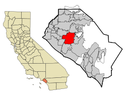
Orange County is a county located in the Los Angeles metropolitan area in Southern California, United States. As of the 2020 census, the population was 3,186,989, making it the third-most-populous county in California, the sixth-most-populous in the United States, and more populous than 19 American states and Washington, D.C. Although largely suburban, it is the second-most-densely-populated county in the state behind San Francisco County. The county's three most-populous cities are Anaheim, Santa Ana, and Irvine, each of which has a population exceeding 300,000. Santa Ana is also the county seat. Six cities in Orange County are on the Pacific coast: Seal Beach, Huntington Beach, Newport Beach, Laguna Beach, Dana Point, and San Clemente.

<span class="mw-page-title-main">Fountain Valley, California</span> City in California, United States

Fountain Valley is a suburban city in Orange County, California. The population was 57,047 at the 2020 census.

<span class="mw-page-title-main">Anaheim, California</span> City in the United States

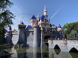
Anaheim is a city in northern Orange County, California, United States, part of the Greater Los Angeles area. As of the 2020 census, the city had a population of 346,824, making it the most populous city in Orange County, the tenth-most populous city in California, and the 55th-most populous city in the United States. The second largest city in Orange County in terms of land area, Anaheim is known for being the home of the Disneyland Resort, the Anaheim Convention Center, and two major league sports teams: the Los Angeles Angels of Major League Baseball (MLB) and the Anaheim Ducks of the National Hockey League (NHL).

<span class="mw-page-title-main">Los Angeles County, California</span> Most populous county in the United States and in California

Los Angeles County, officially the County of Los Angeles, and sometimes abbreviated as L.A. County, is the most populous county in the United States, with 9,861,224 residents estimated in 2022. Its population is greater than that of 40 individual U.S. states. Comprising 88 incorporated cities and many unincorporated areas within a total area of 4,083 square miles (10,570 km2), it is home to more than a quarter of Californians and is one of the most ethnically diverse U.S. counties. The county's seat, Los Angeles, is the second most populous city in the United States and the most populous city in California, with 3,822,238 residents estimated in 2022. It is also known for being the home of the American film and television industry, a distinction it has held since the early 20th century which has given the county global prominence.

<span class="mw-page-title-main">Greater Los Angeles</span> Metropolitan area centered around the city of Los Angeles in California, United States

Greater Los Angeles is the most populous metropolitan area in the U.S. state of California, encompassing five counties in Southern California extending from Ventura County in the west to San Bernardino County and Riverside County in the east, with Los Angeles County in the center, and Orange County to the southeast. The Los Angeles–Anaheim–Riverside combined statistical area (CSA) covers 33,954 square miles (87,940 km2), making it the largest metropolitan region in the United States by land area. The contiguous urban area is 2,281 square miles (5,910 km2), whereas the remainder mostly consists of mountain and desert areas. With a population of 18.4 million in 2024, it is the second-largest metropolitan area in the country, behind New York, as well as one of the largest megacities in the world.

<span class="mw-page-title-main">Pomona, California</span> City in California, United States

Pomona is a city in eastern Los Angeles County, California, United States. Pomona is located in the Pomona Valley, between the Inland Empire and the San Gabriel Valley. At the 2020 census, the city's population was 151,713. The main campus of California State Polytechnic University, Pomona, also known as Cal Poly Pomona, lies partially within Pomona's city limits, with the rest being located in the neighboring unincorporated community of Ramona.

<span class="mw-page-title-main">Buena Park, California</span> City in California, United States

Buena Park is a city in northern Orange County, California, United States. As of the 2020 census its population was 84,034. It is the location of several tourist attractions, including Knott's Berry Farm. It is about 12 miles (20 km) northwest of downtown Santa Ana, the county seat, and is within the Los Angeles metropolitan area.

<span class="mw-page-title-main">Costa Mesa, California</span> City in Orange County, California, United States

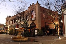
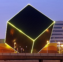
Costa Mesa is a city in Orange County, California, United States. Since its incorporation in 1953, the city has grown from a semi-rural farming community of 16,840 to an urban area including part of the South Coast Plaza–John Wayne Airport edge city, one of the region's largest commercial clusters, with an economy based on retail, commerce, and light manufacturing. The city is home to the two tallest skyscrapers in Orange County. The population was 111,918 at the 2020 census.

<span class="mw-page-title-main">Fullerton, California</span> City in California, United States

Fullerton is a city located in northern Orange County, California, United States. As of the 2020 census, the city had a total population of 143,617.

<span class="mw-page-title-main">Orange, California</span> City in California, United States

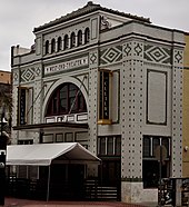
Orange is a city located in northern Orange County, California, United States. It is approximately 3 miles (4.8 km) north of the county seat, Santa Ana. Orange is unusual in this region because many of the homes in its Old Town District were built before 1920. While many other cities in the region demolished such houses in the 1960s, Orange decided to preserve them. The small city of Villa Park is surrounded by the city of Orange. The population of Orange was 139,911 as of 2020.

<span class="mw-page-title-main">Placentia, California</span> City in California, United States

Placentia is a city in northern Orange County, California, United States. Its population was 51,233 during the 2020 census, up from 46,488 in the 2000 census. This includes the community of Atwood, which is included in the city of Placentia, and is located in its southeastern quadrant. Primarily referred to as a bedroom community, Placentia is known for its quiet neighborhoods.

<span class="mw-page-title-main">Tustin, California</span> City in Orange County, California, US

Tustin is a city located in Orange County, California, United States, within the Los Angeles metropolitan area. In 2020, Tustin had a population of 80,276. The city does not include the unincorporated community of North Tustin.

<span class="mw-page-title-main">Yorba Linda, California</span> City in California, United States

Yorba Linda is a suburban city in northeastern Orange County, California, United States, approximately 37 miles (60 km) southeast of Downtown Los Angeles. It is part of the Los Angeles metropolitan area, and had a population of 68,336 at the 2020 census.

<span class="mw-page-title-main">Corona, California</span> City in California, United States

Corona is a city in northwestern Riverside County, California, United States. At the 2020 census, the city had a population of 157,136, up from 152,374 at the 2010 census. Corona is surrounded by Norco to the north and northeast, Yorba Linda to the northwest, Cleveland National Forest and the Santa Ana Mountains to the west, southwest, and south. Several unincorporated communities are along the rest of the city's borders. Downtown Corona is approximately 48 miles southeast of Downtown Los Angeles and 95 miles (153 km) north-northwest of San Diego.

<span class="mw-page-title-main">Chino, California</span> City in California, United States

Chino is a city in the western end of San Bernardino County, California, United States, with Los Angeles County to its west and Orange County to its south in the Southern California region.

<span class="mw-page-title-main">Chino Hills, California</span> City in California, United States

Chino Hills is a city located in the southwestern corner of San Bernardino County, California, United States. The city borders Los Angeles County on its northwest side, Orange County to its south and southwest, and Riverside County to its southeast.

<span class="mw-page-title-main">Ontario, California</span> City in California, United States

Ontario is a city in southwestern San Bernardino County in the U.S. state of California, 35 miles (56 km) east of downtown Los Angeles and 23 miles (37 km) west of downtown San Bernardino, the county seat. Located in the western part of the Inland Empire metropolitan area, it lies just east of Los Angeles County and is part of the Greater Los Angeles Area. As of the 2020 Census, the city had a population of 175,265.

<span class="mw-page-title-main">Pomona Valley</span> Valley in Los Angeles and San Bernardino counties in California

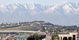
The Pomona Valley is located in the Greater Los Angeles Area between the San Gabriel Valley and San Bernardino Valley in Southern California. The valley is approximately 30 miles (48 km) east of downtown Los Angeles.

<span class="mw-page-title-main">Riverside County, California</span> County in California, United States

Riverside County is a county located in the southern portion of the U.S. state of California. As of the 2020 census, the population was 2,418,185, making it the fourth-most populous county in California and the 10th-most populous in the United States. The name was derived from the city of Riverside, which is the county seat.

<span class="mw-page-title-main">Jurupa Valley, California</span> City in California, United States

Jurupa Valley is a city in the northwest corner of Riverside County, California, United States. It was the location of one of the earliest non-native settlements in the county, Rancho Jurupa. The Rancho was initially an outpost of the Mission San Gabriel Arcángel, then a Mexican land grant in 1838. The name is derived from a Native American village that existed in the area prior to the arrival of Europeans.

References

  1. "City of Santa Ana Vitals & Statistics" (PDF). City of Santa Ana. Archived from the original (PDF) on March 4, 2016. Retrieved February 6, 2015.
  2. "California Cities by Incorporation Date". California Association of Local Agency Formation Commissions. Archived from the original (Word) on February 21, 2013. Retrieved August 25, 2014.
  3. "City Council Members". City of Santa Ana. Retrieved November 23, 2023.
  4. "2019 U.S. Gazetteer Files". United States Census Bureau. Retrieved July 1, 2020.
  5. 1 2 "Santa Ana". Geographic Names Information System . United States Geological Survey, United States Department of the Interior . Retrieved October 12, 2014.
  6. "Quick Facts: Santa Ana, CA". United States Census Bureau.
  7. "ZIP Code(tm) Lookup". United States Postal Service . Retrieved November 12, 2014.
  8. Nagourney, Adam; Medina, Jennifer (October 11, 2016). "This City Is 78% Latino, and the Face of a New California". The New York Times. ISSN   0362-4331 . Retrieved January 17, 2020.
  9. Brown, Sandy (2023). Hiking and Cycling the California Missions Trail. Cicerone Press. p. 255. ISBN   9781783629336.
  10. "A look at Santa Ana as it celebrates its 150th anniversary". Orange County Register. October 26, 2019. Retrieved December 4, 2022.
  11. Santa Ana River Main Stem and Santiago Creek. 1978. pp. 31–32.
  12. Catalysts to complexity : late Holocene societies of the California coast. Jon Erlandson, Terry L. Jones, Jeanne E. Arnold, Cotsen Institute of Archaeology at UCLA. Los Angeles: Cotsen Institute of Archaeology at UCLA. 2002. pp. 64, 66. ISBN   978-1-938770-67-8. OCLC   745176510.{{cite book}}: CS1 maint: others (link)
  13. "Emeryville's History". City of Emeryville. Retrieved October 1, 2021.
  14. Paul R. Spitzzeri (Fall 2007). "What a Difference a Decade Makes: Ethnic and Racial Demographic Change in Los Angeles County during the 1860s" (PDF). Branding Iron.
  15. U.S. Census Bureau. "Population of the United States in 1860: California" (PDF).
  16. 1 2 3 4 5 González, Erualdo R. (2017). Latino city : urban planning, politics, and the grassroots. Abingdon, Oxon. pp. 17–19. ISBN   978-1-317-59023-1. OCLC   971613305.{{cite book}}: CS1 maint: location missing publisher (link)
  17. Staff (May 12, 2015). "A look at the trains that built the O.C. coast". Los Angeles Times . Retrieved January 12, 2016.
  18. "Pacific Electric Santa Ana Line". erha.org.
  19. Featuring Historical Information of Santa Ana Archived March 6, 2013, at the Wayback Machine . Santa Ana History. Retrieved on September 6, 2013.
  20. 1 2 Galvin, Andrew (March 10, 2011). "Santa Ana neighborhood was African American hub". Orange County Register . Retrieved March 14, 2020.
  21. "Historic California Posts: Santa Ana Army Air Base". MilitaryMuseum.org. Retrieved September 6, 2013.
  22. Eng, Lily; Schwartz, Bob (February 26, 1991). "City's Latinos on the Grow : Majority: Santa Ana's Hispanics make up 65% of the population and have recorded solid gains, but some still say they are ignored by City Hall". Los Angeles Times . Retrieved March 19, 2016.
  23. Yost Theater | Soundcheck Archived July 14, 2012, at archive.today . Soundcheck.freedomblogging.com. Retrieved on September 6, 2013.
  24. Sarmiento, Carolina (2022). "Not diverse enough? Displacement, diversity discourse, and commercial gentrification in Santa Ana, California, a majority-Mexican city". Urban Studies. 59 (9): 1782–1799. doi:10.1177/00420980211020912. ISSN   0042-0980. S2CID   237806566.
  25. Masri, Shahir; LeBrón, Alana; Logue, Michael; Valencia, Enrique; Ruiz, Abel; Reyes, Abigail; Lawrence, Jean M.; Wu, Jun (November 15, 2020). "Social and spatial distribution of soil lead concentrations in the City of Santa Ana, California: Implications for health inequities". Science of the Total Environment. 743: 140764. Bibcode:2020ScTEn.743n0764M. doi:10.1016/j.scitotenv.2020.140764. ISSN   0048-9697. PMC   7492407 . PMID   32663692.
  26. "What will Santa Ana do to keep low-income and Latino residents safe from toxic lead?". Daily Pilot. October 21, 2021. Retrieved December 5, 2022.
  27. "US Gazetteer files: 2010, 2000, and 1990". United States Census Bureau. February 12, 2011. Retrieved April 23, 2011.
  28. "Media". The City of Santa Ana. Archived from the original on November 23, 2021. Retrieved November 22, 2021.
  29. Featuring Historical Information of Santa Ana Archived March 26, 2013, at the Wayback Machine . Santa Ana History. Retrieved on September 6, 2013.
  30. Metro East Mixed Use Overlay Zone Archived February 24, 2012, at the Wayback Machine . Santa-ana.org. Retrieved on September 6, 2013.
  31. "Banc of California to Purchase New Corporate Headquarters". Business Wire. October 2, 2015. Retrieved September 12, 2016.
  32. "What it Means to be California's Bank". LA Progressive. June 9, 2016. Retrieved September 12, 2016.
  33. "Climate: Santa Ana". climate-data.org. Retrieved August 23, 2016.
  34. 1 2 3 "U.S. Climate Normals Quick Access – Station: Santa Ana Fire STN, CA". National Oceanic and Atmospheric Administration. Retrieved May 25, 2023.
  35. 1 2 3 4 5 6 "NOWData – NOAA Online Weather Data". National Oceanic and Atmospheric Administration . Retrieved June 20, 2013.
  36. "Ancestry in Santa Ana, California (City)". statisticalatlas.com. Retrieved March 14, 2020.
  37. "State's Population Decline Slows While Housing Grows Per New State Demographic Report" (PDF). dof.ca.gov (Press release). Retrieved September 13, 2023.
  38. "Census of Population and Housing". Census.gov. Retrieved June 4, 2015.
  39. 1 2 "P2: Hispanic or Latino, and Not Hispanic or Latino by Race – 2010: DEC Redistricting Data (PL 94-171) – Santa Ana city, California". United States Census Bureau. Retrieved January 26, 2024.
  40. 1 2 "P2: Hispanic or Latino, and Not Hispanic or Latino by Race – 2020: DEC Redistricting Data (PL 94-171) – Santa Ana city, California". United States Census Bureau. Retrieved January 26, 2024.
  41. "2020 census".
  42. "P004: Hispanic or Latino, and Not Hispanic or Latino by Race – 2000: DEC Summary File 1 – Santa Ana city, California". United States Census Bureau. Retrieved January 26, 2024.
  43. "2010 Census Interactive Population Search: CA - Santa Ana city". U.S. Census Bureau. Archived from the original on July 15, 2014. Retrieved July 12, 2014.
  44. "Santa Ana (city) QuickFacts from the US Census Bureau". census.gov. Archived from the original on August 14, 2012. Retrieved April 30, 2012.
  45. "U.S. Census website". United States Census Bureau . Retrieved January 31, 2008.
  46. 1 2 "Facts and Figures, City of Santa Ana". Ci.santa-ana.ca.us. Archived from the original on November 20, 2017. Retrieved November 7, 2017.
  47. "Archived copy" (PDF). Archived from the original (PDF) on June 16, 2015. Retrieved July 22, 2015.{{cite web}}: CS1 maint: archived copy as title (link)
  48. "City of Santa Ana 2021 Annual Comprehensive Financial Report" (PDF). Ci.santa-ana.ca.us. Archived from the original (PDF) on January 7, 2022. Retrieved January 6, 2022.
  49. Parks and Recreation, City of Santa Ana Archived February 3, 2013, at the Wayback Machine . Ci.santa-ana.ca.us. Retrieved on September 6, 2013.
  50. "Santa Ana". July 18, 2017. Archived from the original on December 24, 2019. Retrieved December 26, 2019.
  51. 1 2 "Men's Soccer Championships". Sacdons.com. Retrieved November 7, 2017.
  52. "Baseball Championships". Sacdons.com. Retrieved November 7, 2017.
  53. "Home – Athletics – Mater Dei High School". Materdei.org. Archived from the original on June 6, 2017. Retrieved November 7, 2017.
  54. "Mayor and City Council". City of Santa Ana. Archived from the original on November 12, 2012. Retrieved March 7, 2012.
  55. "Political Districts within Counties for State Ballot Measures" (PDF). Archived from the original (PDF) on October 18, 2012.
  56. "sobre." Consulate-General of Mexico in Santa Ana . Retrieved on February 1, 2009.
  57. "Norte América Archived January 25, 2009, at the Wayback Machine ." Consulate-General of El Salvador in Miami . Retrieved on February 1, 2009.
  58. Archived March 5, 2012, at the Wayback Machine
  59. "The Demographic Statistical Atlas of the United States - Statistical Atlas".
  60. "Facilities / School Locator & Boundary Maps". www.sausd.us. Retrieved February 17, 2024.
  61. "School of Our Lady". schoolofourlady.org.
  62. "Orange County Archived July 1, 2015, at the Wayback Machine ." International School of Los Angeles. Retrieved on June 29, 2015.
  63. "Orange County Archived July 1, 2015, at the Wayback Machine ." International School of Los Angeles. Retrieved on December 6, 2017. "ORANGE COUNTY CAMPUS 1838 N. Shaffer Street Orange, CA 92865"
  64. "Santa Ana Police Department". City of Santa Ana. Archived from the original on December 6, 2012. Retrieved March 7, 2012.
  65. "Canine Unit". City of Santa Ana. Archived from the original on August 31, 2014. Retrieved March 7, 2012.
  66. "Honor Guard, Mounted Unit & SWAT". City of Santa Ana. Archived from the original on August 31, 2014. Retrieved March 7, 2012.
  67. "Airborne Law Enforcement Services". City of Santa Ana. Archived from the original on August 30, 2014. Retrieved March 7, 2012.
  68. Sewell, Abby (March 6, 2012). "A proud tradition extinguished". Los Angeles Times. section A, p. 1 and 8.