Weaverville, California

Last updated
Weaverville
Weaverville, April 2020-2121.jpg
Main Street in April 2020
Trinity County California Incorporated and Unincorporated areas Weaverville Highlighted.svg
Usa edcp location map.svg
Red pog.svg
Weaverville
Location in the United States
Coordinates: 40°44′12″N122°56′10″W / 40.73667°N 122.93611°W / 40.73667; -122.93611 Coordinates: 40°44′12″N122°56′10″W / 40.73667°N 122.93611°W / 40.73667; -122.93611
Country United States
State California
County Trinity
Area
[1]
  Total10.424 sq mi (26.999 km2)
  Land10.424 sq mi (26.999 km2)
  Water0 sq mi (0 km2)  0%
Elevation
[2]
2,051 ft (625 m)
Population
 (2020)
  Total3,667
  Density350/sq mi (140/km2)
Time zone UTC−8 (Pacific)
  Summer (DST) UTC−7 (PDT)
ZIP code
96093
Area code 530
FIPS code 06-83794
GNIS feature IDs 1652649, 2409537

Weaverville is a census-designated place and the county seat of Trinity County, California, United States. Its population is 3,667 as of the 2020 census, up from 3,600 from the 2010 census.

Contents

History

Founded in 1850, Weaverville is a historic California Gold Rush town. Located at the foot of the current Trinity Alps Wilderness Area, Weaverville was once home to approximately 2,000 Chinese gold miners and had its own Chinatown. Logging and tourism were the economic mainstays of Weaverville for many years. The regional economy has been in steady decline for many years, with only a small uplift brought about by the global real estate bubble. Since 1990, the unemployment rate in the county has ranged from 4.3% in September 2018 to 25.0% in January 1992. The county's unemployment rate in July 2019 was 5.1%. [3]

Geography and climate

Weaverville is located at 40°44′12″N122°56′10″W / 40.73667°N 122.93611°W / 40.73667; -122.93611 (40.736687, -122.936208). [4]

According to the United States Census Bureau, the CDP has a total area of 10.4 square miles (27 km2), all of it land.

Weaverville has a Mediterranean climate (Köppen Csa, bordering on Csb), though owing to its inland valley location the town is wetter and observes much larger diurnal temperature variations, creating colder mornings, than considered prototypical for the climate type. The National Weather Service has had a cooperative weather station in Weaverville since 1894. Based on those records, average January temperatures are a maximum of 47.2 °F (8.4 °C) and a minimum of 27.4 °F (−2.6 °C), while July temperatures average a maximum of 94.1 °F (34.5 °C) and a minimum of 49.1 °F (9.5 °C). There are an average of 77.3 afternoons with highs of 90 °F (32 °C) or higher, plus an average of 126.8 mornings with lows of 32 °F (0 °C) or lower, although only two afternoons every three years fail to rise above freezing, and only one morning every three years will fall to 0 °F (−18 °C) or below. The record high temperature was 116 °F (46.7 °C) on August 4, 1932, and the record low temperature was −10 °F (−23.3 °C) on December 9, 1972.

Average annual precipitation is 35.45 inches (900 mm), with an average of 83 days annually with measurable precipitation. The most precipitation in one month was 20.86 inches (530 mm) in December 2005, while the wettest "rain year" was from July 1982 to June 1983 with at least 65.82 inches (1,672 mm) (several days missing) and the driest from July 1990 to June 1991 with 19.02 inches (483 mm) [5] – although the 1976–77 "rain year" with many days in May missing had a recorded total of only 12.73 inches (323 mm). The most precipitation in 24 hours was 5.5 inches (140 mm) on January 4, 1982. Average annual snowfall is 8.7 inches (22 cm). The most snowfall in one month was 75.3 inches (191 cm) in January 1950. [6]

Climate data for Weaverville, California (1991–2020 normals, 1894–2020 extremes)
MonthJanFebMarAprMayJunJulAugSepOctNovDecYear
Record high °F (°C)75
(24)
82
(28)
90
(32)
94
(34)
106
(41)
113
(45)
113
(45)
116
(47)
111
(44)
104
(40)
89
(32)
85
(29)
116
(47)
Mean maximum °F (°C)61.0
(16.1)
69.2
(20.7)
77.4
(25.2)
84.8
(29.3)
93.5
(34.2)
101.0
(38.3)
105.3
(40.7)
104.4
(40.2)
100.6
(38.1)
91.0
(32.8)
72.4
(22.4)
59.1
(15.1)
106.8
(41.6)
Average high °F (°C)49.5
(9.7)
55.3
(12.9)
61.1
(16.2)
67.6
(19.8)
77.1
(25.1)
86.1
(30.1)
95.1
(35.1)
94.5
(34.7)
88.5
(31.4)
75.2
(24.0)
57.3
(14.1)
46.7
(8.2)
71.2
(21.8)
Daily mean °F (°C)40.3
(4.6)
43.3
(6.3)
47.2
(8.4)
51.8
(11.0)
59.4
(15.2)
66.3
(19.1)
73.7
(23.2)
72.3
(22.4)
66.2
(19.0)
55.8
(13.2)
45.4
(7.4)
38.6
(3.7)
55.0
(12.8)
Average low °F (°C)31.2
(−0.4)
31.2
(−0.4)
33.3
(0.7)
36.1
(2.3)
41.8
(5.4)
46.4
(8.0)
52.2
(11.2)
50.0
(10.0)
43.9
(6.6)
36.4
(2.4)
33.4
(0.8)
30.5
(−0.8)
38.9
(3.8)
Mean minimum °F (°C)20.3
(−6.5)
20.7
(−6.3)
23.1
(−4.9)
25.7
(−3.5)
31.3
(−0.4)
35.9
(2.2)
43.8
(6.6)
42.6
(5.9)
34.8
(1.6)
27.1
(−2.7)
21.3
(−5.9)
19.0
(−7.2)
14.9
(−9.5)
Record low °F (°C)−7
(−22)
0
(−18)
12
(−11)
16
(−9)
22
(−6)
28
(−2)
32
(0)
29
(−2)
23
(−5)
14
(−10)
4
(−16)
−10
(−23)
−10
(−23)
Average precipitation inches (mm)6.68
(170)
5.69
(145)
5.01
(127)
2.62
(67)
1.86
(47)
0.93
(24)
0.27
(6.9)
0.17
(4.3)
0.31
(7.9)
2.00
(51)
4.33
(110)
7.67
(195)
37.54
(954)
Average snowfall inches (cm)2.2
(5.6)
1.3
(3.3)
0.2
(0.51)
0.2
(0.51)
0.0
(0.0)
0.0
(0.0)
0.0
(0.0)
0.0
(0.0)
0.0
(0.0)
0.0
(0.0)
0.8
(2.0)
4.0
(10)
8.7
(22)
Average precipitation days (≥ 0.01 in)15.713.614.110.67.23.61.21.22.05.912.817.1105
Average snowy days (≥ 0.1 in)1.41.20.50.30.00.00.00.00.00.00.51.55.4
Source 1: NOAA [7]
Source 2: National Weather Service [8]

Demographics

One of many spiral staircases in Weaverville WEAVERVILLE, CALFORNIA SPIRAL STAIRCASES.jpg
One of many spiral staircases in Weaverville

Population

Historical population
CensusPop.Note
2010 3,600
2020 3,6671.9%
U.S. Decennial Census [9]
1790-1960 [10] 1900-1990 [11]
1990-2000 [12] 2010-2015 [13]

2010

At the 2010 census Weaverville had a population of 3,600. The population density was 345.4 inhabitants per square mile (133.4/km2). The racial makeup of Weaverville was 3,162 (87.8%) White, 11 (0.3%) African American, 152 (4.2%) Native American, 41 (1.1%) Asian, 1 (0.0%) Pacific Islander, 38 (1.1%) from other races, and 195 (5.4%) from two or more races. Hispanic or Latino of any race were 255 people (7.1%). [14]

The census reported that 3,473 people (96.5% of the population) lived in households, 61 (1.7%) lived in non-institutionalized group quarters, and 66 (1.8%) were institutionalized.

There were 1,513 households, 440 (29.1%) had children under the age of 18 living in them, 622 (41.1%) were married couples living together, 185 (12.2%) had a female householder with no husband present, 112 (7.4%) had a male householder with no wife present. There were 145 (9.6%) unmarried opposite-sex partnerships, and 12 (0.8%) same-sex married couples or partnerships. 473 households (31.3%) were one person and 196 (13.0%) had someone living alone who was 65 or older. The average household size was 2.30. There were 919 families (60.7% of households); the average family size was 2.80.

The age distribution was 842 people (23.4%) under the age of 18, 247 people (6.9%) aged 18 to 24, 734 people (20.4%) aged 25 to 44, 1,109 people (30.8%) aged 45 to 64, and 668 people (18.6%) who were 65 or older. The median age was 44.4 years. For every 100 females, there were 94.5 males. For every 100 females age 18 and over, there were 91.4 males.

There were 1,675 housing units at an average density of 160.7 per square mile, of the occupied units 908 (60.0%) were owner-occupied and 605 (40.0%) were rented. The homeowner vacancy rate was 2.8%; the rental vacancy rate was 6.8%. 2,089 people (58.0% of the population) lived in owner-occupied housing units and 1,384 people (38.4%) lived in rental housing units.

2000

At the 2000 census there were 3,554 people, 1,513 households, and 960 families in the CDP. The population density was 100.4 inhabitants per square mile (38.8/km2). There were 1,653 housing units at an average density of 46.7 per square mile (18.0/km2). The racial makeup of the CDP was 91.5% White, 0.3% African American, 2.9% Native American, 0.7% Asian, 0.1% Pacific Islander, 1.2% from other races, and 3.3% from two or more races. Hispanic or Latino of any race were 4.3%. [15]

Of the 1,513 households 27.9% had children under the age of 18 living with them, 47.1% were married couples living together, 12.4% had a female householder with no husband present, and 36.5% were non-families. 31.3% of households were one person and 13.8% were one person aged 65 or older. The average household size was 2.30 and the average family size was 2.85.

The age distribution was 24.2% under the age of 18, 6.4% from 18 to 24, 23.0% from 25 to 44, 28.0% from 45 to 64, and 18.4% 65 or older. The median age was 43 years. For every 100 females, there were 94.5 males. For every 100 females age 18 and over, there were 90.7 males.

The median household income was $30,319 and the median family income was $37,813. Males had a median income of $34,091 versus $24,722 for females. The per capita income for the CDP was $18,297. About 13.2% of families and 16.3% of the population were below the poverty line, including 23.6% of those under age 18 and 5.3% of those age 65 or over.

Transportation

Major highways

Government

In the California State Legislature, Weaverville is in the 2nd Senate District , represented by Democrat Mike McGuire, and in the 2nd Assembly District , represented by Democrat Jim Wood. [16]

In the United States House of Representatives, Weaverville is in California's 2nd congressional district , represented by Democrat Jared Huffman. [17]

Sites of interest

NameImageDate listedLocationDescription
Weaverville Joss House State Historic Park Added to California Historical markers in 1956Southwest corner of Main Street"The Temple of the Forest Beneath the Clouds"), a Taoist temple, was built in 1874 and is California's best-preserved example of a Gold Rush-era Chinese place of worship.
Racetrack-Airport-GolfCourse Historical Marker [18] Marker erected in 2007Located at current site of the Trinity County Golf Course.Historical Marker for the site of former racetrack and airport
Weaverville Historic DistrictAdded to NHRP 1971Located on both sides of Main Street11 acres (4.5 ha) consisting of 25 historical buildings

Related Research Articles

<span class="mw-page-title-main">Markleeville, California</span> Census-designated place in California, United States

Markleeville is a census-designated place (CDP) and the county seat of Alpine County, California, United States. The population was 191 at the 2020 census, down from 210 at the 2010 census.

<span class="mw-page-title-main">Taft, California</span> City in California, United States

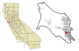
Taft is a city in the foothills at the extreme southwestern edge of the San Joaquin Valley, in Kern County, California. Taft is located 32 miles (51 km) west-southwest of Bakersfield, at an elevation of 955 feet (291 m). The population was 9,327 at the 2010 census. According to the United States Census Bureau, the city has a total area of 15.1 square miles (39.1 km2).

<span class="mw-page-title-main">Kentfield, California</span> Census-designated place in California, United States

Kentfield is a census-designated place (CDP) in Marin County, California, United States, just north of San Francisco. Kentfield is located 2 miles (3 km) southwest of downtown San Rafael, at an elevation of 115 feet. The population was 6,808 at the 2020 census. The ZIP codes are 94904 for street addresses, and 94914 for PO boxes, and are shared with the neighboring community of Greenbrae.

<span class="mw-page-title-main">Angwin, California</span> Census-designated place in California, United States

Angwin is a census-designated place (CDP) in Napa County, California, best known as the site of Pacific Union College. It is part of the northern San Francisco Bay Area. The population was 3,051 at the 2010 census. Its area code is 707. Its two zip codes are 94508 and 94576. It is in the Pacific time zone.

<span class="mw-page-title-main">Borrego Springs, California</span> Census-designated place in California, United States

Borrego Springs is a census-designated place (CDP) in San Diego County, California. The population was 3,429 at the 2010 census, up from 2,535 at the 2000 census, made up of both seasonal and year-round residents. Borrego Springs is surrounded by Anza-Borrego State Park, California's largest state park.

<span class="mw-page-title-main">Los Alamos, California</span> Place in California, United States

Los Alamos is a unincorporated community in Santa Barbara County, California, United States. Located in the Los Alamos Valley, the town of Los Alamos is considered to be a part of the Santa Ynez Valley community. Los Alamos is also connected to other cities Vandenberg SFB, Lompoc, Buellton, Solvang, and other Santa Barbara County cities. It is 140 miles northwest of Los Angeles and 281 miles (452 km) south of San Francisco. The population was 1,890 at the 2010 census, up from 1,372 at the 2000 census. For statistical purposes, the United States Census Bureau has defined Los Alamos as a census-designated place (CDP).

<span class="mw-page-title-main">Ben Lomond, California</span> Census-designated place in Santa Cruz County, California, United States

Ben Lomond is a census-designated place (CDP) in Santa Cruz County, California, United States, and also the name of the mountain to the west. The CDP includes the communities of Glen Arbor and Brackney. The population was 6,337 at the 2020 census.

<span class="mw-page-title-main">Interlaken, California</span> Census-designated place in California, United States

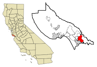
Interlaken is a census-designated place (CDP) in Santa Cruz County, California, United States. The population was 7,368 at the 2020 census.

<span class="mw-page-title-main">Bodega Bay, California</span> Census-designated place in California, United States

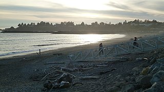
Bodega Bay is a village and census-designated place (CDP) in Sonoma County, California, United States. The population was 912 at the 2020 census. The town, located along State Route 1, is on the eastern side of Bodega Harbor, an inlet of Bodega Bay on the Pacific coast.

<span class="mw-page-title-main">Occidental, California</span> Census-designated place in California, United States

Occidental is a census-designated place (CDP) in Sonoma County, California, United States. The population was 1,115 at the 2010 census, down from 1,272 at the 2000 census.

<span class="mw-page-title-main">Groveland-Big Oak Flat, California</span> Unincorporated community in California, United States

Groveland-Big Oak Flat is an unincorporated community and former census-designated place (CDP) in Tuolumne County, California, United States. The population was 3,388 at the 2000 census. This CDP included the communities of Groveland, Big Oak Flat and Pine Mountain Lake (PML).

<span class="mw-page-title-main">Jamestown, California</span> Census-designated place in California, United States

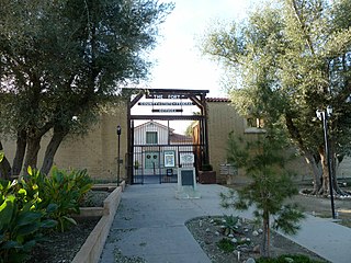
Jamestown is a census-designated place (CDP) in Tuolumne County, California, United States. The population was 3,433 at the 2010 census, up from 3,017 at the 2000 census. Formerly a California Gold Rush town, Jamestown is now a California Historical Landmark. Jamestown is the home of Railtown 1897 State Historic Park and the Sierra Railway, which operates steam passenger trains.

<span class="mw-page-title-main">Meiners Oaks, California</span> Unincorporated community in California, United States

Meiners Oaks is an unincorporated community lying west of the city of Ojai in Ventura County, California, United States. The population was 3,571 at the 2010 census. For statistical purposes, the United States Census Bureau has defined Meiners Oaks as a census-designated place (CDP).

<span class="mw-page-title-main">North Valley, New Mexico</span> Census-designated place in New Mexico, United States

North Valley is a census-designated place (CDP) in Bernalillo County, New Mexico, United States. As of the 2010 Census, the CDP population was 11,333. It is part of the Albuquerque Metropolitan Statistical Area.

<span class="mw-page-title-main">Harbor, Oregon</span> Unincorporated community in the state of Oregon, United States

Harbor is an unincorporated community in Curry County, Oregon, United States. It is located across the Chetco River from the city of Brookings. For statistical purposes, the United States Census Bureau has defined Harbor as a census-designated place (CDP). The census definition of the area may not precisely correspond to local understanding of the area with the same name. The population of the CDP was 2,391 at the 2010 census.

<span class="mw-page-title-main">Hebbronville, Texas</span> County seat and Census-designated place in Texas, United States

Hebbronville is a census-designated place (CDP) in and the county seat of Jim Hogg County, Texas, United States. The population was 4,558 at the 2010 census. In 1918, Helen Sewel Harbison became the first woman in Texas to cast a ballot, two years before the implementation of the Nineteenth Amendment to the United States Constitution.

<span class="mw-page-title-main">Desert Aire, Washington</span> Census-designated place in Washington, United States

Desert Aire is a census-designated place (CDP) in Grant County, Washington, United States. Desert Aire's elevation is 560 ft (170 m). The population was 1,626 at the 2010 census, up from 1,124 at the 2000 census.

<span class="mw-page-title-main">Bridgeport, California</span> Census designated place and county seat in California, United States

Bridgeport is an unincorporated community and census-designated place (CDP) in Mono County, California, United States. It is the Mono county seat. The population was 553 at the 2020 census.

<span class="mw-page-title-main">Thermal, California</span> Resort city in Riverside County, southern California, United States

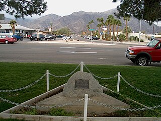
Thermal is an unincorporated community within the Coachella Valley in Riverside County, California, United States, located approximately 25 miles (40 km) southeast of Palm Springs and about 9.5 miles (15.3 km) north of the Salton Sea. The community's elevation is 138 feet (42 m) below mean sea level. It is served by area codes 760 and 442 and is in ZIP Code 92274. The population was 2,865 at the 2010 census. For statistical purposes, the United States Census Bureau has defined Thermal a census-designated place (CDP), which does not precisely correspond to the historical community.

<span class="mw-page-title-main">Whitewater, California</span> Census-designated place in California, United States

Whitewater is a census-designated place in Riverside County, California. It is directly off Interstate 10 halfway between North Palm Springs and Cabazon on the way from Palm Springs to Los Angeles. It is known as the site of the San Gorgonio Pass Wind Farm. The ZIP Code is 92282, and the community is inside area code 760. The population was 859 at the 2010 census. The elevation is 1,575 feet (480 m).

References

  1. "2010 Census U.S. Gazetteer Files – Places – California". United States Census Bureau.
  2. "Weaverville". Geographic Names Information System . United States Geological Survey, United States Department of the Interior . Retrieved January 18, 2015.
  3. "Trinity County, CA Unemployment | Homefacts".
  4. "US Gazetteer files: 2010, 2000, and 1990". United States Census Bureau. 2011-02-12. Retrieved 2011-04-23.
  5. National Weather Service, Eureka, CA; NOW Data: NOW Online
  6. "Weaverville, California (049490): Period of Record Monthly Climate Summary" . Retrieved 4 December 2016.
  7. "U.S. Climate Normals Quick Access – Station: Weaverville, CA". National Oceanic and Atmospheric Administration. Retrieved May 6, 2023.
  8. "NOAA Online Weather Data – NWS Eureka". National Weather Service. Retrieved May 6, 2023.
  9. "U.S. Decennial Census". United States Census Bureau. Retrieved May 31, 2014.
  10. "Historical Census Browser". University of Virginia Library. Retrieved May 31, 2014.
  11. "Population of Counties by Decennial Census: 1900 to 1990". United States Census Bureau. Retrieved May 31, 2014.
  12. "Census 2000 PHC-T-4. Ranking Tables for Counties: 1990 and 2000" (PDF). United States Census Bureau. Retrieved May 31, 2014.
  13. "State & County QuickFacts". United States Census Bureau. Archived from the original on June 6, 2011. Retrieved April 6, 2016.
  14. "2010 Census Interactive Population Search: CA - Weaverville CDP". U.S. Census Bureau. Archived from the original on July 15, 2014. Retrieved July 12, 2014.
  15. "U.S. Census website". United States Census Bureau . Retrieved 2008-01-31.
  16. "Statewide Database". UC Regents. Archived from the original on February 1, 2015. Retrieved December 6, 2014.
  17. "California's 2nd Congressional District - Representatives & District Map". Civic Impulse, LLC. Retrieved March 1, 2013.
  18. "Race Track – Airport – Golf Course Historical Marker". hmdb.org. Retrieved 2021-10-10.{{cite web}}: CS1 maint: url-status (link)
  19. "Hollywood Holds A World Premier In Mining Town". The Christian Science Monitor. Feb 5, 1938. p. 3.
  20. Ballad of Weaverville - Mary McCaslin, archived from the original on 2021-12-11, retrieved 2020-01-15
  21. "Weaverville- Road Trip with Huell Howser (154) – Huell Howser Archives at Chapman University".