Rossmoor, California

Last updated

Rossmoor, California
Orange County California Incorporated and Unincorporated areas Rossmoor Highlighted.svg
Location in Orange County and the state of California
Coordinates: 33°47′20″N118°4′47″W / 33.78889°N 118.07972°W / 33.78889; -118.07972
Country Flag of the United States.svg  United States
State Flag of California.svg  California
County Orange
Area
[1]
  Total1.538 sq mi (3.983 km2)
  Land1.538 sq mi (3.983 km2)
  Water0 sq mi (0 km2)  0%
Elevation
[2]
13 ft (4 m)
Population
 (2010)
  Total10,244
  Density6,700/sq mi (2,600/km2)
Time zone UTC-8 (PST)
  Summer (DST) UTC-7 (PDT)
ZIP code
90720
Area code 562
FIPS code 06-63050
GNIS feature ID 1661336

Rossmoor is a planned census-designated place located in Orange County, California. As of the 2020 census, the CDP had a total population of 10,625 up from the 2010 census population of 10,244. The gated Leisure World retirement community in the city of Seal Beach is to the south of Rossmoor, Los Alamitos is to the east and north, and Long Beach is to the west (on the other side of the San Gabriel River, the 605 freeway and the border with Los Angeles County). The community of Rossmoor has two shopping centers within its boundaries, but only one—the Rossmoor Village Square, is now within the political boundaries of Rossmoor. A larger shopping center, the Rossmoor Business Center, was annexed, despite many protests, by the City of Seal Beach in 1967. The Center has been remodeled several times and was renamed the Shops at Rossmoor in the early 2000s.

Contents

History

The Rossmoor community was developed from 1955 through 1961 by Ross W. Cortese, who had earlier developed the architecturally-significant Lakewood Rancho Estates in Long Beach (1953) and the Frematic Homes (1954) in Anaheim, just north and west of Disneyland. Cortese filed his first subdivision map for Rossmoor on October 20, 1956, and filed his thirteenth and final map on March 21, 1960. [3] Cortese's original partners in securing the first large parcels of land that would become Rossmoor included California governor Goodwin Knight and Judge Alfred Gittelson, who had also partnered with him in the Lakewood Rancho Estates and the Frematic homes. (It was Gittelson who later agreed to annex his Rossmoor Shopping Center property to Seal Beach in the late 1960s.) After Rossmoor, Cortese would construct the first of his very successful Leisure World gated retirement communities in that part of Seal Beach which is immediately south of Rossmoor. The Rossmoor community is easy to recognize because of its red brick "signature wall" that borders the entire unincorporated community. It is a signature of the Rossmoor community that differentiates it from neighboring cities Los Alamitos and Seal Beach.

There are 3,430 single family homes, 1 apartment complex (Accent Apartment Homes, originally Rossmoor Manor on Wallingsford Road), and 1 town house complex (Rossmoor Town Houses with addresses at 12100 Montecito Road or 3342 Bradbury Road) within Rossmoor.

Annexation

According to a June 2006 consultant's report to the Rossmoor Planning Committee, the most cost effective solution for Rossmoor would be to be annexed by the city of Seal Beach. [4]

Although it is not part of the city of Los Alamitos, it is served under the Los Alamitos "sphere of influence" and was proposed to be annexed to the city by 2007 after the Local Agency Formation Commission reviews the proposal. [5]

Another proposal would combine Rossmoor with adjacent Seal Beach and Los Alamitos to form one city. [6]

Rossmoor is served by the Rossmoor/Los Alamitos Area Sewer District. The mainly residential area is also served by the Rossmoor Community Services District (CSD), which serves the community as an independent functionary does. The CSD provides services related to public recreation facilities and park development for Rush Park, Rossmoor Park, two mini parks and the Montecito Center. The CSD also administers street lighting, road rights-of-way services, and manages the street sweeping contract. [7] However, the Rossmoor CSD cannot make decisions about the future of the community, which is all delegated to the County of Orange's Unincorporated Islands Program and the Orange County Board of Supervisors.

At the May 22, 2008 meeting, OC LAFCO recommended that the Rossmoor Incorporation Plan go to a vote of the community. A vote by residents on the issue of incorporation was held on November 4, 2008. The proposition for cityhood was resoundingly defeated by a vote of 72% to 28% indicating that the majority of residents desire not be incorporated as a city. Residents also voted down three separate utility tax proposals by a wide margin. [8]

On February 19, 2021, Assembly Member Nguyen introduced AB-1246 Community services districts which would have made many "latent powers" available the Rossmoor Community Services District (Rossmoor CSD). The bill died at the desk in February 2022 never being sent to committee.

Geography

Rossmoor is east of where Coyote Creek meets the San Gabriel River, and northeast of the junction of Interstate 405, Interstate 605 and California State Route 22 Junction of I-405 and I-605 Near Coyote Creek, Rossmoor, California (6013274625).jpg
Rossmoor is east of where Coyote Creek meets the San Gabriel River, and northeast of the junction of Interstate 405, Interstate 605 and California State Route 22

Rossmoor is located at 33°47'20" North, 118°4'47" West (33.788917, -118.079721). [9] It borders the cities of Los Alamitos and Seal Beach. [10]

According to the United States Census Bureau, the CDP has a total area of 1.54 square miles (4.0 km2), all of it land.

Climate

According to the Köppen Climate Classification system, Rossmoor has a semi-arid climate (abbreviated BSh) with Mediterranean characteristics.

Demographics

Historical population
CensusPop.Note
1970 12,922
1980 10,457−19.1%
1990 9,893−5.4%
2000 10,2984.1%
2010 10,244−0.5%
2020 10,6253.7%
source: [11]

2010

At the 2010 census Rossmoor had a population of 10,244. The population density was 6,660.6 inhabitants per square mile (2,571.7/km2). The racial makeup of Rossmoor was 8,691 (84.8%) White (76.6% Non-Hispanic White), [12] 84 (0.8%) African American, 36 (0.4%) Native American, 838 (8.2%) Asian, 29 (0.3%) Pacific Islander, 168 (1.6%) from other races, and 398 (3.9%) from two or more races. Hispanic or Latino of any race were 1,174 persons (11.5%). [13]

The whole population lived in households, no one lived in non-institutionalized group quarters and no one was institutionalized.

There were 3,631 households, 1,382 (38.1%) had children under the age of 18 living in them, 2,456 (67.6%) were opposite-sex married couples living together, 326 (9.0%) had a female householder with no husband present, 138 (3.8%) had a male householder with no wife present. There were 90 (2.5%) unmarried opposite-sex partnerships, and 20 (0.6%) same-sex married couples or partnerships. 596 households (16.4%) were one person and 390 (10.7%) had someone living alone who was 65 or older. The average household size was 2.83. There were 2,920 families (80.4% of households); the average family size was 3.17.

The age distribution was 2,550 people (24.9%) under the age of 18, 738 people (7.2%) aged 18 to 24, 1,742 people (17.0%) aged 25 to 44, 3,444 people (33.6%) aged 45 to 64, and 1,770 people (17.3%) who were 65 or older. The median age was 45.5 years. For every 100 females, there were 92.4 males. For every 100 females age 18 and over, there were 90.0 males.

There were 3,710 housing units at an average density of 2,412.3 per square mile, of the occupied units 3,180 (87.6%) were owner-occupied and 451 (12.4%) were rented. The homeowner vacancy rate was 0.4%; the rental vacancy rate was 3.6%. 8,998 people (87.8% of the population) lived in owner-occupied housing units and 1,246 people (12.2%) lived in rental housing units.

According to the 2010 United States Census, Rossmoor had a median household income of $208,807, with 3.3% of the population living below the federal poverty line. [12]

2000

At the 2000 census there were 10,298 people in 3,763 households, including 2,975 families, in the CDP. The population density was 6,583.8 inhabitants per square mile (2,542.0/km2). There were 3,763 housing units at an average density of 2,404.5 per square mile (928.4/km2). The racial makeup of the CDP was 88.88% White, 0.78% African American, 0.34% Native American, 5.72% Asian, 0.10% Pacific Islander, 1.36% from other races, and 2.83% from two or more races. 6.7% of the population were Hispanic or Latino of any race. [14] Of the 3,763 households 37.4% had children under the age of 18 living with them, 68.9% were married couples living together, 8.2% had a female householder with no husband present, and 19.9% were non-families. 16.6% of households were one person and 10.6% were one person aged 65 or older. The average household size was 2.77 and the average family size was 3.12.

The age distribution was 26.7% under the age of 18, 5.3% from 18 to 24, 23.4% from 25 to 44, 26.1% from 45 to 64, and 18.5% 65 or older. The median age was 42 years. For every 100 females, there were 94.2 males. For every 100 females age 18 and over, there were 89.6 males.

The median household income was $86,457 and the median family income was $93,500. Males had a median income of $71,875 versus $46,913 for females. The per capita income for the CDP was $38,642. 2.0% of the population and 1.3% of families were below the poverty line. 2.5% of those under the age of 18 and 1.3% of those 65 and older were living below the poverty line.

Government

Politics

As of the 2020 redistricting, Rossmoor is in the 1st Supervisorial District in Orange County, represented by Republican Andrew Do. Because Rossmoor is an unincorporated area within Orange County, the Supervisor is the key local elected official.

In the state legislature Rossmoor is located in the 36th Senate District , represented by Republican Janet Nguyen, and in the 70th Assembly District , represented by Republican Tri Ta. [15]

Federally, Rossmoor is located in California's 45th congressional district, which is represented by Republican Michelle Steel. [16]

Education

The Los Alamitos Unified School District serves Rossmoor. [17] Four of the six elementary schools of the district, Rossmoor, Weaver, Lee, and Hopkinson, are located within the boundaries of Rossmoor.

Notable people

Related Research Articles

<span class="mw-page-title-main">Discovery Bay, California</span> Census-designated place in California, United States

Discovery Bay is a census-designated place (CDP) in eastern Contra Costa County, California in the United States, about 60 miles (97 km) from San Francisco. It is located in the San Francisco Bay Area. As of 2020, its population was 15,358, a 15% percent gain from 13,352 at the 2010 census.

<span class="mw-page-title-main">El Dorado Hills, California</span> Census-designated place in California, United States

El Dorado Hills is an unincorporated town and census-designated place in El Dorado County, California. Located in the Greater Sacramento region of Northern California, it had a population of 50,547 at the 2020 census, up from 42,108 at the 2010 census.

<span class="mw-page-title-main">Salton City, California</span> Census designated place in California, United States

Salton City is a census-designated place (CDP) in Imperial County, California. It is the largest Imperial County development on the Salton Sea coast. It is part of the El Centro, California Metropolitan Statistical Area. The population was 3,763 at the 2010 census, up from 978 in 2000. The reported population for 2020 was 5,155.

<span class="mw-page-title-main">Alondra Park, California</span> Census designated place in California, United States

Alondra Park, also known as El Camino Village, is a census designated place (CDP) in Los Angeles County, California, United States. It is the unincorporated area north of Alondra Community Regional Park and El Camino College. It is east of Lawndale, south of Hawthorne, west of Gardena, and north of Torrance. Manhattan Beach Boulevard and Crenshaw Boulevard are the two major cross streets in the area. The population was 8,569 at the 2020 census, down from 8,592 at the 2010 census. There is an official Alondra Park Post Office of the U.S. Postal Service in nearby Gardena, California. Urbanized cement-lined Dominguez Creek bisects a portion of Alondra Park.

<span class="mw-page-title-main">Avocado Heights, California</span> Census-designated place in California, United States

Avocado Heights is an unincorporated census-designated place (CDP) in the San Gabriel Valley of Los Angeles County, California, United States. It is almost entirely surrounded by the City of Industry with only a small strip of unincorporated Los Angeles County separating it from South El Monte. It is in close proximity to both the Pomona (SR-60) and San Gabriel (I-605) freeways. To the west is the San Gabriel River and the California Country Club. Avocado Heights is approximately 15 miles (24 km) from the downtown Los Angeles Civic Center. The population was 15,411 at the 2010 census, up from 15,148 at the 2000 census.

<span class="mw-page-title-main">East Rancho Dominguez, California</span> Unincorporated community in California, United States

East Rancho Dominguez, also known as East Compton, is an unincorporated community and census-designated place (CDP) located in southern Los Angeles County, California. The population was 15,135 at the 2010 census, up from 9,286 at the 2000 census. East Rancho Dominguez is an accepted city name according to the USPS, and shares the 90221 ZIP Code with Compton.

<span class="mw-page-title-main">East Whittier, California</span> Unincorporated community in California, United States

East Whittier is an unincorporated community in Los Angeles County, California, United States. The population was 9,757 at the 2010 census, up from 9,538 at the 2000 census. For statistical purposes, the United States Census Bureau has defined this community as a census-designated place (CDP). The name was changed from East La Mirada in 2012, likely due to its precise location in relation to the city of Whittier. The previous delineation of East Whittier CDP occurred during the 1960 census, when the area recorded a population of 19,884.

<span class="mw-page-title-main">West Rancho Dominguez, California</span> Unincorporated community in California, United States

West Rancho Dominguez, formerly known as West Compton, is an unincorporated census-designated place (CDP) located in southern Los Angeles County, California. Per the 2020 census, the population was 24,347. The community lies to the west of the city of Compton. The ZIP Codes encompassing the CDP area are 90220 & 90248.

<span class="mw-page-title-main">West Whittier-Los Nietos, California</span> Census-designated place in California, United States

West Whittier-Los Nietos is a census-designated place (CDP) in Los Angeles County, California, near the San Gabriel River and the San Gabriel River (I-605) Freeway. The population was 25,540 at the 2010 census, up from 25,129 at the 2000 census. The census area consists of separate unincorporated communities of Los Nietos and West Whittier.

<span class="mw-page-title-main">Coto de Caza, California</span> Census-designated place in California, United States

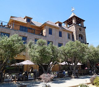
Coto de Caza is a census-designated place (CDP) and guard-gated private community in Orange County, California, United States. The population was 14,710 at the 2020 census.

<span class="mw-page-title-main">Los Alamitos, California</span> City in California, United States

Los Alamitos is a city in Orange County, California. The city was incorporated in March 1960. The population was 11,780 at the 2020 census, up from 11,449 at the 2010 census. The adjacent unincorporated community of Rossmoor uses the same 90720 ZIP code in its mailing address, but is not part of the city. The Los Alamitos Race Course is named for the city, but lies in the neighboring city of Cypress.

<span class="mw-page-title-main">Newport Coast, Newport Beach</span> Community of Newport Beach in California, United States

Newport Coast is a community south of the main body of the city of Newport Beach, California. It was a separate census-designated place in Orange County, California, United States, until 2001, when it was annexed into Newport Beach. Newport Beach, California's estimated population is 86,160 according to the most recent United States census estimates. Newport Beach, California is the 96th largest city in California based on official 2017 estimates from the US Census Bureau.

<span class="mw-page-title-main">Seal Beach, California</span> City in California, United States

Seal Beach is a coastal city in Orange County, California, United States. As of the 2020 census, the population was 25,242, up from 24,168 at the 2010 census.

<span class="mw-page-title-main">North Tustin, California</span> Place in California, United States

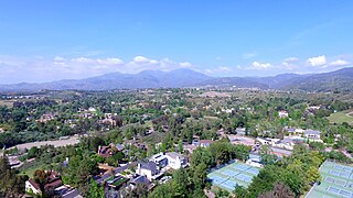
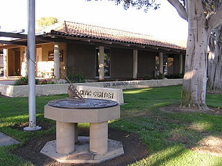
North Tustin is an unincorporated community in Orange County, California. The population was 24,917 at the 2010 Census, up from 24,044 in 2000. For statistical purposes, the United States Census Bureau has defined North Tustin as a census-designated place (CDP). It is both the largest CDP and largest unincorporated community in Orange County. The CDP's name was changed from Tustin Foothills in 2005. Located outside the city limits of Tustin, North Tustin has 92705 and 92780 ZIP Codes.

<span class="mw-page-title-main">Lexington Hills, California</span> Census-designated place in California, United States

Lexington Hills is a census-designated place and an unincorporated area in Santa Clara County, California, United States. The population was 2,492 at the 2020 census. The area is located in the Santa Cruz Mountains, about five miles south of Los Gatos and about 14 miles (23 km) north of Santa Cruz. Lexington Hills is the name assigned by the United States Census Bureau to the area, which actually comprises several small communities, including Redwood Estates, Holy City, Chemeketa Park, and Aldercroft Heights.

<span class="mw-page-title-main">Saylorville, Iowa</span> CDP in Iowa, United States

Saylorville is a census-designated place (CDP) in Polk County, Iowa, United States. The population was 3,301 at the 2010 census. It is part of the Des Moines–West Des Moines Metropolitan Statistical Area. The Saydel Community School District is located in this area, as is the unincorporated community of Marquisville.

<span class="mw-page-title-main">Leisure World, Maryland</span> Census-designated place in Maryland, United States

Leisure World is a census-designated place and unincorporated area in Montgomery County, Maryland, United States. It is an age-restricted, gated development primarily inhabited by retirees. As of the 2020 census it had a population of 9,215. Leisure World was known as the Rossmoor census-designated place for the 2000 census.

<span class="mw-page-title-main">Rossmoor, New Jersey</span> Populated place in Middlesex County, New Jersey, US

Rossmoor is an unincorporated community and census-designated place (CDP) located within Monroe Township in Middlesex County, in the U.S. state of New Jersey. As of the 2010 United States Census, the CDP's population was 2,666.

<span class="mw-page-title-main">Sunset Beach, California</span> Neighborhood of Huntington Beach in Orange, California, United States

Sunset Beach is a Huntington Beach beachfront community in Orange County, California. It was established on September 8, 1904 and developed as a result of the 1920 discovery of oil in the Huntington Beach Oil Field. The census-designated place of Sunset Beach, and its population of 971 as of the 2010 census, was annexed by Huntington Beach in 2011. The elevation is 5.3 feet (1.6 m) above sea level and the community is stretched out along Pacific Coast Highway bracketed by the ocean and Huntington Harbour.

Leisure World Seal Beach is an active-seniors’ retirement community opened in 1962 that introduced many innovations characterizing later senior property developments. When built, it was the nation's first mass-marketed housing project, first gated senior community, first all-electric community, and the first to have a health insurance plan and access to an on-site medical center included in its residents’ monthly payments. At its opening, it was the world's largest housing development for seniors, the United States’ largest cooperative housing development, and the prototype for six other Leisure World communities across the United States built by the Rossmoor Corp, co-founded by developers Ross W. Cortese and his wife, Alona Marlowe Cortese. It is located in Seal Beach, which fronts the Pacific Ocean in Orange County, California. Leisure World houses approximately 9,600 residents in 6,608 one- and two-bedroom apartments and condominiums.

References

  1. "2010 Census U.S. Gazetteer Files – Places – California". United States Census Bureau.
  2. "Rossmoor". Geographic Names Information System . United States Geological Survey, United States Department of the Interior . Retrieved November 20, 2014.
  3. Friis, Leo J. (1965). Orange County Through Four Centuries. Santa Ana: Pioneer Press. p. 175.
  4. "Article: News - Report analyzes cost of Rossmoor's future". www.ocregister.com. Archived from the original on June 29, 2006. Retrieved January 17, 2022.
  5. "Orange County Local Agency Formation Commission". oclafco.ca.gov. Archived from the original on July 16, 2001. Retrieved January 17, 2022.
  6. "News: New O.C. 'supercity' proposed - OCRegister.com". www.ocregister.com. Archived from the original on September 27, 2007. Retrieved January 17, 2022.
  7. "History of Rossmoor". rossmoor-csd.org. Retrieved October 20, 2016.
  8. "General Election". Archived from the original on December 2, 2008. Retrieved November 12, 2008.
  9. "US Gazetteer files: 2010, 2000, and 1990". United States Census Bureau. February 12, 2011. Retrieved April 23, 2011.
  10. "City Boundaries". Orange County GIS. Retrieved January 24, 2021.
  11. "Census of Population and Housing (1790-2000)". U.S. Census Bureau . Retrieved July 17, 2010.
  12. 1 2 "Rossmoor CDP, California". U.S. Census Bureau. Retrieved May 22, 2015.
  13. "2010 Census Interactive Population Search: CA - Rossmoor CDP". U.S. Census Bureau. Archived from the original on July 15, 2014. Retrieved July 12, 2014.
  14. "U.S. Census website". United States Census Bureau . Retrieved January 31, 2008.
  15. "California Districts". UC Regents. Retrieved January 9, 2023.
  16. "California's 45th Congressional District - Representatives & District Map". Civic Impulse, LLC.
  17. "District Attendance Boundaries Archived 2012-03-21 at the Wayback Machine ." Los Alamitos Unified School District. Retrieved on September 28, 2012.