West Athens, California

Last updated

West Athens, California
Los Angeles Southwest College (view from south at 700 ft).jpg
LA County Incorporated Areas West Athens highlighted.svg
Location of West Athens in Los Angeles County, California
Usa edcp location map.svg
Red pog.svg
West Athens, California
Location in the United States
Coordinates: 33°55′21″N118°18′4″W / 33.92250°N 118.30111°W / 33.92250; -118.30111
Country Flag of the United States.svg United States
State Flag of California.svg  California
County Flag of Los Angeles County, California.svg Los Angeles
Area
[1]
  Total1.336 sq mi (3.461 km2)
  Land1.336 sq mi (3.461 km2)
  Water0 sq mi (0 km2)  0%
Elevation
190 ft (58 m)
Population
 (2020)
  Total9,393
  Density7,000/sq mi (2,700/km2)
Time zone UTC-8 (PST)
  Summer (DST) UTC-7 (PDT)
ZIP code
90044, 90047
Area code 323/310
FIPS code 06-84116
GNIS feature ID1867067

West Athens is a census-designated place (CDP) in Los Angeles County, California. The population was 9,393 at the 2020 census. [2] It is an unincorporated community within the 2nd Supervisorial District of Los Angeles County. West Athens is served by the Los Angeles County Sheriff's Department, operating out of the South Los Angeles Station. The approximate boundaries for West Athens are: 87th Street to the north, Vermont Avenue to the east, El Segundo Boulevard to the south, and approximately Western Avenue to Van Ness Avenue to the west. West Athens is predominantly residential, with commercial uses along its main corridors. Los Angeles Southwest Community College lies within the West Athens neighborhood and city limits.

Contents

Geography

West Athens is located at 33°55′21″N118°18′4″W / 33.92250°N 118.30111°W / 33.92250; -118.30111 (33.922414, -118.301156). [3]

According to the United States Census Bureau, the CDP has a total area of 1.3 square miles (3.4 km2), all land. It borders Gardena to the south, Hawthorne to the west, Inglewood to the northwest, Westmont to the north, and the city of Los Angeles to the east.

Demographics

Historical population
CensusPop.Note
1970 13,286
1980 8,531−35.8%
1990 8,8593.8%
2000 9,1012.7%
2010 8,729−4.1%
2020 9,3937.6%
U.S. Decennial Census [4]
2010 [5] 2020 [6]

2020 census

West Athens CDP, California – Racial and ethnic composition
Note: the US Census treats Hispanic/Latino as an ethnic category. This table excludes Latinos from the racial categories and assigns them to a separate category. Hispanics/Latinos may be of any race.
Race / Ethnicity (NH = Non-Hispanic)Pop 2010 [5] Pop 2020 [6] % 2010% 2020
White alone (NH)1161441.33%1.53%
Black or African American alone (NH)4,4924,47351.46%47.62%
Native American or Alaska Native alone (NH)8240.09%0.26%
Asian alone (NH)1041871.19%1.99%
Pacific Islander alone (NH)6280.07%0.30%
Some Other Race alone (NH)53820.61%0.87%
Mixed Race or Multi-Racial (NH)1072341.23%2.49%
Hispanic or Latino (any race)3,8434,22144.03%44.94%
Total8,7299,393100.00%100.00%

Per the 2020 Census, the population was 9,393. [2]

2010 Census

At the 2010 census West Athens had a population of 8,729. The population density was 6,531.5 inhabitants per square mile (2,521.8/km2). The racial makeup of West Athens was 1,584 (18.1%) White (1.3% Non-Hispanic White), [7] 4,578 (52.4%) African American, 31 (0.4%) Native American, 111 (1.3%) Asian, 10 (0.1%) Pacific Islander, 2,127 (24.4%) from other races, and 288 (3.3%) from two or more races. Hispanic or Latino of any race were 3,843 persons (44.0%). [8]

The census reported that 8,674 people (99.4% of the population) lived in households, 50 (0.6%) lived in non-institutionalized group quarters, and 5 (0.1%) were institutionalized.

There were 2,525 households, 1,261 (49.9%) had children under the age of 18 living in them, 1,028 (40.7%) were opposite-sex married couples living together, 774 (30.7%) had a female householder with no husband present, 227 (9.0%) had a male householder with no wife present. There were 175 (6.9%) unmarried opposite-sex partnerships, and 10 (0.4%) same-sex married couples or partnerships. 378 households (15.0%) were one person and 138 (5.5%) had someone living alone who was 65 or older. The average household size was 3.44. There were 2,029 families (80.4% of households); the average family size was 3.77.

The age distribution was 2,539 people (29.1%) under the age of 18, 1,025 people (11.7%) aged 18 to 24, 2,275 people (26.1%) aged 25 to 44, 1,994 people (22.8%) aged 45 to 64, and 896 people (10.3%) who were 65 or older. The median age was 32.1 years. For every 100 females, there were 91.5 males. For every 100 females age 18 and over, there were 86.7 males.

There were 2,691 housing units at an average density of 2,013.5 per square mile, of the occupied units 1,328 (52.6%) were owner-occupied and 1,197 (47.4%) were rented. The homeowner vacancy rate was 1.8%; the rental vacancy rate was 8.4%. 4,427 people (50.7% of the population) lived in owner-occupied housing units and 4,247 people (48.7%) lived in rental housing units.

According to the 2010 United States Census, West Athens had a median household income of $46,391, with 23.6% of the population living below the federal poverty line. [7]

2000 Census

At the 2000 census there were 9,101 people, 2,573 households, and 2,102 families in the CDP. The population density was 6,784.4 inhabitants per square mile (2,619.5/km2). There were 2,673 housing units at an average density of 1,992.6 per square mile (769.3/km2). The racial makeup of the CDP was 12.9% White, 65.1% African American, 0.6% Native American, 1.6% Asian, 0.4% Pacific Islander, 25.1% from other races, and 3.3% from two or more races. Hispanic or Latino people of any race were 25.3%. [9]

Of the 2,573 households 45.7% had children under the age of 18 living with them, 45.4% were married couples living together, 28.4% had a female householder with no husband present, and 18.3% were non-families. 14.2% of households were one person and 4.5% were one person aged 65 or older. The average household size was 3.54 and the average family size was 3.83.

The age distribution was 35.1% under the age of 18, 10.3% from 18 to 24, 28.3% from 25 to 44, 19.0% from 45 to 64, and 7.3% 65 or older. The median age was 28 years. For every 100 females, there were 89.6 males. For every 100 females age 18 and over, there were 86.7 males.

The median household income was $35,423 and the median family income was $39,028. Males had a median income of $27,484 versus $31,750 for females. The per capita income for the CDP was $12,903. About 24.0% of families and 25.8% of the population were below the poverty line, including 35.9% of those under age 18 and 18.6% of those age 65 or over.

Education

West Athens is served by the Los Angeles Unified School District. [10]

Schools

Public schools in West Athens:

West Athens is zoned to:[ citation needed ]

Alternative schools:

Colleges

Infrastructure

Emergency services

The Los Angeles County Sheriff's Department (LASD) operates the South Los Angeles Station serving West Athens. [17] [18] It also operates the Audrey & Sydney Irmas Youth Activity Center in West Athens. [19] [20]

Government

In the California State Legislature, West Athens is in the 35th Senate District , represented by Democrat Steven Bradford, and in the 62nd Assembly District , represented by Democrat Anthony Rendon. [21]

In the United States House of Representatives, West Athens is in California's 43rd congressional district , represented by Democrat Maxine Waters. [22]

Newspapers

See also

Related Research Articles

<span class="mw-page-title-main">Alondra Park, California</span> Census designated place in California, United States

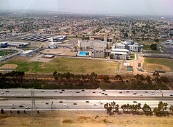
Alondra Park, also known as El Camino Village, is a census designated place (CDP) in the South Bay region of Los Angeles County, California, United States. It is the unincorporated area north of Alondra Community Regional Park and El Camino College. It is east of Lawndale, south of Hawthorne, west of Gardena, and north of Torrance. Manhattan Beach Boulevard and Crenshaw Boulevard are the two major cross streets in the area. The population was 8,569 at the 2020 census, down from 8,592 at the 2010 census. There is an official Alondra Park Post Office of the U.S. Postal Service in nearby Gardena, California. Urbanized cement-lined Dominguez Creek bisects a portion of Alondra Park.

<span class="mw-page-title-main">Charter Oak, California</span> Census designated place in California, United States

Charter Oak is a census-designated place (CDP) in Los Angeles County, California, approximately 26 miles (42 km) east of downtown Los Angeles. The population was 9,310 at the 2010 census, up from 9,027 at the 2000 census.

<span class="mw-page-title-main">Citrus, California</span> Census-designated place in California, United States

Citrus is a census-designated place (CDP) in Los Angeles County, California, United States. It is located in the San Gabriel Valley between Azusa to the north and west, Glendora to the east, and Covina to the south. The population was 10,866 at the 2010 census, up from 10,581 at the 2000 census. Citrus is named after Citrus Avenue, which passes through the community.

<span class="mw-page-title-main">Del Aire, California</span> Census-designated place in California, United States

Del Aire is a census-designated place (CDP) in the inland South Bay, Los Angeles County, California, United States, between El Segundo and Hawthorne. The population was 10,001 at the 2010 census, up from 9,012 at the 2000 census.

<span class="mw-page-title-main">East Rancho Dominguez, California</span> Unincorporated community in California, United States

East Rancho Dominguez, also known as East Compton, is an unincorporated community and census-designated place (CDP) located in southern Los Angeles County, California. The population was 15,135 at the 2010 census, up from 9,286 at the 2000 census. East Rancho Dominguez is an accepted city name according to the USPS, and shares the 90221 ZIP Code with Compton.

<span class="mw-page-title-main">East Pasadena, California</span> Unincorporated community in California, United States

East Pasadena is an unincorporated community in Los Angeles County, California, United States. The population was 6,021 at the 2020 census, down from 6,144 at the 2010 census. For statistical purposes, the United States Census Bureau has defined East Pasadena as a census-designated place (CDP).

<span class="mw-page-title-main">Florence-Graham, California</span> Census-designated place in Huntington Park, California

Florence-Graham is a census-designated place in Los Angeles County, California. The population was 61,983 at the 2020 census, down from 63,387 at the 2010 census. The census area includes separate communities of Florence, Firestone Park, and Graham. It is located in the south central region of Los Angeles County. The neighboring communities are Central-Alameda, Florence, Green Meadows, Lynwood, Vernon, Walnut Park, Watts, and Compton.

<span class="mw-page-title-main">Ladera Heights, California</span> Unincorporated community in Los Angeles County, California, US

Ladera Heights is a community and unincorporated area in Los Angeles County, California. The population was 6,634 at the 2020 census. Culver City lies to its west, the Baldwin Hills neighborhood to its north, the View Park-Windsor Hills community to its east, the Westchester neighborhood to its south and southwest and the city of Inglewood to its southeast. With an average household income of $132,824, Ladera Heights ranks third amongst the ten wealthiest majority-Black communities in the United States.

<span class="mw-page-title-main">Lennox, California</span> Census-designated place in California, United States

Lennox is a census-designated place (CDP) in the South Bay region of Los Angeles County, California, United States. The population was 22,753 at the 2010 census, down from 22,950 at the 2000 census.

<span class="mw-page-title-main">South San Gabriel, California</span> Census-designated place in California, United States

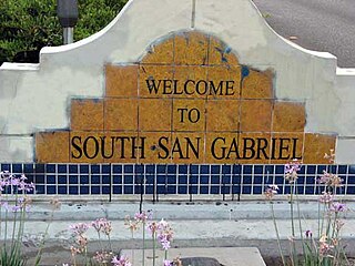
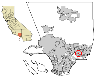
South San Gabriel is a census-designated place (CDP) in Los Angeles County, California, United States. The population was 8,070 at the 2010 census, up from 7,595 at the 2000 census.

<span class="mw-page-title-main">Valinda, California</span> Census-designated place in California, United States

Valinda is a census-designated place (CDP) in the San Gabriel Valley, in Los Angeles County, California, in the United States. At the 2010 census, the population was 22,822, up from 21,776 at the 2000 census.

<span class="mw-page-title-main">Vincent, California</span> Census-designated place in California, United States

Vincent is a census-designated place (CDP) in the central San Gabriel Valley, in Los Angeles County, California, United States. The city name and zipcode for addresses south of Arrow Highway is Covina and 91722, respectively, and Azusa and 91702 for addresses north of Arrow Highway. The population was 15,922 at the 2010 census, up from 15,097 at the 2000 census. Vincent is named after Vincent Avenue, which passes through the community. It should not be confused with another unincorporated community called Vincent, also within Los Angeles County, that is located at the summit of Soledad Pass near the junction of SR 14 and Angeles Forest Highway.

<span class="mw-page-title-main">Walnut Park, California</span> Census-designated place in Huntington Park, California

Walnut Park is a census-designated place (CDP) in Los Angeles County, California, United States, adjacent to Florence-Graham, Huntington Park and South Gate. The population was 15,966 at the 2010 census, down from 16,180 at the 2000 census.

<span class="mw-page-title-main">West Carson, California</span> Unincorporated community in California, United States

West Carson is an unincorporated community in the South Bay region of Los Angeles County, California. The population was 22,870 at the 2020 census. For statistical purposes, the United States Census Bureau has defined West Carson as a census-designated place (CDP).

<span class="mw-page-title-main">West Rancho Dominguez, California</span> Unincorporated community in California, United States

West Rancho Dominguez, formerly known as West Compton and also known as East Gardena, is an unincorporated census-designated place (CDP) located in southern Los Angeles County, California. Per the 2020 census, the population was 24,347. The community lies to the west of the city of Compton. The ZIP Codes encompassing the CDP area are 90220 & 90248.

<span class="mw-page-title-main">West Puente Valley, California</span> Census-designated place in California, United States

West Puente Valley is an unincorporated community and census-designated place in Los Angeles County, California, USA, northwest of La Puente. The population was 22,636 at the 2010 census, up from 22,589 at the 2000 census. The community is probably named for its location related to the city of La Puente.

<span class="mw-page-title-main">West Whittier-Los Nietos, California</span> Census-designated place in California, United States

West Whittier-Los Nietos is a census-designated place (CDP) in Los Angeles County, California, near the San Gabriel River and the San Gabriel River (I-605) Freeway. The population was 25,540 at the 2010 census, up from 25,129 at the 2000 census. The census area consists of separate unincorporated communities of Los Nietos and West Whittier.

<span class="mw-page-title-main">Westmont, California</span> Unincorporated community in California, United States

Westmont is an unincorporated community in Los Angeles County, California, a part of the South Los Angeles area, just east of Inglewood. The population was 33,913 at the 2020 census, up from 31,853 at the 2010 census. For statistical purposes, the United States Census Bureau has defined Westmont as a census-designated place (CDP).

<span class="mw-page-title-main">Willowbrook, California</span> Unincorporated community in California, United States

Willowbrook, alternatively named Willow Brook, is an unincorporated community and census-designated place (CDP) in Los Angeles County, California. The population was 24,295 at the 2020 census, down from 35,983 at the 2010 census.

<span class="mw-page-title-main">Wrightwood, California</span> Unincorporated community in California, United States

Wrightwood is a census-designated place in San Bernardino County, California. It sits at an elevation of 6,208 feet (1,892 m). The population was 4,525 at the 2010 census, up from the population of 3,837 at the 2000 census. Wrightwood is located 77 miles (124 km) northeast of Los Angeles. Wrightwood is on the Pacific Crest Trail.

References

  1. "2010 Census U.S. Gazetteer Files – Places – California". United States Census Bureau.
  2. 1 2 "Benton Heights CDP, Michigan". United States Census Bureau . Retrieved March 13, 2022.
  3. "US Gazetteer files: 2010, 2000, and 1990". United States Census Bureau. February 12, 2011. Retrieved April 23, 2011.
  4. "Decennial Census of Population and Housing by Decades". US Census Bureau.
  5. 1 2 "P2 Hispanic or Latino, and Not Hispanic or Latino by Race – 2010: DEC Redistricting Data (PL 94-171) - West Athens CDP, California". United States Census Bureau .
  6. 1 2 "P2 Hispanic or Latino, and Not Hispanic or Latino by Race – 2020: DEC Redistricting Data (PL 94-171) - West Athens CDP, California". United States Census Bureau .
  7. 1 2 "West Athens CDP, California". quickfacts.census.gov. US Census Bureau. Archived from the original on April 18, 2012. Retrieved March 13, 2023.
  8. "2010 Census Interactive Population Search: CA - West Athens CDP". U.S. Census Bureau. Archived from the original on July 15, 2014. Retrieved July 12, 2014.
  9. "U.S. Census website". United States Census Bureau . Retrieved January 31, 2008.
  10. "2020 CENSUS - SCHOOL DISTRICT REFERENCE MAP: Los Angeles County, CA" (PDF). U.S. Census Bureau. p. 10 (PDF p. 11/19). Retrieved November 19, 2023.
  11. > "2020 CENSUS - CENSUS BLOCK MAP: West Athens CDP, CA" (PDF). U.S. Census Bureau . Retrieved November 19, 2023.
    Compare to: "Home". West Athens Elementary School. Retrieved November 19, 2023. 1110 W 119th St Los Angeles, CA 90044
    Despite the "Los Angeles, CA" postal address, it is not in the city of Los Angeles.
    Note: Note that the City of Houston had stated: "The U.S. Postal Service establishes ZIP codes and mailing addresses in order to maximize the efficiency of their system, not to recognize jurisdictional boundaries."
  12. "Contact". Ánimo Legacy Charter Middle School. Retrieved November 19, 2023. 12226 S Western Ave, Los Angeles, CA 90047 - Compare to the Census map of West Athens.
  13. "Welcome to Henry Clay Middle School". www.lausd.k12.ca.us. Archived from the original on February 5, 2012. Retrieved November 19, 2023. 2226 S. Western Avenue, Los Angeles, CA 90047
  14. "Public School Choice Motion Clay Middle School Executive Summaries" (PDF). Los Angeles Unified School District. p. 3/31. Retrieved November 19, 2023.
  15. "2020 CENSUS - CENSUS BLOCK MAP: West Athens CDP, CA" (PDF). U.S. Census Bureau . Retrieved November 19, 2023.
    Compare to: "Maps". Middle College High School. Retrieved November 19, 2023. 1600 W. Imperial Highway, Los Angeles, CA 90047
    Despite the "Los Angeles, CA" postal address, it is not in the city of Los Angeles.
    Note: Note that the City of Houston had stated: "The U.S. Postal Service establishes ZIP codes and mailing addresses in order to maximize the efficiency of their system, not to recognize jurisdictional boundaries."
  16. "2020 CENSUS - CENSUS BLOCK MAP: West Athens CDP, CA" (PDF). U.S. Census Bureau . Retrieved November 19, 2023.
    Compare to: "Home". Los Angeles Southwest College. Retrieved November 19, 2023. LA Southwest College 1600 West Imperial Highway Los Angeles, CA 90047
    Despite the "Los Angeles, CA" postal address, it is not in the city of Los Angeles.
    Note: Note that the City of Houston had stated: "The U.S. Postal Service establishes ZIP codes and mailing addresses in order to maximize the efficiency of their system, not to recognize jurisdictional boundaries."
  17. "Lenox Station Archived 2010-04-14 at the Wayback Machine ." Los Angeles County Sheriff's Department. Retrieved on January 21, 2010.
  18. "Lenox CDP Archived 2011-06-06 at the Wayback Machine ." U.S. Census Bureau. Retrieved on January 21, 2010.
  19. "Youth Activity Center." Los Angeles County Sheriff's Department. Retrieved on January 21, 2010.
  20. "West Athens CDP, California Archived 2011-06-06 at the Wayback Machine ." U.S. Census Bureau. Retrieved on January 21, 2010.
  21. "Statewide Database". UC Regents. Archived from the original on February 1, 2015. Retrieved December 7, 2014.
  22. "California's 43rd Congressional District - Representatives & District Map". Civic Impulse, LLC.
  23. "Home - Side Park Chronicle - Astro Turf Installers". Side Park Chronicle - Astro Turf Installers. Archived from the original on December 12, 2012. Retrieved December 26, 2012.