Ntare School

Last updated

Ntare School
Location
Ntare School
,
Information
Type Public Middle School and High School
MottoBetter your best
Established1956
HeadteacherRwampororo Saul [1]
Number of students900 (2006) [2]
SloganThe Lion Roars
Athletics Rugby, soccer, track, tennis, hockey, cricket, volleyball, basketball, table tennis
Website Homepage
Ntare School in Mbarara, Uganda Ntare School in Mbarara, Uganda.jpg
Ntare School in Mbarara, Uganda

Ntare School is a residential all-boys' secondary school located in Mbarara, Mbarara District, south western Uganda. It was founded in 1956 by a Scottish educator named William Crichton. [3]

Contents

Location

The school is approximately 1 kilometre (0.62 mi), by road, north of the central business district of Mbarara, [4] the largest city (2014 population: 195,013), [5] in the Western Region. The school campus is approximately 267 kilometres (166 mi), by road, west of Kampala, Uganda's capital and largest city. [6] The coordinates of the school are 0°36'10.0"S, 30°39'11.0"E (Latitude:-0.602778; Longitude:30.653056). [7] The school is situated on the convex slope of Ntare hill at an elevation of 1,400 metres (4,600 ft), above sea level. [8]

Reputation

Ntare School is one of the most prestigious schools in Uganda due to its history, reputation, excellent academic performance, and dominance in sports. [9] [10]

Ntare School also boasts of an Alumni Soccer League the Ntare Lions League [11] which runs every sunday.

Houses of residence

[12]

Former Headmasters

Source: [13]

Mr. William Crichton - Founding Headmaster 1956 to 1971

Mr. Brian Remmer - 1971 to 1977

Mr. Jed Bangizi - 1977 to 1982

Mr. Gumisiriza G.L. - 1983 to 1985

Mr. H.H Mehangye - 1985 to 1987

Mr. Francis Kairagi - 1987 to 1990

Mr. Eric Kansiime - 1990 - 1991

Mr. Stephen Kamuhanda - 1991 to 2002

Mr. Humphrey Ahimbisibwe - 2003 to 2012

Mr. Turyagyenda Jimmy - 2013 up-2023

Mr. Rwampororo Saul- 2023- up to date

Notable alumni

Politicians

Academics

Judges

Lawyers

Writers

Others

Related Research Articles

<span class="mw-page-title-main">Mbarara district</span> District in Western Uganda, Uganda

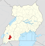
Mbarara District is a district in South Western Uganda. In 2019, the Ugandan Cabinet approved part of Mbarara District, the then-Mbarara municipality, to be upgraded to city status effective July 2020.

<span class="mw-page-title-main">Mbarara</span> Place in Western Region, Uganda

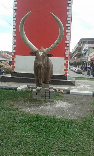
Mbarara City is a city in the Western Region of Uganda and the second largest city in Uganda after Kampala. The city is divided into 6 boroughs of Kakoba Division, Kamukuzi Division, Nyamitanga Division, Biharwe Division, Kakiika Division, Nyakayojo Division. It is the main commercial centre of most of south western districts of Uganda and the site of the district headquarters. In May 2019, the Uganda's cabinet granted Mbarara a city status, which started on 1 July 2020.

Makerere College School is a co-educational government aided O and A Level school founded in 1945 by Makerere University. In 1945 Makerere University was still a constituent college of the University of London. The school is located on the main campus of Makerere University, adjacent to the College of Education and External Studies on Makerere Hill Road.

<span class="mw-page-title-main">Uganda Martyrs University</span> Private university in Uganda

Uganda Martyrs University (UMU) is a private University affiliated with the Roman Catholic Church in Uganda. The University is owned by the Episcopal Conference of the Catholic Bishops of Uganda. It is licensed by the Uganda National Council for Higher Education. UMU consists of seven Faculties, two Institute, six Campuses, nine Departments, and three schools. As of March 2022, total student enrollment is 4,632. Of these, about 1,500 students were residential, while nearly 3,000 students were enrolled in UMU's distance learning programs. The number of staff members was over 400.

<span class="mw-page-title-main">Kiruhura District</span> District in Western Region, Uganda

Kiruhura District is a district in the Western Region of Uganda. The town of Rushere is the site of the district headquarters.

Mbarara High School (MHS), also known as Chaapa is a boys-only boarding middle and high school located in Ruharo Mbarara City in Mbarara District in Western Uganda.

Kiruhura is a town in the Western Region of Uganda. It is the largest town in Kiruhura District and the site of the district headquarters.

Sheema, also Sheema Municipality, is an urban centre in the Western Region of Uganda. It is the largest municipality in Sheema District.

<span class="mw-page-title-main">Law Development Centre</span> Legal school in Uganda

The Law Development Centre (LDC) is an educational institution in Uganda for higher learning that offers various legal courses ranging from one month to one year.

Bweranyangi Girls' Secondary School is a girls-only boarding middle and high school in Bushenyi District in the Western Region of Uganda.

Makenke is a neighborhood within Mbarara City, in the Western Region of Uganda.

The Mbarara Northern Bypass Road is a road that bypasses the northern part of Mbarara City.

<span class="mw-page-title-main">Kigezi College Butobere</span> Secondary school in Kabale, Kabale District, Uganda

Kigezi College Butobere is the first boys-only, boarding, senior secondary school located in Kabale District in the Western Region of Uganda.

The Ntungamo–Rukungiri Road in the Western Region of Uganda connects the town of Ntungamo in Ntungamo District with Rukungiri in Rukungiri District.

Wampeewo is a neighborhood in Wakiso District, in the Central Region of Uganda.

<span class="mw-page-title-main">Ministry of Health (Uganda)</span>

The Ministry of Health is a cabinet-level government ministry of Uganda. It is responsible for planning, delivering, and maintaining an efficient and effective healthcare delivery system, including preventive, curative, and rehabilitative services, in a humane, affordable, and sustainable manner. The ministry is headed by Minister of Health Jane Aceng.

Professor Emmanuel Karooro is a Ugandan educator, academic and academic administrator, who serves as the Vice-Chancellor at Ibanda University, a private co-educational institution of higher learning in the Western Region of Uganda.

Bugongi is a town in the Western Region of Uganda. It is an urban center in Sheema District.

NSSF Mbarara Complex, also Mbarara City House, is a building in Mbarara, a city in the Western Region of Uganda.

References

  1. "Ntare School Students Engage Police In Running Battles". Red Pepper Uganda . 8 April 2013. Retrieved 3 April 2015.
  2. "KayeSchools: Ntare School - The Lion Roars". Kayeschools.com. 2006. Retrieved 3 April 2015.
  3. Nalubwama, Jackie (17 August 2006). "Ntare 'The Only' School: Laissez-Faire Attitude Pays Off". The Observer (Uganda) . Archived from the original on 23 November 2006. Retrieved 3 April 2015.
  4. "Map Showing Downtown Mbarara And Ntare School With Route Marker". Globefeed.com. Retrieved 3 April 2015.
  5. "The Population of The Regions of the Republic of Uganda And All Cities And Towns of More Than 15,000 Inhabitants". Citypopulation.de Quoting Uganda Bureau of Statistics. 27 August 2014. Retrieved 3 April 2015.
  6. "Road Distance Between Kampala And Ntare School With Map". Globefeed.com. Retrieved 3 April 2015.
  7. "Location of Ntare School At Google Maps". Google Maps . Retrieved 3 April 2015.
  8. "About Ntare School". Ntare School (NS). Retrieved 3 April 2015.
  9. Talemwa, Moses; Mwesigye, Shifa (11 February 2010). "Top 10 Schools In Last 10 Years". The Observer (Uganda) . Retrieved 3 April 2015.
  10. Mubangizi, Michael (6 October 2009). "VIP Schools: Ntare And Kisubi OBs In Charge". The Observer (Uganda) . Retrieved 3 April 2015.
  11. Ntare Lions League
  12. Accomodation [sic], Ntare School, accessed 16 April 2017
  13. "Ntare School". Schoolsuganda. Retrieved 22 April 2019.
  14. 1 2 "President Museveni Attends Ntare School Alumni Reunion, Calls for Intellectualisation And Skilling of Society for Future Development". Statehouse.go.ug. 19 April 2014. Retrieved 3 April 2015.

0°36′10″S30°39′11″E / 0.60278°S 30.65306°E / -0.60278; 30.65306