Oakdale, Minnesota

Last updated

Oakdale
Oakdale, Minnesota logo (square).png
Washington County Minnesota Incorporated and Unincorporated areas Oakdale Highlighted.svg
Location of the city of Oakdale
within Washington County, Minnesota
Coordinates: 44°59′14″N92°57′57″W / 44.98722°N 92.96583°W / 44.98722; -92.96583
CountryUnited States
State Minnesota
County Washington
Oakdale Township1848
OrganizedMay and November 1858
Incorporated March 12, 1968
Government
   Mayor Kevin Zabel
Area
[1]
  Total11.31 sq mi (29.29 km2)
  Land10.96 sq mi (28.39 km2)
  Water0.35 sq mi (0.90 km2)
Elevation
[2]
1,056 ft (322 m)
Population
 (2020) [3]
  Total28,303
  Estimate 
(2022) [4]
27,799
  Density2,582.39/sq mi (997.03/km2)
Time zone UTC-6 (Central)
  Summer (DST) UTC-5 (CDT)
ZIP codes
55042, 55128
Area code 651
FIPS code 27-47680 [5]
GNIS feature ID2395287 [2]
Website oakdalemn.gov

Oakdale is a city in Washington County, Minnesota, United States. It is a suburb of Saint Paul and is on the eastern side of the Twin Cities Metropolitan area. The population was 28,303 at the 2020 census. [3] Oakdale is the 36th largest city in Minnesota by population.

Contents

Oakdale lies entirely within the North St. Paul–Maplewood–Oakdale school district, ISD 622, and the city's students are split into two high schools within the district. Tartan Senior High School is within the city's boundaries, and serves the southern half of Oakdale. The city's northern residents are served by North High School in North St. Paul.

Imation (now known as Glassbridge) World Headquarters was in Oakdale. Nearby 3M headquarters employs many residents of the city. [6]

Etymology

Oakdale was named for a grove of oak trees near the original town site. [7] Oakdale Township was organized in 1858. [8] The city of Oakdale is the result of a consolidation of Oakdale and Northdale Townships in the 1970s, and continued to annex land well into the 1990s.

Arthur Stephen suggested the name "Oakdale" at the first town meeting on November 1, 1858. Stephen was born on March 30, 1830, in Scotland. He was the son of Robert and Elizabeth (Grant) Stephen. In 1839, when Arthur was nine years old, the Stephen family came to America and settled in Knox County, Illinois. His father was a schoolteacher and young Arthur learned the trade of bricklayer.

Geography

According to the United States Census Bureau, the city has a total area of 11.29 square miles (29.24 km2); 10.95 square miles (28.36 km2) is land and 0.34 square miles (0.88 km2) is water. [9]

Oakdale is bound between Minnesota State Highway 120 on its west, Washington County Road 13 on its east, Interstate 694 on its north, and Interstate 94 on its south. Other main routes in the community include Minnesota State Highway 36, and Hadley Avenue North which Oakdale designates its "signature street" since it is the primary street running the length of the city.

Demographics

Historical population
CensusPop.Note
1970 7,795
1980 12,12355.5%
1990 18,37451.6%
2000 26,65345.1%
2010 27,3782.7%
2020 28,3033.4%
2022 (est.)27,799 [4] −1.8%
U.S. Decennial Census [10]
2020 Census [3]

2010 census

As of the census of 2010, there were 27,378 people, 10,948 households, and 7,152 families living in the city. The population density was 2,500.3 inhabitants per square mile (965.4/km2). There were 11,388 housing units at an average density of 1,040.0 per square mile (401.5/km2). The racial makeup of the city was 81.4% White, 6.0% African American, 0.4% Native American, 8.2% Asian, 1.2% from other races, and 2.8% from two or more races. Hispanic or Latino of any race were 4.3% of the population.

There were 10,948 households, of which 33.0% had children under the age of 18 living with them, 48.2% were married couples living together, 12.7% had a female householder with no husband present, 4.4% had a male householder with no wife present, and 34.7% were non-families. 28.4% of all households were made up of individuals, and 9.5% had someone living alone who was 65 years of age or older. The average household size was 2.48 and the average family size was 3.07.

The median age in the city was 37.9 years. 24.1% of residents were under the age of 18; 9.4% were between the ages of 18 and 24; 26% were from 25 to 44; 29.2% were from 45 to 64; and 11.2% were 65 years of age or older. The gender makeup of the city was 47.9% male and 52.1% female.

2000 census

As of the census of 2000, there were 26,653 people, 10,243 households, and 7,129 families living in the city. The population density was 2,408.4 inhabitants per square mile (929.9/km2). There were 10,394 housing units at an average density of 939.2 per square mile (362.6/km2). The racial makeup of the city was 92.21% White, 2.29% African American, 0.36% Native American, 2.45% Asian, 0.01% Pacific Islander, 0.77% from other races, and 1.91% from two or more races. Hispanic or Latino of any race were 2.75% of the population.

There were 10,243 households, out of which 38.5% had children under the age of 18 living with them, 55.2% were married couples living together, 11.1% had a female householder with no husband present, and 30.4% were non-families. 25.2% of all households were made up of individuals, and 7.2% had someone living alone who was 65 years of age or older. The average household size was 2.59 and the average family size was 3.14.

In the city, the population was spread out, with 29.0% under the age of 18, 7.2% from 18 to 24, 34.6% from 25 to 44, 20.7% from 45 to 64, and 8.4% who were 65 years of age or older. The median age was 34 years. For every 100 females, there were 93.1 males. For every 100 females age 18 and over, there were 87.0 males.

The median income for a household in the city was $56,299, and the median income for a family was $66,680. Males had a median income of $42,371 versus $32,343 for females. The per capita income for the city was $24,107. About 2.9% of families and 3.6% of the population were below the poverty line, including 4.1% of those under age 18 and 3.9% of those age 65 or over.

Superfund site and environmental damage

The Oakdale Dump is listed as an Environmental Protection Agency Superfund site due to the contamination of residential drinking water wells with volatile organic compounds (VOCs) and heavy metals. After extensive cleanup, the area was converted into a city park.

Notable people

Related Research Articles

<span class="mw-page-title-main">East Oakdale, California</span> Census-designated place in California, United States

East Oakdale is an unincorporated census-designated place (CDP) on the Stanislaus River, located east of the city of Oakdale in Stanislaus County, California.

<span class="mw-page-title-main">Ramsey, Minnesota</span> City in Minnesota, United States

Ramsey is a suburban city 22 miles (35 km) north-northwest of downtown Minneapolis in Anoka County, Minnesota, United States. The population was 27,646 at the 2020 census. It is a northwest suburb of the Twin Cities.

<span class="mw-page-title-main">Wanamingo, Minnesota</span> City in Minnesota, United States

Wanamingo is a community in Goodhue County, Minnesota, United States, incorporated as a city. It lies along the North Fork of the Zumbro River. The population was 1,086 at the 2010 census.

<span class="mw-page-title-main">Independence, Minnesota</span> City in Minnesota, United States

Independence is a rural city in Hennepin County, Minnesota, United States. Most of the city is agricultural land with dense woods and numerous lakes. It is named after Lake Independence, a large lake on the community's eastern boundary.

<span class="mw-page-title-main">Hallock, Minnesota</span> City in Minnesota, United States

Hallock is a city in and the county seat of Kittson County, Minnesota, United States. The population was 906 at the 2020 census.

<span class="mw-page-title-main">Nassau, Minnesota</span> City in Minnesota, United States

Nassau is a city in Lac qui Parle County, Minnesota, United States. The population was 72 at the 2010 census.

<span class="mw-page-title-main">Racine, Minnesota</span> City in Minnesota, United States

Racine is a city in Racine Township, Mower County, Minnesota, United States. The population was 442 at the 2010 census.

<span class="mw-page-title-main">Dovray, Minnesota</span> City in Minnesota, United States

Dovray is a city in Murray County, Minnesota, United States. The population was 57 at the 2010 census.

<span class="mw-page-title-main">Deer Creek, Minnesota</span> City in Minnesota, United States

Deer Creek is a city in Otter Tail County, Minnesota, United States. The population was 330 at the 2020 census.

<span class="mw-page-title-main">Goodridge, Minnesota</span> City in Minnesota, United States

Goodridge is a small city in Pennington County, Minnesota, United States. The population was 112 at the 2020 census. The city is located within Goodridge Township, but is politically independent.

<span class="mw-page-title-main">Morristown, Minnesota</span> City in Minnesota, United States

Morristown is a city in Rice County, Minnesota, United States. The population was 987 at the 2010 census.

<span class="mw-page-title-main">Orr, Minnesota</span> City in Minnesota, United States

Orr is a city in Saint Louis County, Minnesota, United States. The population was 211 at the 2020 census.

<span class="mw-page-title-main">Clarissa, Minnesota</span> City in Minnesota, United States

Clarissa is a city in Todd County, Minnesota, United States. The population was 681 at the 2010 census. It dropped to 261 inhabitants by the 2020 census.

<span class="mw-page-title-main">Oak Park Heights, Minnesota</span> City in Minnesota, United States

Oak Park Heights is a city in Washington County, Minnesota, United States. The population was 4,849 at the 2020 census.

<span class="mw-page-title-main">Genola, Minnesota</span> City in Minnesota, United States

Genola is a city in Morrison County, Minnesota, United States. The population was 70 at the 2020 census.

<span class="mw-page-title-main">Bellevue, Wisconsin</span> Village in Wisconsin, United States

Bellevue is a village in Brown County, Wisconsin. It was a town until incorporating as a village on February 14, 2003. The population was 14,570 at the time of the 2010 census. Bellevue is part of the Green Bay metropolitan area. Bellevue sits around 4.34 miles (6.99 km) east from central Green Bay.

<span class="mw-page-title-main">Greenfield, Wisconsin</span> City in Wisconsin, United States

Greenfield is a city in the U.S. state of Wisconsin. Located in Milwaukee County, Greenfield is one of many bedroom communities in the Milwaukee metropolitan area. The population was 37,803 as of the 2020 Census.

<span class="mw-page-title-main">Minnesota Lake, Minnesota</span> City in Minnesota, United States

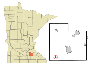
Minnesota Lake is a city in Blue Earth and Faribault counties in the State of Minnesota. The population was 661 at the 2020 census. The bulk of the city is in Faribault County; a small part extends into Blue Earth County.

<span class="mw-page-title-main">Rothsay, Minnesota</span> City in Minnesota, United States

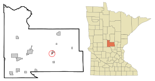
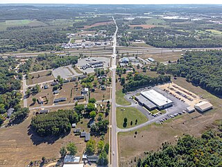
Rothsay is a city in Otter Tail and Wilkin counties in the State of Minnesota. The population was 498 at the 2020 census. One of Rothsay's major tourist attractions is the large prairie chicken statue near the northwest outskirts of the town.

<span class="mw-page-title-main">Oakdale, Wisconsin</span> Village in Wisconsin, United States

Oakdale is a village in Monroe County, Wisconsin, United States. The population was 302 at the 2020 census. The village is located within the Town of Oakdale.

References

  1. "2020 U.S. Gazetteer Files". United States Census Bureau. Retrieved July 24, 2022.
  2. 1 2 U.S. Geological Survey Geographic Names Information System: Oakdale, Minnesota
  3. 1 2 3 "Explore Census Data". United States Census Bureau . Retrieved June 25, 2023.
  4. 1 2 "City and Town Population Totals: 2020-2022". United States Census Bureau. June 25, 2023. Retrieved June 25, 2023.
  5. "U.S. Census website". United States Census Bureau . Retrieved January 31, 2008.
  6. Fellner, Carrie (June 15, 2018). "Toxic Secrets: The town that 3M built - where kids are dying of cancer". The Sydney Morning Herald. Retrieved May 19, 2021.
  7. Chicago and North Western Railway Company (1908). A History of the Origin of the Place Names Connected with the Chicago & North Western and Chicago, St. Paul, Minneapolis & Omaha Railways. p. 185.
  8. Upham, Warren (1920). Minnesota Geographic Names: Their Origin and Historic Significance. Minnesota Historical Society. p.  570.
  9. "US Gazetteer files 2010". United States Census Bureau. Archived from the original on January 12, 2012. Retrieved November 13, 2012.
  10. United States Census Bureau. "Census of Population and Housing" . Retrieved October 28, 2014.
  11. Minnesota Legislators: Past & Present-Jerome J. Belisle
  12. Rhett Miller, Joshua (May 20, 2020). "Officers protect fired cop Derek Chauvin's home after George Floyd death". NY Post. Retrieved December 10, 2020.
  13. "Mueller, Patricia - Legislator Record - Minnesota Legislators Past & Present". Minnesota Legislative Reference Library . Retrieved July 26, 2021.

44°57′47″N92°57′54″W / 44.96306°N 92.96500°W / 44.96306; -92.96500