North St. Paul, Minnesota

Last updated

North Saint Paul
NSP Snowman.jpg
The North Saint Paul Snowman
Motto: 
"Extraordinary"
Ramsey County Minnesota Incorporated and Unincorporated areas North St. Paul Highlighted.svg
Location of the city of North Saint Paul
within Ramsey County, Minnesota
Coordinates: 45°0′46″N92°59′54″W / 45.01278°N 92.99833°W / 45.01278; -92.99833
CountryUnited States
State Minnesota
County Ramsey
Incorporated1887
Government
   Mayor John Monge
Area
[1]
  Total3.01 sq mi (7.80 km2)
  Land2.86 sq mi (7.40 km2)
  Water0.16 sq mi (0.41 km2)
Elevation
[2]
955 ft (291 m)
Population
 (2020) [3]
  Total12,364
  Estimate 
(2022) [4]
12,659
  Density4,329.13/sq mi (1,671.52/km2)
Time zone UTC−6 (Central (CST))
  Summer (DST) UTC−5 (CDT)
ZIP Code
55109
Area code 651
FIPS code 27-47221
GNIS feature ID2395261 [2]
Sales tax 8.375% [5]
Website northstpaul.org

North Saint Paul (abbreviated North St. Paul) is a city in Ramsey County, Minnesota, United States, located east-northeast of the city of Saint Paul. The population was 12,364 at the 2020 census. [3]

Contents

North Saint Paul is a distinct city, and not a neighborhood of nearby Saint Paul. This fact also contributes to a major difference from typical suburbs; rather than being composed of new developments and urban sprawl, many of the structures in town are older, including a downtown area of brick storefronts.

On the east side of the Margaret Street bridge over Minnesota State Highway 36 resides the 20-ton North Saint Paul Snowman. As the official city logo of North Saint Paul, it was constructed on Margaret and 7th Streets from 1971 to 1974 by Lloyd Koesling and moved to its current location in 1990. [6]

Geography

According to the United States Census Bureau, the city has a total area of 3.01 sq mi (7.80 km2), of which 2.85 sq mi (7.38 km2) is land and 0.16 sq mi (0.41 km2) is water. [7] Silver Lake and Casey Lake are the city's largest bodies of water and both have large, adjacent parks.

Transportation

Minnesota Highway 36 and the Gateway State Trail, running over the former Soo Line Railway grade, bisect the city of North Saint Paul.

Highway 36 serves as a main route in the city; it is a four-lane highway with both at-grade and overpass intersections. Additionally, Interstate Highway 694 is in close proximity to the city.

History

North St. Paul was originally called Castle, and under the latter name was laid out in 1887 by Henry Anson Castle when the Wisconsin Central Railroad was extended to that point. [8]

North St. Paul boasts the oldest continuously operating bar in Minnesota, Neumann's Bar, [9] in their historic downtown area. The original bar opened for business in 1887, and has continuously operated as an establishment serving alcoholic beverages ever since. Even during Prohibition, they served near beer in the main bar, and opened a speakeasy upstairs. Visitors can still go upstairs and see the keyhole door used to screen entrants, and the old telephone that was connected to the downstairs bar so that messages could be passed back and forth. [10]

Demographics

Historical population
CensusPop.Note
1890 1,099
1900 1,1101.0%
1910 1,40426.5%
1920 1,97941.0%
1930 2,91547.3%
1940 3,1357.5%
1950 4,24835.5%
1960 8,520100.6%
1970 11,95040.3%
1980 11,921−0.2%
1990 12,3763.8%
2000 11,929−3.6%
2010 11,460−3.9%
2020 12,3647.9%
2022 (est.)12,659 [4] 2.4%
U.S. Decennial Census [11]
2020 Census [3]

2010 census

As of the census of 2010, there were 11,460 people, 4,615 households, and 2,982 families living in the city. The population density was 4,021.1 inhabitants per square mile (1,552.6/km2). There were 4,822 housing units at an average density of 1,691.9 per square mile (653.2/km2). The racial makeup of the city was 81.2% White, 7.0% African American, 0.6% Native American, 6.6% Asian, 0.1% Pacific Islander, 1.6% from other races, and 2.9% from two or more races. Hispanic or Latino of any race were 4.9% of the population.

There were 4,615 households, of which 30.7% had children under the age of 18 living with them, 46.7% were married couples living together, 12.9% had a female householder with no husband present, 5.0% had a male householder with no wife present, and 35.4% were non-families. Of all households 28.2% were made up of individuals, and 10% had someone living alone who was 65 years of age or older. The average household size was 2.47 and the average family size was 3.04.

The median age in the city was 38.5 years. Of residents 22.7% were under the age of 18; 9.9% were between the ages of 18 and 24; 25.3% were from 25 to 44; 29% were from 45 to 64; and 13.1% were 65 years of age or older. The gender makeup of the city was 49.1% male and 50.9% female.

2000 census

As of the census of 2000, there were 11,929 people, 4,703 households, and 3,160 families living in the city. The population density was 4,132.4 inhabitants per square mile (1,595.5/km2). There were 4,753 housing units at an average density of 1,646.5 per square mile (635.7/km2). The racial makeup of the city was 92.86% White, 2.62% African American, 0.55% Native American, 1.68% Asian, 0.03% Pacific Islander, 0.86% from other races, and 1.39% from two or more races. Hispanic or Latino of any race were 2.36% of the population.

There were 4,703 households, out of which 33.3% had children under the age of 18 living with them, 51.6% were married couples living together, 11.5% had a female householder with no husband present, and 32.8% were non-families. Of all households 27.0% were made up of individuals, and 9.9% had someone living alone who was 65 years of age or older. The average household size was 2.52 and the average family size was 3.09.

In the city, the population was spread out, with 26.3% under the age of 18, 8.8% from 18 to 24, 30.6% from 25 to 44, 22.7% from 45 to 64, and 11.7% who were 65 years of age or older. The median age was 36 years. For every 100 females, there were 97.0 males. For every 100 females age 18 and over, there were 91.9 males.

The median income for a household in the city was $50,923, and the median income for a family was $59,652. Males had a median income of $38,958 versus $29,757 for females. The per capita income for the city was $22,411. About 2.2% of families and 4.2% of the population were below the poverty line, including 4.1% of those under age 18 and 3.7% of those age 65 or over.

Religion

Christ Lutheran Church Christ Lutheran Church WELS North St Paul MN.jpg
Christ Lutheran Church

Christ Lutheran Church is a member of the Wisconsin Evangelical Lutheran Synod (WELS) in North St. Paul.

North Church is a Presbyterian congregation in North St. Paul. [12]

St Mark's Lutheran Church was founded in 1887. It is part of the Evangelical Lutheran Church in America (ELCA). [13]

Church of St Peter is a Catholic church and parochial school located on Margaret St, just north of Historic Downtown North St Paul.

The Catholic community in North St. Paul began in 1888 as a mission parish of Guardian Angels parish. Throughout the early years the parish occupied a series of buildings until 1915 when the parishioners built the brick church. The older building was remodeled into the town’s first parochial school. Members of the Sisters of St. Joseph staffed the school until 1928, at which time several things began to change. The Sisters of St. Francis from Rochester were hired to teach in the school. A new school and convent were also built. The school had eight classrooms, a library, and a nurse’s room. [15]

Education

Christ Lutheran School Christ Lutheran School WELS North St Paul, MN.jpg
Christ Lutheran School
Public
Private

Related Research Articles

<span class="mw-page-title-main">St. Ansgar, Iowa</span> City in Iowa, United States

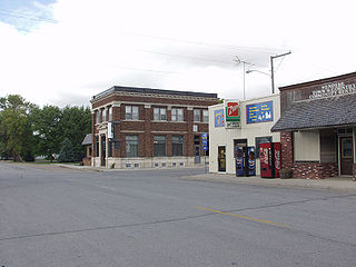
St. Ansgar is a city in Mitchell County, Iowa, United States. The population was 1,160 at the 2020 census.

<span class="mw-page-title-main">Inver Grove Heights, Minnesota</span> City in Minnesota, United States

Inver Grove Heights is a city in Dakota County, Minnesota, United States. The population was 35,801 at the 2020 census. The city was formed on March 9, 1965, with the merger of the village of Inver Grove and Inver Grove Township.

<span class="mw-page-title-main">West St. Paul, Minnesota</span> City in Minnesota, United States

West St. Paul is a city in Dakota County, Minnesota, United States. The population was 20,615 at the 2020 census. It is immediately south of Saint Paul and immediately west of South St. Paul.

<span class="mw-page-title-main">Cannon Falls, Minnesota</span> City in Minnesota, Goodhue County, United States

Cannon Falls is a city in Goodhue County, Minnesota, United States. The population was 4,083 at the 2010 census. Located along U.S. Route 52, southeast of the Twin Cities, Cannon Falls is the home of Pachyderm Studio, where many famous musicians have recorded, including Nirvana, which recorded its 1993 album In Utero there.

<span class="mw-page-title-main">Zumbrota, Minnesota</span> City in Minnesota, United States

Zumbrota is a city in Goodhue County, Minnesota, United States, along the North Fork of the Zumbro River. The population was 3,252 at the 2010 census. It promotes itself as "the only Zumbrota in the world."

<span class="mw-page-title-main">Wendell, Minnesota</span> City in Minnesota, United States

Wendell is a city in Grant County, Minnesota, United States. The population was 167 at the 2010 census.

<span class="mw-page-title-main">Excelsior, Minnesota</span> Lakeside city in Minnesota, United States

Excelsior is a city in Hennepin County, Minnesota, United States. Excelsior's historic commercial district along Water Street is listed on the National Register of Historic Places, and the town has many Victorian-era houses. On Lake Minnetonka's southern shore, the community serves as a local tourism destination for shoppers, boaters, and restaurant-goers.

<span class="mw-page-title-main">Grand Rapids, Minnesota</span> City in Minnesota, United States

Grand Rapids is a city in Itasca County, Minnesota, United States, and it is the county seat. The population was 11,126 at the 2020 census. The city is named for the 3.5-mile (5.6 km) long rapids in the Mississippi River which was the uppermost limit of practical steamboat travel during the late 19th century. Today the rapids are hidden below the dam of UPM Paper Company.

<span class="mw-page-title-main">Warren, Minnesota</span> City in Minnesota, United States

Warren is a city in and the county seat of Marshall County, Minnesota, United States. The population was 1,605 at the 2020 census.

<span class="mw-page-title-main">Litchfield, Minnesota</span> City in Minnesota, United States

Litchfield is a city in and the county seat of Meeker County, Minnesota, United States. The population was 6,624 at the 2020 census.

<span class="mw-page-title-main">Avoca, Minnesota</span> City in Minnesota, United States

Avoca is a city in Murray County, Minnesota, United States. The population was 111 at the 2020 census.

<span class="mw-page-title-main">St. Peter, Minnesota</span> City in Minnesota, United States

St. Peter is a city and the county seat of Nicollet County, Minnesota United States. It is 10 miles north of the Mankato – North Mankato metropolitan area. The population was 12,066 at the 2020 census. It is home to Gustavus Adolphus College.

<span class="mw-page-title-main">Roseville, Minnesota</span> City in Minnesota, United States

Roseville is a city in Ramsey County, Minnesota, United States. It is one of two Twin Cities suburbs that are adjacent to both Saint Paul and Minneapolis. The land comprising Falcon Heights, Lauderdale, and southern Roseville was unincorporated until Roseville incorporated in 1948 and Falcon Heights and Lauderdale incorporated in 1949. The population was 36,254 at the 2020 census.

<span class="mw-page-title-main">Belle Plaine, Minnesota</span> City in Minnesota, United States

Belle Plaine is a city in Scott County, Minnesota, United States, about 40 minutes southwest of Minneapolis. The population was 7,395 at the 2020 census.

<span class="mw-page-title-main">Lewiston, Minnesota</span> City in Minnesota, United States

Lewiston is a city in Winona County, Minnesota, United States. The population was 1,620 at the 2010 census.

<span class="mw-page-title-main">Winona, Minnesota</span> City in Minnesota, United States

Winona is a city in and the county seat of Winona County, Minnesota, United States. Located in bluff country on the Mississippi River, its most noticeable physical landmark is Sugar Loaf. The population was 25,948 at the 2020 census.

<span class="mw-page-title-main">Butterfield, Minnesota</span> City in Minnesota, United States

Butterfield is a city in Watonwan County, Minnesota, United States. The population was 586 at the 2010 census.

<span class="mw-page-title-main">North Fond du Lac, Wisconsin</span> Village in Wisconsin, United States

North Fond du Lac is a village in Fond du Lac County, Wisconsin, United States. The population was 5,378 at the 2020 census. Despite the name, North Fond du Lac is actually located northwest of Fond du Lac, as Lake Winnebago is directly north of Fond du Lac.

<span class="mw-page-title-main">Le Sueur, Minnesota</span> City in Minnesota, United States

Le Sueur is a city in Le Sueur County in the U.S. state of Minnesota, between Mankato and the Twin Cities. It lies along the Minnesota River and U.S. Highway 169. Le Sueur was named in honor of the French explorer Pierre-Charles Le Sueur. The population was 4,213 at the 2020 census.

<span class="mw-page-title-main">Fox Lake, Wisconsin</span> City in Wisconsin, United States

Fox Lake is a city in Dodge County, Wisconsin, United States. The population was 1,519 at the 2010 census. The city is located within the Town of Fox Lake.

References

  1. "2020 U.S. Gazetteer Files". United States Census Bureau. Retrieved July 24, 2022.
  2. 1 2 U.S. Geological Survey Geographic Names Information System: North St. Paul, Minnesota
  3. 1 2 3 "Explore Census Data". United States Census Bureau . Retrieved April 29, 2023.
  4. 1 2 "City and Town Population Totals: 2020-2022". United States Census Bureau. January 21, 2024. Retrieved January 21, 2024.
  5. "North St. Paul (MN) sales tax rate" . Retrieved January 21, 2024.
  6. "Start Seeing Art, North St. Paul Snowman". Archived from the original on March 15, 2016. Retrieved August 4, 2023.
  7. "US Gazetteer files 2010". United States Census Bureau. Archived from the original on July 2, 2012. Retrieved November 13, 2012.
  8. Upham, Warren (1920). Minnesota Geographic Names: Their Origin and Historic Significance. Minnesota Historical Society. p. 437 via Google Books.
  9. "Neumanns History | Minnesota's Oldest Saloon". www.neumannsbar.com.
  10. "The Oldest Bar in Minnesota Has a Fascinating History". January 29, 2018.
  11. United States Census Bureau. "Census of Population and Housing" . Retrieved September 11, 2013.
  12. "Contact Us". North Church. Retrieved August 13, 2019.
  13. "St. Mark's Evangelical Lutheran Church". St. Mark's Evangelical Lutheran Church.
  14. "Our History | Church of St. Peter, North St. Paul, MN | North St. Paul, MN".
  15. "Historic private Christian schools located in Minnesota".
  16. "ChristLutheran.church domain name is for sale. Inquire now". www.christlutheran.church.