Andover, Minnesota

Last updated

Andover
Anoka County Minnesota Incorporated and Unincorporated areas Andover Highlighted.svg
Location of the city of Andover
within Anoka County, Minnesota
Coordinates: 45°14′00″N93°17′29″W / 45.23333°N 93.29139°W / 45.23333; -93.29139
CountryUnited States
State Minnesota
County Anoka
Founded1857
Incorporated (village)1972
Incorporated (city) November 12, 1972
Government
   Mayor Sheri Bukkila
Area
[1]
   City 34.83 sq mi (90.21 km2)
  Land33.87 sq mi (87.73 km2)
  Water0.96 sq mi (2.48 km2)  2.72%
Elevation
[2]
876 ft (267 m)
Population
 (2020) [3]
   City 32,601
  Estimate 
(2022) [4]
32,928
  Density962.48/sq mi (371.62/km2)
   Metro
3,693,729
Time zone UTC-6 (Central)
  Summer (DST) UTC-5 (CDT)
ZIP code
55304
Area code 763
FIPS code 27-01486
GNIS feature ID2393954 [2]
Website andovermn.gov

Andover is a city in Anoka County, Minnesota, United States. [5] The population was 32,601 at the 2020 census. [3]

Contents

Geography

According to the United States Census Bureau, the city has a total area of 34.83 square miles (90.21 km2), of which 33.88 square miles (87.75 km2) is land and 0.95 square miles (2.46 km2) is water. [6] County Roads 9, 18, 78, and 116 are the main routes in the community. U.S. Highway 10 is nearby.

Crooked Lake is the only fully recreational lake in Andover. It is on the southern border of the city with the majority of the lake in neighboring Coon Rapids.

History

Andover first organized in 1857 as Round Lake Township.

In 1860 after an Anoka, Minnesota speech by U.S. Representative Galusha Aaron Grow from Pennsylvania who was an abolitionist and a major figure in the Homestead Act, the town name was changed to Grow Township. [7]

Ham Lake Township split from Andover, known as Grow Township at the time, in 1871. [8]

Once a stop on the Great Northern Railway, Andover was established as a city in 1976. [9]

A popular myth surrounding the origins of the name "Andover" describe a train tipping of the railroad tracks, and an eyewitness describing that the train "went over and over", however this proves to be false because an Anoka County Union Newspaper article first mentions the name in an articled dated March 14, 1899, before any railroad tracks went through the city. The article described the Great Northern Railway announcing the names of new stations being located throughout the area, including a station named "Andover Station". The origin of the name for the station is unknown. [10]

Demographics

Historical population
CensusPop.Note
1860 330
1870 39620.0%
1880 4195.8%
1890 48515.8%
1900 72148.7%
1910 614−14.8%
1920 6262.0%
1930 508−18.8%
1940 65629.1%
1950 75715.4%
1960 1,40285.2%
1970 3,830173.2%
1980 9,387145.1%
1990 15,21662.1%
2000 26,58874.7%
2010 30,59815.1%
2020 32,6016.5%
2022 (est.)32,928 [4] 1.0%
U.S. Decennial Census [11]
2020 Census [3]

2010 census

As of the census of 2010, there were 30,598 people, 9,811 households, and 8,357 families living in the city. The population density was 903.1 inhabitants per square mile (348.7/km2). There were 10,091 housing units at an average density of 297.8 per square mile (115.0/km2). The racial makeup of the city was 93.2% White, 1.7% African American, 0.3% Native American, 2.2% Asian, 0.6% from other races, and 1.9% from two or more races. Hispanic or Latino of any race were 2.0%.

Of the 9,811 households 47.6% had children under the age of 18 living with them, 74.2% were married couples living together, 7.1% had a female householder with no husband present, 3.9% had a male householder with no wife present, and 14.8% were non-families. 10.6% of households were one person and 3.4% were one person aged 65 or older. The average household size was 3.11 and the average family size was 3.35.

The median age was 37.3 years. 30.4% of residents were under the age of 18; 7.6% were between the ages of 18 and 24; 25.5% were from 25 to 44; 29.9% were from 45 to 64; and 6.7% were 65 or older. The gender makeup of the city was 50.7% male and 49.3% female.

2000 census

As of the census of 2000, there were 26,588 people, 8,107 households, and 7,150 families living in the city. The population density was 779.6 inhabitants per square mile (301.0/km2). There were 8,205 housing units at an average density of 240.6 per square mile (92.9/km2). The racial makeup of the city was 96.48% White, 0.54% African American, 0.35% Native American, 1.08% Asian, 0.02% Pacific Islander, 0.32% from other races, and 1.21% from two or more races. Hispanic or Latino of any race were 1.05% of the population.

Of the 8,107 households 55.1% had children under the age of 18 living with them, 80.0% were married couples living together, 5.5% had a female householder with no husband present, and 11.8% were non-families. 8.4% of households were one person and 2.3% were one person aged 65 or older. The average household size was 3.28 and the average family size was 3.48.

The age distribution was 35.5% under the age of 18, 6.0% from 18 to 24, 36.4% from 25 to 44, 19.2% from 45 to 64, and 2.9% 65 or older. The median age was 32 years. For every 100 females, there were 103.4 males. For every 100 females age 18 and over, there were 102.5 males.

The median household income was $76,241 and the median family income was $78,785. Males had a median income of $50,248 versus $33,814 for females. The per capita income for the city was $26,317. About 1.2% of families and 2.0% of the population were below the poverty line, including 2.0% of those under age 18 and 4.0% of those age 65 or over.

Government

The Andover City Council consists of four at-large council members, each elected to four-year terms, while the mayor is elected to two-year terms. At each citywide election, two council members and the mayor are up for election, with council member elections staggered so that only two members are elected at a time. Elections are held every even year concurrently with state and federal general elections. [12]

As of the 2022 election, Andover is represented in the State House by districts 31A (Harry Niska, Republican), 31B (Peggy Scott, Republican), and 35B (Jerry Newton, Democrat); and in the State Senate by districts 31 (Calvin Bahr, Republican), and 35 (Jim Abeler, Republican).

Andover is located in Minnesota's 6th congressional district, represented by Republican Tom Emmer.

Mayor & Current Local Government

As of the 2022 election, the current members of the Andover City Council are: [13] [14]

City Celebration

The annual city celebration is the Andover Family Fun Fest, held near the beginning of July on and around the grounds of City Hall, Andover Elementary School, and Sunshine Park. Events include a 5K fun run, a street dance, a parade, and a fireworks show. [15]

The 25th Annual Andover Family Fun Fest was held on July 9 and 10, 2021. [16]

Education

Andover is part of Minnesota's Anoka-Hennepin School District 11. District 11 schools within Andover's boundaries include Andover Elementary School, Crooked Lake Elementary School, Rum River Elementary School, [17] Oak View Middle School, [18] and Andover High School. In addition, a small strip of the northern part of the city is part of St. Francis Area Schools (Independent School District 15). Legacy Christian Academy is a K-12 college preparatory school. [19]

Notable people

Related Research Articles

<span class="mw-page-title-main">Anoka County, Minnesota</span> County in Minnesota, United States

Anoka County is the fourth-most populous county in the U.S. state of Minnesota. As of the 2020 census, its population was 363,887. The county seat and namesake of the county is the city of Anoka, which is derived from the Dakota word anoka meaning "on both sides", referring to its location on both banks of the Rum River. The largest city in the county is Blaine, the tenth-largest city in Minnesota and the sixth-largest Twin Cities suburb.

<span class="mw-page-title-main">Avon Park, Florida</span> City in Florida, United States

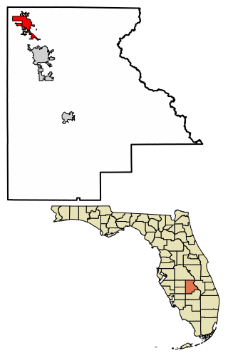
Avon Park is a city in Highlands County, Florida, United States. As of the 2020 census, the population was 9,658, up from the 2010 census when the population was 8,836, but down from the estimated population of 10,695 in 2018. It is the oldest city in Highlands County, and was named after Stratford-upon-Avon, England.

<span class="mw-page-title-main">Andover, Kansas</span> City in Butler County, Kansas

Andover is a city in Butler County, Kansas, United States, and a suburb of Wichita. As of the 2020 census, the population of the city was 14,892. Andover is the most populated city in Butler County.

<span class="mw-page-title-main">Anoka, Minnesota</span> City in Minnesota, United States

Anoka is a city in and the county seat of Anoka County, Minnesota, United States. Its population was 17,142 at the 2010 census. Anoka is the "Halloween Capital of the World" because it hosted one of the first Halloween parades in 1920. It continues to celebrate the holiday each year with several parades. Anoka is a northern suburb of the Twin Cities. U.S. Highways 10 / 169 and State Highway 47 are three of Anoka's main routes, and it has a station on the Northstar Commuter Rail line to Minneapolis.

<span class="mw-page-title-main">Nowthen, Minnesota</span> City in Minnesota, United States

Nowthen is a city in Anoka County, Minnesota, United States. The population was 4,536 at the 2020 census.

<span class="mw-page-title-main">Circle Pines, Minnesota</span> City in Minnesota, United States

Circle Pines is a city in Anoka County, Minnesota, United States. The population was 5,025 at the 2020 census.

<span class="mw-page-title-main">Columbia Heights, Minnesota</span> City in Minnesota, United States

Columbia Heights is a city in Anoka County, Minnesota, United States. The population was 21,973 at the 2020 census.

<span class="mw-page-title-main">East Bethel, Minnesota</span> City in Minnesota, United States

East Bethel is a city in Anoka County, Minnesota, United States. The population was 11,786 at the 2020 census.

<span class="mw-page-title-main">Ham Lake, Minnesota</span> City in Minnesota, United States

Ham Lake is a city in Anoka County, Minnesota, United States. It is a suburb in the Minneapolis–Saint Paul metropolitan area. The population was 15,296 at the 2010 census. It is in the Anoka-Hennepin School District, one of Minnesota's largest school districts.

<span class="mw-page-title-main">Lino Lakes, Minnesota</span> City in Minnesota, United States

Lino Lakes is a city in Anoka County, Minnesota, United States. The population was 21,399 at the 2020 census. Interstates 35W and 35E are two of Lino Lakes's main routes. It is an outer suburb north of the Twin Cities.

<span class="mw-page-title-main">Ramsey, Minnesota</span> City in Minnesota, United States

Ramsey is a suburban city 22 miles (35 km) north-northwest of downtown Minneapolis in Anoka County, Minnesota, United States. The population was 27,646 at the 2020 census. It is a northwest suburb of the Twin Cities.

<span class="mw-page-title-main">Brooklyn Park, Minnesota</span> City in Minnesota, United States

Brooklyn Park is a suburban city on the west bank of the Mississippi River, upstream from downtown Minneapolis in northern Hennepin County. It is the sixth-largest city in the U.S. state of Minnesota. The population was 86,478 at the 2020 census. The city still has undeveloped land and farms, including the historic Eidem Homestead, a 1900s working farm that is a popular tourist attraction for families and school field trips. Brooklyn Park is considered both a second- and third-tier suburb of Minneapolis, because much of the land north of 85th Avenue was developed after 2000.

<span class="mw-page-title-main">Champlin, Minnesota</span> City in Minnesota, United States

Champlin is a city in Hennepin County, Minnesota, United States. The population was 23,919 at the 2020 census. Champlin is a northern suburb of Minneapolis.

<span class="mw-page-title-main">Milaca, Minnesota</span> City in Minnesota, United States

Milaca is a city and the county seat of Mille Lacs County, Minnesota. The population was 3,021 at the time of the 2020 census. It is situated on the Rum River.

<span class="mw-page-title-main">Round Lake, Minnesota</span> City in Minnesota, United States

Round Lake is a city in Nobles County, Minnesota, United States. The population was 376 at the 2010 census.

<span class="mw-page-title-main">Centerville, Minnesota</span> City in Minnesota, United States

Centerville is a city in Anoka County, Minnesota, United States. The population was 3,896 at the 2020 census.

<span class="mw-page-title-main">Coon Rapids, Minnesota</span> City in Minnesota, United States

Coon Rapids is a northern suburb of Minneapolis, and is the second-largest city by population in Anoka County, Minnesota, United States. The population was 63,599 at the 2020 census, making it the fifteenth largest city in Minnesota and the seventh largest Twin Cities suburb.

St. Francis is a city in Anoka and Isanti counties, Minnesota, United States. The population was 8,142 at the 2020 census.

<span class="mw-page-title-main">Blaine, Minnesota</span> City in Minnesota, United States

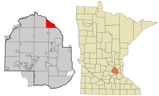
Blaine is a suburban city in Anoka and Ramsey counties in Minnesota, United States. Once a rural town, Blaine's population has increased significantly in the last 60 years. For several years, Blaine led the Twin Cities metro region in new home construction. The population was 70,222 at the 2020 census. The city is mainly in Anoka County, and is part of the Minneapolis–Saint Paul metropolitan area.

<span class="mw-page-title-main">Spring Lake Park, Minnesota</span> City in Minnesota, United States

Spring Lake Park is a city in Anoka and Ramsey counties in the state of Minnesota. The population was 6,412 at the 2010 census. The city is located mainly within Anoka County. Minnesota State Highways 47 and 65 and County Highway 10 are three of the main routes in the city.

References

  1. "2020 U.S. Gazetteer Files". United States Census Bureau. Retrieved July 24, 2022.
  2. 1 2 U.S. Geological Survey Geographic Names Information System: Andover, Minnesota
  3. 1 2 3 "Explore Census Data". United States Census Bureau . Retrieved April 29, 2023.
  4. 1 2 "City and Town Population Totals: 2020-2022". United States Census Bureau. June 9, 2023. Retrieved June 9, 2023.
  5. "Find a County". National Association of Counties. Archived from the original on July 12, 2012. Retrieved June 7, 2011.
  6. "US Gazetteer files 2010". United States Census Bureau. Archived from the original on January 25, 2012. Retrieved November 13, 2012.
  7. Contributer, Community. "Lincoln, Grow and Homestead Act". hometownsource.com. Retrieved June 4, 2022.
  8. 1880 Census
  9. Upham, Warren (2001). Minnesota Place Names: A Geographical Encyclopedia. Minnesota Historical Society Press. p. 23. ISBN   9780873513968.
  10. "About Andover | Andover, MN - Official Website". www.andovermn.gov. Retrieved September 15, 2022.
  11. United States Census Bureau. "Census of Population and Housing" . Retrieved September 11, 2013.
  12. "Elections". www.andovermn.gov. Retrieved April 3, 2024.
  13. "City Council". www.andovermn.gov. Retrieved March 16, 2024.
  14. "Results for Selected Contests in 01486 - Andover". electionresults.sos.mn.gov. Retrieved March 16, 2024.
  15. "Andover FamilyFun Fest | Andover, MN - Official Website". www.andovermn.gov. Retrieved February 16, 2018.
  16. Wentland, Emilee. "25th annual Andover Family Fun Fest coming July 9–10". Hometown Source (ABC Newspapers). Archived from the original on July 24, 2021. Retrieved July 24, 2021.
  17. "Andover Elementary - *Andover Elementary School Home Page". Archived from the original on March 3, 2013. Retrieved April 15, 2013.
  18. "Oak View Middle School - Oak View Home". Archived from the original on March 3, 2013. Retrieved April 15, 2013.
  19. Legacy Christian Academy

45°14′00″N93°17′29″W / 45.23333°N 93.29139°W / 45.23333; -93.29139