Redwood County, Minnesota

Last updated

Redwood County
Redwood County Poor Farm.jpg
Map of Minnesota highlighting Redwood County.svg
Location within the U.S. state of Minnesota
Minnesota in United States.svg
Minnesota's location within the U.S.
Coordinates: 44°24′N95°15′W / 44.4°N 95.25°W / 44.4; -95.25
CountryFlag of the United States.svg United States
StateFlag of Minnesota.svg  Minnesota
FoundedFebruary 6, 1862
Named for Redwood River
Seat Redwood Falls
Largest cityRedwood Falls
Area
  Total882 sq mi (2,280 km2)
  Land879 sq mi (2,280 km2)
  Water3.2 sq mi (8 km2)  0.4%
Population
 (2020)
  Total15,425
  Estimate 
(2023)
15,288 Decrease2.svg
  Density17.5/sq mi (6.8/km2)
Time zone UTC−6 (Central)
  Summer (DST) UTC−5 (CDT)
Congressional district 7th
Website www.co.redwood.mn.us

Redwood County is a county in the U.S. state of Minnesota. As of the 2020 census the population was 15,425. [1] Its county seat is Redwood Falls, along the Redwood River near its confluence with the Minnesota River. [2]

Contents

The Lower Sioux Indian Reservation (also known as the Mdewakankton Tribal Reservation) is entirely within the county, along the southern bank of the Minnesota River in Paxton and Sherman townships. In the 2000 census it had a population of 335.

History

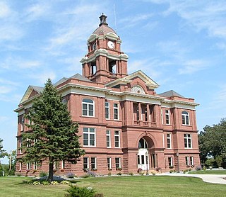
The Minnesota Legislature created the county on February 8, 1862, with Redwood Falls as the county seat. It was named for the Redwood River, which flows eastward through the county. [3]

Geography

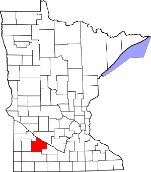
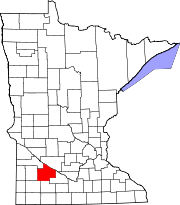
The Minnesota River flows southeast along the county's northeastern border. The Redwood River flows east through the upper part of the county, draining into the Minnesota near Redwood Falls. The Cottonwood River flows east through the lower part of the county, entering adjacent Brown County before discharging into the Minnesota. The county terrain consists of rolling hills, carved with drainages and sprinkled with lakes. [4] The largely rural area is devoted to commodity crops of corn and soybeans. The terrain slopes to the east, with its highest point in the southwest corner at 1,450 ft (440 m) ASL. [5] The county has a total area of 882 square miles (2,280 km2), of which 879 square miles (2,280 km2) is land and 3.2 square miles (8.3 km2) (0.4%) is water. [6]

Soils of Redwood County Redwood Co Pie Chart No Text Version.pdf
Soils of Redwood County
Ramsey Falls Ramsey-falls.jpg
Ramsey Falls

Airports [4]

Major highways

Adjacent counties

Lakes [4]

  • Daubs Lake
  • Gales Lake
  • Lake Francis
  • Lake Redwood
  • Long Lake
  • Three Lakes
  • Tiger Lake

Protected areas [4]

  • Alexander Ramsey State Park
  • Cedar Mountain Scientific and Natural Area
  • Cedar Rock Scientific and Natural Area
  • Daubs Lake State Wildlife Management Area
  • Delhi State Wildlife Management Area
  • Gales State Wildlife Management Area
  • Honner State Wildlife Management Area
  • Klabunde State Wildlife Management Area
  • Luescher-Barnum State Wildlife Management Area
  • Mammenga State Wildlife Management Area
  • Paul State Wildlife Management Area
  • Rohlik State Wildlife Management Area
  • Swedes Forest Scientific and Natural Area (part)
  • Waterbury State Wildlife Management Area
  • Westline State Wildlife Management Area
  • Willow Lake State Wildlife Management Area

Demographics

Historical population
CensusPop.Note
1870 1,829
1880 5,375193.9%
1890 9,88683.9%
1900 17,26174.6%
1910 18,4256.7%
1920 20,90813.5%
1930 20,620−1.4%
1940 22,2908.1%
1950 22,127−0.7%
1960 21,718−1.8%
1970 20,024−7.8%
1980 19,341−3.4%
1990 17,254−10.8%
2000 16,815−2.5%
2010 16,059−4.5%
2020 15,425−3.9%
2023 (est.)15,288 [8] −0.9%
U.S. Decennial Census [9]
1790-1960 [10] 1900-1990 [11]
1990-2000 [12] 2010-2020 [1]

2020 Census

Redwood County Racial Composition [13]
RaceNum.Perc.
White (NH)13,12385.1%
Black or African American (NH)760.5%
Native American (NH)7745.02%
Asian (NH)4142.7%
Pacific Islander (NH)10.01%
Other/Mixed (NH)5413.51%
Hispanic or Latino 4963.22%

2000 census

2022 US Census population pyramid for Redwood County, from ACS 5-year estimates RedwoodCountyMn2022PopPyr.png
2022 US Census population pyramid for Redwood County, from ACS 5-year estimates

As of the census of 2000, the county had 16,815 people, 6,674 households, and 4,524 families. The population density was 19.1 per square mile (7.4/km2). There were 7,230 housing units at an average density of 8.23 per square mile (3.18/km2). The county's racial makeup was 94.97% White, 0.13% Black or African American, 3.24% Native American, 0.32% Asian, 0.07% Pacific Islander, 0.43% from other races, and 0.85% from two or more races. 1.14% of the population were Hispanic or Latino of any race. 55.8% were of German and 13.7% Norwegian ancestry.

There were 6,674 households, of which 31.50% had children under the age of 18 living with them, 57.30% were married couples living together, 7.10% had a female householder with no husband present, and 32.20% were non-families. 28.80% of all households were made up of individuals, and 14.70% had someone living alone who was 65 years of age or older. The average household size was 2.44 and the average family size was 3.02.

26.50% of the county's population was under age 18, 6.60% was from age 18 to 24, 24.80% was from age 25 to 44, 22.70% was from age 45 to 64, and 19.30% was age 65 or older. The median age was 40 years. For every 100 females there were 99.70 males. For every 100 females age 18 and over, there were 96.50 males.

The county's median household income was $37,352, and the median family income was $46,250. Males had a median income of $30,251 versus $21,481 for females. The county's per capita income was $18,903. About 5.50% of families and 7.70% of the population were below the poverty line, including 8.30% of those under age 18 and 8.80% of those age 65 or over.

Communities

Cities and townships of Redwood County Map of Redwood County Minnesota With Municipal and Township Labels.PNG
Cities and townships of Redwood County

Cities

Unincorporated Communities [4]

Townships

Politics

Redwood County is a reliably Republican precinct. In only one national election since 1948 has the county selected the Democratic Party candidate, and even then, the margin of victory was under 2%.

United States presidential election results for Redwood County, Minnesota [14]
Year Republican Democratic Third party
No.%No.%No.%
2020 5,77169.66%2,35528.43%1581.91%
2016 5,13767.49%1,88724.79%5877.71%
2012 4,57058.66%3,00838.61%2122.72%
2008 4,30855.19%3,25041.63%2483.18%
2004 4,89860.18%3,10438.14%1371.68%
2000 4,58959.23%2,68134.60%4786.17%
1996 3,70047.13%2,99738.17%1,15414.70%
1992 3,40838.24%2,74030.74%2,76531.02%
1988 5,07660.73%3,17838.02%1041.24%
1984 6,02066.45%2,95732.64%820.91%
1980 5,99361.79%2,95230.44%7547.77%
1976 4,92650.15%4,52546.07%3713.78%
1972 5,77662.43%3,17734.34%2993.23%
1968 5,13455.29%3,68039.63%4715.07%
1964 4,54649.00%4,72250.90%90.10%
1960 5,89360.47%3,83939.39%140.14%
1956 5,95666.13%3,03933.74%110.12%
1952 7,09372.30%2,69527.47%220.22%
1948 4,16049.26%4,18249.52%1031.22%
1944 5,42865.06%2,88634.59%290.35%
1940 6,10562.41%3,63737.18%400.41%
1936 3,28636.63%4,96555.34%7218.04%
1932 2,63435.21%4,72763.20%1191.59%
1928 5,11163.18%2,89935.84%790.98%
1924 3,34250.66%4436.72%2,81242.63%
1920 5,58983.07%88013.08%2593.85%
1916 2,02956.98%1,36138.22%1714.80%
1912 54217.08%1,12635.48%1,50647.45%
1908 1,82159.86%1,07635.37%1454.77%
1904 2,19479.64%46216.77%993.59%
1900 2,12766.45%91828.68%1564.87%
1896 1,81860.60%1,12337.43%591.97%
1892 1,15543.54%64524.31%85332.15%

See also

Footnotes

  1. 1 2 "State & County QuickFacts". United States Census Bureau. Retrieved April 20, 2023.
  2. "Find a County". National Association of Counties. Retrieved June 7, 2011.
  3. Upham, Warren (1920). Minnesota Geographic Names: Their Origin and Historic Significance. Minnesota Historical Society. p.  448 . Retrieved April 5, 2019.
  4. 1 2 3 4 5 Redwood County MN Google Maps (accessed April 5, 2019)
  5. Find an Altitude/Redwood County MN" Google Maps (accessed April 5, 2019)
  6. "2010 Census Gazetteer Files". United States Census Bureau. August 22, 2012. Archived from the original on September 21, 2013. Retrieved October 24, 2014.
  7. Nelson, Steven (2011). Savanna Soils of Minnesota. Minnesota: Self. pp. 69-70. ISBN   978-0-615-50320-2.
  8. "Annual Estimates of the Resident Population for Counties: April 1, 2020 to July 1, 2023" . Retrieved March 18, 2024.
  9. "U.S. Decennial Census". United States Census Bureau. Retrieved October 24, 2014.
  10. "Historical Census Browser". University of Virginia Library. Retrieved October 24, 2014.
  11. "Population of Counties by Decennial Census: 1900 to 1990". United States Census Bureau. Retrieved October 24, 2014.
  12. "Census 2000 PHC-T-4. Ranking Tables for Counties: 1990 and 2000" (PDF). United States Census Bureau. Archived (PDF) from the original on March 27, 2010. Retrieved October 24, 2014.
  13. "P2 HISPANIC OR LATINO, AND NOT HISPANIC OR LATINO BY RACE – 2020: DEC Redistricting Data (PL 94-171) – Redwood County, Minnesota".
  14. Leip, David. "Atlas of US Presidential Elections". uselectionatlas.org. Retrieved October 10, 2018.

Further reading

44°24′N95°15′W / 44.40°N 95.25°W / 44.40; -95.25

Related Research Articles

<span class="mw-page-title-main">Yellow Medicine County, Minnesota</span> County in Minnesota, United States

Yellow Medicine County is a county in the southwestern part of the U.S. state of Minnesota. Its eastern border is formed by the Minnesota River. As of the 2020 census, the population was 9,528. Its county seat is Granite Falls.

<span class="mw-page-title-main">Watonwan County, Minnesota</span> County in Minnesota, United States

Watonwan County is a county in the U.S. state of Minnesota. As of the 2020 census, the population was 11,253. Its county seat is St. James.

<span class="mw-page-title-main">Swift County, Minnesota</span> County in Minnesota, United States

Swift County is a county in the U.S. state of Minnesota. As of the 2020 census, the population was 9,838. Its county seat is Benson.

<span class="mw-page-title-main">Sherburne County, Minnesota</span> County in Minnesota, United States

Sherburne County is a county in Central Minnesota. At the 2020 census, the population was 97,183. The county seat is Elk River.

<span class="mw-page-title-main">Renville County, Minnesota</span> County in Minnesota, United States

Renville County is a county in the U.S. state of Minnesota. As of the 2020 census the population was 14,723. Its county seat is Olivia.

<span class="mw-page-title-main">Pope County, Minnesota</span> County in Minnesota, United States

Pope County is a county in the U.S. state of Minnesota. As of the 2020 census, the population was 11,308. Its county seat is Glenwood. The county was formed in 1862 and organized in 1866.

<span class="mw-page-title-main">Polk County, Minnesota</span> County in Minnesota, United States

Polk County is a county in the northwestern part of the U.S. state of Minnesota. The population was 31,192 at the 2020 census. Its county seat is Crookston, and the largest community is East Grand Forks.

<span class="mw-page-title-main">Pipestone County, Minnesota</span> County in Minnesota, United States

Pipestone County is a county in the U.S. state of Minnesota. As of the 2020 census, the population was 9,424. Its county seat is Pipestone.

<span class="mw-page-title-main">Pennington County, Minnesota</span> County in Minnesota, United States

Pennington County is a county in the northwestern part of the U.S. state of Minnesota. As of the 2020 census, the population was 13,992. Its county seat is Thief River Falls.

<span class="mw-page-title-main">Norman County, Minnesota</span> County in Minnesota, United States

Norman County is a county in the northwestern part of the U.S. state of Minnesota. As of the 2020 census, the population was 6,441. Its county seat is Ada. The county is in Minnesota's Red River Valley region.

<span class="mw-page-title-main">Murray County, Minnesota</span> County in Minnesota, United States

Murray County is a county in the U.S. state of Minnesota. The population was 8,179 at the 2020 census. Its county seat is Slayton.

<span class="mw-page-title-main">Morrison County, Minnesota</span> County in Minnesota, United States

Morrison County is a county in the U.S. state of Minnesota. As of the 2020 census, the population was 34,010. Its county seat is Little Falls. Camp Ripley Military Reservation occupies a significant area in north-central Morrison County.

<span class="mw-page-title-main">Lyon County, Minnesota</span> County in Minnesota, United States

Lyon County is a county in the U.S. state of Minnesota. As of the 2020 census, the population was 25,269. Its county seat is Marshall.

<span class="mw-page-title-main">Lincoln County, Minnesota</span> County in Minnesota, United States

Lincoln County is a county in the U.S. state of Minnesota. As of the 2020 census, the population was 5,640. Its county seat is Ivanhoe.

<span class="mw-page-title-main">Le Sueur County, Minnesota</span> County in Minnesota, United States

Le Sueur County is a county located in the south central portion of the U.S. state of Minnesota. As of the 2020 census, the population was 28,674. Its county seat is Le Center.

<span class="mw-page-title-main">Lac qui Parle County, Minnesota</span> County in Minnesota, United States

Lac qui Parle County is a county in the southwestern part of the U.S. state of Minnesota. As of the 2020 census, the population was 6,719. Its county seat is Madison. The largest city in the county is Dawson.

<span class="mw-page-title-main">Grant County, Minnesota</span> County in Minnesota, United States

Grant County is a county in the U.S. state of Minnesota. As of the 2020 census, the population was 6,074. Its county seat is Elbow Lake.

<span class="mw-page-title-main">Chippewa County, Minnesota</span> County in Minnesota, United States

Chippewa County is a county in the U.S. state of Minnesota. As of the 2020 census, the population was 12,598. Its county seat is Montevideo. The county was formed in 1862, and was organized in 1868.

<span class="mw-page-title-main">Honner Township, Redwood County, Minnesota</span> Township in Minnesota, United States

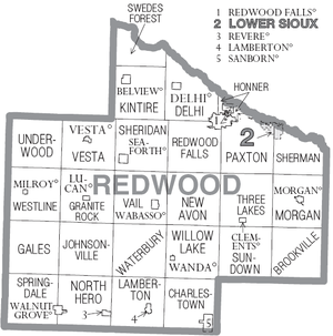
Honner Township was previously one of the twenty-six townships of Redwood County, Minnesota, United States. The population was 86 at the 2000 census.

<span class="mw-page-title-main">Redwood Falls, Minnesota</span> City in the United States

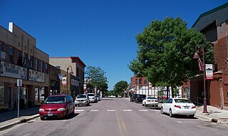
Redwood Falls is a city in Redwood County, located along the Redwood River near its confluence with the Minnesota River, in the U.S. state of Minnesota. The population was 5,102 at the 2020 census. It is the county seat.