Dodge County, Minnesota

Last updated

Dodge County
CourthouseMantorvilleMN.JPG
Dodge County Courthouse
Map of Minnesota highlighting Dodge County.svg
Location within the U.S. state of Minnesota
Minnesota in United States.svg
Minnesota's location within the U.S.
Coordinates: 44°02′N92°52′W / 44.03°N 92.86°W / 44.03; -92.86
CountryFlag of the United States.svg United States
StateFlag of Minnesota.svg  Minnesota
FoundedFebruary 20, 1855 [1]
Named for Henry Dodge
Seat Mantorville
Largest city Kasson
Area
  Total440 sq mi (1,100 km2)
  Land439 sq mi (1,140 km2)
  Water0.3 sq mi (0.8 km2)  0.07%
Population
 (2020)
  Total20,867
  Estimate 
(2023)
21,088 Increase2.svg
  Density47.5/sq mi (18.3/km2)
Time zone UTC−6 (Central)
  Summer (DST) UTC−5 (CDT)
Congressional district 1st
Website www.co.dodge.mn.us

Dodge County is a county in the U.S. state of Minnesota. The population was 20,867 as of the 2020 census. [2] Its county seat is Mantorville. [3]

Contents

Dodge County is part of the Rochester, MN Metropolitan Statistical Area.

History

The area of present Dodge County was a hunting and battle ground for the Mdewakanton Sioux, often fighting Sauk and Fox Indians who wandered into their territory. Possibly the first non-indigenous person to enter the territory was a French fur trader from Canada in 1655. After the fur trappers and early explorers, the area was populated by settlers from New England. The 1820s and 1830s saw significant emigration, eased by completion of the Erie Canal (1825) and the end of the Black Hawk War (1831). They brought a passion for education, establishing many schools, as well as staunch support for abolitionism. They were members of the Congregational or Episcopal church. Culturally Dodge County was similar to colonial New England during the nineteenth century. [4] In 1853 government surveyors set lines for the townships. In 1854, two Mantor brothers and Eli P. Waterman established their claims in the area of present Mantorville. In early 1855, Dodge County was organized for local government. It was named for Henry Dodge, the first governor of Wisconsin (1836–1841). [5]

The Minnesota State Constitution placed Dodge County in the Fifth Judicial District on May 11, 1858. The county courthouse was constructed in 1865; it is presently the oldest still-used courthouse in Minnesota. [6] As the 20th century began, emigrants from Germany, Sweden and Norway flowed to Minnesota in increasing numbers. Their influence added Catholic and Lutheran influence to the cultural mix.

Soils of Dodge County Dodge Co MN Pie Chart No Text Version.pdf
Soils of Dodge County

Geography

The South Branch of the Middle Fork of the Zumbro River flows east-northeast through the upper central part of Dodge County. Salem Creek and Harkcom Creek drain the county to the east. The county terrain consists of rolling hills, devoted to agriculture where possible. [8] The terrain slopes to the northeast; its highest point is on the eastern part of its southern border, at 1,352 ft (412 m) ASL. [9] The county has a total area of 440 square miles (1,100 km2), of which 439 square miles (1,140 km2) is land and 0.3 square miles (0.78 km2) (0.07%) is water. [10]

Dodge County is in southeastern Minnesota and is 24 miles (39 km) long and 18 miles (29 km) wide. The central and northern parts are hilly and thickly wooded with pebbly, loose soil that allows for wheat agriculture. The southern part, in contrast, is flat and wet, more suited to grazing livestock. The soil is very fertile, with heavy black loam. Dodge is one of seven southern Minnesota counties that have no forest ecosystems; only prairie and savanna soils exist here.

Dodge County's plentiful sand and rock also make the area a center for building. Quarries in Mantorville were once enterprises and consist of layers of thick stone that can be cut into any desired shape. Wasioja is known nationwide for its excellent "Wasioja stone."

Streams

Lakes

Major highways

Airport

Adjacent counties

Demographics

Historical population
CensusPop.Note
1860 3,797
1870 8,598126.4%
1880 11,34431.9%
1890 10,864−4.2%
1900 13,34022.8%
1910 12,094−9.3%
1920 12,5523.8%
1930 12,127−3.4%
1940 12,9316.6%
1950 12,624−2.4%
1960 13,2595.0%
1970 13,037−1.7%
1980 14,77313.3%
1990 15,7316.5%
2000 17,73112.7%
2010 20,08713.3%
2020 20,8673.9%
2023 (est.)21,088 [11] 1.1%
U.S. Decennial Census [12]
1790-1960 [13] 1900-1990 [14]
1990-2000 [15] 2010-2020 [2]

2020 Census

Dodge County Racial Composition [16]
RaceNum.Perc.
White (NH)18,80790.13%
Black or African American (NH)1260.6%
Native American (NH)370.2%
Asian (NH)1040.5%
Pacific Islander (NH)10.01%
Other/Mixed (NH)7353.5%
Hispanic or Latino 1,0575.1%

2000 census

2022 US Census population pyramid for Dodge County, from ACS 5-year estimates DodgeCountyMn2022PopPyr.png
2022 US Census population pyramid for Dodge County, from ACS 5-year estimates

As of the census of 2000, there were 17,731 people, 6,420 households, and 4,853 families in the county. The population density was 40.4 per square mile (15.6/km2). There were 6,642 housing units at an average density of 15.1 per square mile (5.8/km2). The racial makeup of the county was 96.58% White, 0.20% Black or African American, 0.17% Native American, 0.41% Asian, 0.01% Pacific Islander, 1.89% from other races, and 0.73% from two or more races. 2.99% of the population were Hispanic or Latino of any race. 34.2% were of German, 26.9% Norwegian, 5.8% Irish, 5.8% American and 5.1% English ancestry.

There were 6,420 households, out of which 40.70% had children under the age of 18 living with them, 64.70% were married couples living together, 7.20% had a female householder with no husband present, and 24.40% were non-families. 20.20% of all households were made up of individuals, and 9.70% had someone living alone who was 65 years of age or older. The average household size was 2.73 and the average family size was 3.15.

The county population contained 30.20% under the age of 18, 7.60% from 18 to 24, 29.90% from 25 to 44, 20.20% from 45 to 64, and 12.10% who were 65 years of age or older. The median age was 35 years. For every 100 females, there were 98.80 males. For every 100 females age 18 and over, there were 97.90 males.

The median income for a household in the county was $47,437, and the median income for a family was $54,261. Males had a median income of $34,195 versus $25,903 for females. The per capita income for the county was $19,259. About 4.40% of families and 5.80% of the population were below the poverty line, including 5.80% of those under age 18 and 9.60% of those age 65 or over.

Communities

Cities

Unincorporated communities

Townships

Politics

Dodge County voters have been reliably Republican for decades. In only one national election since 1964 has the county selected the Democratic Party candidate (as of 2020).

United States presidential election results for Dodge County, Minnesota [17]
Year Republican Democratic Third party
No.%No.%No.%
2020 7,78363.86%4,07933.47%3252.67%
2016 6,52761.26%3,10229.12%1,0259.62%
2012 5,52253.47%4,48743.45%3183.08%
2008 5,46853.54%4,46343.70%2822.76%
2004 5,59356.68%4,11741.72%1581.60%
2000 4,21352.34%3,37041.86%4675.80%
1996 2,88838.84%3,23343.48%1,31417.67%
1992 3,04938.25%2,62032.87%2,30328.89%
1988 3,84856.21%2,92542.73%731.07%
1984 4,42860.97%2,78638.36%480.66%
1980 3,90054.93%2,69838.00%5027.07%
1976 3,44652.23%3,00945.60%1432.17%
1972 3,86365.08%1,92132.36%1522.56%
1968 3,06453.67%2,43742.69%2083.64%
1964 2,47444.02%3,13855.84%80.14%
1960 3,76963.42%2,17036.51%40.07%
1956 3,20563.78%1,81436.10%60.12%
1952 3,89370.68%1,58228.72%330.60%
1948 2,38147.99%2,52350.86%571.15%
1944 2,90261.42%1,80838.26%150.32%
1940 3,25757.90%2,35741.90%110.20%
1936 2,13841.61%2,81254.73%1883.66%
1932 2,12943.53%2,67554.69%871.78%
1928 3,56974.49%1,19624.96%260.54%
1924 2,85665.97%2154.97%1,25829.06%
1920 3,38683.40%51612.71%1583.89%
1916 1,26055.80%89539.64%1034.56%
1912 47023.35%54326.97%1,00049.68%
1908 1,45469.77%51524.71%1155.52%
1904 1,49975.86%31916.14%1588.00%
1900 1,61165.06%67427.22%1917.71%
1896 1,90065.09%91131.21%1083.70%
1892 1,21955.33%53624.33%44820.34%

See also

Related Research Articles

<span class="mw-page-title-main">Yellow Medicine County, Minnesota</span> County in Minnesota, United States

Yellow Medicine County is a county in the southwestern part of the U.S. state of Minnesota. Its eastern border is formed by the Minnesota River. As of the 2020 census, the population was 9,528. Its county seat is Granite Falls.

<span class="mw-page-title-main">Wabasha County, Minnesota</span> County in Minnesota, United States

Wabasha County is a county in the U.S. state of Minnesota. As of the 2020 census, the population was 21,387. Its county seat is Wabasha.

<span class="mw-page-title-main">Steele County, Minnesota</span> County in Minnesota, United States

Steele County is a county in the U.S. state of Minnesota. As of the 2020 census, the population was 37,406. Its county seat is Owatonna.

<span class="mw-page-title-main">Rock County, Minnesota</span> County in Minnesota, United States

Rock County is a county located in the southwestern corner of the U.S. state of Minnesota. According to the 2020 census, its population was 9,704. The county seat is Luverne.

<span class="mw-page-title-main">Rice County, Minnesota</span> County in Minnesota, United States

Rice County is a county located in the south central portion of the U.S. state of Minnesota. As of the 2020 census, the population was 67,097. Its county seat is Faribault.

<span class="mw-page-title-main">Pipestone County, Minnesota</span> County in Minnesota, United States

Pipestone County is a county in the U.S. state of Minnesota. As of the 2020 census, the population was 9,424. Its county seat is Pipestone.

<span class="mw-page-title-main">Olmsted County, Minnesota</span> County in Minnesota, United States

Olmsted County is a county in the U.S. state of Minnesota. As of the 2020 census, the population is 162,847. Its county seat and most populous city is Rochester.

<span class="mw-page-title-main">McLeod County, Minnesota</span> County in Minnesota, United States

McLeod County is a county in the U.S. state of Minnesota. At the 2020 census, the population was 36,771. Its county seat is Glencoe.

<span class="mw-page-title-main">Le Sueur County, Minnesota</span> County in Minnesota, United States

Le Sueur County is a county located in the south central portion of the U.S. state of Minnesota. As of the 2020 census, the population was 28,674. Its county seat is Le Center.

<span class="mw-page-title-main">Houston County, Minnesota</span> County in Minnesota, United States

Houston County is a county in the U.S. state of Minnesota. At the 2020 census, the population was 18,843. Its county seat is Caledonia.

<span class="mw-page-title-main">Goodhue County, Minnesota</span> County in Minnesota, United States

Goodhue County is a county in the U.S. state of Minnesota. As of the 2020 census, the population was 47,582. Its county seat is Red Wing. Nearly all of Prairie Island Indian Community is within the county.

<span class="mw-page-title-main">Faribault County, Minnesota</span> County in Minnesota, United States

Faribault County is a county in the U.S. state of Minnesota. As of the 2020 census, the population was 13,921. Its county seat is Blue Earth.

<span class="mw-page-title-main">Hayfield, Minnesota</span> City in Minnesota, United States

Hayfield is a city in Dodge County, Minnesota, United States. The population was 1,340 at the 2010 census.

<span class="mw-page-title-main">Kasson, Minnesota</span> City in Minnesota, United States

Kasson is a city in Dodge County, Minnesota, United States. The population was 6,851 at the 2020 census. The city is located 13 miles (21 km) west of Rochester along U.S. Highway 14 and is one of the endpoints of Minnesota State Highway 57. The Dakota, Minnesota and Eastern Railroad's main freight rail line also runs through the city. Kasson shares a school system with nearby Mantorville. The K–M school system is a member of the Zumbro Education school district (ZED). Kasson is part of the Rochester, MN Metropolitan Statistical Area.

Mantorville Township is a township in Dodge County, Minnesota, United States. The population was 1,610 at the 2000 census.

<span class="mw-page-title-main">Wasioja Township, Dodge County, Minnesota</span> Township in Minnesota, United States

Wasioja Township is a township in Dodge County, Minnesota. The population was 963 at the time of the 2000 census. The unincorporated community of Wasioja is located within the township.

Vermilion Lake Township is a township in Saint Louis County, Minnesota, United States. The population was 278 at the 2010 census.

<span class="mw-page-title-main">Mantorville, Minnesota</span> City in Minnesota, United States

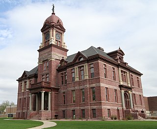
Mantorville is a city in Dodge County, Minnesota, United States. The population was 1,197 at the 2010 census. It is the county seat of Dodge County. Founded in 1854, the city is one of the oldest in Minnesota.

<span class="mw-page-title-main">Rochester metropolitan area, Minnesota</span> Metropolitan area in the United States

The United States Census Bureau defines the Rochester, Minnesota Metropolitan Statistical Area (MSA) as an area consisting of five counties in southeast Minnesota, anchored by the city of Rochester. As of 2018, the US Census Bureau estimates that the Rochester metropolitan statistical area has a population of 221,587. The Rochester–Austin combined statistical area has a population of 259,813 as of 2018.

<span class="mw-page-title-main">Wasioja, Minnesota</span> Unincorporated community in Minnesota, United States

Wasioja is an unincorporated community in Wasioja Township, Dodge County, Minnesota, United States. The community is located near the junction of Dodge County Roads 9 and 16. The South Branch Middle Fork of the Zumbro River and Dodge Center Creek meet at Wasioja. Nearby places include Dodge Center, Mantorville, and Kasson.

References

  1. "Minnesota Place Names". Minnesota Historical Society. Archived from the original on June 20, 2012. Retrieved March 18, 2014.
  2. 1 2 "State & County QuickFacts". United States Census Bureau. Retrieved April 23, 2023.
  3. "Find a County". National Association of Counties. Archived from the original on May 31, 2011. Retrieved June 7, 2011.
  4. The Jones-Steele Family History: Dodge County, Minnesota by Earl W. Velander, Georgean Velander E. & G. Velander, 1990
  5. Upham, Warren (1920). Minnesota Geographic Names: Their Origin and Historic Significance. Minnesota Historical Society. p.  171.
  6. "Dodge County Courthouse". Minnesota Judicial Branch. Retrieved May 14, 2015.
  7. Nelson, Steven (2011). Savanna Soils of Minnesota. Minnesota: Self. pp. 43-48. ISBN   978-0-615-50320-2.
  8. Dodge County MN Google Maps (accessed March 7, 2019)
  9. "Find an Altitude/Dodge County MN" Google Maps (accessed March 7, 2019)
  10. "2010 Census Gazetteer Files". United States Census Bureau. August 22, 2012. Archived from the original on October 6, 2014. Retrieved October 15, 2014.
  11. "Annual Estimates of the Resident Population for Counties: April 1, 2020 to July 1, 2023" . Retrieved March 18, 2024.
  12. "U.S. Decennial Census". United States Census Bureau. Retrieved October 15, 2014.
  13. "Historical Census Browser". University of Virginia Library. Retrieved October 15, 2014.
  14. "Population of Counties by Decennial Census: 1900 to 1990". United States Census Bureau. Retrieved October 15, 2014.
  15. "Census 2000 PHC-T-4. Ranking Tables for Counties: 1990 and 2000" (PDF). United States Census Bureau. Archived (PDF) from the original on March 27, 2010. Retrieved October 15, 2014.
  16. "P2 HISPANIC OR LATINO, AND NOT HISPANIC OR LATINO BY RACE – 2020: DEC Redistricting Data (PL 94-171) – Dodge County, Minnesota".
  17. Leip, David. "Atlas of US Presidential Elections". uselectionatlas.org. Retrieved April 17, 2018.

44°02′N92°52′W / 44.03°N 92.86°W / 44.03; -92.86