Mounds View | |
---|---|
Coordinates: 45°06′26″N93°12′27″W / 45.10722°N 93.20750°W [1] | |
Country | United States |
State | Minnesota |
County | Ramsey |
Organized | May 11, 1858 |
Incorporated | April 24, 1958 |
Government | |
• Mayor | Zachary Lindstrom |
Area | |
• Total | 4.15 sq mi (10.75 km2) |
• Land | 4.06 sq mi (10.51 km2) |
• Water | 0.10 sq mi (0.25 km2) |
Elevation | 912 ft (278 m) |
Population | |
• Total | 13,249 |
• Estimate (2022) [4] | 12,636 |
• Density | 3,265.71/sq mi (1,260.94/km2) |
Time zone | UTC–6 (Central (CST)) |
• Summer (DST) | UTC–5 (CDT) |
ZIP Code | 55112 |
Area code | 763 |
FIPS code | 27-44530 |
GNIS feature ID | 2395118 [1] |
Sales tax | 8.375% [5] |
Website | moundsviewmn.org |
Mounds View is a city in Ramsey County, Minnesota, United States. The population was 13,249 at the 2020 census. [3] It is part of the Twin Cities Metropolitan Area.
U.S. Highway 10, County Road 10, and Interstate Highway 35W are three of the main routes in the city.
According to the United States Census Bureau, the city has a total area of 4.12 square miles (10.67 km2), of which 4.03 square miles (10.44 km2) is land and 0.09 square miles (0.23 km2) is water. [6]
Rice Creek flows through the southeast part of Mounds View. [7]
Nearby places include Shoreview, Arden Hills, New Brighton, Fridley, Spring Lake Park, and Blaine. The boundary line between Ramsey and Anoka counties is nearby.
The city of Mounds View is located in the former Mounds View Township, which was organized in 1858. [8] In 1958, 100 years after Minnesota became a state, the village of Mounds View was incorporated. Post-World War II growth was partially fueled by the proximity of the Twin Cities Arsenal.
The city is primarily residential, with several business parks and businesses located in Mounds View. The bulk of businesses are located along the County Road 10 corridor, with most residential areas flanking it to the north and south. Some of the businesses include Sysco Distributing and Mermaid Entertainment & Event. [9] Former notable businesses include Muldoon's Off 10 and Totino's.
A petroleum pipeline exploded in Mounds View on July 8, 1986. Two-hundred people had to evacuate their homes and two people, a mother and her young daughter, were killed. The Office of Pipeline Safety was created in response to the tragedy.
In 2005, the Mounds View City Council voted to sell the city-owned golf course, "The Bridges of Mounds View", to Medtronic, Inc., to become its new campus. [10] [11] [12] The new campus is located in the north east corner of the city and opened Fall of 2007. [13]
In June 2016, the Mounds View city council voted to change the name of County Road 10 to Mounds View Blvd for the city’s portion of the road. [14]
Census | Pop. | Note | %± |
---|---|---|---|
1960 | 6,416 | — | |
1970 | 10,599 | 65.2% | |
1980 | 12,593 | 18.8% | |
1990 | 12,541 | −0.4% | |
2000 | 12,738 | 1.6% | |
2010 | 12,155 | −4.6% | |
2020 | 13,249 | 9.0% | |
2022 (est.) | 12,636 | [4] | −4.6% |
U.S. Decennial Census [15] 2020 Census [3] |
As of the census of 2010, there were 12,155 people, 4,954 households, and 3,236 families residing in the city. The population density was 3,016.1 inhabitants per square mile (1,164.5/km2). There were 5,221 housing units at an average density of 1,295.5 per square mile (500.2/km2). The racial makeup of the city was 81.3% White, 5.5% African American, 0.8% Native American, 7.0% Asian, 0.1% Pacific Islander, 2.3% from other races, and 3.1% from two or more races. Hispanic or Latino of any race were 5.0% of the population.
There were 4,954 households, of which 31.6% had children under the age of 18 living with them, 47.5% were married couples living together, 12.8% had a female householder with no husband present, 5.0% had a male householder with no wife present, and 34.7% were non-families. 27.8% of all households were made up of individuals, and 8.4% had someone living alone who was 65 years of age or older. The average household size was 2.45 and the average family size was 2.98.
The median age in the city was 37.8 years. 23.1% of residents were under the age of 18; 8.8% were between the ages of 18 and 24; 27.9% were from 25 to 44; 27.6% were from 45 to 64; and 12.6% were 65 years of age or older. The gender makeup of the city was 50.1% male and 49.9% female.
As of the census of 2000, there were 12,738 people, 5,018 households, and 3,387 families residing in the city. The population density was 3,096.6 inhabitants per square mile (1,195.6/km2). There were 5,130 housing units at an average density of 1,247.1 per square mile (481.5/km2). The racial makeup of the city was 90.65% White, 2.40% African American, 0.66% Native American, 3.12% Asian, 0.05% Pacific Islander, 1.02% from other races, and 2.09% from two or more races. Hispanic or Latino of any race were 2.62% of the population.
There were 5,018 households, out of which 33.5% had children under the age of 18 living with them, 50.8% were married couples living together, 12.2% had a female householder with no husband present, and 32.5% were non-families. 23.9% of all households were made up of individuals, and 6.6% had someone living alone who was 65 years of age or older. The average household size was 2.53 and the average family size was 3.02.
In the city, the population was spread out, with 25.8% under the age of 18, 10.5% from 18 to 24, 32.4% from 25 to 44, 22.4% from 45 to 64, and 8.9% who were 65 years of age or older. The median age was 34 years. For every 100 females, there were 99.7 males. For every 100 females age 18 and over, there were 97.5 males.
The median income for a household in the city was $51,974, and the median income for a family was $60,685. Males had a median income of $37,418 versus $29,196 for females. The per capita income for the city was $24,271. About 4.4% of families and 5.9% of the population were below the poverty line, including 9.4% of those under age 18 and 5.2% of those age 65 or over.
Calvin Academy, a private school for children with behavioral disabilities, [16] [17] relocated to the area in 1999. The school was no longer in operation by the end of 2005. [18] Since the 2014-2015 school year, the Mounds View Public Schools Area Learning Center has operated from the former location of Calvin Academy. [19]
Other schools in Mounds View include public schools Edgewood Middle School and Pinewood Elementary School, both operated by Mounds View Public Schools.
Lansing is a city in Lansing Township, Allamakee County, Iowa, United States. The population was 968 at the time of the 2020 census.
Pilot Mound is a city in Pilot Mound Township, Boone County, Iowa, United States. The population was 163 at the time of the 2020 census. It is part of the Boone, Iowa Micropolitan Statistical Area, which is a part of the larger Ames-Boone, Iowa Combined Statistical Area.
Mound City is a city in and the county seat of Linn County, Kansas, United States. As of the 2020 census, the population of the city was 647.
Andover is a city in Anoka County, Minnesota, United States. The population was 32,601 at the 2020 census.
Columbia Heights is a city in Anoka County, Minnesota, United States. The population was 21,973 at the 2020 census.
Fridley is a city in Anoka County, Minnesota, United States. Its population was 29,590 at the 2020 census. It was first settled as a placed named Manomin where Rice Creek flows into the Mississippi river and the Red River Oxcart trail crosses the creek. Fridley was incorporated in 1949 as a village, and became a city in 1957. It is part of the Minneapolis–Saint Paul metropolitan area as a northern "first-ring" or "inner-ring" suburb. Most of the growth in Fridley occurred between 1950 and 1970. Fridley borders Minneapolis to the southwest. Neighboring first-ring suburbs are Columbia Heights to the south and Brooklyn Center to the west, across the Mississippi River.
Pilot Mound Township is a township in Fillmore County, Minnesota, United States. The population was 364 at the 2000 census.
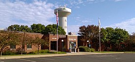
Mound is a city in western Hennepin County, Minnesota, United States. The population was 9,052 at the 2010 census. Mound was the birthplace of the Tonka truck that is named after Lake Minnetonka, which the eastern part of town sits on. Mound is 22 miles (35 km) west of Minneapolis, the county seat.
Shorewood is a city nestled in the woods along on the shores of Lake Minnetonka in Hennepin County, Minnesota, United States. The population was 7,307 at the 2010 census. The city was incorporated in 1956. Its area was originally part of the former Excelsior Township.
Blue Mounds Township is a township in Pope County, Minnesota, United States. The population was 207 at the 2000 census.
New Brighton is a city in Ramsey County, Minnesota, United States. It is a suburb of the Twin Cities. The population was 23,454 at the 2020 census.
Shoreview is a city in Ramsey County, Minnesota, United States. The population was 26,921 at the time of the 2020 census. In 2008, Shoreview ranked fourth in a Family Circle list of best family towns.
Vadnais Heights is a city in Ramsey County, Minnesota, United States. The population was 12,912 at the 2020 census.
Nimrod is a city in Wadena County, Minnesota, United States. The population was 69 at the 2010 census, making it one of the smallest incorporated towns in Minnesota, though it is included on most major maps. Nimrod was incorporated as a city in 1946. The town is named after the Biblical Nimrod.
Mound City is a town in and the county seat of Campbell County, South Dakota, United States. The population was 69 at the 2020 census.
Elbow Lake is a city and county seat of Grant County, Minnesota, United States. The population was 1,276 at the 2020 census.
Spring Lake Park is a city in Anoka and Ramsey counties in the state of Minnesota. The population was 6,412 at the 2010 census. The city is located mainly within Anoka County. Minnesota State Highways 47 and 65 and County Highway 10 are three of the main routes in the city.
North Mankato is a city in Nicollet and Blue Earth counties in the State of Minnesota. The population was 14,275 at the 2020 census.
Comfrey is a city in Brown and Cottonwood counties in the U.S. state of Minnesota. The population was 382 at the 2010 census. The majority of the people live in Brown County.
Clearwater is a city in Stearns and Wright counties in the U.S. state of Minnesota. The population was 1,922 at the 2020 census. Most of the city lies within Wright County.