Oceanside, New York

Last updated

Oceanside, New York
Liberty Lighthouse Oceanside 20211019 182238284.jpg
Oceanside's Liberty Lighthouse on the Veterans Triangle in 2021.
Nassau County New York incorporated and unincorporated areas Oceanside highlighted.svg
Location in Nassau County and the state of New York.
Location map Long Island.png
Red pog.svg
Oceanside, New York
Location on Long Island
USA New York location map.svg
Red pog.svg
Oceanside, New York
Location within the state of New York
Coordinates: 40°38′11″N73°38′15″W / 40.63639°N 73.63750°W / 40.63639; -73.63750
Country Flag of the United States.svg  United States
State Flag of New York.svg  New York
County Nassau
Town Hempstead
Area
[1]
  Total5.43 sq mi (14.06 km2)
  Land4.93 sq mi (12.77 km2)
  Water0.50 sq mi (1.30 km2)
Elevation
10 ft (3 m)
Population
 (2020)
  Total32,637
  Density6,620.08/sq mi (2,556.05/km2)
Time zone UTC-5 (Eastern (EST))
  Summer (DST) UTC-4 (EDP)
ZIP code
11572
Area codes 516, 363
FIPS code 36-54441
GNIS feature ID0959214

Oceanside is a hamlet and census-designated place (CDP) located in the southern part of the town of Hempstead, Nassau County, New York, United States. The population was 32,109 at the 2010 census. [2]

Contents

History

Oceanside in 1930 New York - Oakdale through Shelter Island - NARA - 68145581 (cropped).jpg
Oceanside in 1930

Originally known as South Bay, the English government established a township there in 1674 called Christian Hook, basing the name on the predominant religious affiliation of colonists in the area. Land development proceeded rapidly, and oyster sales took their place as a dominant force, with the local business "Mott's Landing" becoming a favorite place to buy oysters.

In the nineteenth century, the town residents decided that "Oceanville" sounded better than "Christian Hook": it was "Oceanville Oysters" that sold, and in 1864, the new name became official. However, there was already an Oceanville in New York, so "Ocean Side", as two words, was adopted as the town's name in 1890 (this despite it not actually fronting the Atlantic Ocean, which is located a few miles to the south. It is separated from the ocean by Reynolds Channel and other marsh islands, as well as the Long Beach Barrier Island).

The Oceanside Fire Department [3] was established in 1902. Columbia Engine Co. #1, an old firehouse, still exists, and is located at the southwest corner of the triangle where Lincoln Avenue meets Long Beach Road.

In the 1900s, the town began rapidly expanding south, building over swamps and marshes and dramatically increasing the size of the town from a small port to a large hamlet. In 1918, the name was condensed to "Oceanside".

Former dump Oceanside Dump jeh.JPG
Former dump

Nathan's Famous opened its second restaurant on June 4, 1959, on Long Beach Road in Oceanside, taking over the site of the once-popular Roadside Rest, which had opened several decades before and had offered live entertainment and dancing on a large dance floor as well as Nathan's-type frankfurters and locally caught seafood. [4] There was a large Nathan's building with play areas and a big open dining room that had a stage. Shows were family events. The building was razed in 1976, and a strip mall was built in its place. A modern Nathan's franchise subsequently opened on a small section of the original property, at the corner of Long Beach Road and Windsor Parkway. In 2016, Nathan's moved to a smaller location on Long Beach Road. [4]

Oceanside, New York, was a part of the post-World War II housing boom, with even more land being built over with houses and as a result, the town began to resemble Levittown. More schools were built as well as massive houses and a public park on the swampland. Because of this, Oceanside became more vulnerable to floods and natural disasters. This was proven in 2012, when Oceanside saw its worst natural disaster when Hurricane Sandy hit the area. The storm completely flooded the southern portion of the town with areas as far north as Nathan's reporting waves of water rushing down streets. [5] Sandy also knocked out power for nearly two weeks after a substation in the nearby town of Island Park exploded. Oceanside was one of the many towns upset with the slow response from the Long Island Power Authority and held a rally because of it. [6] As of 2019, Oceanside still has many who are dealing with the consequences of Sandy, and some have begun leaving, with the value of houses remaining high. Flooding in low-lying areas would be much more common.

In 2014, after years of speculation and lack of business, Nathan's announced it was moving to a smaller location on the corner of Long Beach Road and Merle Avenue (near the former Chwatsky's). This move was greeted with controversy as many feared that the traffic from deliveries would interfere with the traffic headed to the school during weekdays. [7] Eventually, the Town of Hempstead approved this move and The original building was officially closed on January 4, 2015. The third Nathan's opened in early 2015, and was built as a throwback to both the first and second locations as well as having a contemporary feel to the interior. [8] In 2016, a massive blizzard slammed into the island and dumped nearly 2 feet of snow, and flooded many of the towns around it and some portions of the town closest to the channel. [9]

Geography

U.S. Census Map Oceanside-ny-map.gif
U.S. Census Map

According to the United States Census Bureau, the community has a total area of 5.4 square miles (14 km2), of which 5.0 square miles (13 km2) is land and 0.4 square miles (1.0 km2), or 7.38%, is water. [10]

Oceanside has a humid subtropical climate (Cfa) and average monthly temperatures in the village centre range from 32.1 °F in January to 74.8 °F in July. The local hardiness zone is 7b.

The Town was built over swampland spanning from the early 1900s to the late 1970s. Most of the town before this, was a small sea port near the more established villages of Rockville Centre, Baldwin, and East Rockaway. The area of the town increased exponentially and its population would boom to nearly 30,000 people by the end of the 1990s.

Transportation

Road

Long Beach Road, Oceanside Road, Lawson Boulevard, and Atlantic Avenue are some of the main roads in Oceanside. [11] Other roads such as Brower Avenue and Waukena Avenue, which were built as residential streets, also carry major traffic. Sunrise Highway (NY 27) is located along the Northern border of the hamlet, with Rockville Centre and Baldwin. Merrick Road briefly passes through near South Nassau Communities Hospital. [11]

Rail

The Long Beach Branch of the Long Island Rail Road passes through the west side of Oceanside, with the Oceanside station being at Weidner Avenue and Lawson Boulevard. [11] The Oceanside train stop is the 3rd train station south on the Long Beach line. The travel time from the Oceanside train station to Penn Station is approximately 40 minutes. In the northern part of Oceanside, many commuters use either the nearby Rockville Centre Station or the Baldwin Station on the Babylon Branch. [11]

Bus

The Nassau Inter-County Express passes through Oceanside with the n4 and n15 routes. The n36 served Oceanside until 2017, and the n16 also served Oceanside until 2012, but saw its route shortened due to budget cuts. [12] There is presently no bus headed for the Oceanside LIRR nor are there plans for this. [11] [13]

Demographics

Historical population
CensusPop.Note
2020 32,637
U.S. Decennial Census [14]

2010 Census

As of the 2010 census [15] the population was 92.2% White, 85.9% Non-Hispanic White 1.7% African American, 0.1% Native American, 2.7% Asian, 0.0% Pacific Islander, 2.4% from other races, and 1.3% from two or more races. Hispanic or Latino of any race were 9.2% of the population.

2000 Census

As of the census [16] of 2000, there were 32,733 people, 11,224 households, and 9,125 families residing in the area. The population density was 6,523.6 inhabitants per square mile (2,518.8/km2). There were 11,396 housing units at an average density of 2,271.2 per square mile (876.9/km2). The racial makeup of the CDP was 94.95% White, 0.56% African American, 0.07% Native American, 1.83% Asian, 0.01% Pacific Islander, 1.58% from other races, and 1.00% from two or more races. Hispanic or Latino of any race were 5.90% of the population.

There were 11,224 households, out of which 36.9% had children under the age of 18 living with them, 69.5% were married couples living together, 8.8% had a female householder with no husband present, and 18.7% were non-families. 16.1% of all households were made up of individuals, and 9.1% had someone living alone who was 65 years of age or older. The average household size was 2.90 and the average family size was 3.25.

In the community, the population was spread out, with 25.0% under the age of 18, 6.1% from 18 to 24, 27.6% from 25 to 44, 25.7% from 45 to 64, and 15.6% who were 65 years of age or older. The median age was 40 years. For every 100 females, there were 93.7 males. For every 100 females age 18 and over, there were 89.5 males.

According to a 2007 estimate, [17] the median income for a household in the community was $100,167, and the median income for a family was $109,937. Males had a median income of $55,652 versus $40,163 for females. The per capita income for the CDP was $30,245. About 2.8% of families and 3.5% of the population were below the poverty line, including 3.8% of those under age 18 and 3.9% of those age 65 or over.

Education

The hamlet is served by the Oceanside School District. [11]

Oceanside's first school was built around 1838 on the northwest corner of Oceanside and Foxhurst Roads. It only had one room and an attic. The structure still stood as of 1960, but was moved and is now a private dwelling. The land where the school once stood is now known as the Schoolhouse Green, where many school events are held. Oceanside schools have adopted numerical names, 1 through 9. School #1 was razed in 1981. Today, Schools #2-5, 8 and 9E are elementary schools, School #6 is a kindergarten center, School #7 is a high school, and #9M serves as the middle school. School #9 bears the name of Walter Boardman.

Presently, Phyllis Harrington is the superintendent of the Oceanside School District. She replaced Dr. Herb Brown, who retired at the end of 2012–2013 school year. [18]

Nearby colleges include Adelphi University, Nassau Community College, Molloy College, Hofstra University, New York Institute of Technology, Farmingdale State College, Stony Brook University and C.W. Post College.

Notable people

Jay Fiedler Jay Fiedler.jpg
Jay Fiedler
Harold Varmus National Cancer Institute director Harold E. Varmus (3) (cropped).jpg
Harold Varmus

Politics

All of Oceanside is in New York's 4th congressional district, which is represented by Congressman Anthony D'Esposito. Despite Democratic Victories in the past, Donald Trump won the Popular vote in Oceanside in the 2016 election. [23]

Exterior of the Greater Lincoln Shopping Center that was used for the Netflix Show Maniac Bank of Eli Maniac.png
Exterior of the Greater Lincoln Shopping Center that was used for the Netflix Show Maniac

Related Research Articles

<span class="mw-page-title-main">Nassau County, New York</span> County in New York, United States

Nassau County is a suburban county located on Long Island, immediately to the east of New York City. As of the 2020 United States census, Nassau County's population was 1,395,774, making it the sixth-most populous county in the State of New York, and reflecting an increase of 56,242 (+4.2%) from the 1,339,532 residents enumerated at the 2010 census. Its county seat is Mineola, while the county's largest town is Hempstead. Along with the remainder of Long Island, Nassau County lies in the southeastern portion of New York State.

<span class="mw-page-title-main">Albertson, New York</span> Hamlet and census-designated place in New York, United States

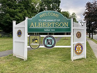
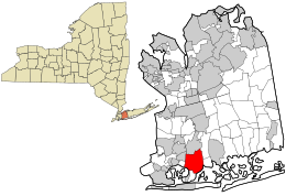
Albertson is a hamlet and census-designated place (CDP) in the Town of North Hempstead in Nassau County, on Long Island, in New York, United States. The population was 5,220 at the time of the 2020 census.

<span class="mw-page-title-main">Barnum Island, New York</span> Hamlet and census-designated place in New York, United States

Barnum Island is a hamlet and census-designated place (CDP) in Nassau County, New York, United States. The population was 2,590 at the 2020 census. It occupies the eastern portion of an island situated between Long Island and Long Beach. That island, previously known in its entirety as Hog Island, consists entirely of the communities of Barnum Island and Island Park.

<span class="mw-page-title-main">Bay Park, New York</span> Hamlet and census-designated place in New York, United States

Bay Park is a hamlet and census-designated place (CDP) in the Town of Hempstead in Nassau County, on the South Shore of Long Island, in New York, United States. The population was 2,212 at the 2010 census.

<span class="mw-page-title-main">East Meadow, New York</span> Hamlet and census-designated place in New York, United States

East Meadow is a hamlet and census-designated place (CDP) in the Town of Hempstead in Nassau County, on Long Island, in New York, United States. The population was 36,856 at the time of the 2024 census.

<span class="mw-page-title-main">East Rockaway, New York</span> Village in New York, United States

East Rockaway is a village in Nassau County, on the South Shore of Long Island, in New York, United States. The population was 9,818 at the 2010 census.

<span class="mw-page-title-main">Greenvale, New York</span> Hamlet and census-designated place in New York, United States

Greenvale is a hamlet and census-designated place (CDP) in the towns of North Hempstead and Oyster Bay in Nassau County, on the North Shore of Long Island, in New York, United States. It is considered part of the Greater Roslyn area, which is anchored by the Incorporated Village of Roslyn. The population was 1,069 at the time of the 2020 census.

<span class="mw-page-title-main">Herricks, New York</span> Hamlet and census-designated place in New York, United States

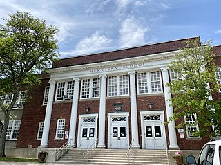
Herricks is a hamlet and census-designated place (CDP) in Nassau County, on Long Island, in New York, United States. The population was 4,398 at the 2020 census.

<span class="mw-page-title-main">Hicksville, New York</span> Hamlet and census-designated place in New York, United States

Hicksville is a hamlet and census-designated place (CDP) within the Town of Oyster Bay in Nassau County, on Long Island, in New York. The population of the CDP was 43,869 at the 2020 census.

<span class="mw-page-title-main">Island Park, New York</span> Village in New York, United States

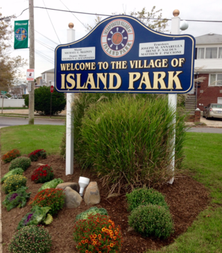
Island Park is a village located in the Town of Hempstead in Nassau County, New York, United States. It is a suburb of Long Beach, New York to the south, and a neighbor of Oceanside to the north. The population was 4,928 at the 2020 census.

<span class="mw-page-title-main">Manhasset Hills, New York</span> Hamlet and census-designated place in New York, United States

Manhasset Hills is a hamlet and census-designated place (CDP) in the Town of North Hempstead in Nassau County, on Long Island, in New York, United States. The population was 3,592 at the 2010 census. Neighboring communities include Herricks, North Hills, North New Hyde Park, and Lake Success.

<span class="mw-page-title-main">Port Washington, New York</span> Hamlet and CDP in Nassau County, New York

Port Washington is a hamlet and census-designated place (CDP) on the Cow Neck Peninsula in the Town of North Hempstead, in Nassau County, on the North Shore of Long Island, in New York. The hamlet is the anchor community of the Greater Port Washington area. The population was 16,753 at the 2020 census.

<span class="mw-page-title-main">Roslyn Heights, New York</span> Hamlet and census-designated place in New York, United States

Roslyn Heights is a hamlet and census-designated place (CDP) in the Town of North Hempstead in Nassau County, on the North Shore of Long Island, in New York, United States. It is considered part of the Greater Roslyn area, which is anchored by the Incorporated Village of Roslyn. The population was 6,747 at the time of the 2020 census.

<span class="mw-page-title-main">Saddle Rock Estates, New York</span> Hamlet and census-designated place in New York, United States

Saddle Rock Estates is a hamlet and census-designated place (CDP) located on the Great Neck Peninsula within the Town of North Hempstead in Nassau County, on the North Shore of Long Island, in New York, United States. The population was 466 at the 2010 census.

<span class="mw-page-title-main">Seaford, New York</span> Hamlet and census-designated place in New York, United States

Seaford is a census-designated place in the town of Hempstead, Nassau County, on the South Shore of Long Island, in New York, United States. The population was 15,251 at the 2020 census.

<span class="mw-page-title-main">Searingtown, New York</span> Hamlet and census-designated place in New York, United States

Searingtown is a hamlet and census-designated place (CDP) in the Town of North Hempstead in Nassau County, on Long Island, in New York, United States. It is considered part of the Greater Roslyn area, which is anchored by the Village of Roslyn. The population was 4,915 at the 2010 census.

<span class="mw-page-title-main">Uniondale, New York</span> Hamlet and census-designated place in New York, United States

Uniondale is a hamlet and census-designated place in Nassau County, New York, on Long Island, in the town of Hempstead. The population was 32,473 at the 2020 United States Census. Uniondale is home to Hofstra University's north campus, as well as a portion of its southern campus.

<span class="mw-page-title-main">University Gardens, New York</span> Hamlet and census-designated place in New York, United States

University Gardens is a hamlet and a census-designated place (CDP) in Nassau County, on the North Shore of Long Island, in New York, United States. It is located within the Town of North Hempstead and is part of the Greater Great Neck area. The population was 4,358 at the time of the 2020 census.

<span class="mw-page-title-main">Sound Beach, New York</span> Hamlet and census-designated place in New York, United States

Sound Beach, established in 1929, is a hamlet and census-designated place (CDP) in the north part of the Town of Brookhaven in Suffolk County, New York, United States. The population of the CDP was 7,612 at the 2010 census.

<span class="mw-page-title-main">Hempstead, New York</span> Town in New York, United States

The Town of Hempstead is the largest of the three towns in Nassau County on Long Island, in New York, United States. The town's combined population was 793,409 at the 2020 census, which is the majority of Nassau County's population and makes it, by far, the largest population of any town in the United States.

References

  1. "ArcGIS REST Services Directory". United States Census Bureau. Retrieved September 20, 2022.
  2. "Race, Hispanic or Latino, Age, and Housing Occupancy: 2010 Census Redistricting Data (Public Law 94-171) Summary File (QT-PL), Oceanside CDP, New York". United States Census Bureau . Retrieved October 4, 2011.
  3. Oceanside Fire Department
  4. 1 2 Nathan's Famous/Roadside Rest
  5. Morse, Stephen R. (December 26, 2012). "My Hometown's Recovery From Sandy Has Been Lackluster, And Could Have Been Better". PolicyMic.
  6. Twarowski, Christopher; Mian, Rashed (November 9, 2012). "Oceanside Residents Hit by Sandy Blast LIPA, Pols". Long Island Press.
  7. "New location for Nathan's". Long Island Herald. July 23, 2014.
  8. "NATHAN'S IS BACK IN OCEANSIDE!". Nathan's Famous. Archived from the original on March 7, 2016. Retrieved March 7, 2016.
  9. Rathbun, Brett. "Record-breaking blizzard buries mid-Atlantic with over 2 feet of snow". Accuweather. Archived from the original on April 6, 2016. Retrieved March 11, 2016.
  10. "US Gazetteer files: 2010, 2000, and 1990". United States Census Bureau. February 12, 2011. Retrieved April 23, 2011.
  11. 1 2 3 4 5 6 "Long Island Index: Interactive Map". www.longislandindexmaps.org. Retrieved April 1, 2023.
  12. Kabak, Benjamin (February 16, 2012). "NICE BUS, $7.3 million in the red, already threatening service cuts". Second Avenue Sagas. Retrieved February 20, 2012.
  13. NICE Bus [@theNICEbus] (November 16, 2015). "@marcuspearl429 thanks for the suggestion. Currently we don't have plans to expand our service to include the Oceanside LIRR" (Tweet) via Twitter.
  14. "Census of Population and Housing". Census.gov. Retrieved June 4, 2016.
  15. American FactFinder – Results
  16. "U.S. Census website". United States Census Bureau . Retrieved January 31, 2008.
  17. American FactFinder – Community Facts
  18. "History-1900to1960". Archived from the original on December 3, 2013. Retrieved August 8, 2013.
  19. The BSA's First Eagle Scout Arthur Rose Eldred, EagleScout.org. Accessed September 22, 2015. "Arthur Rose Eldred was born in Brooklyn, NY on August 16, 1895. His father died when Arthur was very young, and he was raised in Oceanside, Long Island, NY by his mother."
  20. Kriegel, Mark. "FIEDLER STANDS THE PASS OF TIME", Daily News (New York) , November 19, 2000. Accessed September 22, 2015. "And today, that's what he is. Jay Fiedler starts for the Miami Dolphins. The kid who was living in his parents house in Oceanside, out of football for two years, has replaced the great Dan Marino."
  21. Sharp, Bracha K. "Cooking With Elegance, Artistry, and Love: An Interview With Susie Fishbein", The Jewish Link – Bronx, Westchester & Connectict, May 7, 2015. Accessed September 22, 2015. "Fishbein grew up in Oceanside, N.Y., and now resides in Livingston, N.J. with her family."
  22. Kerr, Kathleen. "They Began Here: Around the country, leading thinkers in health and science can trace their roots to Long Island" Archived 2008-06-09 at the Wayback Machine , Newsday , July 16, 2008. Accessed September 17, 2008.
  23. "How Long Island Voted". Newsday. Retrieved December 10, 2018.
  24. Lovece, Frank. "Emma Stone, Jonah Hill Netflix series 'Ronald' filming in Oceanside". Newsday. Newsday LLC. Retrieved September 24, 2018.