
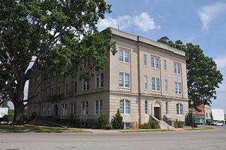
Scotland County is a county located in the southern part of the U.S. state of North Carolina. Its county seat is and largest city is Laurinburg. The county was formed in 1899 from part of Richmond County and named in honor of the Scottish settlers who occupied the area in the 1700s. As of the 2020 census, its population was 34,174.

Robeson County is a county in the southern part of the U.S. state of North Carolina and is its largest county by land area. Its county seat and largest city is Lumberton. The county was formed in 1787 from part of Bladen County and named in honor of Thomas Robeson, a colonel who had led Patriot forces in the area during the Revolutionary War. As of the 2020 census, the county's population was 116,530. It is a majority-minority county; its residents are approximately 38 percent Native American, 22 percent white, 22 percent black, and 10 percent Hispanic. It is included in the Fayetteville-Lumberton-Laurinburg, NC Combined Statistical Area. The state-recognized Lumbee Tribe of North Carolina is headquartered in Pembroke.

Pender County is a county located in the U.S. state of North Carolina. As of the 2020 census, the population was 60,203. Its county seat is Burgaw. Pender County is part of the Wilmington, NC Metropolitan Statistical Area.

New Hanover County is a county located in the U.S. state of North Carolina. As of the 2020 census, the population was 225,702. Though the second-smallest county in North Carolina by land area, it is one of the most populous, as its county seat, Wilmington, is one of the state's largest cities. The county was created in 1729 as New Hanover Precinct and gained county status in 1739. New Hanover County is included in the Wilmington, NC Metropolitan Statistical Area, which also includes neighboring Pender County.
Moore County is a county located in the U.S. state of North Carolina. As of the 2020 census, its population was 99,727. Its county seat is Carthage and its largest municipality Pinehurst. It is a border county between the Piedmont and the Atlantic Coastal Plain.

Harnett County is a county located in the U.S. state of North Carolina. As of the 2020 census, the population was 133,568. Its county seat is Lillington; its largest city is Dunn. Harnett County is part of the Fayetteville metropolitan statistical area.

Brunswick County is the southernmost county in the U.S. state of North Carolina. As of the 2020 census, the population was 136,693. Its population was only 73,143 in 2000, making it one of the fastest-growing counties in the state. With a nominal growth rate of approximately 47% in ten years, much of the growth is centered in the eastern section of the county in the suburbs of Wilmington such as Leland, Belville and Southport. The county seat is Bolivia, which at a population of around 150 people is among the least populous county seats in the state.

Hockessin is a census-designated place (CDP) in New Castle County, Delaware, United States. The population was 13,478 at the 2020 Census.

Altamahaw is a census-designated place (CDP) in Alamance County, North Carolina, United States. It is part of the Burlington, North Carolina Metropolitan Statistical Area. As of the 2010 census it had a population of 347. The community was listed as Altamahaw-Ossipee at the 2000 census, at which time the population was 996. The town of Ossipee incorporated in 2002 and currently has a population of 543. The remainder of the territory was reassigned as the Altamahaw CDP.
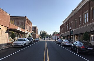
Weldon is a town in Halifax County, North Carolina, United States. The population was 1,655 at the 2010 census. It is part of the Roanoke Rapids, North Carolina Micropolitan Statistical Area.

Lowesville is a census-designated place (CDP) in Lincoln County, North Carolina, United States. The population was 2,945 at the 2010 census, up from 1,440 in 2000.

Castle Hayne is a census-designated place (CDP) in New Hanover County, North Carolina, United States. The population was 1,202 at the 2010 census, up from 1,116 in 2000. It is part of the Wilmington Metropolitan Statistical Area.

Hightsville is a census-designated place (CDP) in New Hanover County, North Carolina, United States. The population was 739 at the 2010 census. It is part of the Wilmington Metropolitan Statistical Area.
Ivanhoe is a census-designated place (CDP) in Sampson County, North Carolina, United States. The population was 198 at the 2020 U.S. census.

Apex is a town in Wake County, North Carolina, United States. At its southern border, Apex encompasses the community of Friendship. In 1994, the downtown area was designated a historic district, and the Apex train depot, built in 1867, is designated a Wake County landmark. The depot location marks the highest point on the old Chatham Railroad, hence the town's name. The town motto is "The Peak of Good Living".

Dudley is an unincorporated community and census-designated place (CDP) in Wayne County, North Carolina, United States, about 9 miles south of Goldsboro. It was first listed as a CDP in the 2020 census with a population of 826. Dudley is included in the Goldsboro, North Carolina Metropolitan Statistical Area.
Hampstead is an unincorporated community and census-designated place (CDP) in Pender County, North Carolina, United States. It is located between Wilmington and Jacksonville on U.S. Route 17 and includes an area sized just over 20 square miles.

Linville is an unincorporated community and census-designated place (CDP) in Avery County, North Carolina, United States. It was first listed as a CDP in the 2020 census with a population of 283. Centered just south of US 221 and NC 105, the community is known as a summer mountain resort and host of the Grandfather Mountain Highland Games, the largest modern Highland games events in North Carolina.
Delco is an unincorporated community and census-designated place (CDP) in Columbus County, North Carolina, United States. The population was 348 at the 2010 census.
Jackson Heights is an unincorporated community and census-designated place (CDP) in Lenoir County, North Carolina, United States. Its population was 1,141 as of the 2010 census.


