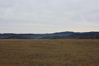
The Ottawa River crossing the Ottawa Valley near the City of Ottawa. In the foreground, skirts of the Gatineau Hills make up part of the southern tip of the Canadian Shield.
The Ottawa Valley is the valley of the Ottawa River, along the boundary between Eastern Ontario and the Outaouais, Quebec, Canada. The valley is the transition between the Saint Lawrence Lowlands and the Canadian Shield. Because of the surrounding shield, the valley is narrow at its western end and then becomes increasingly wide (mainly on the Ontario side of the river) as it progresses eastward. The underlying geophysical structure is the Ottawa-Bonnechere Graben. Approximately 1.3 million people reside in the valley (and along its tributaries), around 80% of whom reside in Ottawa. The total area of the Ottawa Valley is 2.4 million ha (6 million ac). The National Capital Region area has just over 1.4 million inhabitants in both provinces.
Near the City of Ottawa, the Ottawa Valley merges with the St. Lawrence Valley to the south to create a delta of flat farmland stretching unbroken from the Ottawa River to the Saint Lawrence River as far east as the island of Montreal, where the two rivers meet. The area is sometimes referred to as the "Lower Ottawa Valley," in contrast with the "Upper Ottawa Valley" west of Ottawa, but the name is not common, and most people think of the Ottawa Valley as only the upper portion. Cornwall is typically not included in the Ottawa Valley.[according to whom?]
The entire Ottawa Valley is claimed to be within Omàmiwininiwak (Algonquin Country traditional territory) and is presently under land claim.[1]
Federally Recognized Algonquin Communities and Dialect Isoglosses
The entire territory south of the Ottawa river was conquered by the Iroquois during the French-Indian War/Seven Years' War, who then left it to the British Crown when they relocated to upstate New York. As a result the majority of Algonquins reside on the Quebec (north) side of the border, where all but two Algonquin communities are located.[1] However, there are many Algonquin communities and individuals not recognized as such by the Government of Canada under the Indian Act. These individuals are referred to as "non-status Indians". Ardoch Algonquin First Nation is one such community located in the Ottawa Valley fighting for the return of the land they lost to the Iroquois. As a relatively recent adaptation resulting from the economic pressures of the encroachment of non-native settling of the valley, the Algonquin First Nation is unevenly distributed within their territory.
After the arrival of European settlers in North America, the first major industry of the Ottawa Valley was fur trading. The valley was part of the major cross-country route for French-Canadian Voyageurs, who would paddle canoes up the Ottawa River as far as Mattawa and then portage west through various rivers and lakes to Georgian Bay on Lake Huron. Later, lumber became the valley's major industry, and it is still important in the far western part where the valley is narrow and little farmland is available. Today, the vast majority of the valley's residents live at its eastern end in Ottawa and its suburbs, where government and technology are major industries.
In the areas of Morrison's Island and Allumette Island there were many archaeological sites found from the earlier years of the Algonquin First Nations tribes. Many of these sites were found by the late Clyde C. Kennedy, who was a student of history; he was very interested in history and worked hard while researching the sites. The items found on the different sites are dated from about five thousand years ago to about two thousand years ago, and are a range of different things from native copper, to spear heads.
Major settlements in the Upper Ottawa Valley
Petawawa is a town located in Renfrew County, in the Ottawa Valley. It was thought to have been first settled by the Algonquian peoples and the name comes from their language meaning "where one hears the noise of the water". Samuel de Champlain passed through the area and it was used as an important location for the Hudson's Bay Company. Many of the first settlers were of Irish, Scottish, and later German origin. Today Petawawa is the home of one of the largest Canadian Forces Land Force Command bases in Canada CFB Petawawa.
Pembroke is located in Renfrew County on the Ottawa River. It is known as “the heart of the Ottawa Valley”. It was established in 1828 by pioneers and became a centre for the logging industry. Today, it is the largest regional service centre between Ottawa and North Bay.
Historical notes
Samuel de Champlain spent the years between 1613 and 1615 traveling the Ottawa River with Algonquin and Huron guides. He was the first documented European to see the Ottawa Valley. When Champlain first arrived there the Huron, Algonquin, Iroquois, and Outaouais tribes were living in the Valley. In charting the new land Champlain inaugurated the route that would be used by French fur traders for the next 200 years.*Between 1847 and 1879 a "horse railway" was used to portage passengers from the Ottawa River steamboat in a horse-drawn car for 5.5 kilometres along the wooded shore, around the Chats Falls, on the Quebec side of the river between the ghost villages of Pontiac Village and Union Village, near Quyon Quebec, to another steamboat to continue their journey upriver.
Language
English and French are both commonly spoken throughout the Ottawa Valley on both sides of the river. The Counties of Prescott and Russell County, in the Ottawa Valley, has the highest concentration of francophones in Canada west of Quebec. The variant of French spoken in this area of the province is also based on Quebec French, but distinctly different from that of the Outaouais region.
Valley twang
Regional English accents are rare west of Québec, but because of its isolation before the arrival of the railways and also by the mixture of the dominant French, Irish and Scottish populations, the valley at one time developed a distinctive dialect, referred to as the Ottawa Valley Twang. Many traces of it can still be heard today, especially in the valley's more isolated western portions.
Music and musical heritage
The Ottawa Valley has rich musical heritage that finds its roots in the music traditions of Irish and French immigrants. The music and traditions continued and developed in the lumber camps that are storied part of the Ottawa River lumber industry. Traditions continued in the Valley's festivals and hotels. Of these, Lennox Gavan's Hotel in Quyon, Quebec and Fred Meilleur's Chapeau Hotel on L'Ile aux Allumettes (now burned down), Quebec were particularly influential. Legendary performer and songwriter Mac Beattie and the Melodiers were also large influences on keeping the Ottawa Valley's musical culture vibrant and living. Today, many performers keep the musical traditions alive, including Gail Gavan, Terry McLeish, April Verch and Trevor Grahl.
Food
The Ottawa Valley has a rich beef and corn farming community. There are a great many local breweries spread about the valley. The village of Killaloe is also the birthplace of the pastry known as a "beaver tail".
Transportation
There are two 400-series highways which service the Ottawa Valley region on the southern side (Ontario side) of the Ottawa River, Highway 417 (The Queensway) which runs east–west through Ottawa and Highway 416 (The Veterans Memorial Highway) which runs north–south. To the west of Ottawa, Highway 417 eventually ends near Arnprior, where it continues westward as the two-lane Highway 17. In Ottawa there is a split in the Queensway near Cyrville and Pineview where Highway 174 branches off from Highway 417 and runs further north. East of Ottawa Highway 174 eventually ends and becomes County Road 17 again, and both it and Highway 417 continue eastwards to eventually merge near the Quebec border. At its northernmost point Highway 416 connects to Highway 417 in Ottawa near Nepean, and at its southernmost point it connects with Highway 401 near Prescott.
On the Northern side (Quebec side) of the Ottawa river Autoroute 5 runs primarily North-South through Gatineau starting from the Macdonald Cartier Bridge. It eventually becomes Quebec Route 105 further north. Route 148 runs primarily east–west through Gatineau and Hull; however, to the west of Hull it goes north-westward to south-eastern in order to follow the direction of the Ottawa River.
There are five major road bridges which cross the Ottawa River in the Ottawa area. There are also three road bridges to the west of the city and one to the east, all along Country Road 17 and Route 148. There are also a number of ferries at various points along the river which can transport people and vehicles across.
Part of the Trans Canada Railway passes through the Ottawa Valley. Via Rail operates passenger trains to and from Ottawa and other towns in the Ottawa Valley. The main passenger runs which operate from the region are Ottawa to Montreal and Ottawa to Toronto. The closest cities along the rail line to Ottawa are Montreal to the east of Ottawa and Brockville to the South. Freight trains also operate on the railway and Ottawa has a sizable train yard. A new commuter rail line between Ottawa and Pembroke is in the planning stages, along the Beachburg spur line.[2]
The Ottawa Macdonald–Cartier International Airport, ICAO Code CYOW operates both flights to other major Canadian cities and other international airports. The airport is also a major hub for diplomats and international figures to come into Canada. Major airlines such as Air Canada, West jet, American Airlines and First Air use the airport consistently. The airport is also home to two flight training colleges on the north side of the field. It is Canada's 7th busiest airport.
Many Ottawa natives have excelled in the athletic world, particularly winter sports. Barbara Ann Scott was world figure skating champion and won the gold medal at St. Moritz, Switzerland in 1948. Skier Ann Heggtveit won a gold medal at the 1960 Winter Olympics in Squaw Valley, California. Elizabeth Manley won the silver medal for women's figure skating at the Calgary Winter Olympics in 1988. The Clifford family has long been associated with skiing in the Ottawa area. Linda Thom won Olympic gold at the 1984 Summer Olympics in Los Angeles. Francis Amyott, from the Britannia Club, won the single canoeing event when it was held for the first time at the Berlin Olympic Games in 1936.
Two Ontario premiers came from the Ottawa Valley - Premier Howard Ferguson (Kemptville) in the 1920s and Premier Dalton McGuinty (Ottawa), who became premier in 2003.
"Hockey Country"
The public relations office of the Ottawa Senatorsice hockey team call Ottawa and the Valley "hockey country". Indeed, it is the home not only of the once prominent Senators, which folded in 1934 and came back in 1992, but also of such famous NHL builders as Tommy Gorman and Ambrose O'Brien. With the Senators' arena "Canadian Tire Centre (CTC)", originally named the "Palladium", located in Kanata, Ontario, which links Ottawa with the Valley, residents of the Upper Ottawa Valley can easily access the games. The CTC is the home of the "Ottawa Sports Hall of Fame", several restaurants, a fitness complex and several businesses. The CTC, including the standing room, has a capacity of holding 20,500 people for any event. Many of the members of the Senator's coaching and management staff in 2010 hail from, or have strong connections to, the town of Shawville.
The Ottawa Valley's Renfrew Millionaires, the creation of lumber baron O'Brien, was a small-town professional hockey team that won the league championship in 1910. Ottawa and the valley are also the home of such outstanding players as Frank Nighbor, Aurel Joliat, Frank "King" Clancy, Frank Boucher, Kurtis Foster and Denis Potvin; the latter was the star defenceman of the New York Islanders dynasty of the late 1970s. Ottawa's Brian Kilrea holds the record as the Ontario Hockey League's longest-serving coach with a record number of games behind the bench of the Ottawa 67's junior hockey team. The 67's themselves are something of a legend, having a loyal following that results in sellout games almost every time they step on the ice. The Ottawa 67's play hockey at Lansdowne Park which used to be home to the Ottawa Senators. Lansdowne has a capacity of over 9,682 seats. The Ottawa 67's have won only two memorial cups (1984, 1999) since they first started in 1967.
Geography
The Ottawa Valley covers over 7,645 square kilometres. Some 12,800 years ago, glaciers retreated from what is now the Ottawa Valley region, leaving the area covered by the Champlain Sea for thousands of years. Ten thousand years ago the water retreated and land emerged, exposing fossils preserved in limestone, particularly in Eganville along the Bonnechere River and the historical site of the Bonnechere Caves and its subterranean river caverns.
More than half of the Ottawa Valley is now wilderness. Renfrew County, located in the heart of the Ottawa Valley, is the largest county in Ontario. (outside of "districts", administrative regions in Northern Ontario). There are over 900 lakes and four major river systems in the Ottawa Valley. Ottawa itself is at the confluence of three rivers. These are the Ottawa, Gatineau and Rideau rivers.
The Ottawa River is 1,130 kilometres long with a watershed of 140,000km squared. Its source is Lac Capimitchigama in Quebec. The Ottawa River was first navigated and settled by the Huron, Algonquin, Iroquois and Outaouais people. The Ottawa River bears the name of an aboriginal tribe that traded on the waterway; the "Outaouais" which is French for Ottawa. The Ottawa River provided the means for entrepreneurs to start up their logging business. The River watershed had unlimited resources, loose regulations, and cheap labour pools which allowed the entrepreneurs to quickly increase control over the timber trade. Many people involved in the logging industry took advantage of the waterway and built their empires because of the fast-moving waters and forests along the River. These loggers played a crucial role in the development of the valley community as they guided logs downriver [3] this boost is what led to the development of major towns and cities such as Ottawa and Gatineau. The Algonquin people called the Ottawa River "Kitchissippi", which means “Great River”. The Algonquin word Kichesippirini means "Big River People". The name Petawawa comes from the Algonquin language meaning “where one hears a noise like this.”
Flora and fauna
More than 400 species of animals live in the Ottawa Valley. The white trillium, which grows throughout the Ottawa Valley, has been Ontario's provincial floral emblem since 1937. Its white blossom is associated with peace and hope. White pine, the Ontario provincial tree, was the most commercially important tree during the heyday of the logging industry in the 19th century. It was exported to Europe and used for building the masts of sailing ships. Winter was the best season for cutting timber as trees fell more easily when their sap wasn’t running and ice and snow made it easier to drag the timber. Spring was the season when the loggers would “drive” the logs downriver.
The Ottawa River is a river in the Canadian provinces of Ontario and Quebec. It is named after the Algonquin word 'to trade', as it was the major trade route of Eastern Canada at the time. For most of its length, it defines the border between these two provinces. It is a major tributary of the St. Lawrence River and the longest river in Quebec.
Gatineau is a city in south western Quebec, Canada. It is located on the northern bank of the Ottawa River, immediately across from Ottawa, Ontario. Gatineau is the largest city in the Outaouais administrative region and is part of Canada's National Capital Region. As of 2021, Gatineau is the fourth-largest city in Quebec with a population of 291,041, and a census metropolitan area population of 1,488,307 making it the fourth largest in Canada.
The Algonquin people are an Indigenous people who now live in Eastern Canada. They speak the Algonquin language, which is part of the Algonquian language family. Culturally and linguistically, they are closely related to the Odawa, Potawatomi, Ojibwe, Mississaugas, and Nipissing, with whom they form the larger Anicinàpe (Anishinaabeg). Algonquins call themselves Omàmiwinini or the more generalised name of Anicinàpe.
Arnprior is a town in Renfrew County, in the eastern portion of Southern Ontario, Canada. It is located 65 km (40 mi) west of Downtown Ottawa, at the confluence of the Madawaska River and the Ottawa River in the Ottawa Valley. Arnprior has experienced significant growth in populations with the widening of the 417 Provincial Highway to four lanes. The town experienced an increase in population by 8.4% from 2011 to 2016, at which time its population was 8,795. The town is a namesake of Arnprior, Scotland, and is known for lumber, hydro power generation, aerospace, farming and its proximity to the National Capital Region.
Petawawa is a town located in the eastern portion of Southern Ontario. Situated in the Ottawa Valley, with a population of 18,160, Petawawa is the most populous municipality in Renfrew County.
Renfrew is a town on the Bonnechere River in Renfrew County, Ontario, Canada. Located one hour west of Ottawa in Eastern Ontario, Renfrew is the fourth largest town in the county after Petawawa, Pembroke and Arnprior. The town is a small transportation hub connecting Highway 60 and Highway 132 with the Trans-Canada Highway. Renfrew is also known historically for its role in the formation of the National Hockey League. It lies about 5 kilometres from the Quebec border, about 10 kilometres by road. Renfrew makes most of Canada’s hockey tape.
The National Capital Region, also referred to as Canada's Capital Region and Ottawa–Gatineau, is an official federal designation for the Canadian capital of Ottawa, Ontario, the neighbouring city of Gatineau, Quebec, and surrounding suburban and exurban communities. The term National Capital Region is frequently used to describe the Ottawa–Gatineau metropolitan area, although the official boundaries of the NCR do not correspond to the statistical metropolitan area.
The Petawawa River is a river in the Saint Lawrence River drainage basin in Nipissing District and Renfrew County in eastern and northeastern Ontario, Canada. The river flows from Algonquin Provincial Park to the Ottawa River at the town of Petawawa, and is only one of two major tributaries of the Ottawa River to flow completely free. The river's name comes from the Algonquian for "where one hears a noise like this", which refers to its many rapids.
The Bonnechere River is a river in the Saint Lawrence River drainage basin in Nipissing District and Renfrew County in eastern and northeastern Ontario, Canada. The river flows from Algonquin Provincial Park to the Ottawa River east and north of the town of Renfrew. The river's name is thought to come from the French "bonne chère" meaning "good cheer".
The Barron River is a river in the Saint Lawrence River drainage basin in Nipissing District and Renfrew County, Ontario, Canada. It flows from Clemow Lake in northern Algonquin Provincial Park and joins the Petawawa River, whose southern branch it forms, in the municipality of Laurentian Hills, near the municipality of Petawawa.
The Chaudière Falls, also known as the Kana:tso or Akikodjiwan Falls, are a set of cascades and waterfall in the centre of the Ottawa-Gatineau metropolitan area in Canada where the Ottawa River narrows between a rocky escarpment on both sides of the river. The location is just west of the Chaudière Bridge and Booth-Eddy streets corridor, northwest of the Canadian War Museum at LeBreton Flats and adjacent to the historic industrial E. B. Eddy complex. The islands surrounding the Chaudière Falls, counter-clockwise, are Chaudière Island, Albert Island, little Coffin Island was just south of Albert Island but is now submerged, Victoria Island and Amelia Island,, Philemon Island was originally called the Peninsular Village by the Wrights but became an island when the timber slide was built in 1829 it is now fused to south shore of City of Gatineau, and Russell Island, now submerged, was at the head of the Falls before the Ring dam was built. The falls are about 60 metres (200 ft) wide and drop 15 metres (49 ft). The area around the falls was once heavily industrialized, especially in the 19th century, driving growth of the surrounding cities.
John Egan was an Irish-Canadian businessman and political figure in the Ottawa region.
Eganville is a community occupying a deep limestone valley carved at the Fifth Chute of the Bonnechere River in Renfrew County, Ontario, Canada. Eganville lies within the township of Bonnechere Valley.
The Ottawa, Arnprior and Parry Sound Railway, or OA&PS, is a historic railway that operated in central and eastern Ontario, Canada from 1897 until 1959. It was, for a time, the busiest railway route in Canada, carrying both timber and wood products from today's Algonquin Provincial Park areas, as well as up to 40% of the grain traffic from the Canadian west from Depot Harbour at Parry Sound through to the St. Lawrence River valley.
The Ottawa-Bonnechere Graben is a geological structure that coincides with a 55 km (34 mi) wide topographic depression extending from near Montréal through Ottawa. It is part of the Saint Lawrence rift system that also includes the seismically active Saguenay graben. This rift valley was formed when the Earth's crust moved downward about a kilometre between two major fault zones known as the Mattawa and Petawawa faults.
Pembroke is a city in the Canadian province of Ontario at the confluence of the Muskrat River and the Ottawa River in the Ottawa Valley. Pembroke is the location of the administrative headquarters of Renfrew County, though the city itself is politically independent. It is 145 kilometres (90 mi) northwest of Ottawa.
The Opeongo Hills are a range of hills in Southern Ontario, near Algonquin Provincial Park. The hills stretch from Opeongo Lake in Algonquin Park in the west, along the Madawaska and Opeongo Rivers, towards the Opeongo Colonization Road, and extending towards the Deacon Escarpment, Bonnechere, Ontario, and Dacre in the east. To the east of the Opeongo Hills lie the Madawaska River valley, the Mississippi River Valley, and the Ottawa-Bonnechere Graben along the Ottawa River. Its tallest peak is roughly 7 km northeast of Highway 60. At roughly 586 meters, it is the tallest point in Southern Ontario. The community of Foymount is one of the highest settlements in Southern Ontario.
The Champlain Sea was a prehistoric inlet of the Atlantic Ocean into the North American continent, created by the retreating ice sheets during the closure of the last glacial period. The inlet once included lands in what are now the Canadian provinces of Quebec and Ontario, as well as parts of the American states of New York and Vermont. Today, the remains of the sea include the St. Lawrence Seaway, Lake Champlain, Lake of Two Mountains on the lower Ottawa River, the lower Saguenay River, as well as other lakes, islands and shores.
The history of Ottawa, capital of Canada, was shaped by events such as the construction of the Rideau Canal, the lumber industry, the choice of Ottawa as the location of Canada's capital, as well as American and European influences and interactions. By 1914, Ottawa's population had surpassed 100,000 and today it is the capital of a G7 country whose metropolitan population exceeds one million.
The Ottawa River timber trade, also known as the Ottawa Valley timber trade or Ottawa River lumber trade, was the nineteenth century production of wood products by Canada on areas of the Ottawa River and the regions of the Ottawa Valley and western Quebec, destined for British and American markets. It was the major industry of the historical colonies of Upper Canada and Lower Canada and it created an entrepreneur known as a lumber baron. The trade in squared timber and later sawed lumber led to population growth and prosperity to communities in the Ottawa Valley, especially the city of Bytown. The product was chiefly red and white pine.The Ottawa River being conveniently located with access via the St. Lawrence River, was a valuable region due to its great pine forests surpassing any others nearby. The industry lasted until around 1900 as both markets and supplies decreased, it was then reoriented to the production of wood pulp which continued until the late 1990s and early 2000s.
This page is based on this Wikipedia article Text is available under the CC BY-SA 4.0 license; additional terms may apply. Images, videos and audio are available under their respective licenses.