Jombang Regency is a regency of East Java, Indonesia, situated to the southwest of Surabaya. The capital of the regency is the town of Jombang. The regency has an area of 1,159.48 km2 and a population of 1,202,407 at the 2010 census and 1,318,062 at the 2020 census; the official estimate as of mid-2022 was 1,335,972. It became a regency in 1910. It was the birthplace of Abdurrahman Wahid, the 4th president of Indonesia.

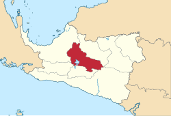
Pamekasan Regency is a regency (kabupaten) of the province of East Java, Indonesia. It is located on Madura Island approximately 120 kilometres (75 mi) east of Surabaya, the provincial capital. The regency covers an area of 792.30 square kilometres (305.91 sq mi), and at the 2010 census it had a population of 795,918 ; at the 2020 census the total was 850,057 and the official estimate as of mid-2022 was 857,818 – comprising 420,612 males and 437,206 females. The administrative capital is the town of Pamekasan.

Pelalawan is a regency (kabupaten) of Riau Province, Indonesia. It is located on the island of Sumatra. The regency was created on 4 October 1999 as a result of the division of Kampar Regency, of which it was previously the eastern 43%. It now has an area of 13,408.72 km² and had a population of 301,829 at the 2010 Census and 390,046 at the 2020 Census; the official estimate as at mid 2022 was 410,988. The administrative centre is in the town of Pangkalan Kerinci.

Indragiri Hulu is a landlocked regency (kabupaten) of Riau, Indonesia. It is located on the island of Sumatra. The original regency was split in two on 4 October 1999, with the western half being created as a separate Kuantan Singingi Regency. The regency now has an area of 8,198.71 km2 and had a population of 363,442 at the 2010 census, 408,704 at the 2015 census and 444,548 at the 2020 census; the official estimate as at mid 2022 was 464,076. The administrative seat of the regency is located at the town of Rengat.

Tabalong Regency is the most northerly of the regencies in the Indonesian province of South Kalimantan, on Borneo Island. It has an area of 3,553.36 km2, and had a population at the 2010 Census of 218,620 and 253,305 at the 2020 Census; the official estimate as of mid-2022 was 261,353. The administrative capital is the town of Tanjung. Motto: "Saraba Kawa" (Banjarese).

Sorong Regency is a regency of the Southwest Papua province of Indonesia. It covers an area of 13,075.28 km2, and had a population of 70,619 at the 2010 Census, and 118,679 at the 2020 Census; the official estimate as of mid-2022 was 125,949. Its administrative centre is the town of Aimas. Sorong Regency surrounds Sorong City (Kota) on the landward side; the city is administratively independent of the Regency and is not included in the above statistics; Sorong City has an airport, Sorong Airport, which also serves the Regency.

Banjarnegara is an inland regency in the southwestern part of Central Java province in Indonesia. The regency covers an area of 1,069.73 km2, and it had a population of 868,913 at the 2010 Census and 1,017,767 at the 2020 Census; the official estimate as at mid 2022 was 1,038,718. Its capital is the town of Banjarnegara.

West Bangka Regency is a regency (kabupaten) of Bangka Belitung Islands Province, Indonesia. It comprises the northwestern part of Bangka Island, together with a number of small islands off its coast. The regency covers an area of 2,820.61 km2 and had a population of 175,110 at the 2010 Census, rising to 204,612 at the 2020 census; the official estimate as at mid 2022 was 209,791 - comprising 108,102 males and 101,689 females. The town of Muntok is its regency seat.

Central Bangka Regency is a regency (kabupaten) of the Bangka Belitung Islands Province, Indonesia. It covers an area of 2,155.77 km2 and had a population of 161,075 at the 2010 Census, rising to 198,946 at the 2020 Census; the official estimate as at mid 2022 was 205,510 - comprising 106,340 males and 99,170 females. The town of Koba is its regency seat.

Deiyai Regency is one of the regencies (kabupaten) in the Indonesian province of Central Papua; it was formed on 29 October 2008 from the southeastern corner of the Paniai Regency area, and inaugurated by the Indonesian Minister of Home Affairs, Mardiyanto. The legal basis for the formation of this regency was the Law of the Republic of Indonesia of 2008 Number 55.

Intan Jaya Regency is one of the regencies (kabupaten) in the Indonesian province of Central Papua; it was formed in 2008 from part of Paniai Regency. It covers an area of 3,922 km2, and had a population of 40,490 at the 2010 Census, but this greatly increased to 135,043 at the 2020 Census; the official estimate as at mid 2022 was 139,236. The administrative centre is the town of Sugapa.

Nabire Regency is one of the regencies (kabupaten) in the Indonesian province of Central Papua. It covers an area of 12,010.65 km2, and had a population of 129,893 at the 2010 Census and 169,136 at the 2020 Census, comprising 87,688 males and 81,448 females. The official estimate as at mid 2022 was 173,043 - comprising 90,823 males and 82,220 females. The administrative centre is the town of Nabire, which faces onto Cenderawasih Bay.

Mimika Regency is one of the regencies (kabupaten) in the Indonesian province of Central Papua. It covers an area of 21,693.51 km2, and had a population of 182,001 at the 2010 Census, but grew to 311,969 at the 2020 Census. The official estimate as at mid 2022 was 321,657. The administrative centre is the town of Timika, which lies within Mimika Baru District, which had 144,893 inhabitants in mid 2021.

Mappi Regency is a regency (kabupaten) in the Indonesian province of South Papua. It was split off from Merauke Regency on 12 November 2002. It covers an area of 25,609.94 km2, and had a population of 81,658 at the 2010 Census and 108,295 at the 2020 Census; the official estimate as at mid 2022 was 111,141. The administrative centre is the town of Kepi.

Jayawijaya Regency is one of the regencies (kabupaten) in the Indonesian province of Highland Papua. It occupies an area of 13,925.31 km2 in the Baliem Valley, situated in the central highlands of the province. It had a population of 196,085 at the 2010 Census, and 269,553 at the 2020 Census; the official estimate as of mid-2022 was 277,923 - comprising 144,500 males and 133,423 females. Its capital is the town of Wamena.

Lanny Jaya Regency is a regency (kabupaten) located in the Indonesian province of Highland Papua. It covers an area of 6,077.4 km2, and had a population of 148,522 at the 2010 Census and 196,399 at the 2020 Census; the official estimate as at mid 2022 was 201,461. The administrative centre is the town of Tiom.

Katingan Regency is one of the thirteen regencies which comprise the Central Kalimantan Province on the island of Kalimantan (Borneo), Indonesia. It was created on 10 April 2002 from what were previously the eastern districts of East Kotawaringin Regency. The town of Kasongan is the capital of the Regency, which covers an area of 17,500 km2. The population of Katingan Regency was 146,439 at the 2010 Census and 162,222 at the 2020 Census; the official estimate as at mid 2022 was 163,989.
Sukamara Regency is one of the thirteen regencies which comprise the Central Kalimantan Province on the island of Kalimantan (Borneo), Indonesia. It was created on 10 April 2002 from the former southwest part of West Kotawaringin Regency. The town of Sukamara is the capital of Sukamara Regency, which covers an area of 3,827 km2. The population of the Regency was 44,952 at the 2010 Census and 63,464 at the 2020 Census; the official estimate as at mid 2022 was 66,845.

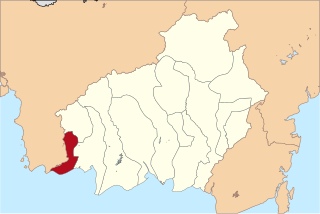
South Sorong Regency is a regency of Southwest Papua province of Indonesia. It has an area of 6,594.31 km2, and had a population of 37,900 at the 2010 Census and 52,469 at the 2020 Census; the official estimate as at mid 2022 was 53,884. The administrative centre is the town of Teminabuan.

Pasuruan Regency is a regency in East Java, province of Indonesia. The capital of this regency is Bangil. The regency covers an area of 1,474.02 km2, and it had a population of 1,512,468 at the 2010 Census and 1,605,969 at the 2020 Census; the official estimate as at mid 2022 was 1,619,035. These figures excludes the population of the city of Pasuruan, which lies geographically within this regency but is administratively separate from it. At present, there are moves under way to make Bangil the new administrative centre of Pasuruan Regency, with some offices being transferred from Pasuruan city to Bangil.