Parks and Greenways in Huntsville

Last updated
Big Spring Park in Downtown Big Spring Park overlook.jpg
Big Spring Park in Downtown

An extensive collection of parks and greenways exists in Huntsville, Alabama for the public's recreational use.

Contents

Parks

Parks within Huntsville city limits

The city of Huntsville currently has 57 parks which cover over 3,000 acres of land. [1] [2]

Park NameLocationAddressAcreagePlaygroundWalking TrailsNumber of Fields and CourtsNotes
SoccerFootballBaseballSoftballBasketballTennis
Archer ParkSouthwest3315 Archer Dr3.62YesNo12
Beirne Ave ParkNortheast330 Beirne Av1.68YesNo12Located across the Street from Goldsmith Schiffman Field
Bell Mountain ParkSouthwest2560 Redstone Rd30.05YesNo1122
Bicentennial ParkDowntown315 Fountain Cir0.30NoNoPassive Greenspace
Big Spring Park Downtown200 Church St17.96NoYesPassive Greenspace
Brahan SpringSouthwest500 Drake Av169.92YesNo31556 outdoor volleyball fields and 2 playgrounds
Buchanan ParkSouthwest10044 Fielding Dr3.97YesNo112
California Street ParkSoutheast708 California St 2.00YesNo12
Cavalry Hills ParkNorthwest2800 Poplar Av6.91YesNo212
Chelsea ParkSouthwest2851 Chelsea Ln3.50YesNo11
Cove ParkSoutheast834 Old Highway 431 98.04YesNo122
Creekwood ParkNorthwest360A Harvestwood Ct71.88YesYesDisc Golf Course, Passive Greenspace, Dog Park, connects to Indian Creek Greenway
Downtown Dog SpotDowntown200 Cleveland Av1.50YesNoPassive Greenspace, Dog Park
Dr. Richard Showers, Sr. ParkNorthwest4600 Blue Spring Rd17.70YesYes11Outdoor Exercise facility
Fern Bell / Fern Gulley ParkSouthwest6900 Whitesburg Dr 14.20YesNo3432 multipurpose fields
Goldsmith-Schiffman Wildlife SanctuarySoutheastTaylor & Terry Drake375.7NoYesPassive Greenspace
Halsey ParkSoutheast435 White St0.2NoNoPassive Greenspace
Hastings ParkSouthwest2801 Hastings Rd0.34YesNo
Hays Nature Preserve Southeast7153 Hwy 431 S 552.35NoYesPassive Greenspace, connects to Big Cove Creek Greenway and Flint River Greenway
Hermitage ParkSoutheast915 Kennamer Dr4.11YesNo1
Hillendale ParkNorthwest2811 Holmes Av 0.39YesNo
Holmes Avenue ParkNorthwest Holmes Av 2.9YesNo11
James C. Crawford ParkNortheast3915 Melody Rd8.33YesNo11formerly Edmonton Heights Park
John Hunt ParkSouthwest2151 Airport Rd 428.01YesYes2122Outdoor Exercise facility and a multipurpose field
Jones Family ParkSoutheast33NoYesPassive Greenway, will be part of the future Aldridge Creek greenway expansion
Ken Johnston ParkSoutheast1100 Mt. Gap Rd18.36YesNoOutdoor Exercise facility, Trail head for Aldridge Creek greenway
Kent Roberson ParkSouthwest7620 Logan Dr13.68YesNo222Also known as "Logan Park"
Kids' SpaceSouthwest2010 Airport Rd 0YesNoLocated within John Hunt Park
Kiwanis Soccer ParkSouthwest4201 Bob Wallace Av 6.39NoNo1
Knox Creek ParkNorthwest180 Greenbank Dr26.76YesNo1
Lakewood ParkNorthwest2225 York Rd32.45YesNo231 multipurpose field
Lewter ParkNortheast1501 Wellman Av0.52YesNoformerly Wellman Park
Maple Hill ParkSoutheast1351 Mcclung Av8.64YesNoAlso known as "Dead Children's Playground," 1 multipurpose field
Maplewood ParkNorthwest4943 N Mem Pkwy 9.5YesNo1
Mastin Lake ParkNorthwest3315 Watson Dr31.73YesNo122
Mayfield ParkSouthwest550 Thornton Av8.88YesNo22
McGucken ParkSoutheast13020 Bailey Cove Rd37.1YesYes21232accesses Aldridge Creek Greenway
Meadow Hill ParkNorthwestMedaris Rd1.06YesNo11
Merrimack ParkSouthwest3501 Triana Blvd46.8YesNo10Also known as "Huntsville Park"
Metro Kiwanis SportsplexSouthwest3590 Patton Rd64.92YesNo6
Oak ParkNortheast2250 Oakwood Av9.2YesNo22
Oakmont ParkNorthwest2224 Euclid Rd3.72YesNo
Ogden ParkSouthwest5251 Triana BlvdNoNo11 multipurpose field
Optimist ParkNortheast703 Oakwood Av8.5YesNo1Playground good size for toddlers, small equipment
Philpot ParkNortheast1211 Philpot Av4YesNo2Also known as "Chapman Park"
Pine ParkSouthwest3951 Pine Av2.34YesNo
Robert E. Lee Cramer Jr. ParkSoutheast600 Meridian St 2.8YesNoA part of "Gateway Greenway"
Sandhurst ParkSouthwest2928 Green Cove Rd17.1YesNo12
Scenic OverlookSoutheast2251 Governors Dr 4.5NoNoPassive Greenspace
Scenic View ParkNorthwest2705 Scenic View Dr5.1YesNo1
Sherwood ParkNorthwest325 Town and Country Dr5YesYes11Also known as "Forest Park"
SkateparkDowntown200 Cleveland Av0.66NoNo
Stoner ParkNorthwest3715 Bragg St67.62YesNo11642
University ParkNorthwest4419 Saundralane Dr10.74YesNo14A part of UAH
Veteran's ParkDowntown200 Monroe St2.64NoNoformerly Gateway Park, accesses Gateway Greenway, Passive Greenspace
Willow ParkSoutheast1928 Aftonbrae Dr9.34YesYes221 multipurpose field
Windsor Manor ParkNorthwest6500 Pisgah Dr7.99No112

Proposed parks

Current greenways

As of 2017, there are 9 greenways with 73 miles (117 km) of trail.

Aldridge Creek Greenway

Aldridge Creek Greenway is a 103.55-acre greenway [3] consisting of a 4.25-mile-long (6.84 km) walking and biking trail in South Huntsville that runs along Aldridge Creek connecting Ken Johnston Park to Ditto Landing and the Tennessee River. The greenway runs north along Aldridge Creek from the main trailhead for 1.25 miles to the sidewalk on the west side of Bailey Cove Road just north of Country Lane Drive and south to the entrance of Ditto Landing, about 3.5 miles. The address of the park is 1100 Mountain Gap Road at Ken Johnston Park just west of Bailey Cove Road. Parking is also available on the south end of the greenway at Ditto Landing and additional parking is located behind Challenger School on Chaney Thompson Road.

The city had planned to continue the greenway north to connect to Atwood Linear Park Greenway. However, Valley Hill Country Club will not allow the city to expand the greenway through their golf course. The city has plans to construct future segments of the greenway from the current north terminus to the east end of Esslinger Road.

Atwood Linear Park Greenway

Atwood Linear Park Greenway is a 0.9-mile-long (1.4 km) trail [4] that connects Jones Family Park to the Valley Hill Country Club. The trail is a multi-use walking and biking trail that runs along Atwood Drive in the Jones Valley area of Southeast Huntsville. Parking is available at Jones Family Park on the north side of Four Mile Post Road.

Big Cove Creek Greenway

Big Cove Creek Greenway is a 53-acre greenway in southeast Huntsville's Hampton Cove subdivision that runs along Big Cove Creek north to just south of Caldwell Lane. There is a multipurpose walking and biking trail that is 2.86 miles (4.60 km) long [5] that connects the Flint River greenway to the Hampton Cove community. The city of Huntsville plans to extend the greenway north to Monte Sano Mountain and connect it to the existing Arrowhead trail.

Flint River Greenway

The Flint River Greenway is one of the newest greenways in the city of Huntsville. It is located in southeast Huntsville in the Hampton Cove subdivision. Currently, there is a 1.87-mile-long (3.01 km) walking and biking trail [6] connecting Old US 431 to the Big Cove Creek Greenway in the Hays Nature Preserve where parking is available. The city of Huntsville plans to extend the greenway south along the Flint River to eventually connect to the Tennessee River greenway.

When completed, the greenway will be 36.0 miles (57.9 km) long and contain canoe launch sites spaced throughout the length of the greenway.

Gateway Greenway

Gateway Greenway is a 0.6 miles (0.97 km) long trail that connects Veterans Park to Pratt Avenue [7] in downtown Huntsville. Parking is available along Meridian Street.

Indian Creek Greenway

Indian Creek Greenway
Indian Creek Greenway Huntsville.jpg
TypePublic Greenway
Location Huntsville, Alabama
Area61.68 acres (0.10  sq mi)

Indian Creek Greenway is a series of greenways that make up 3.77 miles (6.07 km) of walking and biking trails in West Huntsville. [8] The north section of the greenway is located in the Providence subdivision off of University Drive. The larger, south section of the greenway, which is 2.95 miles (4.75 km) long, runs from Creekwood Park to Old Madison Pike just west of Cummings Research Park. Parking is available at the trail heads at Creekwood Park and off Old Madison Pike east of Slaughter Road.

Little Cove Road Greenway

Little Cove Road Greenway is made up of a 5.04 miles (8.11 km) long trail [9] that connects Big Cove Creek Greenway north to the Flint River in Southeast Huntsville. The greenway travels along Little Cove Road/Eastern Bypass/Old Hwy 431.

Tennessee River Greenway

The Tennessee River Greenway connects to the Aldridge Creek Greenway at Ditto Landing in South Huntsville and adds an additional 0.93 miles (1.50 km) of walking and biking trail that runs along the Tennessee River. [10] This greenway connects Ditto Landing to the Madison County Marina. Parking is available at Ditto Landing. The City of Huntsville plans to extend the greenway south along the river and will end at the Flint River, where it will eventually connect to the Flint River greenway.

Wade Mountain Greenway

In North Huntsville lies nearly 5.5 miles (8.9 km) of greenway known as Wade Mountain Greenway with 1 mile (1.6 km) of a paved trail and 4.375 miles (7.041 km) is an unpaved hiking trail.

Proposed greenways

Trails

Preserves

Goldsmith Schiffman Wildlife Sanctuary

The Goldsmith Schiffman Wildlife Sanctuary is located in southeast Huntsville, near Hampton Cove, to the west of the Hays Nature Preserve.

Hays Nature Preserve

The Hays Nature Preserve, located in southeast Huntsville near the subdivision of Hampton Cove, is the city's largest and most undeveloped parklands. [16] The Flint River and Big Cove Creek greenways run through the nature preserve and connect with various hiking trails along the way. [17] [18]

Monte Sano Nature Preserve

Located on Monte Sano Mountain, Monte Sano Nature Preserve covers 1,107 acres (448 ha) making it one of the largest urban nature preserves in the US, larger than Central Park. It includes over 25 miles (40 km) of trails for hiking and mountain biking, which connect to Monte Sano State Park and Burritt on the Mountain. [19] This Preserve is managed in partnership with the Land Trust of North Alabama.

Wade Mountain Nature Preserve

Wade Mountain Nature Preserve is a series of greenways and trails that make up 5.375 miles (8.650 km) of walking and hiking trails in North Huntsville. [20] The trails are made up of 1-mile-long (1.6 km) paved trail and 4.375 miles (7.041 km) of unpaved hiking trails that lead up Wade Mountain to the Devil's Race Track. This Preserve is managed in partnership with the Land Trust of North Alabama.

Related Research Articles

Madison County, Alabama County in Alabama, United States

Madison County is located in the north central portion of the U.S. state of Alabama. As of the 2010 Census, the population was 334,811, making it the third-most populous county in Alabama. Its county seat is Huntsville. The county is named in honor of James Madison, fourth President of the United States and the first President to visit the state of Alabama. Madison County covers parts of the former Decatur County. Madison County is included in the Huntsville, Alabama Metropolitan Statistical Area.

Huntsville, Alabama City in Alabama, United States

Huntsville is a city in the Appalachian region of northern Alabama and is the county seat of Madison County. The city also extends west into neighboring Limestone County and extends south into Morgan County.

East Coast Greenway Long-distance hiking trail in the United States

The East Coast Greenway is a 3,000-mile (4,800 km) rail trail linking the major cities of the Atlantic coast of the United States, from Calais, Maine, to Key West, Florida. The spine route and branching complementary routes are for non-motorized human transportation for everything from local commutes to long-distance trips.

American Discovery Trail Long-distance hiking trail across the United States

The American Discovery Trail is a system of recreational trails and roads which collectively form a coast-to-coast hiking and biking trail across the mid-tier of the United States. Horses can also be ridden on most of this trail. The coastal trailheads are the Delmarva Peninsula on the Atlantic Ocean and the northern California coast on the Pacific Ocean. The trail has northern and southern alternates for part of its distance, passing through Chicago and St. Louis respectively. The total length of the trail including both the north and south routes is 6,800 miles (10,944 km). The northern route covers 4,834 miles (7,780 km) with the southern route covering 5,057 miles (8,138 km). It is the only non-motorized coast-to-coast trail.

Monte Sano Mountain Mountain in Huntsville, Alabama, United States

Monte Sano Mountain is a mountain located in Huntsville, Alabama. The name Monte Sano is Spanish for "Mountain of health". This name comes from the fact that curative health resorts used to be located on the mountain to take advantage of the fresh air, clean water, and cooler temperatures.

Monte Sano State Park State park in Huntsville, Alabama, United States

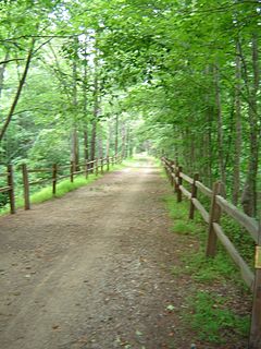
Monte Sano State Park is a publicly owned recreation area and mountaintop retreat encompassing 2,140 acres (870 ha) on the eastern portion of the top and slopes of Monte Sano Mountain on the east side of Huntsville, Alabama. The state park has 1930s-era, Civilian Conservation Corps–built rustic cottages, hiking trails and picnic areas with scenic overlooks, and modern campsites. It is managed by the Alabama Department of Conservation and Natural Resources.

Big Spring Park (Huntsville, Alabama) United States historic place

Big Spring International Park is located in downtown Huntsville, Alabama. The park is built around its namesake "Big Spring", the original water source that the city of Huntsville was built around. The Huntsville Museum of Art and Von Braun Center are located in the park. The park is also notable as the venue for the Panoply Arts Festival, held the last full weekend in April, Big Spring Jam, an annual music festival held on the fourth weekend in September from 1993 to 2011, and The Battle of the Buffalo, a buffalo wings competition held by the University of Alabama in Huntsville Alpha Tau Omega fraternity to support cancer research.

Greenway (landscape) Long piece of land, where vegetation and slow travel are encouraged

A greenway is usually a shared-use path along a strip of undeveloped land, in an urban or rural area, set aside for recreational use or environmental protection. Greenways are frequently created out of disused railways, canal towpaths, utility or similar rights of way, or derelict industrial land. Greenways also can also be linear parks, and can serve as wildlife corridors. The path's surface may be paved and often serves multiple users: walkers, runners, bicyclists, skaters and hikers. A characteristic of greenways, as defined by the European Greenways Association, is "ease of passage": that is that they have "either low or zero gradient", so that they can be used by all "types of users, including mobility impaired people".

Hampton Cove is a master-planned community located in Huntsville, Alabama. Situated in the foothills and valleys of North Alabama's Cumberland Plateau, the 2,800-acre (11 km2) community lies in the coves between Monte Sano Mountain and Green Mountain to the west, and Keel Mountain to the east.

Huntsville-Decatur-Albertville, AL Combined Statistical Area Combined Statistical Area in Alabama, United States

The Huntsville–Decatur–Albertville, AL Combined Statistical Area is the most populated sub-region of North Alabama, and is the second fastest growing region in the State of Alabama, with 774,480 living within the CSA. It is also currently the 64th largest CSA in the country.

Three Rivers Park District

Three Rivers Park District is a special park district serving the suburban areas of the Twin Cities including suburban Hennepin, Carver, Dakota, Scott and Ramsey counties. Three Rivers's mission is "To promote environmental stewardship through recreation and education in a natural resources-based park system." Three Rivers operates twenty parks and ten regional trails, with at least two more regional trails planned. Nearly seven million people visit Three Rivers facilities each year. It has over 27,000 acres (11,000 ha) of parks and trails.

Cove Lake State Park

Cove Lake State Park is a state park in Campbell County, Tennessee, in the southeastern United States. The park consists of 673 acres (2.72 km2) situated around Cove Lake, an impoundment of Cove Creek created by the completion of Caryville Dam in 1936. The park's location is adjacent to the town of Caryville and just west of Jacksboro.

Monte Bello Open Space Preserve

Monte Bello Open Space Preserve is a 3,133-acre (12.68 km2) open space preserve, located near Palo Alto in the Santa Cruz Mountains, in San Mateo and Santa Clara Counties, California, United States. The preserve encompasses the upper Stevens Creek watershed in the valley between Monte Bello Ridge and Skyline Ridge. "Monte Bello" means "beautiful mountain" in Italian, and refers to Black Mountain which is the highest part of Montebello Ridge. The straight valley of upper Stevens Creek is also the rift valley of the San Andreas Fault.

Trails in Detroit

This is a list of trails and greenways in Detroit.

Cecil Ashburn Drive

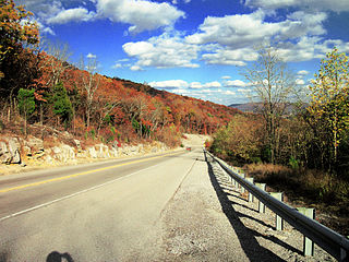
Cecil Ashburn Drive is a major road in South Huntsville that carries nearly 20,000 vehicles across Huntsville Mountain in and out of the city from neighboring subdivisions. The scenic mountain route is a two-lane road with wide shoulders to allow joggers and bicyclists to safely travel the road. The city of Huntsville is in the process of widening 3.4 miles of Cecil Ashburn Drive, beginning at Donegal Drive to Taylor Road. That portion of the roadway will close completely for 10–12 months beginning in January 2019. The project will ultimately convert Cecil Ashburn Drive into a four-lane divided highway, including paved shoulders and bike lanes in both directions.

Monte Sano Nature Preserve Nature preserve in Alabama, United States

Monte Sano Nature Preserve is, at 1,107 acres (448 ha), one of the largest urban nature preserves in the US and is located on Monte Sano Mountain in Huntsville, Alabama. The Land Trust of North Alabama manages the nature preserve and Land Trust volunteers have created 23+ miles of public trails. Residents and visitors alike enjoy the multi-use trails for hiking, biking, running, bird watching, environmental education, and general recreation. The trail system was honored in 2011 by the Department of the Interior as National Recreation Trails making them the first NRT trails in Madison County.

Blevins Gap Nature Preserve

Blevins Gap Nature Preserve is a nature preserve in southern Huntsville, Alabama. It measures 994 acres (402 ha) in total and contains over 12 miles of trails within its borders. Cecil Ashburn Drive splits the preserve into two parts. The northern section measures 267 acres (108 ha) with 4.5 miles of trails, a rocky incline, and waterfalls. The southern portion measures the remaining 727 acres (294 ha) and contains 8 miles of woodland trails.

References

  1. City of Huntsville Parks Department Archived 2012-06-28 at the Wayback Machine
  2. City of Huntsville Parks and Gyms Guide
  3. City of Huntsville - Aldridge Creek Greenway
  4. City of Huntsville - Atwood Linear Park Greenway
  5. City of Huntsville - Big Cove Creek Greenway
  6. City of Huntsville - Flint River Greenway
  7. City of Huntsville - Gateway Greenway
  8. City of Huntsville - Indian Creek Greenway
  9. City of Huntsville - Little Cove Road Greenway
  10. City of Huntsville - Tennessee River Greenway
  11. - Land Trust of North Alabama
  12. Madison County Nature Trail - www.madisoncountyal.gov Archived 2012-02-10 at the Wayback Machine
  13. "Monte Sano State Park - Alabama State Parks". Archived from the original on 2014-10-11. Retrieved 2012-01-15.
  14. Singleterry, Sarah (5 February 2019). "Singing River Trail gets positive community feedback". WAAY 31. Retrieved 22 July 2020.CS1 maint: discouraged parameter (link)
  15. Ballard, Kimberly (31 December 2019). "Singing River Trail a Merger of Native American History and Smart Technology". Huntsville Business Journal. Retrieved 22 July 2020.CS1 maint: discouraged parameter (link)
  16. Operation Green Team - Hays Nature Preserve
  17. City of Huntsville - Hays Nature Preserve trails map
  18. Hays Nature Preserve trails
  19. "Monte Sano Nature Preserve Trail System : National Recreation Trail Database". American Trails. Retrieved 21 September 2016.
  20. City of Huntsville - Wade Mountain Preserve