Pattuvam

Last updated

Pattuvam
village
Sunset in Pattuvam.JPG
Sunset viewed from a hill near Pattuvam U.P school.
India Kerala location map.svg
Red pog.svg
Pattuvam
Location in Kerala, India
India location map.svg
Red pog.svg
Pattuvam
Pattuvam (India)
Coordinates: 12°02′21″N75°19′16″E / 12.039290°N 75.321110°E / 12.039290; 75.321110 Coordinates: 12°02′21″N75°19′16″E / 12.039290°N 75.321110°E / 12.039290; 75.321110
CountryFlag of India.svg  India
State Kerala
District Kannur
Area
  Total16.18 km2 (6.25 sq mi)
Population
 (2011)
  Total15,659
  Density970/km2 (2,500/sq mi)
Languages
  Official Malayalam, English
Time zone UTC+5:30 (IST)
PIN
670143
Telephone code+914602
ISO 3166 code IN-KL
Vehicle registration KL-59
Lok Sabha constituencyKasaragod
Legislative Assembly constituencyKalliasseri
Pattuvam river seen from Mangalassery Kuppam river.JPG
Pattuvam river seen from Mangalassery

Pattuvam is a village in Kannur district in the Indian state of Kerala. It is bordered by the Kuppam river on the north, west and south (known locally as Pattuvam river). It shares a border with Taliparamba municipality on the east. A bridge over the river connects Pattuvam to Kottakkeel of Ezhome village in the northwest. [1]

Contents

Demographics

As of the 2011 Census, Pattuvam village had a population of 15,659 of which 7,214 are male and 8,445 are female. The number of children between the ages of 1 and 6 is 1,813, making up 11.6% of the total. The average sex ratio was 1171, which is higher than the Kerala state average of 1084. The child sex ratio is 962, lower than the Kerala average of 964. It has a lower literacy rate compared to Kerala, reaching 91.04%, compared to Kerala's 94%. The male literacy stands at 96.2% while the female literacy rate is 86.8%. [2]

Geography

Surrounded by the river on all sides except the east, where it shares a boundary with Taliparamba, Pattuvam has rich biodiversity. Pattuvam made history in the 2010s when it used its autonomy to assert its right to protect local biodiversity.

The Panchayat consists of mini-villages including Mangalasseri, Muthukuda, kavungal, Pattuvam, Muriyathode, Mullool, Ariyil, Kunnaru, Parappool, and Vellikkeel.

Governance

The panchayat is ruled by the left front led by President Miss Sreemathi.P.

Temples

Vadakke Kavu (Panchuruli Temple), Kunhimathilam Temple, Valiyamathilakam Temple, Karayapath Kathivanoor Veeran Temple, Cheriyamrambu Sree Narasimha Murthy Temple, Muthukuda Siva temple, Parappool kavu and Parappool Sree Maha Vishnu Temple are some of the temples there.

Sports

Pattuvam Panchayath organizes an annual sports event called Panchayath Mela, which includes sports and athletic games. Football and cricket are the favourite sports. Parappool Cricket Club is one of the oldest cricket clubs in Kerala. It plays District level championship every year. Pattuvam Turf is a new sports turf for football and cricket and was inaugurated on 8 May 2022. It is one of the biggest turfs in Kannur.

Education

Schools

Colleges

Tourist attractions

Transport

The national highway NH 66 passes through Taliparamba junction. Goa and Mumbai can be accessed on the north and Cochin and Thiruvananthapuram can be accessed on the south. The road to the east of Iritty connects to Mysore and Bangalore.

The nearest railway station is Payangadi on Mangalore-Palakkad line, which can be accessed by the Pazhayangadi-Taliparamba road. Trains are available to almost all parts of India and have scheduled stops at this station.

There are airports are at Kannur, Mangalore and Calicut.

Related Research Articles

Taliparamba Municipality in Kerala, India

Taliparamba is a Municipality in Taliparamba taluk of Kannur district, Kerala, India. The municipal town spreads over an area of 18.96 square kilometres (7.32 sq mi) and is inhabited by 44,247 number of people.

Vellavu Village in Kerala, India

Vellavu is a place in the Pariyaram gram panchayat of the Kannur District, state of Kerala, India.

Irikkur Town in Kerala, India

Irikkur is a town and grama panchayat in Kannur District of Kerala state, India.

Ulikkal is a growing town in Kannur District in Kerala. It is the HQ of Ulikkal Grama Panchayat in Iritty Taluk. The town is surrounded by small villageslike Manikkadavu, Manippara,Nuchiyad,Mattra, etc.... The people of this area are very adaptable and amicable, who live in harmony, irrespective of religion or culture. Kerala State Hill highway SH 59 passes through Ulikkal Town.

Kalliasseri Census Town in Kerala, India

Kalliasseri is a census town in Kannur district in the Indian state of Kerala. Kalliaseri Panchayat comprises two villages: Kalliasseri and Irinave.

Kannapurampronunciation  is a census town in Kannur district of North Malabar region in the Indian state of Kerala.

Pappinisseri Census Town in Kerala, India

Pappinisseri is the only grama panchayath in Kannur district in the Indian state of Kerala to have consistently won the Swaraj Trophy for best grama panchayath from 2017-2018 to 2021. Pappinisseri Panchayat also bagged the third position in the Swaraj Trophy during 2015-2016. Pappinisseri Panchayat comprises two villages viz Pappinisseri and Aroli. Pappinisseri better known for visha chikitsa kendram

Peralasseri Census Town in Kerala, India

Peralasseri is a census town and Panchayat headquarters in Kannur district in the Indian state of Kerala, situated on the Kannur-Kuthuparamba State Highway 38 (Kerala), 12 km from Kannur city, on the bank of Anjarakandy river.

Mayyil Census Town in Kerala, India

Mayyil is a Census Town and Grama Panchayat in Kannur District of Kerala State. Mayyil Panchayat established in 1962 by merging the villages of Kayaralam, Mayyil and Kandakkai.

Sreekandapuram is a municipality in Kannur district, in the Indian state of Kerala.

Koodali is a census town in Thalassery taluk of Kannur district in Kerala state, India. Koodali is located 15.5 km (9.6 mi) east of Kannur city on Kannur-Mattanur road.

Kelakam, India Village in Kerala, India

Kelakam is a village and Grama Panchayat near to kottiyoor panchayat in the Kannur district of Kerala, India.

Cherukunnu Census Town in Kerala, India

Cherukunnu is a census town in Kannur district in the Indian state of Kerala. Cherukunnu town is located on Valapattanam-Pappinisseri-Pazhayangadi main road, situated to the south of the Pazhayangadi in Kannur District of North Malabar region in Kerala.

Kunhimangalam Census Town in Kerala, India

Kunhimangalam (കുഞ്ഞിമംഗലം) is a census town situated in the northern coastal part of Kannur District in Kerala state on the outskirt of Payyanur. The population in 2011 was around 19,000 including Hindus, Christians and Muslim residents. The village lies in an agricultural region.

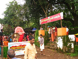
Eruvessi is a village in Irikkur Block Panchayat, Taliparamba Taluk, Kannur district in Kerala, India. It is located at a distance of around 50 Kilometers from Kannur. There is a famous temple called Padikkutti Devi temple and the festival or Utsav is well known. Eruvessi Sri Padikutty temple is the birthplace of Sree Muthappan. This place was ruled by Mannanar dynasty of Muthedath Aramana and Elayadath Aramana. The ruins of Aramana of the Mananar are still visible on the banks of Eruvessi River.

Mavichery is a village which is the part of Pariyaram Gramapanchayath in the Kannur district of Kerala, India.

Aroli Village in Kerala, India

Aroli is a village of Pappinisseri Panchayat in Kannur district in the Indian state of Kerala.

Anthoor Municipality in Kerala, India

Anthoor is a municipality in the Kannur district of the North Malabar region in the Indian state of Kerala. Anthoor is located roughly 15 km from the Kannur City, and 7 km from Taliparamba town.

Chapparapadavu

Chapparapadavu is a Grama panchayat in Kannur district in the Indian state of Kerala. Chapparapadavu Panchayat have administration over the villages of Kooveri, Thimiri, and Vellad.

Kolachery is a census town and Grama Panchayat in Kannur District of Kerala state, India. Kolachery is located 15 kilometres (9.3 mi) north east of Kannur city.

References

  1. "Malabar gets its first joint-less bridge". Mangalam.
  2. Kerala, Directorate of Census Operations. District Census Handbook, Kannur (PDF). Thiruvananthapuram: Directorateof Census Operations,Kerala. p. 154,155. Retrieved 14 July 2020.