Vengad

Last updated

Vengad
Town
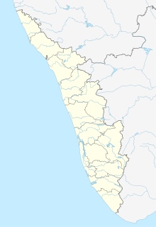
India Kerala location map.svg
Red pog.svg
Vengad
Location in Kerala, India
Coordinates: 11°52′58″N75°32′06″E / 11.88281°N 75.53513°E / 11.88281; 75.53513 Coordinates: 11°52′58″N75°32′06″E / 11.88281°N 75.53513°E / 11.88281; 75.53513
CountryFlag of India.svg  India
State Kerala
District Kannur
Area
  Total28.09 km2 (10.85 sq mi)
Population
 (2011)
  Total38,606
  Density1,400/km2 (3,600/sq mi)
Languages
  Official Malayalam, English
Time zone UTC+5:30 (IST)
PIN
670612 [1]
Telephone code0497
Vehicle registration KL 58

Vengad is a gram panchayat situated in Thalassery taluk, Kannur district, Kerala, India, on the banks of the Anjarakandi River. [2] Vengad is famous for its black pepper and handloom. One state seed farm is located in Vengad. [3] Vengad gram panchayat consists of 21 wards; viz Pattathari (1), Kallayi (2), Vengad Angadi (3), Vengad Metta (4), Vengad Theru (5), Oorppalli (6), Kaitheripoyil (7), Valankichal (8), Pathiriyad (9), Pachapoika (10), Parambayi (11), Kelalur (12), Mambaram (13), [4] Poyanad (14), Keezhathur Balavadi (15), Keezhathur Vayanasala (16), Kuzhiyil Peedika (17), Mailulli (18), Kunnirikka (19), [5] Paduvilayi (20) [6] and Thattari (21). [7]

Contents

Vengad Panchayat has administration over Pathiriyad and Paduvilayi census towns. Vengad Gramapanchayat office is situated in Paduvilayi. The Kannur International Airport is 6 km away from Vengad. [8]

Places of worship

Schools

  1. EKNS Govt Higher Secondary School [12]
  2. Vengad South UP School [13]
  3. Vengad LP School [14]
  4. Vengad Mappila UP School [15]
  5. Vani Vidyalayam [16]
  6. Indira Gandhi Public School
  7. Kottayam Rajas High School Pathiriyad
  8. Mambaram HSS Mambaram
  9. Mambaram English Medium School Mambaram
  10. Keezhathur U P School Keezhathur
  11. Kunnirikka U P School Kunnirikka

Transportation

The national highway passes through the town of Kannur. Goa and Mumbai can be accessed on the northern side and Cochin and Thiruvananthapuram can be accessed on the southern side. The road to the east of Iritty connects to Mysore and Bangalore. The nearest railway station is Kannur on Mangalore-Palakkad line. [17] Trains are available to almost all parts of India subject to advance booking over the internet. There are airports at Mattanur, Mangalore and Calicut. All of them are international airports but direct flights are available only to Middle Eastern countries. [18]

See also

Related Research Articles

Mattanur Municipality in Kerala, India

Mattanur, also spelled Mattannur, is a town, municipality, and an aerotropolis in Kannur district, Kerala, India. Mattanur is about 27 km east of Kannur and Thalassery, two major towns of the district.
Payyoli Municipality in Kerala, India

Payyoli is a Municipality town on the Malabar Coast of Kozhikode district in the South Indian state of Kerala. Payyoli is famous for being the hometown of athlete PT Usha, who is nicknamed as the Payyoli Express. It is a town in Quilandy Taluk, Kozhikode District.

Edakkad Town in Kerala, India

Edakkad is part of the Kannur Municipal Corporation in Kannur District of Kerala state, in India.

Kuthuparamba Municipality in Kerala, India

Kuthuparamba is a town and a municipality in the Kannur district, state of Kerala, India. It is about 24 km south east of Kannur and 14 km east of Thalassery.

Edacheri is a small panchayath in the district of Kozhikode in the South Indian state of Kerala.

Kalliasseri Census Town in Kerala, India

Kalliasseri is a census town in Kannur district in the Indian state of Kerala. Kalliaseri Panchayat comprises two villages: Kalliasseri and Irinave.

Kannapuram Town in Kerala, India

Kannapurampronunciation  is a census town in Kannur district of North Malabar region in the Indian state of Kerala.

Pappinisseri Census Town in Kerala, India

Pappinisseri is the only grama panchayath in Kannur district in the Indian state of Kerala to have consistently won the Swaraj Trophy for best grama panchayath from 2017-2018 to 2021. Pappinisseri Panchayat also bagged the third position in the Swaraj Trophy during 2015-2016. Pappinisseri Panchayat comprises two villages viz Pappinisseri and Aroli. Pappinisseri better known for visha chikitsa kendram

Pinarayi Census Town in Kerala, India

Pinarayi is a census town in Kannur district in the Indian state of Kerala.

Mayyil Census Town in Kerala, India

Mayyil is a Census Town and Grama Panchayat in Kannur District of Kerala State. Mayyil Panchayat established in 1962 by merging the villages of Kayaralam, Mayyil and Kandakkai.
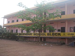
Mambaram, Kannur town in Kerala, India

Mambaram is a small town situated on the shores of Anjarakkandy river in Thalassery taluk, Kannur district, Kerala state, South India.

Mullakkodi Kayaralam village in Kerala, India

Mullakkodi is a village in Mayyil Gram Panchayat of Kannur District situated on the East Bank of Valapattanam river. Mullakkodi known for its backwaters, paddy fields and for its community festival called the Ayar Munamba Manna Maqam Urooz.

Sreekandapuram Municipality in Kerala, India

Sreekandapuram is a municipality in Kannur district, in the Indian state of Kerala.

Koodali Census Town in Kerala, India

Koodali is a census town in Thalassery taluk of Kannur district in Kerala state, India. Koodali is located 15.5 km (9.6 mi) east of Kannur city on Kannur-Mattanur road.

Pattuvam Village in Kerala, India

Pattuvam is a village in Kannur district, Kerala, India. It is bounded by Kuppam river on the north-west-south directions. It shares border with Taliparamba municipality on the east. A joint-less bridge over Kuppam river which connects Pattuvam to Kottakkeel of Ezhome village in northwest direction was inaugurate by Chief Minister of Kerala Pinarayi Vijayan in January 2017.

Koyyam village in Kerala, India

Koyyam is the part of Chengalai Panchayat, Kannur district, in the state of Kerala on the southwestern coast of India. Koyyam LP school is situated in "Koyyam". Koyyam Govt High School situated in Perinthaleri, Koyyam. The new bridge is constructing from koyyam to Velam, Mayyil. The transportation will be much easier to Kannur Town after completion Koyyam Bridge(23 km). The bridge will make koyyam is a very accessible place to the new Kannur International Airport, Mattannur. Main Airport Road will be passing through Koyyam from chempanthotti & Valakkai. This will be parallel rout for existing Parassinikkadavu from Taliparamba to Mattannur

Kunhimangalam Census Town in Kerala, India

Kunhimangalam (കുഞ്ഞിമംഗലം) is a census town situated in the northern coastal part of Kannur District in Kerala state on the outskirt of Payyanur. The population in 2011 was around 19,000 including Hindus, Christians and Muslim residents. The village lies in an agricultural region.
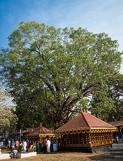
Andalurkavu

Sree Andalurkavu is a famous and prominent temple in Andalur in Dharmadam village of Kannur district, North Kerala. This old temple is in the name of Lord Rama and the main festival is celebrated in mid-February: the first week of the month "Kumbam" of the Malayalam calendar.

Mavichery is a village which is the part of Pariyaram Gramapanchayath in the Kannur district of Kerala, India.

Aroli Village in Kerala, India

Aroli is a village of Pappinisseri Panchayat in Kannur district in the Indian state of Kerala.

References

  1. "Pin Code: VENGAD, KANNUR, KERALA, India". Pincode.net.in. Retrieved 28 November 2021.
  2. "A police station in Kannur that grooms tomorrow's soldiers". The Times of India . Retrieved 28 November 2021.
  3. "The Vengad {CannLoom} Handloom Men's Cotton Mundu - Set of 2 (White & Off White) : Amazon.in: Clothing & Accessories". Amazon.in. Retrieved 28 November 2021.
  4. "Mambaram,-Kannur News". The Times of India . Retrieved 28 November 2021.
  5. "Kunnirikka, Kannur District, Kerala, India". Keralatourism.org. Retrieved 28 November 2021.
  6. "Kerala (India): Districts, Cities and Towns - Population Statistics, Charts and Map". Citypopulation.de. Retrieved 28 November 2021.
  7. "Local Self Government Department | Local Self Government Department". Lsgkerala.gov.in. Retrieved 28 November 2021.
  8. "5.0 Km | Distance Between Kannur International Airport And Kinavakkal – Vengad Road Via Vengad". Citymeter.net. Retrieved 28 November 2021.
  9. [ dead link ]
  10. "Sree Paduvilakkav Kshetram Temple, Kerala". Vymaps.com. Retrieved 28 November 2021.
  11. "VENGAD SREE KURUMBA KAVU". Vengattumkavu.webs.com. Retrieved 28 November 2021.
  12. "Ekns Government Higher Secondary School Vengad, Kannur | Admissions 2020-2021, Contacts, FAQs". Uniformapp.in. Retrieved 28 November 2021.
  13. "VENGAD SOUTH UP SCHOOL - Paduvilayi, District Kannur (Kerala)". Schools.org.in. Retrieved 28 November 2021.
  14. [ dead link ]
  15. "Vengad Mappila Upper Primary School - 2021-2022 StudyChaCha". Studychacha.com. Retrieved 28 November 2021.
  16. "Sree Vani Vidyalaya Em School, Kannur - Reviews, Address, Fees and Admissions 2021". Icbse.com. Retrieved 28 November 2021.
  17. "NH 66 still in pathetic shape". Thehindu.com. 19 November 2019. Retrieved 28 November 2021.
  18. "Kannur International Airport". The Economic Times . Retrieved 28 November 2021.