The town was incorporated in 1810 by the proprietor Daniel Penfield, a veteran of the Revolutionary War who purchased the town lands in 1795 and moved to the area in 1809. His house still stands at 1784 Penfield Road.[5] Penfield is a suburb of Rochester. The town's motto is "A Town of Planned Progress".
Geography
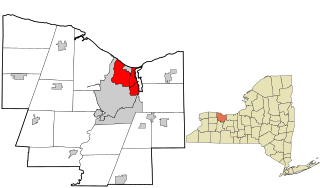
According to the United States Census Bureau, the town has a total area of 37.9 square miles (98km2), of which 37.5 square miles (97km2) is land and 0.4 square miles (1.0km2) (1.11%) is water. Penfield is surrounded in all four directions by neighboring towns. To the north is Webster, to the south are Perinton, Pittsford and East Rochester, to the east is Walworth (Wayne County), and to the west are Irondequoit and Brighton.[6]
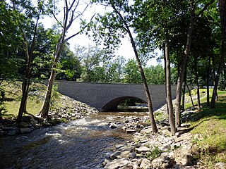
Geographically, Penfield includes a number of parks with a variety of terrain, water features, lodges and shelters, open spaces, and athletic facilities.[7]
Athletic Fields
Abraham Lincoln Park
Channing H Philbrick Park (formerly Linear Park)
Ellison Park
Greenwood Park
Harris Whalen Park
Heritage Park
LaSalle's Landing Park
Lucien Morin Park
Rothfuss Park
Schaufelberger Park
Shadow Pines Municipal Land
Sherwood Fields Park
Veteran's Memorial Park
Nearly two million years ago, Penfield's topography was formed by melting glaciers.[citation needed] The same forces that created the Finger Lakes helped develop interesting terrain in and around Ellison Park. These glacial ice melt carvings left fertile lands which today is used in farming (and from the late 20th century to the present, housing developments). The soil is rich for farming certain types of apples, cherries, plums, peaches, and pears.
Penfield shares Irondequoit Bay with the towns of Irondequoit and Webster. The southeastern end of the bay is in Penfield.
As of the census[9] of 2000, there were 34,645 people, 13,144 households, and 9,634 families residing in the town. The population density was 923.9 inhabitants per square mile (356.7/km2). There were 13,673 housing units at an average density of 364.6 per square mile (140.8/km2). The racial makeup of the town was 93.48% White, 3.05% Asian, 2.11% African American, 0.12% Native American, 0.02% Pacific Islander, 0.30% from other races, and 0.92% from two or more races. Hispanic or Latino of any race were 1.43% of the population. There are an estimated 2,393 veterans in the town.[10]
There were 13,144 households, out of which 34.9% had children under the age of 18 living with them, 63.4% were married couples living together, 7.4% had a female householder with no husband present, and 26.7% were non-families. 22.3% of all households were made up of individuals, and 8.5% had someone living alone who was 65 years of age or older. The average household size was 2.58 and the average family size was 3.05.
In the town, the population was spread out, with 25.8% under the age of 18, 4.8% from 18 to 24, 27.4% from 25 to 44, 27.0% from 45 to 64, and 14.9% who were 65 years of age or older. The median age was 40 years. For every 100 females, there were 92.3 males. For every 100 females age 18 and over, there were 88.7 males.
The median income for a household in the town was $63,223, and the median income for a family was $74,959. Males had a median income of $52,282 versus $33,365 for females. The per capita income for the town was $29,576. About 2.3% of families and 3.7% of the population were below the poverty line, including 3.9% of those under age 18 and 5.0% of those age 65 or over.
The unemployment rate, as of July 2013, was 5.5%. This is below the 7.6% unemployment rate of New York State in July 2013.[11]
Communities and locations in the Town of Penfield
East Penfield - a hamlet near the eastern town line on Route 441
East Rochester - A small part of the Village of East Rochester is near the southern town line.
Lloyd's Corners - a hamlet at the intersection of Routes 441 and 250.
Panorama - a hamlet at the interchange between Routes 441 & 153, east of the village of Penfield.
Penfield - the hamlet of Penfield is near the western town line, on Route 441 and Five Mile Line Road.
Penfield Center - a hamlet at the intersection of Penfield Center Road, Route 250 (Fairport Nine Mile Point Road), and Route 286 (Atlantic Avenue).
Roseland - a hamlet in the north-eastern corner of the town on Plank Road.
The town is primarily served by the Penfield and Webster Central School Districts, with relatively small portions of the town served by the East Rochester, Pittsford and Wayne central school districts.[12]
Additionally, there are several privately run schools:
The lands that now constitute the Town of Penfield were part of the hunting grounds of the Seneca Nation, a member of the Haudenosaunee tribes. There is no evidence of Seneca settlements within Penfield, but the town does include the place now called "Indian Landing." From this landing on the shores of Irondequoit Bay, trails and water routes went throughout the region and beyond. This included a water route with only two portages leading from the Great Lakes to the Gulf of Mexico.
Following the American Revolution the lands that became Penfield were included in the Phelps and Gorham Purchase. After passing through several hands, Townships 13 and 14 of Range IV of the Phelps and Gorham Purchase were acquired by Daniel Penfield in several transactions during the course of 1795.
The area in today's Monroe County remained divided by the Genesee River, and all the settlements to the east of the Genesee became part of the town of Northfield in 1796. Those to the west of the river were organized into Northampton in 1797. As the population rapidly grew both settlements divided. Northfield first became Boyle, from which Penfield split in 1810.[13]
The Town of Penfield was established in 1810 and the first Town Meeting was held on April 2, 1811. The town initially consisted of Townships 13 and 14 of Range IV. A portion of the southwest corner went to the Town of Brighton when it was established in 1814, and Township 14 became the Town of Webster in 1840. So modern Penfield is, with minor differences, Township 13 of Range IV of the Phelps and Gorham Purchase.
The original Penfield Town Hall was built in 1895 and was deemed a Penfield landmark in 1981. This building is located at 2131 Five Mile Line Road. In the 1950s the downstairs of the town hall was the library and when the location of the Penfield Town Hall was changed, the library took over the entire building. The library has now since been moved to Baird Road Community Center. In 1966 the Penfield Town hall was moved to its current location at 3100 Atlantic Avenue. The original building of the town hall is currently a maternity clothing store.[14]
The town is governed by a board (consisting of a supervisor, four councilpersons, a clerk, and two justices) that is elected by registered town voters. Major responsibilities can be grouped into planning & preservation, libraries & recreation, ethics & environment, trails & transportation.
The town court handles approximately 6,000 cases per year, adjudicated by the justices.
The Penfield Town Hall can be found at 3100 Atlantic Avenue, Penfield, NY, 14526. It can also be reached by phone at (585) 340-8600.[16]
Emergency response
There are a few levels of emergency response in Penfield. First level support is from County and City resources. Second and Third level support is provided by trained and untrained citizens lending a helping hand.
First level support is from the County and the City. Dialing 9-1-1 connects the caller to the City of Rochester's Emergency Communications Department (9-1-1 Center). For the Town of Penfield, the Monroe County Sheriff's Department provides primary law enforcement for the town's residents. Penfield is located in Zone A where Captain Robert Clar is the Commander and Deputy Andy Hildreth is the Crime Prevention Officer.[17]
Second level support is from trained town and citizen resources. The Penfield Volunteer Emergency Ambulance (PVEA) provides Basic Life Support with trained Emergency Medical Technicians. Advanced Life Support services are provided by the Southeast Quadrant Mobile Critical Care Unit (SEQ MCCU). The volunteer Penfield Fire Company provides fire protection, rescue, and non-transport emergency medical services to areas within the Penfield Fire District. Northern parts of Penfield receive the same services from the Webster Fire Department.
Third level support is from within the community.[18]
Edmund Mann Pope - United States military officer and Minnesota state senator
Related Research Articles
Monroe County is a county in the Finger Lakes region of the State of New York. The county is along Lake Ontario's southern shore. As of the 2022 census estimates, Monroe County's population was 752,035, a decrease since the 2020 census. Its county seat and largest city is the city of Rochester. The county is named after James Monroe, the fifth president of the United States. Monroe County is part of the Rochester, NY Metropolitan Statistical Area.
Gates is a town in Monroe County, New York, United States. The town is named after General Horatio Gates. The population was 28,400 at the 2010 census. Gates and North Gates are census-designated places located within the town's boundaries.
Mendon is a town in Monroe County, New York, United States, and has been ranked as the most affluent suburb of the city of Rochester. As of the 2020 United States Census, the population was 9,095.
Perinton is a town in Monroe County, New York, United States. The population was 46,462 at the 2010 census.
Hopewell is a town in Ontario County, New York, United States. The population was 3,841 at the 2020 census.
Ontario is a town in the northwest corner of Wayne County, New York, United States. The population was 9,778 at the 2000 census, and 10,136 at the 2010 census. The town is named after the Great Lake on its northern border.
Walworth is a town in Wayne County, New York, United States named after Reuben Walworth, a state official. The population was 9,449 at the 2010 census.
East Rochester is a coterminous town and village located southeast of the City of Rochester in Monroe County, New York, United States. The town and village, home to 6,334 people at the time of the 2020 United States Census, is surrounded by Pittsford on the west side, by Perinton to the east, and by Penfield to the north. Most of the southern boundary is delimited by New York State Route 31F.
Irondequoit is a town in Monroe County, New York, United States. As of 2019, the coterminous town-CDP had a total population of 50,055. Irondequoit is a suburb of the city of Rochester, lying just north and east of the city limits. The name is of Iroquois origin and means "where the land meets the water".
Caledonia is a town in Livingston County, New York, United States. The population was 4,255 at the 2010 census. The town contains the village of Caledonia. The town is in the northwestern part of the county and is southwest of Rochester. It is part of the Rochester metropolitan area.
Pittsford is an incorporated town in Monroe County, New York. A suburb of Rochester, its population was 30,617 at the time of the 2020 census.
Webster is a town in the northeastern corner of Monroe County, New York, United States. The town is named after orator and statesman Daniel Webster. The population was 42,641 at the 2010 census. The town's motto is "Where Life Is Worth Living." The town contains a village also named Webster. It is located in the Rochester Metropolitan Area.
Phelps is a town in Ontario County, New York, United States. The population was 6,637 at the 2020 census. The Town of Phelps contains a village called Phelps. Both are north of Geneva.
Macedon is a town in Wayne County, New York, United States. The population was 9,148 at the 2010 census.
Victor is an incorporated town in Ontario County, New York, United States. The population was 15,969 at the time of the 2020 census. The town is named after Claudius Victor Boughton, an American hero of the War of 1812.
New York State Route 441 (NY 441) is an east–west state highway in the eastern suburbs of Rochester, New York, in the United States. It extends for 12.55 miles (20.20 km) from an intersection with NY 96 in Brighton to a junction with NY 350 in Walworth. The route starts as a four-lane divided highway in Brighton and western Penfield, and gradually narrows to a two-lane undivided road as it heads away from the city of Rochester. NY 441 connects to Interstate 490 (I-490) in Brighton and intersects NY 250 in Penfield.
New York State Route 153 (NY 153) is a 3.03-mile (4.88 km) long north–south state highway located in the eastern suburbs of Rochester, New York, in the United States. The southern terminus of the route is at NY 96 in the village of Pittsford. Its northern terminus is at an interchange with NY 441 in the town of Penfield. Over the course of its routing, NY 153 passes through the towns of Pittsford, East Rochester, Perinton, and Penfield. NY 153 connects to Interstate 490 (I-490) twice in East Rochester by way of NY 31F and West Commercial Street.
New York State Route 404 (NY 404) is an east–west state highway located in eastern Monroe County, New York, in the United States. It extends for just over 10 miles (16 km) from an interchange with NY 590 in Irondequoit to an intersection with NY 104 on the Monroe–Wayne County line in the town of Webster. The route traverses the southern tip of Irondequoit Bay and passes through the village of Webster, where NY 404 intersects NY 250. Most of NY 404 passes through commercial areas; however, the western and eastern extents of the highway serve areas more residential in nature. The westernmost 3 miles (5 km) of the route is part of the Seaway Trail, a National Scenic Byway.
New York State Route 253 (NY 253) is a 10.83-mile-long (17.43 km) east–west state highway in Monroe County, New York, in the United States. The western terminus of the route is at NY 383 in the village of Scottsville. Its eastern terminus is at NY 65 in the town of Pittsford. NY 253 meets Interstate 390 (I-390) and connects to the New York State Thruway (I-90) in the town of Henrietta. The majority of NY 253 passes through either rural or residential areas; however, the midsection of NY 253 is located in a heavily commercial portion of Henrietta.
Irondequoit Bay is a large body of water located in northeastern Monroe County, New York. The bay, roughly 0.5 miles (0.80 km) wide and 4 miles (6.4 km) in length, is fed by Irondequoit Creek to the south and flows into Lake Ontario at its northern end. On average, the surface of Irondequoit Bay rests at 245 feet (75 m) above sea level and is 80 feet (24 m) deep at its deepest point a short distance north of the Irondequoit Bay Bridge carrying the six-lane New York State Route 104 over the bay.
This page is based on this Wikipedia article Text is available under the CC BY-SA 4.0 license; additional terms may apply. Images, videos and audio are available under their respective licenses.