
The Sesia is a river in Piedmont, north-western Italy, tributary to the Po.
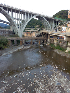
The Cerusa is a 10.7-kilometre (6.6 mi) stream of Liguria (Italy).

Capriata d'Orba is a comune (municipality) in the Province of Alessandria in the Italian region Piedmont, located about 90 kilometres (56 mi) southeast of Turin and about 25 kilometres (16 mi) south of Alessandria. As of 31 December 2004, it had a population of 1,862 and an area of 28.3 square kilometres (10.9 sq mi).
Castelletto d'Orba is a comune (municipality) in the Province of Alessandria in the Italian region Piedmont, located about 90 kilometres (56 mi) southeast of Turin and about 25 kilometres (16 mi) south of Alessandria. As of 31 December 2004, it had a population of 1,979 and an area of 14.3 square kilometres (5.5 sq mi).
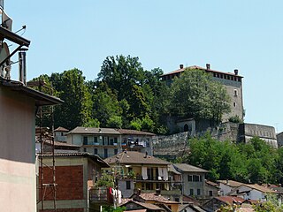
Lerma is a comune (municipality) in the Province of Alessandria in the Italian region Piedmont, located about 90 kilometres (56 mi) southeast of Turin and about 30 kilometres (19 mi) south of Alessandria.

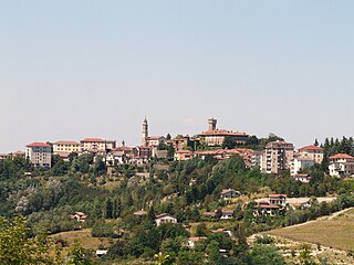
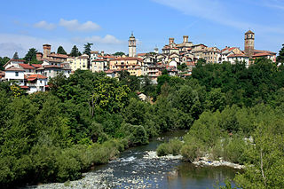
Ovada is a comune (municipality) of 11,484 inhabitants in the Province of Alessandria in the northern Italian region Piedmont, located about 90 kilometres (56 mi) southeast of Turin and about 30 kilometres (19 mi) south of Alessandria.

Silvano d'Orba is a comune (municipality) in the Province of Alessandria in the Italian region Piedmont, located about 90 kilometres (56 mi) southeast of Turin and about 25 kilometres (16 mi) south of Alessandria. As of 31 December 2004, it had a population of 1,856 and an area of 12.1 square kilometres (4.7 sq mi).
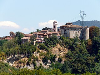
Tagliolo Monferrato is a comune (municipality) in the Province of Alessandria in the Italian region Piedmont, located about 90 kilometres (56 mi) southeast of Turin and about 30 kilometres (19 mi) south of Alessandria. As of 31 December 2004, it had a population of 1,499 and an area of 25.9 square kilometres (10.0 sq mi).
The Orba is a torrent of northern Italy.

The Toce is a river in Piedmont, Italy, which stretches the length of the Val d'Ossola from the Swiss border to Lake Maggiore into which it debouches near Fondotoce in the commune of Verbania. The river is 83.6 kilometres (51.9 mi) long and is formed in the upper Val Formazza by the confluence of a number of torrents in the plain of Riale.

The Tavoliere delle Puglie is a plain in northern Apulia, southern Italy, occupying nearly a half of the Capitanata traditional region. It covers a surface of c. 3,000 km², once constituting a sea bottom: it is bounded by the Daunian Pre-Apennines on the West, the Gargano Promontory and the Adriatic Sea on the East, by the Fortore river on the north, and the Ofanto river on the south. It is the largest Italian plain after the Pianura Padana.

The Geography of Piedmont is that of a territory predominantly mountainous, 43.3%, but yes with extensive areas of hills which represent 30.3% of the territory, and of plains (26.4%).

The Bormida di Spigno is a river of north-west Italy.
The Lemme is a 35 km torrent, a right tributary of the Orba, which flows through the Province of Alessandria in northern Italy.

The Grue is a torrent in north-west Italy, a right tributary of the Scrivia, whose 32-kilometre (20 mi) course lies entirely within the Province of Alessandria, Piedmont.
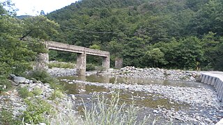
The Gorzente is an Apennine torrent of the Po basin in north-west Italy. A tributary of the Piota, it flows through the territory of the communes of Campomorone, Bosio, Mornese, Casaleggio Boiro, Lerma and Tagliolo Monferrato.

The Capanne di Marcarolo Natural Regional Park is a natural park in the province of Alessandria. It gets the name from a small village in the protected area, Capanne di Marcarolo.

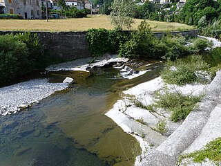
The Stura di Ovada is a 32.9-kilometre (20.4 mi) stream of Liguria and Piedmont (Italy); it is the main tributary of the Orba.
The Italian geographical region is a geographical region of Southern Europe and Western Europe delimited to the north and west by the chain of the Alps. This region is composed of a continental part in the north, a peninsular part and an insular part in the south. Located between the Balkan Peninsula and the Iberian Peninsula, it overlooks the Mediterranean Sea and in particular the Adriatic Sea, the Ionian Sea, the Ligurian Sea, the Sardinian Channel, the Sea of Corsica, the Sea of Sardinia, the Strait of Sicily, and the Tyrrhenian Sea.


