Pontprennau

Last updated

Pontprennau
  • Welsh: Pontprennau
    "Bridge of Trees"
Heol Glandulais - geograph.org.uk - 193835.jpg
Heol Glandulais runs through the centre of Pontprennau. The large buildings near the horizon are the CELSA Group Steelworks; between them is the island of Steep Holm. On the left horizon is Brean Down in Somerset
Cardiff UK location map.svg
Red pog.svg
Pontprennau
Location within Cardiff
Population7,353 
OS grid reference ST214824
Principal area
Preserved county
Country Wales
Sovereign state United Kingdom
Post town CARDIFF
Postcode district CF23
Dialling code 029
Police South Wales
Fire South Wales
Ambulance Welsh
UK Parliament
Senedd Cymru – Welsh Parliament
List of places
UK
Wales
Cardiff
51°32′11″N3°08′27″W / 51.5365°N 3.1408°W / 51.5365; -3.1408

Pontprennau is a ward and community in the north of the city of Cardiff, Wales, lying north of Pentwyn and Cyncoed, between the village of Old St Mellons and the farmlands east of Lisvane. The community had a population of 7,353 in 2011. [1]

Contents

History

Pontprennau is the Welsh for "Bridge of Trees". Lying east-west along the foot of the hills of the South Wales valleys, with Caerphilly directly north, the area is defined by a series of hills, intersected by shallow valleys created by streams which feed as tributaries into the Rhymney River.

Once a part of an area made up of several farms in Llanedeyrn, Pontprennau was designated in the 1970s for residential development, with the M4 Motorway Junction 30 developed for the purpose. It has expanded greatly since the early 1990s, driven primarily by private sector housing, and then corporate offices on Cardiff Gate. [2] St. Mellons and Pontprennau were suburbs of Cardiff by 1974 and by the 1990s the estates started to spill over the boundaries into Lisvane and Cyncoed.

The Pontprennau community was created from part of the Llanedeyrn ward of the previously existing St Mellons community in 1996. The remaining part of the St Mellons community became Old St Mellons. [3]

Today

According to the United Kingdom Census 2001, there were 8,037 people living in Pontprennau. However, this has expanded greatly since, due to sustained housing development both in West Pontprennau and on further pieces of unused land.

East Pontprennau, adjacent to the M4 motorway junction 30, is the commercial sector of the development, housing Cardiff Gate Business Park, Cardiff Gate services, and Cardiff Gate Retail Park. The 100 acres (40 ha) business park provides office accommodation to regional representation for many multinational companies and is also home to the Emergency Control Centre for South Wales, as well as the fire training centre. There is also a motorway service station, Ibis Hotel and Toby Cavery. The retail park is home to a large 24/7 Asda supermarket and petrol station, [4] a B&Q DIY store, a McDonald's restaurant, a gym, coffee shop, and several home furniture stores.

Central Pontprennau is mainly devoted to housing development. The northern edge and highest point in the community is where the community centre, the church, Pontprennau Primary School and Pontprennau Medical Centre, dentist and pharmacy are located. At the bottom of the hill is the western edge, which has a small commercial area, with a large proportion of the land dedicated to industrial use now being converted to private sector housing. It also houses a Waitrose supermarket, Tesla, Inc. car centre, The Village Inn Public House and restaurant, and the Spire Healthcare hospital.

West Pontprennau, situated to the west of Butterfield Park and bordering Lisvane, is the newest of the three areas. It consists mainly of residential housing, but it also contains an Aldi supermarket and Cyncoed Medical Centre, which transferred from Cyncoed to Pontprennau in 2005. There is also a small children's play area at Peppermint Park.

Coffee shop, Pontprennau Community Church Centre - geograph.org.uk - 2112289.jpg
Pontprennau Community Church Centre
Pontprennau Community Centre - geograph.org.uk - 2112298.jpg
Pontprennau Community Centre, now part of the building of Pontprennau Primary school
Asda, Cardiff Gate Retail Park, Cardiff.jpg
Asda supermarket in Cardiff Gate Retail Park

School

Pontprennau Primary school opened in September 2015. It is a 2 Form of Entry school with 48 full-time equivalent nursery places.

The school was completed in two phases. The first phase was ready in time for the school year starting September 2015. At this stage the school had two reception classes plus a nursery. The school was then fully open in time for the school year commencing September 2016.

The establishment of a primary school within Pontprennau aims to stop the over subscription of children attending schools in Lisvane and Llanishen. This project forms part of Cardiff Councils 21st Century Schools Programme which is 50% funding by Welsh Government.

Proposed expansion

There are several sites remaining within the area with potential to be developed. The first is to the east in a plot east of the linkroad between Pontprenau and Old St Mellons. Scheduled to provide an additional 50 or more houses, this has now been turned down twice on planning permission.[ citation needed ] Developments further east would be barred, due to the scheduled green land space between Cardiff and Newport, in which Old St Mellons lies.

A proposed major expansion of the area to the west by the Welsh Government is opposed by Cardiff Council. This would see a development by Redrow plc of a further 4,000 houses in the farmland lying between West Pontprennau and Lisvane. However, since the late-2000s financial crisis, and with apartments lying empty in Cardiff Bay and the councils pressing for development of brown field sites within the city first, development is delayed with no timescale. [5]

In July 2012, Cardiff Council's preferred new Local Development Plan was released. The plan proposed 45,000 new homes to be built in Cardiff by 2026, allowing the city's population to rise by a quarter to more than 400,000. The proposal encompasses: 7,500 homes in a new suburb west of Pentrebane; 2,000 homes on land north of junction 33 on the M4; and 6,000 west and 2,000 east of Pontprennau. [6]

The Pontprennau development would extend:

Transport

The A4232 Pentwyn Link Road marks the eastern edge of Pontprennau. View heading north towards Pontprennau roundabout, beyond which is the M4 motorway A4232 Pentwyn.jpg
The A4232 Pentwyn Link Road marks the eastern edge of Pontprennau. View heading north towards Pontprennau roundabout, beyond which is the M4 motorway

Pontprennau has good transportation links, being located next to the M4 motorway junction 30. Public transport is provided by Cardiff Bus, [7] which serves Pontprennau with services 57 and 58, with buses running approximately every 7–8 minutes during peak time, taking around 40 minutes to reach Cardiff City Centre via Pentwyn, Llanedeyrn, Penylan and Roath. Services 51 and 53 run through west and central Pontprenau to the city centre via the Heath Hospital, and the 52 service stops near west Pontprenau, running to the city centre approximately every half hour via Cyncoed, Penylan and Roath. Additionally NAT Group operates the X1 bus, running from Cardiff Gate in East Pontprenau to Culverhouse Cross via the city centre.

On the council's bicycle network plan, Pontprennau is linked directly to the city centre via onroad routes via Pentwyn. However, to the south a gravel trail path runs along the flood plain of the Rhymney River on the Llanrumney side of the A48 link road, which is easily accessible via tarmac paths which run north–south within the Pontprennau community. The Rhymney River trail gives both walkers and cyclists easy access to the Newport Road both west and east of Llanrumney, and hence via the eastern entrance through Llanrumney Bowls club to the extensive retail park on Newport Road West.

Sport

The field is the home of the "Pontprennau Pumas", the local football team, running two adult teams in the Cardiff Combination Leagues. They also have teams at under 12's and under 11's. The club are sponsored by Cardiff Gate Business Park. [8] Pontprennau Community Centre playing fields (allocated to the school, but open for community use) provides one of many "green-grass-expanse" family activity areas within the community, and a standard sized football field.

Local services

Community Centre

Church

Library

Parks & Play Areas

Supermarket

Garden Centre

Public Houses

Local Council

Cardiff Council the local authority which covers Pontprennau, the main council offices are at County Hall, Atlantic Wharf, Cardiff.

Representation

Pontprennau & Old St Mellons ward Cardiff ward location - Pontprennau Old St Mellons.png
Pontprennau & Old St Mellons ward

Pontprennau is a community of the City of Cardiff but there is no community council for the area.

Pontprennau & Old St. Mellons is an electoral division located in the North East of Cardiff. It is represented by Dianne Rees of the Welsh Conservative Party, and Georgina Phillips of Welsh Labour. [11]

Government

Senedd

Pontprennau is in the Cardiff North constituency for the Senedd, represented by Julie Morgan MS, a member of the Welsh Labour Party.

Westminster

Cardiff North has been represented since 2017 by Anna McMorrin MP, a member of the Labour Party.

Related Research Articles

<span class="mw-page-title-main">Llanrumney</span> Suburb and community in Cardiff, Wales

Llanrumney is a suburb, community and electoral ward in east Cardiff, Wales.

<span class="mw-page-title-main">Lisvane</span> Community in Cardiff, Wales

Lisvane is a community in the north of Cardiff, the capital of Wales, located 5 miles (8 km) north of the city centre. Lisvane is generally considered to be one of the wealthiest residential areas of Wales, with many properties worth in excess of £1 million. Lisvane had 3,319 residents in 2001 and comprises approximately 1,700 dwellings, a local village shop, primary school, community cabin library, park, nursery, parish church, public house, war memorial, Scout hall and community or village hall.

<span class="mw-page-title-main">Cyncoed</span> Community in Cardiff, Wales

Cyncoed ; is a community in the northeast of Cardiff, the capital of Wales. With many properties in the area fetching over £1 million, Cyncoed is considered to have some of the highest property prices in the country. Cyncoed overlooks the city centre of Cardiff, near Roath Park, with views of the surrounding mountains.

<span class="mw-page-title-main">St Mellons</span> District of Cardiff, Wales

St Mellons is a district and suburb of eastern Cardiff, the capital city of Wales. Prior to 1996 St Mellons was the name given to the community largely north of Newport Road (B4487) which included the old St Mellons village. After 1996 the old community was divided and renamed as Old St Mellons and Pontprennau, with the newer, much larger area of modern housing and business parks to the south of Newport Road retaining the St Mellons name. Historically in Monmouthshire, St Mellons became part of South Glamorgan and Cardiff in 1974.

<span class="mw-page-title-main">Llanedeyrn</span> District and community in Cardiff, Wales

Llanedeyrn is a former village, now a district and community, in the east of the city of Cardiff, Wales, located around 3.5 miles from the city centre. The parish of Llanedeyrn rests on the banks of the river Rhymney and is visible nesting on a hill side above the A48(M), westbound on the approach into Cardiff.

<span class="mw-page-title-main">Canton, Cardiff</span> District and community in Cardiff, Wales

Canton is an inner-city district and community in the west of Cardiff, capital of Wales, lying 2 miles (3.2 km) west of the city's civic centre. It is located adjacent to Pontcanna. Canton is one of the most ethnically diverse of Cardiff's suburbs, with a significant Pakistani and Indian population. The total population of Canton increased to 14,304 at the 2011 census. It is also the most Welsh-speaking district of central Cardiff, with 19.1% of the population speaking Welsh.

<span class="mw-page-title-main">Pontprennau and Old St Mellons</span> Electoral ward in Wales

Pontprennau and Old St Mellons is an electoral ward in Cardiff, Wales. Covering the communities of Old St Mellons and Pontprennau, it is represented by two councillors on Cardiff Council.

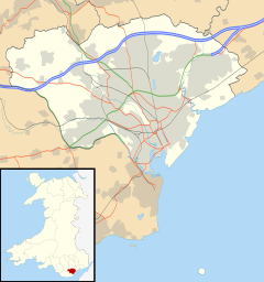
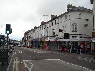
Transport in Cardiff, capital and most populous city in Wales involves road, rail, bus, water and air. It is a major city of the United Kingdom and a centre of employment, government, retail, business, culture, media, sport and higher education.

<span class="mw-page-title-main">A4232 road</span> Road in Cardiff, Wales

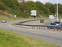
The A4232, which is also known either as the Peripheral Distributor Road (PDR) (Welsh: Ffordd Ddosbarthu Ymylol) or the Cardiff Link Road (Welsh: Ffordd Gyswllt Caerdydd), is a distributor road in Cardiff, the capital of Wales.

<span class="mw-page-title-main">Pentwyn, Cardiff</span> District and community of Cardiff, Wales

Pentwyn is a district, community and electoral ward in the east of Cardiff, Wales, located northeast of the city centre. Llanedeyrn is immediately to the south, Cyncoed to the west, Pontprennau to the north and the Rhymney River forms the eastern border. The population of the ward taken at the 2011 census was 15,634.

<span class="mw-page-title-main">Cycling in Cardiff</span> Transport by bicycle in Cardiff, Wales

Cycling in Cardiff, capital of Wales, is facilitated by its easy gradients and large parks. In the mid-2000s between 2.7% and 4.3% of people commuted to work by cycling in the city. In 2017 12.4% of workers cycled to work at least 5 days a week. However, cyclists in the city are deterred from cycling by poor facilities and aggressive traffic, according to research by Cardiff University.

The centre of Cardiff, the capital of Wales, is relatively flat and is bounded by hills on the outskirts to the east, north and west. Its geographic features were influential in its development as the world's largest coal port, most notably its proximity and easy access to the coal fields of the south Wales valleys.

<span class="mw-page-title-main">Old St Mellons</span> Village and community in Cardiff, Wales

Old St Mellons is a village, a community and a civil parish on the eastern edge of Cardiff, Wales. Lying to the east of the Rhymney River, it forms part of the historic county of Monmouthshire. It is separated from the modern St Mellons suburb by the main road to Newport – the Newport Road (B4487) – and which was formerly the A48 road.

<span class="mw-page-title-main">St Edeyrn's Church</span> Church in Cardiff, Wales

St Edeyrn's Church is a listed Anglican church within the boundary of Old St Mellon's, Cardiff, though giving its name to the nearby area of Llanedeyrn.

<span class="mw-page-title-main">Pentwyn (electoral ward)</span> Electoral ward in Wales

Pentwyn is the name of an electoral ward in the northeast of Cardiff, capital city of Wales. It covers the communities of Pentwyn and Llanedeyrn. The ward has elected councillors to the post-1996 Cardiff Council and the pre-1996 Cardiff City Council.

The 1983 Cardiff City Council election was held on Thursday 5 May 1983 to the district council known as Cardiff City Council, in Cardiff, South Glamorgan, Wales. It took place on the same day as other district council elections in Wales and England. The Conservative Party regained control of the council from the Labour Party.

The Cardiff & District League is a football league covering the city of Cardiff and surrounding areas in South Wales. The leagues are at the seventh to tenth levels of the Welsh football league system.

References

  1. "Custom report - Nomis - Official Labour Market Statistics".
  2. History of Pontprennau
  3. "STATUTORY INSTRUMENTS 1996 No. 494 The Cardiff (St. Mellons Community) Order 1996". UK Stationery Office. Retrieved 13 February 2018.
  4. Asda Pentwyn
  5. James, David (11 February 2010). "Battle is on over city's green space". South Wales Echo. Retrieved 31 January 2012.
  6. "Cardiff earmarks space for 45,000 new homes by 2026". BBC Wales. 13 July 2012. Retrieved 26 July 2012.
  7. "Cardiff Bus". cardiffbus.com.
  8. "Pontprennau Pumas". Pontprennau Pumas. Archived from the original on 18 October 2009. Retrieved 10 May 2010.
  9. Cardiff Libraries
  10. Barry, Sion (June 25, 2018) (25 June 2018). "Cardiff Council has just bought a prime seven acre site". Walesonline. Retrieved 30 April 2020.{{cite web}}: CS1 maint: multiple names: authors list (link) CS1 maint: numeric names: authors list (link)
  11. "Election results for the division of Pontprennau & Old St Mellons / Pontprennau a Phentref Llaneirwg". Cardiff Council. 4 May 2012. Retrieved 4 May 2012.