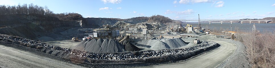
Port Deposit is a town in Cecil County, Maryland, United States. It is located on the east bank of the Susquehanna River near its discharge into the Chesapeake Bay. The population was 653 at the 2010 census.

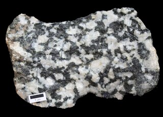
Amphibolite is a metamorphic rock that contains amphibole, especially hornblende and actinolite, as well as plagioclase feldspar, but with little or no quartz. It is typically dark-colored and dense, with a weakly foliated or schistose (flaky) structure. The small flakes of black and white in the rock often give it a salt-and-pepper appearance.
The Llano Uplift is a geologically ancient, low geologic dome that is about 90 miles (140 km) in diameter and located mostly in Llano, Mason, San Saba, Gillespie, and Blanco counties, Texas. It consists of an island-like exposure of Precambrian igneous and metamorphic rocks surrounded by outcrops of Paleozoic and Cretaceous sedimentary strata. At their widest, the exposed Precambrian rocks extend about 65 miles (105 km) westward from the valley of the Colorado River and beneath a broad, gentle topographic basin drained by the Llano River. The subdued topographic basin is underlain by Precambrian rocks and bordered by a discontinuous rim of flat-topped hills. These hills are the dissected edge of the Edwards Plateau, which consist of overlying Cretaceous sedimentary strata. Within this basin and along its margin are down-faulted blocks and erosional remnants of Paleozoic strata which form prominent hills.
Diorite is an intrusive igneous rock formed by the slow cooling underground of magma that has a moderate content of silica and a relatively low content of alkali metals. It is intermediate in composition between low-silica (mafic) gabbro and high-silica (felsic) granite.
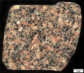
Quartz monzonite is an intrusive, felsic, igneous rock that has an approximately equal proportion of orthoclase and plagioclase feldspars. It is typically a light colored phaneritic (coarse-grained) to porphyritic granitic rock. The plagioclase is typically intermediate to sodic in composition, andesine to oligoclase. Quartz is present in significant amounts. Biotite and/or hornblende constitute the dark minerals. Because of its coloring, it is often confused with granite, but whereas granite contains more than 20% quartz, quartz monzonite is only 5–20% quartz. Rock with less than five percent quartz is classified as monzonite. A rock with more alkali feldspar is a syenite whereas one with more plagioclase is a quartz diorite. The fine grained volcanic rock equivalent of quartz monzonite is quartz latite.

Lamprophyres are uncommon, small-volume ultrapotassic igneous rocks primarily occurring as dikes, lopoliths, laccoliths, stocks, and small intrusions. They are alkaline silica-undersaturated mafic or ultramafic rocks with high magnesium oxide, >3% potassium oxide, high sodium oxide, and high nickel and chromium.

Granodiorite is a coarse-grained (phaneritic) intrusive igneous rock similar to granite, but containing more plagioclase feldspar than orthoclase feldspar.

Maryland Route 222 (MD 222) is a state highway in the U.S. state of Maryland. The highway runs 11.36 miles (18.28 km) from MD 7 in Perryville north to U.S. Route 1 (US 1) near Conowingo. MD 222 connects Perryville, Port Deposit, and Conowingo along its route paralleling the Susquehanna River in western Cecil County. Due to limitations in the highway in Port Deposit, including a steep hill and a low-clearance railroad bridge, trucks are directed to use MD 275, MD 276, and US 1 through Woodlawn and Rising Sun to connect Interstate 95 (I-95) with US 222 in Conowingo.

Guernsey has a geological history stretching further back into the past than most of Europe. The majority of rock exposures on the Island may be found along the coastlines, with inland exposures scarce and usually highly weathered. There is a broad geological division between the north and south of the Island. The Southern Metamorphic Complex is elevated above the geologically younger, lower lying Northern Igneous Complex. Guernsey has experienced a complex geological evolution with multiple phases of intrusion and deformation recognisable.
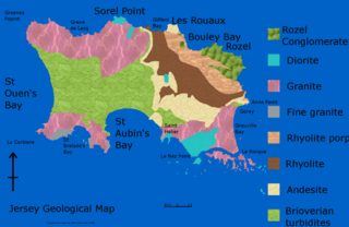
The geology of Jersey is characterised by the Late Proterozoic Brioverian volcanics, the Cadomian Orogeny, and only small signs of later deposits from the Cambrian and Quaternary periods. The kind of rocks go from conglomerate to shale, volcanic, intrusive and plutonic igneous rocks of many compositions, and metamorphic rocks as well, thus including most major types.
The Piégut-Pluviers Granodiorite is situated at the northwestern edge of the Variscan Massif Central in France. Its cooling age has been determined as 325 ± 14 million years BP.
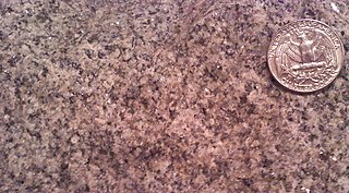
The Guilford Quartz Monzonite is a Silurian or Ordovician quartz monzonite pluton in Howard County, Maryland. It is described as a biotite-muscovite-quartz monzonite which occurs as discontinuous lenticular bodies which intrude mainly through the Wissahickon Formation (gneiss).

The Woodstock Quartz Monzonite is a Silurian or Ordovician quartz monzonite pluton in Baltimore County, Maryland. It is described as a massive biotite-quartz monzonite which intrudes through the Baltimore Gneiss at a single locality surrounding the town of Granite, Maryland.
The Norbeck Intrusive Suite is an Ordovician granitic pluton in Montgomery County, Maryland. The intrusive suite was originally mapped as the Norbeck Quartz Diorite by Hopson, and is shown as such on the Geologic Map of Maryland of 1968. A. A. Drake later revised the name after more detailed mapping. It intrudes through the Wissahickon Formation.

The Ellicott City Granodiorite is a Silurian or Ordovician granitic pluton in Howard and Baltimore Counties, Maryland. It is described as a biotite granodiorite along the margin of the intrusion which grades into a quartz monzonite in its core. It intrudes through the Wissahickon Formation and the Baltimore Gabbro Complex.

The Vishnu Basement Rocks is the name recommended for all Early Proterozoic crystalline rocks exposed in the Grand Canyon region. They form the crystalline basement rocks that underlie the Bass Limestone of the Unkar Group of the Grand Canyon Supergroup and the Tapeats Sandstone of the Tonto Group. These basement rocks have also been called either the Vishnu Complex or Vishnu Metamorphic Complex. These Early Proterozoic crystalline rocks consist of metamorphic rocks that are collectively known as the Granite Gorge Metamorphic Suite; sections of the Vishnu Basement Rocks contain Early Paleoproterozoic granite, granitic pegmatite, aplite, and granodiorite that have intruded these metamorphic rocks, and also, intrusive Early Paleoproterozoic ultramafic rocks.

The geology of the Democratic Republic of the Congo is extremely old, on the order of several billion years for many rocks. The country spans the Congo Craton: a stable section of ancient continental crust, deformed and influenced by several different mountain building orogeny events, sedimentation, volcanism and the geologically recent effects of the East Africa Rift System in the east. The country's complicated tectonic past have yielded large deposits of gold, diamonds, coltan and other valuable minerals.

The Baltimore Gneiss is a Precambrian geological formation in the Piedmont region of Maryland, Pennsylvania, and Delaware.

The Siilinjärvi carbonatite complex is located in central Finland close to the city of Kuopio. It is named after the nearby village of Siilinjärvi, located approximately 5 km west of the southern extension of the complex. Siilinjärvi is the second largest carbonatite complex in Finland after the Sokli formation, and one of the oldest carbonatites on Earth at 2610±4 Ma. The carbonatite complex consists of a roughly 16 km long steeply dipping lenticular body surrounded by granite gneiss. The maximum width of the body is 1.5 km and the surface area is 14.7 km2. The complex was discovered in 1950 by the Geological Survey of Finland with help of local mineral collectors. The exploration drilling began in 1958 by Lohjan Kalkkitehdas Oy. Typpi Oy continued drilling between years 1964 and 1967, and Apatiitti Oy drilled from 1967 to 1968. After the drillings, the laboratory and pilot plant work were made. The mine was opened by Kemira Oyj in 1979 as an open pit. The operation was sold to Yara in 2007.

The Boscobel complex is unit of interlayered granite and gneiss within Goochland and Powhatan Counties, Virginia. The area had been mapped as the Petersburg Granite in 1970 by B. K. Goodwin.