The Jimmy Barnes' 1985 song "I'd die to be with you Tonight" was filmed on the Bridge, with it in the swing-out configuration. (See:I'd Die to be with You Tonight)
History
The first Pyrmont Bridge was opened on 17 March 1858,[4] and was a wooden pile bridge with an iron centre 'swing panel' to allow ships to pass. In the first two weeks 20,000 pedestrians paid the one penny toll. It was also crossed by "932 carts and drays, 43 gigs, 17 carriages and 125 horse and rider." When the NSW government bought the bridge for £52,500 from the Pyrmont Bridge Company in 1884, they abolished the toll.[5]
The wooden Pyrmont Bridge vanished with the construction in 1902 of a new steel bridge which took 33 months to build and was completed in time to accommodate Sydney's first cars.[6] In 1891 competitive designs were invited for a new bridge on the south side of the old structure, but due to the economic depression no further action was taken until 1894, when, after prolonged inquiry and the consideration of about twenty six schemes, the Parliamentary Standing Committee on Public Works decided in favour of a design for a steel bridge with a swing span of 16 metres (54ft), affording two 21 metres (70ft) clear fairways, submitted by the Department of Public Works (PWD).[1]
The foundations stone of the new bridge was laid by Edward William O'Sullivan, State Minister for Works, on 6 September 1899; and the bridge opened for traffic on 28 June 1902, by Harry Rawson, Governor of New South Wales. Powered by electricity from the Ultimo Powerhouse, the swing bridge could be opened and closed in 45 seconds. Percy Allan, PWD Engineer-in-Chief of bridge design, designed the Pyrmont Bridge and over 550 bridges.[1]
As part of the construction of the Western Distributor project, the eastern abutment of Pyrmont Bridge was demolished and redirected in 1980, with City-bound traffic crossing the bridge temporarily funnelled onto a northbound viaduct to enter the city or access the Harbour Bridge via King Street, while the viaduct across the southern end of Cockle Bay was being constructed. Just a year later, the Western Distributor viaduct to King Street was completed across the eastern end of Pyrmont Bridge, the temporary access ramp from the bridge to the viaduct was removed, and the bridge was permanently closed to traffic. The Government ordered the bridge to be demolished, but later revoked this decision. In 1984 the Darling Harbour Authority was formed with the task of redeveloping Darling Harbour. The Pyrmont Bridge was restored, with the swing span in full working order, and incorporated as a pedestrian bridge in the redevelopment of Darling Harbour. An elevated pedestrian walkway was constructed across the Western Distributor viaduct to link the eastern end of the bridge to Market Street at surface level. A section of the Monorail was built across the bridge at this time. The Pyrmont Bridge was re-opened to pedestrian traffic in 1988.[1]
Following the end of the monorail's 25 years of operation in July 2013, the monorail track was removed from the bridge. Some changes that had been made to the bridge during the construction of the monorail were then reversed, including the conversion of the electrical braking system back to a hand-operated system, and the relocation of the control cab to the middle of the bridge.[7]
After the removal of the monorail, the Sydney Harbour Foreshore Authority began discussing plans to give the bridge a facelift to coincide with Darling Harbour's $2.5b redevelopment. The SHFA commissioned a design brief to look at options for future enhancements including furniture, lighting and pop-up cafes. "Pyrmont Bridge will remain open and accessible to the public...Any future use proposals must not impact on the bridge's surviving historic fabric, or its technological significance, or prevent the continued use as an open swing span bridge".[8][1] The NSW Government will invest in a $23m renewal of heritage-listed Pyrmont Bridge. The project is part of a $73m commitment over the next four years to protect heritage assets along Sydney Harbour foreshore. The projets include $15m to replace ferry wharves in Cockle Bay and $20m to refurbish public spaces at Campbell's Cove at the Rocks and Darling Harbour.[1][9]
Description
Pyrmont Bridge, circa 1902–1917.
The foundation stone for the new bridge was laid on 6 December 1899 by E. W. O'Sullivan and the bridge was opened for traffic on 28 June 1902 by the Governor of New South Wales, Harry Rawson.[10] The bridge was designed under the engineering supervision of Percy Allan. The bridge had one of the largest swing spans in the world at the time of its construction and it was one of the first to be powered by electricity. Allan also designed the similar Glebe Island Swing Bridge, completed in 1903.
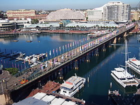
The Pyrmont Bridge is 369 metres (1,211ft) long and cost £112,500 to build. The bridge is made up of 14 spans with Australian ironbark timber used on 12 spans, while the two central spans, which swing, are constructed from steel. The swingspan weighs 1,000 tonnes (1,100 short tons) and is supported on a base made from concrete and Hawkesbury Sandstone. The base is filled with mass concrete and weighs 6,800 tonnes (7,500 short tons). The swingspan is 13 metres (43ft) in diameter and 19 metres (62ft) deep. The water is 6.5 metres (21ft) deep and the base extends a further 10 metres (33ft) below the sea floor.[3]
Pyrmont Bridge takes approximately 60 seconds to open completely to 83 degrees. It has to be opened for vessels more than 7 metres (23ft) high. Vessels/barges up to 21.5 metres (71ft) wide can pass through the channel once the Bridge has been opened. Pyrmont Bridge is driven by the original two 50 horsepower (37kW) 600V DCGeneral Electric type 57 electric motors. Manual drum-type General Electric tramway controllers are used to drive the motors for the swingspan and gates. Power to operate the bridge was originally drawn from the Ultimo Power House (now the Powerhouse Museum). As a young engineer, J.J.C. Bradfield helped design the sandstone abutment walls at each end of Pyrmont Bridge.[3]
In 1981 the Wran government ordered the bridge to be demolished, but later revoked this decision.[6] The bridge was closed to vehicular traffic on 7 August 1981,[3] the traffic having been diverted over the Western Distributor freeway structures built further south of Cockle Bay, and it was then re-opened as a pedestrian bridge as part of the re-development of Darling Harbour as a recreational pedestrian precinct. The swing bridge remains in operation, and opens to a schedule managed by the Sydney Harbour Foreshore Authority.[11]
In 1992 Engineers Australia recognised the bridge as a National Engineering Landmark.[2]
Modifications
As built, the bridge had stone abutments on both ends, the western end connecting it to Union Street and the eastern end connecting it to Market Street. In 1980, most of the eastern abutment was demolished as part of the construction of the Western Distributor. A section connected to the bridge remains, and the isolated easternmost plinth and lamppost can still be seen near the corner of Market Street and Sussex Street. In 1980, the eastern end of the bridge was initially connected via a ramp to the viaduct leading north to King Street, but this was demolished in 1981 when the rest of the viaduct was completed around the southern end of Cockle Bay. Only a narrow pedestrian and cycle path still connects the eastern end of the bridge to the viaduct and to King Street. A separate pedestrian bridge was constructed over the Western Distributor roadway to connect the eastern end of the bridge to Market Street at surface level.
The monorail crossing Pyrmont Bridge, photographed in 1990
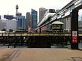
Between 1988 and 2013, the bridge carried the elevated Sydney Monorail, which travelled between Darling Harbour and the Sydney central business district. The monorail track rested on a pivot that allowed the track to remain stationary while the bridge swung underneath. The pivot allowed the monorail to continue to cross the bridge even when the bridge was opened. The construction of the monorail led to some changes to the bridge, including the electrification of the previously hand-operated brakes used to control the bridge's swing, and the relocation of the control cab six metres away from the middle of the bridge (so that the control cab would not hit the monorail track when the bridge is open).
Upon the closure of the Monorail in June 2013 the hydraulic lifting rams and support infrastructure were removed, and the control cab was relocated to its original position in the middle of the bridge.[12]
Heritage listing
As at 24 July 2001, Pyrmont Bridge is an item of State heritage significance for its aesthetic, historical and scientific cultural values. An essential link between the city and the inner western suburbs, Pyrmont Bridge is closely associated with the economic and social development of Sydney at the end of the 19th century.[1]
Pyrmont Bridge is closely associated with Percy Allan, PWD Engineer-in-Chief of bridge design, who was responsible for the introduction of American timber bridge practice to NSW and designed over 500 bridges in NSW. The quality of the carved stonework of the piers and portals added to the aesthetic appeal of the bridge.[1]
At the time of construction the swing span of Pyrmont Bridge was one of the largest in the world. It was one of the first swing bridges to be powered by electricity. The timber approach spans demonstrate a rare example of deck type Allan trusses; there being no other known example. The bridge's Australian design and technological innovation was a source of pride for the people of NSW.[1]
Despite the demolition of the eastern approach to the bridge and the construction of the monorail track, Pyrmont Bridge retains its essential heritage values.[1]
The place is important in demonstrating the course, or pattern, of cultural or natural history in New South Wales.
Pyrmont Bridge, an essential link between the city and the inner western suburbs, is closely associated with the economic and social development of Sydney at the end of the 19th century. Pyrmont Bridge is closely associated with Percy Allan, PWD Engineer-in-Chief of bridge design, with the assistance of JJ Bradfield and Gordon Edgell. Percy Allen was responsible for the introduction of American timber bridge practice to NSW, and designed over 500 bridges in NSW.[1]
The place has a strong or special association with a person, or group of persons, of importance of cultural or natural history of New South Wales's history.
Pyrmont Bridge is closely associated with Percy Allan, PWD Engineer-in-Chief of bridge design, with the assistance of JJ Bradfield and Gordon Edgell. Percy Allan was responsible for the introduction of American timber bridge practice to NSW, and designed over 500 bridges in NSW.[1]
The place is important in demonstrating aesthetic characteristics and/or a high degree of creative or technical achievement in New South Wales.
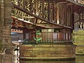
Pyrmont Bridge demonstrates a high level of aesthetic value in the stonework and carved stone detailing of the bridge approaches, pivot pier and rest piers, as well as displaying the high aesthetic values of the timber and steel bridge structures . The watchhouse also demonstrates fine architectural detailing.[1]
The place has a strong or special association with a particular community or cultural group in New South Wales for social, cultural or spiritual reasons.
When completed the Pyrmont Bridge was regarded as a landmark in the development of Australian engineering skills and technological innovation, being favourably compared with the technical achievements of the recently completed Tower Bridge in London. Its Australian design, technological innovation and construction made it a source of pride for the people of NSW.[1]
The place has potential to yield information that will contribute to an understanding of the cultural or natural history of New South Wales.
When completed the Pyrmont Bridge was regarded as a landmark in the development of Australian engineering skills and technological innovation, being favourably compared with the technical achievements of the recently completed Tower Bridge in London. The bridge's innovative design included; the size of the swing span and speed of operation; development of the timber bridge truss; caisson construction; design of the swing span bearings; and use of electric power. The design of the approach spans represent the highest level of development of the timber truss.[1]
The place possesses uncommon, rare or endangered aspects of the cultural or natural history of New South Wales.
The timber approach spans demonstrate a rare example of deck type Allan trusses; there being no other known example.[13][1]
Gallery
The point at which the bridge turns
Pyrmont Bridge mid-swing.
The control cab for bridge's swinging operation being moved back to the middle of the bridge in 2013, after the removal of the monorail.
Looking at CBD
The arc-shaped split between bridge sections is shown here.
Darling Harbour is a harbour adjacent to the city centre of Sydney, New South Wales, Australia that is made up of a large recreational and pedestrian precinct that is situated on western outskirts of the Sydney central business district.
Gladesville Bridge is a heritage-listed concrete arch road bridge that carries Victoria Road over the Parramatta River, linking the Sydney suburbs of Huntleys Point and Drummoyne, in the local government areas of Canada Bay and Hunter's Hill, in New South Wales, Australia. Despite its name, the bridge is not in Gladesville.
The Anzac Bridge is an eight-lane cable-stayed bridge that carries the Western Distributor (A4) across Johnstons Bay between Pyrmont and Glebe Island, on the western fringe of the Sydney central business district, New South Wales, Australia. The bridge forms part of the road network leading from the central business district, the Sydney Harbour Bridge, and Cross City Tunnel to the Inner West and Northern Suburbs.
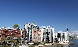
Pyrmont is an inner-city suburb of Sydney, in the state of New South Wales, Australia 2 kilometres south-west of the Sydney central business district in the local government area of the City of Sydney. It is also part of the Darling Harbour region. As of 2011, it is Australia's most densely populated suburb.
The Glebe Island Bridge is a heritage-listed disused swing Allan truss road bridge that carried Victoria Road across Johnstons Bay, located in the inner city Sydney suburb of Pyrmont in the City of Sydney local government area of New South Wales, Australia. The bridge, that connected Rozelle to Pyrmont by road, is one of the last remaining swing bridges of its type in Australia and in the world. It was designed by Percy Allan and built from 1899 to 1903 by Bridges Branch of NSW Public Works Department. It is also known as RMS Bridge No. 61. It was added to the New South Wales State Heritage Register on 29 November 2013 and was listed on the Register of the National Estate on 19 April 1989.
The Fig Tree Bridge is a road bridge that carries Burns Bay Road across the Lane Cove River, and connects the suburbs of Hunters Hill in the south and Linley Point in the north, located approximately seven kilometres northwest of the central business district of Sydney in New South Wales, Australia. The concrete girder bridge carries motor vehicles, and a grade-separated footpath and cycleway.
The Sydney Freight Network is a network of dedicated railway lines for freight in Sydney, Australia, linking the state's rural and interstate rail network with the city's main yard at Enfield and Port Botany. Its primary components are the Southern Sydney Freight Line (SSFL) and a line from Sefton to Enfield and Port Botany. The Network has been managed by the Australian Rail Track Corporation (ARTC) since 2012. Prior to the completion of the SSFL, it was managed by RailCorp as the Metropolitan Freight Network.
The Grafton Bridge is a heritage-listed bascule truss bridge that carries Bent Street and North Coast railway line across the Clarence River in Grafton, New South Wales, Australia. The bridge links the Grafton central business district with South Grafton, and was added to the New South Wales State Heritage Register on 2 April 1999.
The Victoria Bridge is a heritage-listed timber trestle truss road bridge across the Stonequarry Creek, located at Prince Street in the south-western Sydney town of Picton in the Wollondilly Shire local government area of New South Wales, Australia. The bridge is owned by Transport for NSW, an agency of the Government of New South Wales. The bridge is also known as the Victoria Bridge over Stonequarry Creek. It was added to the New South Wales State Heritage Register on 20 June 2000. Designed by Percy Allan and opened on 7 October 1897, Victoria Bridge employs Allan trusses and was built by C. J. Ford of Sydney.
Glebe Island was a major port facility in Sydney Harbour and, in association with the adjacent White Bay facility, was the primary receiving venue for imported cars and dry bulk goods in the region until 2008. It is surrounded by White, Johnstons, and Rozelle Bays. Whilst retaining its original title as an "island", it has long been infilled to the shoreline of the suburb of Rozelle and connected by the Glebe Island Bridge to Pyrmont.
This list documents historical bridges located in New South Wales, Australia. Road, rail and pedestrian bridges are listed. Generally bridges built before World War II (1939) have been included in this list.
The Prince Alfred Bridge is a wrought iron truss and timber beam partially-disused road bridge over the Murrumbidgee River and its floodplain at Middleton Drive, Gundagai, Cootamundra-Gundagai Regional Council, New South Wales, Australia. The heritage-listed road bridge was designed by William Christopher Bennett and built from 1864 to 1867 by Francis Bell. It is also known as Prince Alfred Bridge – Iron Road Bridge and Iron Bridge over Murrumbidgee River at Gundagai. The iron bridge is owned by Transport for NSW and the timber viaduct is owned by Crown Lands. The bridge was added to the New South Wales State Heritage Register on 5 July 2019 and on the Register of the National Estate on 21 March 1978.
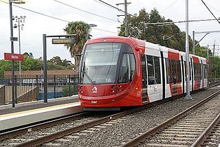
The Inner West Light Rail is a 12.8-kilometre (8.0 mi) light rail line in Sydney, New South Wales, Australia, running from Central railway station through the Inner West to Dulwich Hill and serving 23 stops. It is the original line of the Sydney light rail network, and was originally known as Sydney Light Rail. Light rail services on the line are now branded as the L1 Dulwich Hill Line.
The Tooleybuc Bridge is a dual heritage-listed road bridge that carries Tooleybuc Road across the Murray River, located in Tooleybuc, New South Wales, Australia. It was built in 1925. The bridge is owned by the Transport for NSW, and is also called the Tooleybuc Bridge over Murray River. The bridge was added to the New South Wales State Heritage Register on 20 June 2000 and the Victorian Heritage Register on 10 July 2008.
The Dunmore Bridge is a heritage-listed road bridge that carries Clarence Town Road across the Paterson River in Woodville, New South Wales, Australia. It was designed by Percy Allan and built in 1899 by Morpeth contractor, S. McGill. The property is owned by Transport for NSW. It was added to the New South Wales State Heritage Register on 20 June 2000.
The Hinton Bridge over Paterson River is a heritage-listed road bridge that carrier the Hinton-Morpeth Road across the Paterson River at Hinton, New South Wales, Australia. The bridge was designed by Ernest de Burgh and built in 1901. The bridge is owned by Transport for NSW. The bridge was added to the New South Wales State Heritage Register on 20 June 2000.
The Ultimo Road railway underbridge is a heritage-listed former railway bridge located on the former Darling Harbour goods railway line in the inner city Sydney suburb of Ultimo in the City of Sydney local government area of New South Wales, Australia. It was designed by engineering staff in the Existing Lines branch of the New South Wales Public Works Department and built in 1879. The property is owned by Transport Asset Holding Entity, an agency of the Government of New South Wales. It was added to the New South Wales State Heritage Register on 2 April 1999.
The Glebe and Wentworth Park railway viaducts are a series of two heritage-listed railway bridges and arch viaducts that carry the Inner West Light Rail across Wentworth Park, Jubilee Park, and Johnstons Creek in the inner western Sydney suburb of Glebe in the City of Sydney local government area of New South Wales, Australia. They were designed by the New South Wales Government Railways and built from 1892 to 1922 by day labour. They are also known as Wentworth Park Viaduct, Jubilee Park Viaduct and Glebe Viaducts. The viaducts were added to the New South Wales State Heritage Register on 2 April 1999.
Darling Harbour Yard was a goods railway yard in Darling Harbour, New South Wales, Australia. The yard was once the origin of all outgoing goods traffic from Sydney. It was one of two major yards on the former Metropolitan Goods line, the other being in Rozelle. After closing to heavy rail in 1993, the alignment of the Metropolitan Goods line which passed through it was reutilised by light rail. The precinct around the yard was significantly redeveloped in the decades following its closure.
Council of the City of Sydney. Ultimo Pyrmont Haymarket Study.
Engineering Heritage Committee, Sydney Division, I.E. Australia (1991). The Pyrmont Bridge, Darling Harbour.{{cite book}}: CS1 maint: multiple names: authors list (link)
Gorman, James (2013). 'Facelift for a Favourite landmark'.
Sydney Cove Authority (SCA) (1998). SCA Register 1979-1998.
This page is based on this Wikipedia article Text is available under the CC BY-SA 4.0 license; additional terms may apply. Images, videos and audio are available under their respective licenses.