
24 Sussex Drive, originally called Gorffwysfa and usually referred to simply as 24 Sussex, is the official residence of the prime minister of Canada, located in the New Edinburgh neighbourhood of Ottawa, Ontario. Built between 1866 and 1868 by Joseph Merrill Currier, it has been the official home of the prime minister of Canada since 1951. It is one of two official residences made available to the prime minister, the Harrington Lake estate in nearby Gatineau Park being the other.

The Rideau Canal is a 202 kilometre long canal that links the Ottawa River, at Ottawa, with the Saint Lawrence River at Kingston, Ontario, Canada. Its 46 locks raise boats from the Ottawa River 83 metres upstream along the Rideau River to the Rideau Lakes, and from there drop 50 metres downstream along the Cataraqui River to Kingston.

The National Capital Commission is the Crown corporation responsible for development, urban planning, and conservation in Canada's Capital Region, including administering most lands and buildings owned by the Government of Canada in the region.

Bank Street is the major commercial north-south street in Ottawa, Ontario, Canada. It runs south from Wellington Street in downtown Ottawa, south through the neighbourhoods of Centretown, The Glebe, Old Ottawa South, Alta Vista, Hunt Club, and then through the villages of Blossom Park, Leitrim, South Gloucester, Greely, Metcalfe, Spring Hill, and Vernon before exiting the city limits at Belmeade Road.

Rideau Street is a major street in downtown Ottawa, Ontario, Canada, and one of Ottawa's oldest and most famous streets running from Wellington Street in the west to Montreal Road in the east where it connects to the Vanier district. Rideau Street is home to the Château Laurier, the CF Rideau Centre and the Government Conference Centre. Along with Wellington Street and Sussex Drive it was among the first streets in Ottawa to be host to businesses; it was created with the founding of the early town. The Plaza Bridge by the Rideau Canal is at its westmost point and the Cummings Bridge is at its eastmost point.

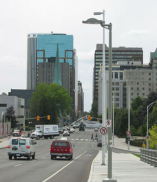
Sussex Drive, also known as Ottawa Regional Road 93, is an arterial road in Ottawa, Ontario, the capital of Canada. It is one of the city's main ceremonial and institutional routes. Travelling roughly parallel to the Ottawa River, Sussex Drive begins as a continuation of Sir George-Étienne Cartier Parkway at Rideau Gate, at the entrance to Rideau Hall. It travels south to Rideau Street, with the portion south of St. Patrick Street forming the northbound half of a one-way pair with Mackenzie Avenue. Both Mackenzie Avenue and Sussex Drive connect with Colonel By Drive at their southern end, which continues south alongside the Rideau Canal.
Laurier Avenue(French: Avenue Laurier) is a central east west street running through Ottawa, Ontario, Canada. Originally known as "Maria Street" and "Theodore Street", it was renamed in honour of Canadian Prime Minister Sir Wilfrid Laurier. Laurier House, the residence of Prime Ministers Laurier and William Lyon Mackenzie King, is located at the corner of Laurier Avenue East and Chapel Street.

Dow's Lake in Ottawa, Ontario, Canada is a small man-made lake on the Rideau Canal, situated two kilometres north of Hog's Back Falls in the middle of Ottawa. It is at the south end of Preston Street, just south of Carling Avenue, and just to the west of Bronson Avenue. At the south end of the lake is Carleton University, and to the west is the Dominion Arboretum, at the edge of the Central Experimental Farm.

The Senate of Canada Building is a government building and former railway station that serves as the temporary seat of the Senate of Canada. Located at 2 Rideau Street in downtown Ottawa, it was known as Ottawa Union Station and served as the city's central railway station from 1912 until 1966. From 1966 to 2018, it was operated by the Government of Canada as the Government Conference Centre. The building currently includes a temporary Senate chamber, as well as some Senate offices and committee rooms.
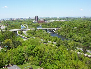
Colonel By Drive is an 8.1 km (5.0 mi) long scenic parkway in Ottawa, Ontario, Canada named after Colonel John By. It runs along the Rideau Canal from the end of Sussex Drive at Rideau Street. It then continues 8 km (5.0 mi) south and west to Hog's Back Road, winding through several residential areas and going past Dow's Lake and Carleton University. To the north, the road passes Department of National Defence Headquarters, the Ottawa Congress Centre and the Westin Hotel before ending at Wellington Street and Rideau Street. The rear door of the Government Conference Centre can be accessed from the street as well, after it passes under the Mackenzie King Bridge. It is named for Lieutenant-Colonel John By, who built the Rideau Canal. The winding two-lane road has a speed limit of 60 km/h (37 mph).

Somerset Street is a street in Ottawa, Ontario, Canada. It is divided into Somerset Street East and Somerset Street West by the Rideau Canal.

The Kichi Zībī Mīkan, formerly the Sir John A. Macdonald Parkway, and previously the Ottawa River Parkway, is a four-lane scenic parkway along the Ottawa River in Ottawa, Ontario, Canada. It runs from Carling Avenue near Connaught Avenue, to Booth Street at the Canadian War Museum and National Holocaust Monument. It is maintained by the National Capital Commission. The speed limit is 60 km/h (37 mph). Bicycles are allowed on the road and on a parallel recreational path along the parkway.
Island Park Drive is an important and scenic north-south thoroughfare in Ottawa, Ontario, Canada with a length of about 4 km. It is one of several parkways in Ottawa administered by the National Capital Commission providing scenic routes throughout Canada's capital region.

Confederation Park(French: Parc de la Confédération) is a public park and National Historic Site of Canada, located in the downtown core of Ottawa, Ontario, Canada. It is bordered on the south by Laurier Avenue and Ottawa City Hall; on the east by the Rideau Canal and National Defence Headquarters; on the north by the Mackenzie King Bridge, the Rideau Centre and the National Arts Centre; and to the west by Elgin Street and the Lord Elgin Hotel.

Prince of Wales Drive is a road serving Ottawa, Ontario, named after the eponymous road in Battersea, London, U.K. The northern section is a low-speed street running along the west bank of the Rideau River, while southern portions of the road were formerly Highway 16.

Nicholas Street is an arterial road in the central area of Ottawa, Ontario which connects Highway 417 with the downtown core. Despite being a municipal road, the street is designated as part of Canada's National Highway System, as part of an interconnecting route between Highway 417 and Quebec Autoroute 5 in Gatineau.

The Golden Triangle is a sub-neighbourhood of Centretown in Somerset Ward in central Ottawa, Ontario, Canada. It borders Elgin Street, at its west, and the Rideau Canal, at its east. The Ottawa City Hall is to its north and the Elgin Street Police Station to its south. According to the 2016 Canada Census, the total population for this area was 5,778.


