Randolph, Utah

Last updated
Randolph, Utah
Randolph Utah Tabernacle.jpeg
The Randolph Tabernacle, an early Latter-day Saint meetinghouse which is still used today after being in use for a little over a hundred years
Rich County Utah incorporated and unincorporated areas Randolph highlighted.svg
Location in Rich County and the state of Utah
Map of USA UT.svg
Location of Utah in the United States
Coordinates: 41°39′52″N111°11′0″W / 41.66444°N 111.18333°W / 41.66444; -111.18333 Coordinates: 41°39′52″N111°11′0″W / 41.66444°N 111.18333°W / 41.66444; -111.18333
CountryUnited States
State Utah
County Rich
FoundedMarch 14, 1870
Founded byRandolph H. Stewart
Area
[1]
  Total1.29 sq mi (3.34 km2)
  Land1.29 sq mi (3.34 km2)
  Water0.00 sq mi (0.00 km2)
Elevation
6,283 ft (1,915 m)
Population
 (2010)
  Total464
  Estimate 
(2019) [2]
508
  Density393.80/sq mi (152.10/km2)
Time zone UTC−7 (Mountain (MST))
  Summer (DST) UTC−6 (MDT)
ZIP code
84064
Area code 435
FIPS code 49-63020 [3]
GNIS feature ID1431567 [4]

Randolph is a town in Rich County, Utah, United States. As of the 2010 census, the town population was 464. It is the county seat of Rich County. [5] Randolph had the highest percentage of people of any city in the country vote for George W. Bush in the 2004 election, at 95.6% [6] Randolph's municipal classification was officially changed from a city to a town on January 1, 2009. The controversial WWASPS boarding school Old West Academy (formerly Majestic Ranch Academy) is located just outside Randolph. [7]

Contents

Geography and climate

According to the United States Census Bureau, the town has a total area of 1.0 square mile (2.7 km2), all land.

Randolph has a humid continental climate (Köppen Dfb), with long and cold winters, short summers with very warm days and cold nights, and fairly heavy winter snowfall totalling 70.8 inches or 1.80 metres during an average year. Between July 2008 and June 2009, there was as much as 98.9 inches (2.51 m), whilst the most precipitation in a calendar year has been 23.42 inches or 594.9 millimetres in 1998, although as much as 27.25 inches (692.1 mm) fell between July 1997 and June 1998. The driest calendar year has been 2020 with 7.07 inches or 179.6 millimetres, but as little as 6.28 inches (159.5 mm) fell between July 1988 and June 1989. The most precipitation in one day has been 2.26 inches (57.4 mm) on July 31, 1912, and the most in one month 5.16 inches (131.1 mm) in June 1998.

The hottest temperature has been 97 °F (36.1 °C) on July 19, 1893, whilst the coldest has been −43 °F (−41.7 °C) on February 1, 1985.

Climate data for Randolph, Utah, 1991–2020 normals, extremes 1893–present
MonthJanFebMarAprMayJunJulAugSepOctNovDecYear
Record high °F (°C)53
(12)
59
(15)
71
(22)
77
(25)
88
(31)
92
(33)
97
(36)
96
(36)
94
(34)
82
(28)
70
(21)
62
(17)
97
(36)
Mean maximum °F (°C)42.8
(6.0)
46.6
(8.1)
58.0
(14.4)
69.4
(20.8)
77.8
(25.4)
85.1
(29.5)
90.4
(32.4)
88.5
(31.4)
82.8
(28.2)
73.8
(23.2)
60.1
(15.6)
46.4
(8.0)
91.0
(32.8)
Average high °F (°C)27.7
(−2.4)
31.6
(−0.2)
42.4
(5.8)
52.0
(11.1)
61.8
(16.6)
72.7
(22.6)
81.6
(27.6)
80.3
(26.8)
71.0
(21.7)
57.5
(14.2)
41.9
(5.5)
29.0
(−1.7)
54.1
(12.3)
Daily mean °F (°C)15.9
(−8.9)
19.1
(−7.2)
30.2
(−1.0)
38.6
(3.7)
47.4
(8.6)
56.3
(13.5)
63.6
(17.6)
61.7
(16.5)
52.5
(11.4)
40.8
(4.9)
28.8
(−1.8)
17.7
(−7.9)
39.4
(4.1)
Average low °F (°C)4.1
(−15.5)
6.5
(−14.2)
18.0
(−7.8)
25.2
(−3.8)
33.0
(0.6)
39.8
(4.3)
45.6
(7.6)
43.0
(6.1)
34.1
(1.2)
24.2
(−4.3)
15.9
(−8.9)
6.3
(−14.3)
24.6
(−4.1)
Mean minimum °F (°C)−18.9
(−28.3)
−16.1
(−26.7)
−3.4
(−19.7)
11.0
(−11.7)
17.5
(−8.1)
26.7
(−2.9)
34.6
(1.4)
29.9
(−1.2)
19.3
(−7.1)
8.6
(−13.0)
−6.0
(−21.1)
−17.7
(−27.6)
−24.3
(−31.3)
Record low °F (°C)−40
(−40)
−43
(−42)
−25
(−32)
−15
(−26)
10
(−12)
18
(−8)
26
(−3)
17
(−8)
8
(−13)
−21
(−29)
−21
(−29)
−41
(−41)
−43
(−42)
Average precipitation inches (mm)1.17
(30)
1.05
(27)
1.07
(27)
1.34
(34)
1.87
(47)
1.15
(29)
0.83
(21)
1.21
(31)
1.29
(33)
1.25
(32)
1.11
(28)
1.02
(26)
14.36
(365)
Average snowfall inches (cm)12.7
(32)
12.6
(32)
10.3
(26)
6.1
(15)
1.8
(4.6)
0.1
(0.25)
0.0
(0.0)
0.0
(0.0)
0.6
(1.5)
3.6
(9.1)
9.3
(24)
13.7
(35)
70.8
(179.45)
Average extreme snow depth inches (cm)9.7
(25)
10.7
(27)
8.3
(21)
3.7
(9.4)
0.7
(1.8)
0.0
(0.0)
0.0
(0.0)
0.0
(0.0)
0.4
(1.0)
2.0
(5.1)
4.0
(10)
7.3
(19)
13.3
(34)
Average precipitation days (≥ 0.01 in)8.59.08.78.99.56.15.56.56.27.47.89.893.9
Average snowy days (≥ 0.1 in)7.57.86.53.61.20.10.00.00.21.75.88.643.0
Source 1: NOAA [8]
Source 2: National Weather Service [9]

Demographics

Historical population
CensusPop.Note
1870 76
1880 446486.8%
1890 4725.8%
1900 82173.9%
1910 533−35.1%
1920 5869.9%
1930 447−23.7%
1940 65646.8%
1950 562−14.3%
1960 537−4.4%
1970 500−6.9%
1980 65931.8%
1990 488−25.9%
2000 483−1.0%
2010 464−3.9%
2019 (est.)508 [2] 9.5%
U.S. Decennial Census [10]

As of the census [3] of 2000, there were 483 people, 150 households, and 118 families residing in the town. The population density was 466.1 people per square mile (179.3/km2). There were 190 housing units at an average density of 183.4 per square mile (70.5/km2). The racial makeup of the city was 99.38% (480 people) White, 0.21% (one person) Asian, and 0.41% (two people) from two or more races. Hispanic or Latino of any race were 1.86% of the population (nine individuals).

There were 150 households, out of which 49.3% had children under the age of 18 living with them, 73.3% were married couples living together, 2.7% had a female householder with no husband present, and 20.7% were non-families. 18.7% of all households were made up of individuals, and 7.3% had someone living alone who was 65 years of age or older. The average household size was 3.21 and the average family size was 3.74.

In the town, the population was spread out, with 38.5% under the age of 18, 7.2% from 18 to 24, 26.3% from 25 to 44, 16.8% from 45 to 64, and 11.2% who were 65 years of age or older. The median age was 30 years. For every 100 females, there were 101.3 males. For every 100 females age 18 and over, there were 102.0 males.

The median income for a household in the town was $34,792, and the median income for a family was $42,917. Males had a median income of $35,625 versus $20,833 for females. The per capita income for the city was $13,477. About 9.5% of families and 14.0% of the population were below the poverty line, including 17.6% of those under age 18 and 3.5% of those age 65 or over.

Notable people

Related Research Articles

<span class="mw-page-title-main">Randolph County, Alabama</span> County in Alabama, United States

Randolph County is a county on the central eastern border of the U.S. state of Alabama. As of the 2020 census, the population was 21,967. Its county seat is Wedowee. Its name is in honor of John Randolph, a member of the United States Senate from Virginia. Randolph County was a prohibition or dry county until 2012, when the citizens of Randolph County voted to repeal prohibition.

<span class="mw-page-title-main">Randolph County, Illinois</span> County in Illinois, United States

Randolph County is a county located in the U.S. state of Illinois. According to the 2020 census, it had a population of 30,163. Its county seat is Chester.

<span class="mw-page-title-main">Weaverville, California</span> Census-designated place in California, United States

Weaverville is a census-designated place and the county seat of Trinity County, California, United States. Its population is 3,667 as of the 2020 census, up from 3,600 from the 2010 census.

<span class="mw-page-title-main">Estancia, New Mexico</span> Town in New Mexico, United States

Estancia is a town in Torrance County, New Mexico, United States. As of the 2020 census, the town population was 1,242. It is the county seat of Torrance County.

East Randolph is a hamlet, census-designated place, and former village in Cattaraugus County, New York, United States. The population was 620 at the 2010 census. East Randolph is adjacent to the northeast part of the former village of Randolph and is mostly within the town of Randolph, with a small part inside the town of Conewango. Their area code is 716.

<span class="mw-page-title-main">Highland Township, Elk County, Pennsylvania</span> Township in Pennsylvania, United States

Highland Township is a township in Elk County, Pennsylvania, United States. The population was 398 at the 2020 census, down from 492 in 2010.

<span class="mw-page-title-main">Syracuse, Utah</span> City in Utah, United States

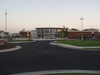
Syracuse is a city in Davis County, Utah, United States. It is situated between the Great Salt Lake and Interstate 15, about 30 miles (48 km) north of Salt Lake City. It is part of the Ogden–Clearfield, Utah Metropolitan Statistical Area. The city has seen rapid growth and development since the 1990s. The city population was 24,331 at the time of the 2010 census, an increase of 158.9% since the 2000 census.

<span class="mw-page-title-main">Castle Dale, Utah</span> City in Utah, United States

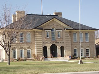
Castle Dale is a city in northwestern Emery County, Utah, United States. The population was 1,630 at the 2010 census. It is the county seat of Emery County.

<span class="mw-page-title-main">Cannonville, Utah</span> Town in Utah, United States

Cannonville is a town in Garfield County, Utah, United States, along Utah Scenic Byway 12. As of the 2010 census, the population was 167, up from 148 at the 2000 census.

<span class="mw-page-title-main">Panguitch, Utah</span> City and county seat in Utah, United States

Panguitch is a city in and the county seat of Garfield County, Utah, United States. The population was 1,520 at the 2010 census, and was estimated in 2018 to be 1,691. The name Panguitch comes from a Southern Paiute word meaning “Big Fish,” likely named after the plentiful nearby lakes hosting rainbow trout year-round.

<span class="mw-page-title-main">Castle Valley, Utah</span> Town in Utah, United States

Castle Valley is a town in Grand County, Utah, United States. The population was 319 at the 2010 census. The town is approximately 16 miles northeast of Moab, near State Route 128.

<span class="mw-page-title-main">Brian Head, Utah</span> Town in Utah, United States

Brian Head is a town in Iron County, Utah, United States. The population was 83 at the 2010 census, a significant decrease from the 2000 figure of 118.

<span class="mw-page-title-main">Ephraim, Utah</span> City in Utah, United States

Ephraim is a city in Sanpete County, Utah, United States. The population was 5,611 at the 2020 census, making it the largest city in Sanpete County. It is the location of Snow College and is located along U.S. Route 89.

<span class="mw-page-title-main">Francis, Utah</span> Town in the state of Utah, United States

Francis is a town in on the western edge of Summit County, Utah, United States. It is part of the Salt Lake City, Utah Metropolitan Statistical Area. The population was 1,077 at the 2010 census.

<span class="mw-page-title-main">Henefer, Utah</span> Town in the state of Utah, United States

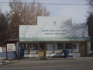
Henefer is a town in Summit County, Utah, United States. It is part of the Salt Lake City, Utah Metropolitan Statistical Area. The population was 766 at the 2010 census.

<span class="mw-page-title-main">Cedar Fort, Utah</span> Town in Utah, United States

Cedar Fort is a town in Utah County, Utah, United States. It is part of the Provo–Orem Metropolitan Statistical Area. The population was 368 at the 2010 census.

<span class="mw-page-title-main">Rockville, Utah</span> Town in the state of Utah, United States

Rockville is a town in Washington County, Utah, United States. It is located along the Virgin River near the mouth of Zion Canyon. The city lies just outside the park boundary for Zion National Park; the park entrance is located approximately 5 miles (8 km) northeast of the town.

<span class="mw-page-title-main">Randolph, Maine</span> Town in the state of Maine, United States

Randolph is a town and a census-designated place (CDP) in Kennebec County, Maine, United States. The population was 1,743 at the 2020 census. The town was named for Randolph, Massachusetts. Randolph is included in the Augusta, Maine micropolitan New England City and Town Area.

Randolph is a town in Cattaraugus County, New York, United States. The population was 2,470 at the 2020 census. The town was named after Randolph, Vermont.

<span class="mw-page-title-main">Randolph, Wisconsin</span> Village in Wisconsin, United States

Randolph is a village in Columbia and Dodge Counties in the U.S. state of Wisconsin. The population was 1,811 at the 2010 census. Of this, 1,339 were in Dodge County, and 472 were in Columbia County. The village is located at the southeast corner of the Town of Randolph in Columbia County, although only a tiny portion of the village lies within the town. Most of the village lies within the Town of Westford in Dodge County. Small portions also lie within the Town of Fox Lake to the north and the Town of Courtland in Columbia County.

References

  1. "2019 U.S. Gazetteer Files". United States Census Bureau. Retrieved August 7, 2020.
  2. 1 2 "Population and Housing Unit Estimates". United States Census Bureau. May 24, 2020. Retrieved May 27, 2020.
  3. 1 2 "U.S. Census website". United States Census Bureau . Retrieved 2008-01-31.
  4. "US Board on Geographic Names". United States Geological Survey. 2007-10-25. Retrieved 2008-01-31.
  5. "Find a County". National Association of Counties. Retrieved 2011-06-07.
  6. Deseret News ; ‘Utah town Bush’s No. 1 supporter’
  7. "WWASP Survivors | Majestic Ranch Academy/ Old West Academy". wwaspsurvivors.com. Retrieved 2018-05-04.
  8. "U.S. Climate Normals Quick Access – Station: Randolph, UT". National Oceanic and Atmospheric Administration. Retrieved February 9, 2023.
  9. "NOAA Online Weather Data – NWS Salt Lake City". National Weather Service. Retrieved February 9, 2023.
  10. "Census of Population and Housing". Census.gov. Retrieved June 4, 2015.