St. George, Utah

Last updated

St. George, Utah
Overlook of St. George, Utah.jpg
Overlook of downtown St. George and adjacent Pine Valley Mountains
Flag of St George, Utah.svg
Seal of the City of St. George.png
Nickname(s): 
Utah's Dixie, (the) STG
Motto: 
It's The Brighter Side
Washington County Utah incorporated and unincorporated areas St. George highlighted.svg
Location within Washington County
Coordinates: 37°06′15″N113°35′03″W / 37.10417°N 113.58417°W / 37.10417; -113.58417
CountryUnited States
State Utah
County Washington
Founded1861
Incorporated January 17, 1862
Named for George A. Smith
Government
  TypeMayor – Council
   Mayor Michelle Randall
  City ManagerJohn Willis
Area
[1]
   City 77.151 sq mi (199.820 km2)
  Land77.148 sq mi (199.811 km2)
  Water0.003 sq mi (0.076 km2)  0.72%
Elevation
[2]
2,697 ft (822 m)
Population
 (2020) [3]
   City 95,342
  Estimate 
(2022) [4]
102,519
  RankUS: 320th
UT: 5th
  Density1,329.0/sq mi (513.1/km2)
   Urban
134,109 (US: 255th)
  Urban density2,198.0/sq mi (848.5/km2)
   Metro
197,680 (US: 234th)
  Metro density81.40/sq mi (31.44/km2)
Demonym St. Georgian
Time zone UTC–7 (Mountain (MST))
  Summer (DST) UTC–6 (MDT)
ZIP Codes
84770, 84771, 84790, 84791
Area code 435
FIPS code 49-65330
GNIS feature ID1455098 [2]
Sales tax 6.75% [5]
Website sgcity.org

St. George is a city in and the county seat of Washington County, Utah, United States. Located in southwestern Utah on the Arizona border, it is the principal city of the St. George Metropolitan Statistical Area (MSA). The city lies in the northeasternmost part of the Mojave Desert, immediately south of the Pine Valley Mountains, which mark the southern boundary of the Great Basin. St. George lies slightly northwest of the Colorado Plateau, which ends at the Hurricane Fault. [6] The city is 118 miles (190 km) northeast of Las Vegas, Nevada, and 300 miles (480 km) south-southwest of Salt Lake City, Utah, on Interstate 15.

Contents

The population was 95,342 at the 2020 census, [3] with the overall MSA having an estimated population of 180,279. St. George is the fifth largest city in Utah and most populous city in the state outside of the Wasatch Front.

The city was settled in 1861 as a cotton mission, earning it the nickname "Dixie". While the crop never became a successful commodity, the area steadily grew in population. Between 2000 and 2005, St. George emerged as the fastest growing metropolitan area in the United States. [7] Today, the St. George region is well known for its year-round outdoor recreation and proximity to several state parks, Zion National Park and The Grand Canyon. Utah Tech University is located in St. George and is an NCAA Division I institution.

History

Brigham Young Winter Home and Office in St. George Brigham Young's winter home St George.jpg
Brigham Young Winter Home and Office in St. George

St. George was founded as part of the cotton mission [8] in 1861 under the direction of Latter Day Saint apostle Erastus Snow. At the outbreak of the American Civil War, Brigham Young accelerated the colonization effort:

Fearing that the war would take away the cotton supply, he began plans for raising enough in this southwestern country to supply the needs of his people. Enough favorable reports had come to him from this warm region below the rim of the Great Basin, that he was convinced cotton could be raised successfully here. At the general church conference in Salt Lake City on October 6th, 1861, about three hundred families were "called" to the Dixie mission to promote the cotton industry. Most of the people knew nothing of this expedition until their names were read from the pulpit; but in nearly every case, they responded with good will, and made ready to leave within the month's time allotted to them. The families were selected so as to ensure the communities the right number of farmers, masons, blacksmiths, businessmen, educators, carpenters, as needed. [9]

The settlement was named after George A. Smith, an LDS Church apostle. [10]

In April 1877, the LDS Church completed the St. George Utah Temple. It was the church's third temple and is the oldest still in active use. [11]

The 1992 St. George earthquake destroyed three houses as well as above- and below-ground utilities, causing about US$1 million in damage. [12] [13]

St. George was the location of the 1997 United States Academic Decathlon national finals.

In January 2005, a 100-year flood occurred throughout the region, due to prolonged heavy rainfall overflowing both the Virgin River and Santa Clara river. One person was killed and 28 homes were destroyed by the Santa Clara River. [14] [15]

Nuclear contamination

In the early 1950s, St. George received the brunt of the fallout of above-ground nuclear testing at the Yucca Flats/Nevada Test Site northwest of Las Vegas. Winds routinely carried the fallout of these tests directly through the St. George and southern Utah area. Marked increases in the frequency of cancer in the population, not limited to leukemia, lymphoma, thyroid cancer, breast cancer, melanoma, bone cancer, brain tumors, and gastrointestinal tract cancers, were reported from the mid-1950s until the early 1980s. [16] [17]

In 1980, American popular weekly magazine People reported that from about 220 cast and crew who filmed in a 1956 movie, The Conqueror , on location near St. George, 91 had come down with cancer, and 50 had died of cancer. [18] Of these, 46 had died of cancer by 1980. Among the cancer deaths were John Wayne, Pedro Armendáriz and Susan Hayward, the stars of the film. [18] However, the lifetime odds of developing cancer for men in the U.S. population are 43 percent and the odds of dying of cancer are 23 percent (38 percent and 19 percent, respectively, for women). [19] This places the cancer mortality rate for the 220 primary cast and crew quite near the expected average. [20]

A 1962 United States Atomic Energy Commission report found children living in St. George, Utah, at the time of the fallout may have received doses to the thyroid of radioiodine as high as 120 to 440 rads" (1.2 to 4.4 Gy). [21]

Geography

The red hills of the Red Cliffs Desert Reserve north of St. George St. george utah pic.JPG
The red hills of the Red Cliffs Desert Reserve north of St. George

According to the United States Census Bureau, the city has a total area of 77.151 square miles (199.82 km2), of which 77.148 square miles (199.81 km2) is land and 0.003 square miles (0.0078 km2) (0.72%) is water. [1] St. George lies in a desert valley, with most of the city lying below 3,000 feet (900 m). It is situated near a geological transition zone where the Colorado Plateau and Great Basin converge. The Beaver Dam Mountains/Utah Hill lie to the west, the Red Cliffs National Conservation Area and Pine Valley Mountains to the north, the western edge of the Colorado Plateau and Zion National Park to the east, and the Arizona Strip to the south. The Virgin River and Santa Clara River flow through the St. George valley and converge near the western base of Webb Hill near the city center.

Eubrontes, a dinosaur footprint in the Lower Jurassic Moenave Formation at the St. George Dinosaur Discovery Site Eubrontes01.JPG
Eubrontes, a dinosaur footprint in the Lower Jurassic Moenave Formation at the St. George Dinosaur Discovery Site

The city uses street numbers rather than names, such as "East 100 South". Exceptions have been made for streets with curves or those not fitting into the traditional grid system. Some roads have names along with numerals, such as "400 East" which is also known as "Flood Street". [22]

Neighborhoods

Some neighborhoods are large housing developments created during the city's rapid modern expansion; others carry the names of geographical features or unincorporated communities which have been annexed by St. George.

Climate

St. George's arid climate is significantly warmer on average than the rest of the state, and more closely resembles nearby Las Vegas. The climate is cold arid (BWk). St. George has hot summers and cool to relatively mild winters. The monthly average temperature ranges from 42.1 °F (5.6 °C) in December to 87.8 °F (31.0 °C) in July. On average, there are 60 afternoons with high temperatures over 100 °F (38 °C), with an average window of June 29 through August 13, and 122 days with high temperatures over 90 °F (32 °C) with the average window fluctuating between late April and early October. There are approximately 60 mornings where the low temperature drops to the freezing mark, with the historical average window between November 12 and March 14.

The highest temperature statewide was 118 °F (48 °C), which was recorded in south St. George, near the Arizona border on July 4, 2007, breaking the previous record-holder, at 117 °F (47 °C), also set in St. George on July 5, 1985. [23] The record high minimum temperature is 89 °F (32 °C) set on July 15, 1970, and July 3, 2013. Nighttime freezes are common during the winter due to radiational cooling. Both the record low temperature of −11 °F (−24 °C) and record low maximum temperature of 17 °F (−8 °C) were set on January 22, 1937; the record low temperature occurred again on January 26, 1937, both during the record cold month of January 1937 across the Western United States. [23]

The city has abundant sunshine year-round and averages about 300 sunny days per year, with an average 8.80 inches (224 mm) of precipitation annually. [23] The wettest "rain year" has been from July 2004 to June 2005 with at least 15.66 inches (398 mm) (some days were missing) and the driest from July 1973 to June 1974 with 3.89 inches (98.8 mm). Record breaking widespread flooding occurred during January 2005 when area creeks and rivers far exceeded their banks and washed out homes and some neighborhoods. The wettest month has been January 1993, when 4.74 inches (120 mm) fell. Precipitation is fairly evenly distributed throughout the year, except for a markedly drier period from April through June, which occurs after the Pacific storm season ends, but before the southwest monsoon begins, usually in mid-July. Precipitation mostly comes from the Pacific Ocean from late fall through early spring. The storm track usually lifts north of the city by mid-April. The monsoon brings localized and often intense thunderstorms from early July through mid-September. The greatest rainfall in 24 hours was 2.40 inches (61 mm) on August 31, 1909. [23]

The St. George valley occasionally receives wet or slushy snowfall in the winter, but what accumulates usually melts off by the mid-to-late morning; the normal seasonal snowfall is 1.4 inches (3.6 cm). [23] The earliest snowfall was measured on October 29, 1971, and the latest on April 11, 1927. [23] The record single-day snowfall is 10.0 inches (25 cm) which was set on January 5, 1974. With the city having elevations ranging from 2,500 to about 3,500 feet (760 to about 1,070 m), some areas such as Diamond Valley and Winchester Hills will typically receive more snowfall and colder temperatures than the rest of the lower valley. The most recent major snow event was on December 8, 2013, when between 6.0 and 8.0 inches (15 and 20 cm) virtually shut down the city, making it the third heaviest snowfall in the city's history. Also significant about the storm was how low temperatures dropped and remained that way for several days with daytime highs failing to reach the freezing mark, and one night time low temperature of 1 °F (−17 °C), recorded at the airport, was the coldest in the city in over 100 years. The cold spell killed or severely damaged much of the area's non-native vegetation, such as the Mexican fan palm trees.

Climate data for St. George, Utah, 1991–2020 normals, extremes 1893present
MonthJanFebMarAprMayJunJulAugSepOctNovDecYear
Record high °F (°C)72
(22)
84
(29)
91
(33)
100
(38)
108
(42)
115
(46)
117
(47)
113
(45)
112
(44)
107
(42)
88
(31)
75
(24)
117
(47)
Mean maximum °F (°C)64.7
(18.2)
70.4
(21.3)
81.0
(27.2)
90.0
(32.2)
98.3
(36.8)
105.6
(40.9)
110.0
(43.3)
107.5
(41.9)
102.9
(39.4)
92.3
(33.5)
76.0
(24.4)
63.9
(17.7)
110.5
(43.6)
Mean daily maximum °F (°C)54.0
(12.2)
59.3
(15.2)
67.8
(19.9)
75.0
(23.9)
85.4
(29.7)
96.4
(35.8)
101.9
(38.8)
99.9
(37.7)
92.4
(33.6)
78.8
(26.0)
63.8
(17.7)
53.0
(11.7)
77.3
(25.2)
Daily mean °F (°C)41.2
(5.1)
45.8
(7.7)
53.4
(11.9)
60.4
(15.8)
70.5
(21.4)
80.4
(26.9)
86.8
(30.4)
85.1
(29.5)
76.5
(24.7)
63.0
(17.2)
49.2
(9.6)
40.4
(4.7)
62.7
(17.1)
Mean daily minimum °F (°C)28.4
(−2.0)
32.4
(0.2)
39.0
(3.9)
45.7
(7.6)
55.5
(13.1)
64.5
(18.1)
71.7
(22.1)
70.3
(21.3)
60.7
(15.9)
47.3
(8.5)
34.7
(1.5)
27.9
(−2.3)
48.2
(9.0)
Mean minimum °F (°C)20.7
(−6.3)
25.1
(−3.8)
31.3
(−0.4)
37.8
(3.2)
44.9
(7.2)
55.2
(12.9)
66.4
(19.1)
64.3
(17.9)
52.4
(11.3)
38.0
(3.3)
27.3
(−2.6)
20.7
(−6.3)
18.9
(−7.3)
Record low °F (°C)−11
(−24)
1
(−17)
12
(−11)
18
(−8)
20
(−7)
35
(2)
41
(5)
43
(6)
25
(−4)
20
(−7)
4
(−16)
−4
(−20)
−11
(−24)
Average precipitation inches (mm)1.22
(31)
1.38
(35)
1.02
(26)
0.66
(17)
0.33
(8.4)
0.16
(4.1)
0.50
(13)
1.07
(27)
0.67
(17)
0.77
(20)
0.67
(17)
0.86
(22)
9.31
(237.5)
Average snowfall inches (cm)0.5
(1.3)
0.5
(1.3)
0.2
(0.51)
0.0
(0.0)
0.0
(0.0)
0.0
(0.0)
0.0
(0.0)
0.0
(0.0)
0.0
(0.0)
0.0
(0.0)
0.0
(0.0)
0.0
(0.0)
1.2
(3.11)
Average precipitation days (≥ 0.01 in)5.45.74.53.22.91.22.82.92.33.43.04.541.8
Average snowy days (≥ 0.1 in)0.10.20.10.10.00.00.00.00.00.00.00.10.6
Source: NOAA (extremes 1893–present) [23] [24]

Demographics

Historical population
CensusPop.Note
1870 1,142
1880 1,38421.2%
1890 1,377−0.5%
1900 1,69022.7%
1910 1,7694.7%
1920 2,27128.4%
1930 2,4347.2%
1940 3,59147.5%
1950 4,56227.0%
1960 5,13012.5%
1970 7,09738.3%
1980 11,35059.9%
1990 28,502151.1%
2000 49,72874.5%
2010 72,89746.6%
2020 95,34230.8%
2022 (est.)102,519 [4] 7.5%
U.S. Decennial Census [25]
2020 Census [3]

As of the 2015, the largest self-reported ancestry groups in St. George are: [26]

Largest ancestries (2015)Percentage
English 28.2%
German 11.3%
Irish 8.5%
Danish 4.6%
Swedish 4.0%
Italian 3.8%
Scottish 3.7%
Dutch 2.4%
Norwegian 1.8%
French (except Basque) 1.8%
Swiss 1.4%
Welsh 1.2%
Polish 1.2%
Scots-Irish 1.0%

2020 census

St. George, Utah – Racial and ethnic composition
Note: the US Census treats Hispanic/Latino as an ethnic category. This table excludes Latinos from the racial categories and assigns them to a separate category. Hispanics/Latinos may be of any race.
Race / Ethnicity (NH = Non-Hispanic)Pop 2000 [27] Pop 2010 [28] Pop 2020 [29] % 2000% 2010% 2020
White alone (NH)44,21559,72274,86089.03%81.93%78.52%
Black or African American alone (NH)1104066340.22%0.56%0.66%
Native American or Alaska Native alone (NH)7588569561.53%1.17%1.00%
Asian alone (NH)2705621,1270.54%0.77%1.18%
Pacific Islander alone (NH)2927031,0880.59%0.96%1.14%
Other race alone (NH)44553280.09%0.08%0.34%
Mixed race or Multiracial (NH)6371,2913,2571.28%1.77%3.42%
Hispanic or Latino (any race)3,3379,30213,0926.72%12.76%13.73%
Total49,66372,89795,342100.00%100.00%100.00%

As of the 2020 census, there were 95,342 people, 37,515 households, and _ families residing in the city. The population density was _ people per square mile. There were 39,933 housing units at an average density of _ per square mile.

Map of racial distribution in St. George, 2020 U.S. census. Each dot is one person:
.mw-parser-output .legend{page-break-inside:avoid;break-inside:avoid-column}.mw-parser-output .legend-color{display:inline-block;min-width:1.25em;height:1.25em;line-height:1.25;margin:1px 0;text-align:center;border:1px solid black;background-color:transparent;color:black}.mw-parser-output .legend-text{}
 White
 Black
 Asian
 Hispanic
 Multiracial
 Native American/Other Race and ethnicity 2020 St. George, UT.png
Map of racial distribution in St. George, 2020 U.S. census. Each dot is one person:  White Black Asian Hispanic Multiracial Native American/Other

2010 census

As of the 2010 census, there were 72,897 people, 27,552 households, and 13,042 families residing in the city. The population density was 1,135 people per square mile. There were 32,089 housing units at an average density of _ per square mile. The city's racial makeup was 87.2% White, 0.7% African-American, 1.5% Native American, 0.8% Asian, 1.0% Pacific Islander, and 8.9% from other races. 12.8% of the population was Hispanic or Latino of any race.

2000 census

As of the 2000 census, there were 49,728 people, 17,367 households, and 13,042 families residing in the city. The population density was 771.2 people per square mile (297.7/km²). There were 21,083 housing units at an average density of 327.4 per square mile (126.4/km²). The racial makeup of the city was 92.27% White, 0.24% African-American, 1.64% Native American, 0.57% Asian, 0.59% Pacific Islander, 2.87% from other races, and 1.83% from two or more races. Hispanic or Latino of any race were 6.72% of the population.

There were 17,367 households out of which 34.2% had children under the age of 18 living with them, 63.6% were married couples living together, 8.6% had a female householder with no husband present, and 24.9% were non-families. 19.4% of all households were made up of individuals and 10.2% have someone living alone who is 65 years old or older. The average household size was 2.81 individuals and the average family size was 3.21.

In the city, the age distribution of the population showed 28.4% under the age of 18, 13.7% from 18 to 24, 22.0% from 25 to 44, 16.8% from 45 to 64, and 19.3% who were 65 years of age or older. The median age was 31 years. For every 100 females, there were 94.5 males. For every 100 females age 18 and over, there were 91.2 males.

The median income for a household in the city was $36,505, and the median income for a family was $41,788. Males had a median income of $31,106 versus $20,861 for females. The per capita income for the city was $17,022. About 7.4% of families and 11.6% of the population were below the poverty line, including 14.4% of those under age 18 and 4.4% of those age 65 or over.

Religion

St. George Utah Temple of the Church of Jesus Christ of Latter-day Saints was completed in 1877. St. George Temple.jpg
St. George Utah Temple of the Church of Jesus Christ of Latter-day Saints was completed in 1877.

Approximately 78.0% of St. George's residents identify as religious; below are statistics as of 2014: [30]

Whilst specific data for irreligion is difficult to source for St. George the following applies for Utah as a whole [31]

Economy

SkyWest Airlines is headquartered in St. George, and is the primary airline provider at the city's regional airport. [32] Walmart has a distribution center just outside the city and Family Dollar recently opened a distribution center in the Fort Pierce Industrial Park for the southwest region of the United States.

The Washington County School District main offices are based in the city. [33]

The Cafe Rio restaurant chain was started in St. George in 1997, [34] though is now headquartered in Salt Lake City.

The local economy is largely based on tourism, manufacturing, and new home construction.[ citation needed ] Over a dozen golf courses offering year-round golfing, and various world-recognized events also make for large contributors to the city's economy. The city is a popular retirement destination [35] and also hosts a significant number of vacation homes for people who primarily live in colder areas.

Arts and culture

The City of St. George sponsors art shows and concerts at Vernon Worthen Park. The Southwest Symphony Orchestra and Southern Utah Heritage Choir are located in St. George. The up-and-coming Downtown Arts District features "Art Around the Corner" offering outdoor sculptures and statues depicting cultural themes from around the world, and hosts the annual St. George Arts Festival each spring. Other major events include the St. George Parade of Homes; the Dixie Roundup Rodeo; St. George Marathon; St. George Ironman triathlon; and the Huntsman World Senior Games.

Venues, museums and sites

Shopping

The Red Cliffs Mall is an indoor shopping mall, built in 1990. There are additional commercial districts on River Road, St. George Boulevard, and Bluff Street.

Sports

The St. George community has been the home to two minor-league independent baseball teams. The first, the St. George Pioneerzz (originally the Zion Pioneerzz) who played in the independent Western Baseball League from 1999 to 2001, winning the league championship in 2000. A new franchise, managed by former major league player Darell Evans, was awarded to St. George in 2007. The team, the St. George Roadrunners, played in the independent Golden Baseball League before being taken over by the league and moved to Henderson, Nevada, in 2010.

St. George area high schools—Crimson Cliffs, Dixie, Desert Hills, Pine View, and Snow Canyon—all play in 4A state competition as part of 4A Region 9 with nearby Hurricane High School in Hurricane and Cedar high school in Cedar City. [36] Utah Tech University participates in the NCAA Division I Western Athletic Conference. In January 2019, Dixie State announced they were reclassifying to NCAA Division I and joining the Western Athletic Conference. [37] Former DSU athletes include Corey Dillon, Anton Palepoi, Reno Mahe, and Scott Brumfield, who all later played in the NFL and Marcus Banks, Lionel Hollins, Keon Clark, and Mo Baker were Dixie players who later played in the NBA. Utah Tech athletes are called Trailblazers (formerly The Rebels and Red Storm), and former Trailblazers Bradley Thompson and Brandon Lyon later played in major league baseball while Bruce Hurst of Dixie High School later played for the Boston Red Sox a pitcher, and then ended up managing the now retired Zion Pioneerzz for its inaugural 1999 season (1999).

St. George has hosted Ironman and Ironman 70.3 events including the 2021 Ironman 70.3 World Championships. In May 2021, the Ironman World Championship hosted by the city due to the COVID-19 and the original venue, Kona, being unable to host. This was the first time that the Ironman World Championship has been hosted outside of Hawai'i.

Parks and recreation

The St. George parks division manages over 20 city parks and nearly 60 miles of paved urban trails interlinking neighborhoods, communities, parks and open space. The city also has over a dozen award-winning golf courses making the area a Southwestern golfing mecca. [38] Major parks and sites include the Canyons Softball Complex; Little Valley Softball Complex; Pioneer Park; Tonaquint Nature Center; nationally-recognized Snake Hollow bike park; Thunder Junction All Abilities dinosaur theme park; Red Hills Desert Garden - a public water-conservation garden displaying both native and exotic flora suited for the local climate; three local skate parks; Legacy Regional Park and fairgrounds is just east of the city in Hurricane. The St. George area has several public recreation centers; the St. George Rec Center; Washington City Rec Center and the Sand Hollow Aquatics Center. [39] [40] St. George is fast-becoming a popular rock climbing and mountain biking destination. [41]

Government

5th District Courthouse Wactyutah5thdist.jpg
5th District Courthouse

The city of St. George has a council-manager form of government, with five representatives elected at-large. The mayor, also elected at-large, also serves as a member on the City Council. The Council hires a city manager to deal with regular operations. [42] As of January 2021, the mayor of St. George is Michele Randall. The city manager is John Willis.

Council members are Jimmy Hughes, Dannielle Larkin, Natalie Larsen, Michelle Tanner and Steve Kemp. City Council meetings are held on the first and third Thursdays of each month at the City Council Chambers. [43]

The U.S. Federal Courthouse, Washington County Justice Court, Juvenile Court and the Fifth District Courthouse are downtown.

Education

Primary and secondary education

The city of St. George is a part of the Washington County School District. The city's middle schools are located near or adjacent to the like-named high schools.

Intermediate (6th-7th grade) and middle schools (8th-9th grade)

  • Dixie Middle School
  • Pine View Middle School
  • Desert Hills Middle School
  • Snow Canyon Middle School
  • Crimson Cliffs Middle School in Washington City
  • Washington Fields Intermediate in Washington City
  • Tonaquint Intermediate
  • Sunrise Ridge Intermediate
  • Fossil Ridge Intermediate
  • Lava Ridge Intermediate in Santa Clara (western suburb)

High schools

St. George public high schools (10th-12th grade):

Higher education

Media

Radio

Call signFrequencyFormatNotes
KDXU 890 AM & 94.9 FM Talk radio
KLGU 90.3 FM Christian contemporary
KUTU 91.3 & 94.9 FM Variety (radio)
KZHK 95.9 FM Classic rock
KCLS 96.3 FM Active Rock
KRQX 98.9 FM Classic Hits
KONY 99.9 FM Country music
KFUR-LP 101.1 FM Regional Mexican
K272AQ 102.3 FM Oldies Repeater of KXFF, Colorado City, Arizona
K279BN 103.7 FM Oldies Repeater of KJUL, Las Vegas, Nevada
KURR 103.1 FM Top 40
KUTQ 102.3 FM Country music
KZYN 104.1 FM Adult Alternative
KPLD 94.1 & 105.1 Hot adult contemporary
KWBR-LP 105.7 FM Smooth Jazz
KIYK 107.3 FM Hot adult contemporary
KHKR 1210 AM Sports radio
KSGO 1450 AM-93.1 FM Conservative talk radio

Newspapers

  • The Spectrum , which is owned by Gannett, is the local daily newspaper.
  • The Independent newspaper offers a monthly print edition featuring local news, arts, entertainment & events coverage. It also provides free online daily news and an online community events calendar.
  • St. George News (stgnews.com) is free-access online news.
  • Southern Utah Weekly is a weekly newspaper

The Salt Lake Tribune , Deseret News , Las Vegas Review-Journal and Las Vegas Sun are also widely distributed in St. George and offer home delivery.

Other publications include St. George Magazine, a monthly magazine covering a variety of local content, and View on Southern Utah is a magazine offering a variety of content for the southern Utah, southern Nevada and northwestern Arizona area.

Television

Like other major cities in Utah, St. George is in the Salt Lake City market, so it has only one television station licensed to the city, KMYU, a MyNetworkTV affiliate. [47] It is carried in HD on Dish Network and DirecTV, as well as on Comcast Ch. 643 in Salt Lake City, and on Ch. 20 on local cable, TDS Communications, formerly Baja Broadband. KMYU (known as My Utah TV) [48] is sister station to KUTV-DT, and is operated out of KUTV's offices in Salt Lake City, although the station has a news bureau with a reporter and photographer based in St. George.

Also in St. George are the offices of Cedar City, Utah–licensed [47] KCSG Channel 14, a MeTV affiliate, which broadcasts local news. The city also receives local TV channels from Salt Lake City with broadcast translators in the St. George area.

The Las Vegas NBC affiliate, KSNV-DT, has a local translator owned by Cherry Creek Radio, KVBT-LP channel 41, on which some of its programming airs two hours later than the same programming broadcast on Salt Lake City NBC affiliate KSL-TV.

Infrastructure

Healthcare

St. George Regional Hospital is an Intermountain Health Care hospital and is the only 24-hour trauma center between Las Vegas and the Wasatch Front, serving the tri-state region of southern Utah, northwest Arizona and southeastern Nevada. [49]

Utilities

St. George is served by City of St. George Power, which serves most of the city, and Dixie Power, which serves southern areas of the city. Rocky Mountain Power serves parts of the greater St. George area. The municipal water department obtains its own water from wells located near Gunlock and in Snow Canyon State Park, Mountain Springs on Pine Valley Mountain. It also purchases wholesale water from the Washington County Water Conservancy District which is sourced from the Virgin River and purified at the Quail Creek Water Treatment Plant. [50]

St. George Telecommunications such as Internet, are provided by TDS Telecom (Cable/Fiber), CenturyLink (DSL/Fiber), Quantum(Fiber) and InfoWest (WISP/Fiber)

Transportation

Central St. George, looking east with Zion National Park in the distance St. George, Utah.jpg
Central St. George, looking east with Zion National Park in the distance

St. George Regional Airport is located in southeast St. George on Airport Parkway. The airport is served by American Airlines, Delta Air Lines, and United Airlines. All flights are operated by SkyWest Airlines. As of 2023, two-way flights to Salt Lake City, Denver, Phoenix, with seasonal flights to Dallas–Fort Worth were available. [51] [52]

Local and regional transportation

SunTran is the local public transit system and operates seven fixed-routes serving most areas of St. George, Washington and Ivins. [53] Rent-A-Bike and Spin scooters are available for rated use in numerous locations city-wide. Greyhound serves St. George on its Denver-Las Vegas and Salt Lake City-Las Vegas routes. [54] [55] Greyhound connects with Amtrak's California Zephyr in Salt Lake City. [56] St. George is also served by the bus company Tufesa and the shuttle companies Salt Lake Express and St. George Shuttle. [57] [58]

Major highways

I-15.svg Interstate 15 runs northeast-southwest through St. George.

  • SR-7 (Southern Parkway) runs east-west through the southern periphery of the city.
  • SR-8 (Sunset Boulevard) runs east-west through west St. George
  • SR-34 (St. George Boulevard) runs east-west through central St. George
  • SR-18 (Bluff Street) runs north-south through St. George

Notable people

See also

Related Research Articles

<span class="mw-page-title-main">Utah</span> U.S. state

Utah is a landlocked state in the Mountain West subregion of the Western United States. It borders Colorado to its east, Wyoming to its northeast, Idaho to its north, Arizona to its south, and Nevada to its west. Utah also touches a corner of New Mexico in the southeast. Of the fifty U.S. states, Utah is the 13th-largest by area; with a population over three million, it is the 30th-most-populous and 11th-least-densely populated. Urban development is mostly concentrated in two areas: the Wasatch Front in the north-central part of the state, which is home to roughly two-thirds of the population and includes the capital city, Salt Lake City; and Washington County in the southwest, with more than 180,000 residents. Most of the western half of Utah lies in the Great Basin.

<span class="mw-page-title-main">Salt Lake City</span> State capital and largest city of Utah, United States

Salt Lake City, often shortened to Salt Lake or SLC, is the capital and most populous city of the U.S. state of Utah. It is the seat of Salt Lake County, the most populous county in the state. The city is the core of the Salt Lake City Metropolitan Statistical Area (MSA), which had a population of 1,257,936 at the 2020 census. Salt Lake City is further situated within a larger metropolis known as the Salt Lake City–Ogden–Provo Combined Statistical Area, a corridor of contiguous urban and suburban development stretched along a 120-mile (190 km) segment of the Wasatch Front, comprising a population of 2,746,164, making it the 22nd largest in the nation. With a population of 200,133 in 2020, it is the 117th most populous city in the United States. It is also the central core of the larger of only two major urban areas located within the Great Basin.

<span class="mw-page-title-main">Salt Lake County, Utah</span> County in Utah, United States

Salt Lake County is located in the U.S. state of Utah. As of the 2020 United States census, the population was 1,185,238, making it the most populous county in Utah. Its county seat and largest city is Salt Lake City, the state capital. The county was created in 1850. Salt Lake County is the 37th most populated county in the United States and is one of four counties in the Rocky Mountains to make it into the top 100. Salt Lake County has been the only county of the first class in Utah – under the Utah Code is a county with a population of 700,000 or greater. Although, Utah County directly to the south has recently reached this threshold.

<span class="mw-page-title-main">Washington County, Utah</span> County in Utah, United States

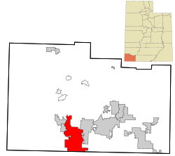
Washington County is a county in the southwestern corner of Utah, United States. As of the 2020 United States Census, the population was 180,279, making it the fifth-most populous county in Utah. Its county seat and largest city is St. George. The county was created in 1852 and organized in 1856. It was named after the first President of the United States, George Washington. A portion of the Paiute Indian Reservation is in western Washington County. Washington County comprises the St. George, UT Metropolitan Statistical Area.

<span class="mw-page-title-main">Provo, Utah</span> City in Utah, United States

Provo is a city in and the county seat of Utah County, Utah, United States. It is 43 miles (69 km) south of Salt Lake City along the Wasatch Front, and lies between the cities of Orem to the north and Springville to the south. With a population at the 2020 census of 115,162, Provo is the fourth-largest city in Utah and the principal city in the Provo-Orem metropolitan area, which had a population of 526,810 at the 2010 census. It is Utah's second-largest metropolitan area after Salt Lake City.

<span class="mw-page-title-main">Logan, Utah</span> City in Utah, United States

Logan is a city in Cache County, Utah, United States. The 2020 census recorded the population was 52,778. Logan is the county seat of Cache County and the principal city of the Logan metropolitan area, which includes Cache County and Franklin County, Idaho. The Logan metropolitan area contained 147,908 people as of the 2020 census. Logan is the location of the main campus of Utah State University.

<span class="mw-page-title-main">Panguitch, Utah</span> City and county seat in Utah, United States

Panguitch is a city in and the county seat of Garfield County, Utah, United States. The population was 1,725 at the 2020 census. The name Panguitch comes from a Southern Paiute word meaning “Big Fish,” likely named after the plentiful nearby lakes hosting rainbow trout year-round.

<span class="mw-page-title-main">Cedar City, Utah</span> City in the United States

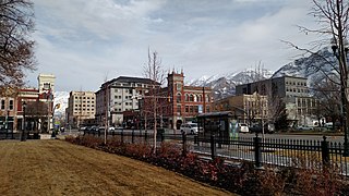
Cedar City is the largest city in Iron County, Utah, United States. Located 250 miles (400 km) south of Salt Lake City, it is 170 miles (270 km) north of Las Vegas on Interstate 15. Southern Utah University is located in Cedar City. It is the home of the Utah Shakespeare Festival, the Utah Summer Games, the Simon Fest Theatre Co., and other events. As of the 2020 census the city had a population of 35,235, up from 28,857 in the 2010 census.

<span class="mw-page-title-main">Richfield, Utah</span> City in the United States

Richfield is a city in and the county seat of Sevier County, Utah, United States, and is the largest city in southern-central Utah.

<span class="mw-page-title-main">Hurricane, Utah</span> City in Utah, United States

Hurricane is a city in Washington County, Utah, United States. Its population was 20,036 as of the 2020 United States Census estimates. The Hurricane valley makes up the easternmost part of the St. George metropolitan area and is near Zion National Park. Hurricane is known for its historic peach and pecan orchards, open space, and green fields.

<span class="mw-page-title-main">Santa Clara, Utah</span> American city in Utah, founded 1854

Santa Clara is a city in Washington County, Utah, United States and is a part of the St. George Metropolitan Area. The population was 7,553 at the 2020 census, up from 6,003 at the 2010 census, and 4,630 at the 2000 census. The city is a western suburb of St. George.

<span class="mw-page-title-main">Washington, Utah</span> City in Utah, United States

Washington is a city in south central Washington County, Utah, United States and is a part of the St. George Metropolitan Area. The area is also known as Utah's Dixie because the Mormon pioneers who settled the St. George area came to the area to raise cotton, which was milled at the cotton mill in Washington. The population was 27,993 as of 2020. Washington is a fast-growing suburb of St. George, and is the second largest city in Washington County.

<span class="mw-page-title-main">U.S. Route 91</span> Numbered Highway in Utah and Idaho in the United States

U.S. Route 91 or U.S. Highway 91 is a 172.7-mile-long (277.9 km) north–south United States highway running from Brigham City, Utah, to Idaho Falls, Idaho, in the U.S. states of Idaho and Utah. Despite the "1" as the last digit in the number, US 91 is no longer a cross-country artery, as it has mostly been replaced by Interstate 15. The highway currently serves to connect the communities of the Cache Valley to I-15 and beyond. Prior to the mid-1970s, US 91 was an international commerce route from Long Beach, California, to the Canada–US border north of Sweetgrass, Montana. US 91 was routed on the main streets of most of the communities it served, including Las Vegas Boulevard in Las Vegas and State Street in Salt Lake City. From Los Angeles to Salt Lake, the route was built along the corridor of the Arrowhead Trail. A portion of the highway's former route in California is currently State Route 91.

<span class="mw-page-title-main">Anthony W. Ivins</span> American Mormon leader (1852–1934)

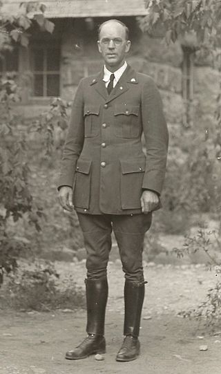
Anthony Woodward Ivins was an apostle of the Church of Jesus Christ of Latter-day Saints and was a member of the church's First Presidency from 1921 until his death.

<span class="mw-page-title-main">Utah's Dixie</span> Cultural region of the U.S. state of Utah

Dixie is a nickname for the populated, lower-elevation area of south-central Washington County, the southwest corner of the State of Utah. The area lies in the northeastern Mojave Desert, south of Black Ridge and west of the Hurricane Cliffs. Its winter climate is significantly more mild than the rest of Utah.

<span class="mw-page-title-main">Church Educational System</span> Educational system of the Church of Jesus Christ of Latter-day Saints

The Church Educational System (CES) of the Church of Jesus Christ of Latter-day Saints consists of several institutions that provide religious and secular education for both Latter-day Saint and non–Latter-day Saint elementary, secondary, and post-secondary students and adult learners. Approximately 700,000 individuals were enrolled in CES programs in 143 countries in 2011. CES courses of study are separate and distinct from religious instruction provided through wards. Clark G. Gilbert, a general authority seventy, has been the CES commissioner since August 1, 2021.

<span class="mw-page-title-main">The Church of Jesus Christ of Latter-day Saints in Nevada</span>

The Church of Jesus Christ of Latter-day Saints in Nevada refers to the Church of Jesus Christ of Latter-day Saints and its members in Nevada. Nevada has the 7th most church members of any U.S. state, and the fifth-highest percentage of members. The LDS Church is the 2nd largest denomination in Nevada, behind the Roman Catholic Church.

Utah is the 30th most populous state in the United States with a population of about 3.3 million, according to projections from the US Census Bureau's 2017 estimates. The state has also been characterized by a tremendous amount of growth in the last decade, with the highest percent increase in population of any state since 2010. Utah has a surface area of 84,899 square miles, though around 80% of its population is concentrated around a metropolitan area in the north-central part of the state known as the Wasatch Front.

<span class="mw-page-title-main">Angus M. Woodbury</span> American zoologist and ecologist

Angus Munn Woodbury was an American zoologist and ecologist from Utah. He was professor at the University of Utah for over 20 years, and also worked for many years as a ranger-naturalist at Zion National Park. He produced over 100 publications, many focused on the biology of reptiles and birds, but also on insects, ecological succession, and the history of Utah. He and his wife of 55 years, Grace Atkin Woodbury, died in an automobile collision on August 1, 1964, near Loveland, Colorado.

<span class="mw-page-title-main">Cane Beds, Arizona</span> Census-designated place in Arizona, United States

Cane Beds is an unincorporated community and census-designated place (CDP) in Mohave County, Arizona, United States. It lies 4 miles (6 km) south of the border with Utah in the Arizona Strip, and is supported by services in Utah as well as some in Nevada.

References

  1. 1 2 "2023 U.S. Gazetteer Files". United States Census Bureau. Retrieved July 24, 2022.
  2. 1 2 U.S. Geological Survey Geographic Names Information System: St. George, Utah
  3. 1 2 3 "Explore Census Data". United States Census Bureau . Retrieved February 13, 2024.
  4. 1 2 "City and Town Population Totals: 2020-2022". United States Census Bureau. February 13, 2024. Retrieved February 13, 2024.
  5. "St. George (UT) sales tax rate" . Retrieved February 13, 2024.
  6. "WWF Terrestrial Ecoregions Of The World (Biomes)". www.arcgis.com. Retrieved September 15, 2022.
  7. https://www.census.gov/prod/2006pubs/smadb/smadb-06appe.pdf [ bare URL PDF ]
  8. Anderson, Bart (1994), "St. George", Utah History Encyclopedia, University of Utah Press, ISBN   9780874804256, archived from the original on November 18, 2023, retrieved March 26, 2024
  9. Under Dixie Sun, 1950, Washington County Chapter, Daughters Utah Pioneers, pp 293–294. Printed by Garfield County News, Panguitch Utah.
  10. Lynn Arave, "St. George likely named after an LDS apostle", Deseret Morning News, 8 July 2007
  11. "St. George LDS Temple, Utah's first, to close Nov. 4 for several years to undergo seismic upgrade and major renovation". The Salt Lake Tribune. Retrieved September 14, 2023.
  12. "'92 quake left St. George virtually unshaken". Deseret News. Associated Press. May 15, 1994. Retrieved March 18, 2020.
  13. Christenson, Gary E., ed. (1995). The September 2, 1992 ML 5.8 St. George Earthquake, Washington County, Utah (PDF). Utah Geological Survey. ISBN   1-55791-367-6. Archived (PDF) from the original on December 13, 2016. Retrieved March 18, 2020.
  14. "City of St. George, Utah :: Flood Pictures". sgcity.org. January 2005. Retrieved January 2, 2011.[ dead link ]
  15. "Flooding and streamflow in Utah during water year 2005" (PDF). Retrieved April 7, 2014.
  16. Johnson, Carl (1984). "Cancer Incidence in an Area of Radioactive Fallout Downwind From the Nevada Test Site". Journal of the American Medical Association . 251 (2): 230–6. doi:10.1001/jama.1984.03340260034023. PMID   6690781.
  17. Falk, Jim (1982). Global Fission: The Battle Over Nuclear Power, p. 134.[ ISBN missing ]
  18. 1 2 Gerald H. Clarfield and William M. Wiecek (1984). Nuclear America: Military and Civilian Nuclear Power in the United States 1940–1980, Harper & Row, New York, p. 208.
  19. American Cancer Society. "Lifetime Risk of Developing or Dying From Cancer". Archived from the original on November 25, 2016. Retrieved May 19, 2021.
  20. "Was The Movie The Conqueror Really Cursed? A Look At Radiation Paranoia" . Retrieved September 15, 2022.
  21. Pat Ortmeyer and Arjun Makhijani. The Bulletin of the Atomic Scientists , November/December 1997, via October 31, 2007, retrieval.[ page needed ]
  22. Mori Kessler (December 11, 2015). "City officials discuss street names". St George News. Retrieved March 1, 2022.
  23. 1 2 3 4 5 6 7 "NowData – NOAA Online Weather Data". National Oceanic and Atmospheric Administration . Retrieved July 18, 2013.
  24. "U.S. Climate Normals Quick Access – Station: St. George, UT". National Oceanic and Atmospheric Administration. Retrieved January 31, 2023.
  25. "Census of Population and Housing". census.gov. Retrieved June 4, 2015.
  26. Bureau, U.S. Census. "U.S. Census website". United States Census Bureau . Retrieved December 14, 2018.
  27. "P004: Hispanic or Latino, and Not Hispanic or Latino by Race – 2000: DEC Summary File 1 – St. George city, Utah". United States Census Bureau.
  28. "P2: Hispanic or Latino, and Not Hispanic or Latino by Race – 2010: DEC Redistricting Data (PL 94-171) – St. George city, Utah". United States Census Bureau.
  29. "P2: Hispanic or Latino, and Not Hispanic or Latino by Race – 2020: DEC Redistricting Data (PL 94-171) – St. George city, Utah". United States Census Bureau.
  30. "Bestplaces.net
  31. "Religious Landscape Study".
  32. "SkyWest Airlines corporate website" . Retrieved February 9, 2013.
  33. "Washington County School District website". Archived from the original on January 28, 2013. Retrieved February 9, 2013.
  34. "Cafe Rio corporate website". Archived from the original on January 11, 2013. Retrieved February 9, 2013.
  35. Top 25: St. George makes list of cities with most retirees
  36. "2023-25 UHSAA Alignment - All Activities Except Football" (PDF). Utah High School Activities Association . Retrieved April 19, 2024.
  37. "Dixie State University to join Western Athletic Conference, ascend to NCAA's top division" . Retrieved September 15, 2022.
  38. "Trails". SGCity.org. November 6, 2007. Retrieved March 29, 2013.
  39. SGCity.org [ permanent dead link ]
  40. "Washington City Community Center - Washington City Utah - Where Dixie Begins". Washingtoncity.org. Retrieved March 29, 2013.
  41. Passey, Brian. "Rock on: Southern Utah grows as climbing destination". The Spectrum & Daily News. Retrieved April 27, 2020.
  42. "Code Book Viewer". www.sterlingcodifiers.com. Archived from the original on December 15, 2018. Retrieved December 14, 2018.
  43. "City Council Members".
  44. "Utah Tech University" (PDF). Retrieved September 15, 2022.
  45. "Dixie Tech celebrates permanent campus with ribbon-cutting" . Retrieved September 15, 2022.
  46. "Dixie State University". Dixie.edu. Retrieved March 29, 2013.
  47. 1 2 "Utah Full Power Broadcast TV Stations – Online Public Inspection Files". communitymediadatabase.org. Archived from the original on March 14, 2014. Retrieved March 11, 2014.
  48. Group, Sinclair Broadcast (December 14, 2018). "Salt Lake City News, Weather, Sports". KMYU.
  49. [ dead link ]
  50. "St. George". www.sgcity.org. Retrieved September 15, 2022.
  51. "St. George Municipal Airport". FlightView. OAG. Retrieved February 22, 2017.
  52. DeMille, David. "St. George Regional Airport adds flight to Phoenix". The Spectrum. USA Today. August 11, 2016.
  53. "suntran web page". City of St. George website. Retrieved February 15, 2013.
  54. "Greyhound DENVER - GRAND JUNCTION - LAS VEGAS" (PDF). Retrieved September 15, 2022.
  55. "SALT LAKE CITY - LAS VEGAS" (PDF). Retrieved September 15, 2022.
  56. "Amtrak". www.amtrak.com.
  57. "Salt Lake Express - Shuttle & Charter Services". Salt Lake Express.
  58. "Home - St George Shuttle". www.stgshuttle.com. March 25, 2022. Retrieved September 15, 2022.
  59. "National Day of the Cowboy: Southern Utah cowgirl, cowboy honored".
  60. Washington County Document Search [ dead link ]
  61. County property record [ dead link ]
  62. Washington County Document Search [ dead link ]
  63. "My History". The Worlds and Works of Tracy Hickman. Retrieved January 2, 2011.
  64. "信誉网站大全". 815385.com. Archived from the original on July 1, 2006.
  65. "Bruce Hurst". IMDb.
  66. Biography NFL Players Association (NFLPlayers.com)
  67. "AboutTanya Tucker". tanyatucker.com. Archived from the original on December 15, 2018. Retrieved December 14, 2018.

Further reading