Arizona Strip

Last updated
Arizona Strip Az strip.png
Arizona Strip
Side canyon in the Arizona Strip Grand canyon-parachant nm.jpg
Side canyon in the Arizona Strip
The Wave, Arizona: a sandstone formation in the Arizona Strip Verm wave.jpg
The Wave, Arizona : a sandstone formation in the Arizona Strip

The Arizona Strip is the part of Arizona lying north of the Colorado River. [1] Despite being larger in area than several U.S. states, the entire region has a population of fewer than 10,000 people. Consisting of northeastern Mohave County and northwestern Coconino County, the largest settlements in the Strip are Colorado City, Fredonia, and Beaver Dam, with smaller communities of Scenic, Littlefield and Desert Springs. The Kaibab Indian Reservation lies within the region. Lying along the North Rim of the Grand Canyon creates physical barriers to the rest of Arizona. Only three major roads traverse the region, I-15 crosses the northwestern corner while Arizona State Route 389 and U.S. Route 89A crosses the northeastern part of the strip, US 89A crosses the Colorado River via the Navajo Bridge, providing the only direct road connection between the strip and the rest of the state. The nearest metropolitan area is the St. George, Utah metro area, to which the region is more connected than to the rest of Arizona.

Contents

Aside from the scattered settlements through the region, most of the land is protected areas, with various units of the National Park Service, the Bureau of Land Management, or the U.S. Forest Service covering most of the region.

General characteristics

The Strip is very typical of the American West in its red-rock canyon country, and the aridity of the climate, which leads to the predominance of sagebrush vegetation. However, the first European settlers were witness to great stretches of grassland in such areas as House Rock Valley which are returning under better ranching practices. The land is also dotted with juniper trees, moving into pinyon pine and juniper forests, and eventually ponderosa pines, spruce, firs, and aspen in the higher elevations such as the Kaibab Plateau.[ citation needed ]

It has been divided between Coconino County in the east (east of Kanab Creek) and Mohave County in the west. The only significant settlements are Fredonia on Kanab Creek and Colorado City (the Strip's largest community) on the Utah border to the northwest (see also Hildale, Utah). In the extreme west on the Virgin River are the small settlements of Beaver Dam, Littlefield and Scenic, just off Interstate 15. However, the Strip provides the only route accessing the North Rim of the Grand Canyon, and numerous service communities catering to tourists exist along the Strip's main routes heading south from Jacob Lake.[ citation needed ]

The Strip has a total surface area of 7,878.11 square miles (20,404.2 km2). Of this, 7,856.45 square miles (20,348.12 km2) is land, and only 56.08 km2 (21.653 sq mi, or 0.275%) is water. Its land area is larger than that of the state of Massachusetts, and comprises 6.9 percent of Arizona's land area. About 64.4 percent of its area is in Mohave County and 35.6 percent in Coconino County. Its total population was 8,095 inhabitants at the 2000 census, with 6,221 residing in Mohave County and 1,874 in Coconino County. [2]

History

Since the area was first settled by Mormon Pioneers led by Jacob Hamblin in the mid-19th century, the Arizona Strip has been one of the last strongholds of the nineteenth-century practice of polygamy, though this practice was officially disavowed by the Church of Jesus Christ of Latter-day Saints (LDS Church) in 1890. Over the last century the region has been the subject of controversy because of the control that groups such as the United Effort Plan, a polygamist Mormon offshoot, exert within the region; nonetheless, such groups remain merely a visible minority.

The Arizona Strip was long a cattleman's paradise with large stretches of grassy meadow in the valleys and the high Kaibab Plateau as summer forage. At the beginning of the 20th century the Grand Canyon Cattle Company, otherwise known as the Bar Z Brand, ran upwards of 100,000 cattle throughout the strip. Land and water use often led to friction between competing brands, and there are accounts of limited range wars between different outfits and between sheepmen and cattlemen.

The strip had been a battleground between Native American and white settlers during the 19th century, with Navajo parties crossing over the Colorado River and raiding Mormon settlements. Peace was largely maintained through the diplomatic efforts of Jacob Hamblin. It also served as the primary route from Utah into Arizona, as the Grand Canyon and the Colorado River serve as almost impenetrable barriers to the south.

Access

The Arizona Strip is very sparsely populated and connected to the rest of Arizona by only limited highway links, at Navajo Bridge and the Glen Canyon Dam bridge, both at the eastern end on U.S. Route 89 and crossing the Colorado River, a few Arizona state highways and U.S. Route 89A at Fredonia, Arizona. It does have multiple road links to Utah to the north; as a result, the region has stronger historic, economic and cultural ties to Utah than to Arizona. Residents of Littlefield, Arizona, and the surrounding northwestern corner of the state, near Interstate 15, must physically leave the state and reenter from Utah, Nevada, or California.

Four primary unpaved roads enter the core of the strip: from Mesquite, Nevada; St. George, Utah; Colorado City, Arizona; and Fredonia, Arizona. All four are dirt/gravel and should not be driven by vehicles with low ground clearance. Motorists should check with the BLM locally before heading into the strip on these roads, and are advised to be prepared – even rangers may not know current conditions, such as snow/ice cover and washouts.

Nature and monuments

Protected lands

Cabin on the historic Kane Ranch, a conservation project of the Grand Canyon Trust. Kane Ranch Cabin.jpg
Cabin on the historic Kane Ranch, a conservation project of the Grand Canyon Trust.

Most of the land in the Arizona Strip is managed by the United States Bureau of Land Management or the United States Forest Service. The area holds several U.S. Wilderness Areas and U.S. National Monuments and the Kaibab Indian Reservation. The southern part of the Arizona Strip includes the north rim of Grand Canyon National Park and the northern section of the Lake Mead National Recreation Area.

National Monuments

National Parks

National Recreation Areas

Wilderness Areas

Related Research Articles

<span class="mw-page-title-main">Coconino County, Arizona</span> County in Arizona, United States

Coconino County is a county in the north-central part of the U.S. state of Arizona. Its population was 145,101 at the 2020 census. The county seat is Flagstaff. The county takes its name from Cohonino, a name applied to the Havasupai people. It is the second-largest county by area in the contiguous United States, behind San Bernardino County, California. It has 18,661 sq mi (48,300 km2), or 16.4% of Arizona's total area, and is larger than the nine smallest states in the U.S.

<span class="mw-page-title-main">Mohave County, Arizona</span> County in Arizona, United States

Mohave County is in the northwestern corner of the U.S. state of Arizona. As of the 2020 census, its population was 213,267. The county seat is Kingman, and the largest city is Lake Havasu City. It is the fifth largest county in the United States.

<span class="mw-page-title-main">Fredonia, Arizona</span> Community in Coconino County, Arizona

Fredonia is a town in Coconino County, Arizona, United States. As of the 2010 census it had a population of 1,314. Fredonia is the gateway to the North Rim of the Grand Canyon.

<span class="mw-page-title-main">Lees Ferry</span> Historical Colorado River ferry crossing

Lees Ferry is a site on the Colorado River in Coconino County, Arizona in the United States, about 7.5 miles (12.1 km) southwest of Page and 9 miles (14 km) south of the Utah–Arizona state line.

<span class="mw-page-title-main">U.S. Route 89</span> Highway in the United States

U.S. Route 89 is a north–south United States Numbered Highway with two sections, and one former section. The southern section runs for 848 miles (1,365 km) from Flagstaff, Arizona, to the southern entrance of Yellowstone National Park. The northern section runs for 404 miles (650 km) from the northern entrance of Yellowstone National Park in Montana, ending at the Canadian border. Unnumbered roads through Yellowstone connect the two sections. Before 1992, US 89 was a Canada–Mexico, border-to-border highway that ended at Nogales, Arizona, on its southern end.

<span class="mw-page-title-main">Marble Canyon</span> Section of the Colorado River in Arizona

Marble Canyon is the section of the Colorado River canyon in northern Arizona from Lee's Ferry to the confluence with the Little Colorado River, which marks the beginning of the Grand Canyon.

<span class="mw-page-title-main">Northern Arizona</span> Region of the US state of Arizona

Northern Arizona is an unofficial, colloquially-defined region of the U.S. state of Arizona. Generally consisting of Apache, Coconino, Mohave, Navajo, and Gila counties, the region is geographically dominated by the Colorado Plateau, the southern border of which in Arizona is called the Mogollon Rim.

<span class="mw-page-title-main">U.S. Route 89A</span> Highway in Arizona and Utah

U.S. Route 89A is a 91.74-mile (147.64 km) north–south auxiliary U.S. highway in southwestern Kane County, Utah and northeastern Coconino County, Arizona in the southwestern United States. The highway is an old routing of U.S. Route 89 from Bitter Springs, Arizona to Kanab, Utah. The state of Arizona has designated this highway the Fredonia-Vermilion Cliffs Scenic Road. The highway is used to access the North Rim of Grand Canyon National Park and is known for the Navajo Bridge. Until 2008, the Utah portion was signed State Route 11. The route provides the only direct road connection between the Arizona Strip and the rest of Arizona.

<span class="mw-page-title-main">Vermilion Cliffs</span> Landform in Utah and Arizona in the United States

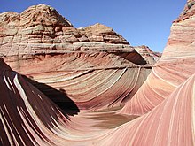
The Vermilion Cliffs are the second "step" up in the five-step Grand Staircase of the Colorado Plateau, in northern Arizona and southern Utah in the southwestern United States. They extend west from near Page, Arizona, for a considerable distance, in both Arizona and Utah.

<span class="mw-page-title-main">Kanab Creek</span> River in Utah and Arizona in the United States

Kanab Creek is one of the many tributaries of the Colorado River. It begins in Kane County, Utah, just south of the watershed to the Great Basin and flows 125 miles (201 km) south to the Colorado River.

<span class="mw-page-title-main">Jacob Lake, Arizona</span> Unincorporated community in the state of Arizona, United States

Jacob Lake is a small unincorporated community on the Kaibab Plateau in Coconino County, Arizona, United States, at the junction of U.S. Route 89A and State Route 67. Named after the Mormon explorer Jacob Hamblin, the town is known as the "Gateway to the Grand Canyon" because it is the starting point of Route 67, the only paved road leading to the North Rim of the Grand Canyon some 44 miles (71 km) to the south. The town itself consists of the Jacob Lake Inn which maintains motel rooms and cabins, a restaurant, lunch counter, gift shop, bakery, and general store; a gas station/garage; campground; and a visitors center run by the U.S. Forest Service. In the summer months, there is also a nearby center for horse rides.

<span class="mw-page-title-main">Beaver Dam, Arizona</span> Census-designated place in Arizona, United States

Beaver Dam is an unincorporated community and census-designated place (CDP) in Mohave County, Arizona, United States, that is located in the Arizona Strip region and was settled on December 2, 1863. It is located along Interstate 15 approximately 10 miles (16 km) northeast of Mesquite, Nevada. It is located in the 86432 ZIP Code. It had a population of 1,552 as of the 2020 census, a decline from the figure of 1,962 tabulated in 2010.

<span class="mw-page-title-main">Kanab Creek Wilderness</span> Protected area in the Kaibab National Forest

Kanab Creek Wilderness is a 75,300-acre (305 km2) wilderness area located along the Coconino/Mohave County line in the U.S. state of Arizona, approximately 30 miles (48 km) south of Fredonia. 68,600 acres (278 km2) of the Wilderness are located in the North Kaibab Ranger District of the Kaibab National Forest, the remaining 6,700 acres (27 km2) are administered by the Bureau of Land Management.

<span class="mw-page-title-main">Marble Canyon, Arizona</span> Unincorporated community in the state of Arizona, United States

Marble Canyon is an unincorporated community along the Colorado River in Coconino County, Arizona, United States. It is partially located within the Glen Canyon National Recreation Area and the Grand Canyon National Park.

<span class="mw-page-title-main">Hurricane Cliffs</span> Landform in Arizona and Utah, United States

The Hurricane Cliffs of southwest Utah and northwest Arizona are a red, limestone geographic feature, sets of cliffs along the western, eroded edge of the Kaibab Limestone; the cliffs are about 135-mi (217 km) long, with the south end terminus just north of the Grand Canyon. The cliffs are associated with the Hurricane Fault.

Buckskin Mountain is a 16-mile (26 km) mountain ridge that spans from Coconino County, Arizona to Kane County, Utah in the United States, that is divided almost equally between the two counties.

<span class="mw-page-title-main">Kanab Plateau</span> Plateau in Arizona, United States

The Kanab Plateau is a 45-mile long plateau located at the north of the Grand Canyon in Arizona, United States. The plateau is adjacent west of the Kaibab Plateau of the North Rim, with a basin containing the Kanab Creek watershed in between. The basin is the site of the Kanab Creek Wilderness, with Snake Gulch at its north perimeter, and at the base of the Kanab Plateau, forming its southeast border.

<span class="mw-page-title-main">Toroweap Formation</span> Middle Permian geologic unit in the Grand Canyon

The Middle Permian Toroweap Formation is a thin, darker geologic unit, between the brighter colored units of the Kaibab Limestone above, and Coconino Sandstone below. It is a prominent unit in Grand Canyon, Arizona, USA, found through sections of the South Rim, Grand Canyon, and the North Rim, of the Kaibab Plateau; also the Kaibab's southeast extension to Cape Royal, the Walhalla Plateau. The Colorado River of the Grand Canyon makes its excursion from due-south to due-west around the Walhalla Plateau, as it enters the east end of the Grand Canyon's interior, Granite Gorge. The formation is also found in southeast Utah.

<span class="mw-page-title-main">Isis Temple</span> Landform in the Grand Canyon, Arizona

Isis Temple is a prominence in the Grand Canyon, Arizona, Southwestern United States. It is located below the North Rim and adjacent to the Granite Gorge along the Colorado River. The Trinity Creek and canyon flow due south at its west border; its north, and northeast border/flank is formed by Phantom Creek and canyon, a west tributary of Bright Angel Creek; the creeks intersect about 3 mi (4.8 km) southeast, and 1.0 mi (1.6 km) north of Granite Gorge. The Isis Temple prominence, is only about 202 ft (62 m) lower than Grand Canyon Village, the main public center on Grand Canyon’s South Rim.

<span class="mw-page-title-main">Cane Beds, Arizona</span> Census-designated place in Arizona, United States

Cane Beds is an unincorporated community and census-designated place (CDP) in Mohave County, Arizona, United States. It lies 4 miles (6 km) south of the border with Utah in the Arizona Strip, and is supported by services in Utah as well as some in Nevada.

References

  1. Garrett, Dean (1994), "The Arizona Strip", Utah History Encyclopedia, University of Utah Press, ISBN   9780874804256, archived from the original on November 3, 2022, retrieved March 22, 2024
  2. "American FactFinder: Kaibab CCD, Coconino County, Arizona". Census 2000 Summary File 1 (SF 1) 100-Percent Data. United States Census Bureau. Archived from the original on February 11, 2020. Retrieved September 25, 2023.

36°39′N112°50′W / 36.650°N 112.833°W / 36.650; -112.833