Hualapai War

Last updated
Hualapai War
Part of the American Indian Wars, Yavapai Wars
Camp Date Creek 1869.jpg
A map of Camp Date Creek and the adjoining Hualapai reservation in 1869.
Date1865–1870
Location
Result United States victory
Belligerents
Flag of the United States (1867-1877).svg  United States Hualapai
Yavapai
Havasupai
Commanders and leaders
Flag of the United States (1867-1877).svg William Hardy
Flag of the United States (1867-1877).svg William Redwood Price
Anasa 
Wauba Yuba  
Sherum
Leve Leve
Hitchi Hitchi
Hualapai Charley
Strength
unknown ~250 warriors [1]

The Hualapai War, or Walapai War, was an armed conflict fought from 1865 to 1870 between the Hualapai native Americans and the United States in Arizona Territory. The Yavapai also participated on the side of the Hualapai and Mohave scouts were employed by the United States Army. Following the death of the prominent Yavapai leader Anasa in April 1865, the natives began raiding American settlements which provoked a response by the United States Army forces stationed in the area. By the spring of 1869 disease forced the majority of the Hualapais to surrender though some skirmishing continued for almost two more years. [2] [3]

Contents

War

Tensions between the Hualapai people and settlers began with encroachment of Indian lands. The Hualapai lived in the area between the Grand Canyon and the Bill Williams River. In 1857 Edward Fitzgerald Beale carved a road through Hualapai territory, leading to Needles, California, and in 1863, gold was discovered in the Prescott Valley. The gold rush brought a steady flow of miners and other settlers to the area so in 1864 Captain William Hardy built a toll road through Hualapai territory between Prescott and Bull Head City, which was then known as Hardyville. The road later spread out, leading to other places such as Fort Mohave and the Colorado River ports. Relations with the natives were generally peaceful and Hardy was able to acquire a fortune by building a ferry across the Colorado River and by taxing the settlers who used his road. However, in April 1865, drunken settlers killed Anasa during a meeting which led the Yavapai to wage war. The Hualapai called on their Havasupai and Yavapai allies to help them fight and they accepted, warriors under Chief Leve Leve (half-brother to Sherum and Hualapai Charley, both Chiefs of the Middle Mountain People subtribe) of the Amat Whala Pa'a (Mad hwa:la Ba:' – "Hualapai Mountains band") of the Yavapai Fighters subtribe assembled. [4] In all there were about 250 Hualapai warriors, and an unknown number of Yavapai and Apache allies, facing hundreds of United States Army troops and militia. At the time, there was no distinction between the Yavapai and the Western Apache people. Due to their close relationship with tribes such as the Tonto Apache, the word Yavapai was not then in use so the Yavapai was considered as Tonto Apaches, or Apache-Mohaves. [5] The actual fighting took the form of guerrilla warfare, in which small bands of natives cut off Hardy's road and raided using hit and run tactics. It was not until Captain Hardy negotiated a peace treaty with the Hualapai at Camp Beale's Spring that the raids were ceased. Nine months later, during another meeting with the Hualapai chiefs, settlers killed Wauba Yuma which renewed the hostilities. [6] [7] [8]

Men of the 8th Cavalry Regiment, from Fort Whipple, and men of the 14th Infantry Regiment, under William Redwood Price, responded by counter raiding into Hualapai territory. The soldiers fought several small battles with the natives and burned many of their rancherías. They also built posts, including Camp Date Creek, in January 1867, and Camp Hualapai, in May 1869. Camp Date Creek was located along Date Creek and the road between Prescott and La Paz. Camp Hualapai was located north of Prescott, southeast of Aztec Pass, along Walnut Creek and Captain Hardy's toll road. Both of the posts greatly improved the military's ability to defeat the natives but disease would conquer the Hualapai first. The war is generally recorded as having ended in December 1868 due to an outbreak of dysentery and whooping cough that caused many of the natives to surrender, however, Chief Leve Leve did not surrender until 1869 and Chief Sherum continued to lead his followers until 1870. Many of the Hualapais were moved to a reservation at Camp Beale's Spring but three years later moved to the Colorado River Reservation near La Paz. Some went to a temporary reservation at Camp Date Creek but by 1874 the post was closed. Conditions at the reservations led to starvation and disease so in 1875 some of the Hualapai escaped to their traditional lands, only to find that it had already been settled by others. The Hualapais then either went back to the reservation or took up work in mines or on ranches. In 1882, a 900,000 acre reservation was established for the Hualapai but it was described as poor land, either because of weather, or from the ranchers whose cattle destroyed many of the indigenous plants that were vital to the Hualapais' source of food. It is estimated that one-third of the Hualapai population was lost between 1865 and 1870. [9] [10] [11]

See also

Notes

  1. Broder, pp. 70–72
  2. Hualapai War (1865–1868) – Accessed 2012-02-11
  3. fort tours – Accessed 2012-02-11
  4. often Leve Leve is mistaken for a Yavapai leader – but he is actually only a band leader of the Yavapai Fighters subtribe, which were named for their fighting against the enemy Yavapai
  5. Utley, p. 255
  6. Mohave museum Archived 2011-11-12 at the Wayback Machine - Accessed 2012-02-11
  7. Indian war battles – Accessed 2012-02-11
  8. Broder, pp. 70–72
  9. Arizona forts- Accessed 2012-02-11
  10. Legends of America – Accessed 2012-02-11
  11. Broder, pp. 70–72

Related Research Articles

<span class="mw-page-title-main">Fort Verde State Historic Park</span> NRHP-designated site in Yavapai County, Arizona

Fort Verde State Historic Park in the town of Camp Verde, Arizona is a small park that attempts to preserve parts of the Apache Wars-era fort as it appeared in the 1880s. The park was established in 1970 and was added to the National Register of Historic Places a year later.

Indigenous peoples of Arizona are the Native American people of the state of Arizona. These include people that have lived in the region since time immemorial, tribes who entered the region centuries ago, such as the Southern Athabascan peoples, and the Pascua Yaqui, who settled Arizona in the early 20th century.

<span class="mw-page-title-main">Western Apache people</span> Native American ethnic group

The Western Apache live primarily in east central Arizona, in the United States and north of Mexico in the states of Sonora and Chihuahua. Most live within reservations. The Fort Apache Indian Reservation, San Carlos Apache Indian Reservation, Yavapai-Apache Nation, Tonto Apache, and the Fort McDowell Yavapai Nation are home to the majority of Western Apache and are the bases of their federally recognized tribes. In addition, there are numerous bands. The Western Apache bands call themselves Ndee (Indé). Because of dialectical differences, the Pinaleño/Pinal and Arivaipa/Aravaipa bands of the San Carlos Apache pronounce the word as Innee or Nnēē:.

<span class="mw-page-title-main">Apache Wars</span> Conflicts between the U.S. Army and native Apache tribe (1849–1924)

The Apache Wars were a series of armed conflicts between the United States Army and various Apache tribal confederations fought in the southwest between 1849 and 1886, though minor hostilities continued until as late as 1924. After the Mexican–American War in 1846, the United States inherited conflicted territory from Mexico which was the home of both settlers and Apache tribes. Conflicts continued as new United States citizens came into traditional Apache lands to raise livestock and crops and to mine minerals.

<span class="mw-page-title-main">Tonto Apache</span> Western Apache Indigenous people

The Tonto Apache is one of the groups of Western Apache people and a federally recognized tribe, the Tonto Apache Tribe of Arizona. The term is also used for their dialect, one of the three dialects of the Western Apache language.

<span class="mw-page-title-main">Hualapai</span> Native American tribe

The Hualapai is a federally recognized Native American tribe in Arizona with about 2300 enrolled members. Approximately 1353 enrolled members reside on the Hualapai Reservation, which spans over three counties in Northern Arizona.

Yavapai is an Upland Yuman language, spoken by Yavapai people in central and western Arizona. There are four dialects: Kwevkepaya, Wipukpaya, Tolkepaya, and Yavepe. Linguistic studies of the Kwevkepaya (Southern), Tolkepaya (Western), Wipukepa, and Yavepe (Prescott) dialects have been published.

Arizona's 2nd congressional district is a congressional district located in the U.S. state of Arizona. The district is in the north eastern part of the state and includes Apache, Coconino, Gila, Navajo, and Yavapai counties in their entirety and portions of Graham, Maricopa, Mohave, and Pinal counties. The largest city in the district is Flagstaff.

<span class="mw-page-title-main">Camp Grant massacre</span> Part of the Apache Wars

<span class="mw-page-title-main">Apache Scouts</span> Military unit

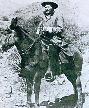
The Apache Scouts were part of the United States Army Indian Scouts. Most of their service was during the Apache Wars, between 1849 and 1886, though the last scout retired in 1947. The Apache scouts were the eyes and ears of the United States military and sometimes the cultural translators for the various Apache bands and the Americans. Apache scouts also served in the Navajo War, the Yavapai War, the Mexican Border War and they saw stateside duty during World War II. There has been a great deal written about Apache scouts, both as part of United States Army reports from the field and more colorful accounts written after the events by non-Apaches in newspapers and books. Men such as Al Sieber and Tom Horn were sometimes the commanding officers of small groups of Apache Scouts. As was the custom in the United States military, scouts were generally enlisted with Anglo nicknames or single names. Many Apache Scouts received citations for bravery.

<span class="mw-page-title-main">Yavapai</span> Ethnic Group

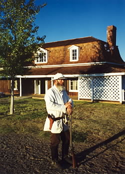
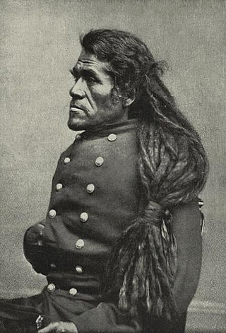
The Yavapai are a Native American tribe in Arizona. Historically, the Yavapai – literally “people of the sun” – were divided into four geographical bands who identified as separate, independent peoples: the Ɖulv G’paaya, or Western Yavapai; the Yaavpe', or Northwestern Yavapai; the Gwev G’paaya, or Southeastern Yavapai; and the Wiipukpaa, or Northeastern Yavapai – Verde Valley Yavapai.

<span class="mw-page-title-main">Battle of Turret Peak</span> Part of the Yavapai and Apache Wars (1873)

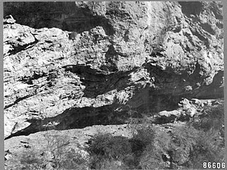
The Battle of Turret Peak occurred March 27, 1873 in the Arizona Territory between the United States Army and a group of Yavapai and Tonto Apaches as part of Lieutenant Colonel George Crook's campaign to return the natives to reservations.

<span class="mw-page-title-main">Fort Mohave</span> United States historic place

Fort Mohave was originally named Camp Colorado when it was established on April 19, 1859 by Lieutenant Colonel William Hoffman during the Mohave War. It was located on the east bank of the Colorado River, at Beale's Crossing, near the head of the Mohave Valley in Mohave County, Arizona by the recommendation of Lieutenant Edward Fitzgerald Beale. After the end of the Indian Wars, the fort was transferred to the Bureau of Indian Affairs in 1890. In 1935 it was transferred to the Fort Mojave Indian Reservation; the fort is administered by the state of Arizona.

<span class="mw-page-title-main">Fort McDowell, Arizona</span> Unincorporated community in the state of Arizona, United States

Fort McDowell is an unincorporated community in Maricopa County, Arizona, United States. Fort McDowell is 23 miles northeast of Phoenix. Fort McDowell has a post office with ZIP code 85264.

<span class="mw-page-title-main">Fort Date Creek</span> Historic place in Yavapai County, Arizona

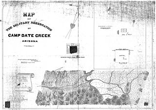
Fort Date Creek, also known as Camp McPherson or Camp Date Creek, was a United States Army post established in 1867 sixty miles south of Prescott, Arizona. It was built to safeguard American settlers in Yavapai County.

<span class="mw-page-title-main">Stoneman Military Trail</span> Supply road in Yapavai & Maricopa Counties, Arizona, 1870–1890

The Stoneman Road, an important supply road between Fort McDowell and Fort Whipple in Prescott between 1870 and 1890. It was an important conduit for the shipping of supplies from Fort Whipple in Prescott to Fort McDowell on what is today the Yavapai Reservation near Fountain Hills.

<span class="mw-page-title-main">Yavapai Wars</span> Part of the Apache Wars

The Yavapai Wars, or the Tonto Wars, were a series of armed conflicts between the Yavapai and Tonto tribes against the United States in the Arizona Territory. The period began no later than 1861, with the arrival of American settlers on Yavapai and Tonto land. At the time, the Yavapai were considered a band of the Western Apache people due to their close relationship with tribes such as the Tonto and Pinal. The war culminated with the Yavapai's removal from the Camp Verde Reservation to San Carlos on February 27, 1875, an event now known as Exodus Day.

<span class="mw-page-title-main">Irataba</span> Leader of the Mohave Nation (c. 1814 – 1874)

Irataba was a leader of the Mohave Nation, known as a mediator between the Mohave and the United States. He was born near the Colorado River in present-day Arizona. Irataba was a renowned orator and one of the first Mohave to speak English, a skill he used to develop relations with the United States.

<span class="mw-page-title-main">Fort Tyson</span> Historic site in La Paz County, Arizona

Fort Tyson was a privately owned fort built in 1856 by Charles Tyson in the area which is now called Quartzsite, Arizona. He built the fort to protect the local miners and water supply from the raids of the Yavapai (Mohave-Apache), a Native-American tribe. The area in which Fort Tyson was located has been known as Fort Tyson, Tyson’s Well and is now called the town of Quartzsite because of the large amount of quartz found in its surrounding areas.

References