Apache County, Arizona

Last updated

Apache County
Navajo Nation Council Chambers 6809.jpg
Apache County, Az.png
Map of Arizona highlighting Apache County.svg
Location within the U.S. state of Arizona
Arizona in United States.svg
Arizona's location within the U.S.
Coordinates: 35°25′26″N109°26′33″W / 35.4239°N 109.4425°W / 35.4239; -109.4425
CountryFlag of the United States.svg United States
StateFlag of Arizona.svg  Arizona
FoundedFebruary 24, 1879
Named for Apache people
Seat St. Johns
Largest town Eagar
Area
  Total11,218 sq mi (29,050 km2)
  Land11,198 sq mi (29,000 km2)
  Water21 sq mi (50 km2)  0.2%
Population
 (2020)
  Total66,021
  Estimate 
(2023)
65,036 Decrease2.svg
  Density5.9/sq mi (2.3/km2)
Time zone UTC−7 (Mountain)
Congressional district 2nd
Website www.apachecountyaz.gov
Apache County includes the Arizona section of the Four Corners Monument. Four Corners marker, southwestern United States.jpg
Apache County includes the Arizona section of the Four Corners Monument.

Apache County is in the northeast corner of the U.S. state of Arizona. Shaped in a long rectangle running north to south, as of the 2020 census, its population was 66,021. [1] The county seat is St. Johns. [2]

Contents

Most of the county is occupied by part of the federally recognized Navajo Nation and the Fort Apache Indian Reservation, respectively.

History

The United States acquired this territory following its victory in the Mexican–American War in 1848. It was originally part of the New Mexico Territory established at the time. In 1863, during the American Civil War, Congress established the Arizona Territory to improve regional administration. It operated until 1912 when it was admitted as a state.

In 1879 the Tenth Territorial Legislature organized Apache County from the eastern section of Yavapai County; officially all land east of 109°45′ W was included in the new county. As population increased in the area, by 1895, the legislature divided this county to create Navajo County and assigned some of the lands to the newly organized Graham, Greenlee and Gila counties. The county seat was first designated as the town of Snowflake, but a year later it was moved to St. Johns. From 1880 to 1882, the county seat was temporarily in Springerville, before being returned to St. Johns. [3]

An 1896 history of the area described the county by the following:

Apache County was created in 1879 and lies in the northeastern corner of the Territory. Until March, 1895, it also embraced what is now Navajo County, but at that date the latter was set apart and established as a separate county. Apache County is justly noted for its great natural resources and advantages. It is destined some day in the early future to have a large agricultural population. Now, immense herds of cattle and flocks of sheep roam over its broad mesas and its fertile valleys. The Navajo Indians occupy the northern part of the county-in fact, occupy much of the remainder of the county, as they refuse to remain on their reservation, preferring to drive their sheep and cattle on lands outside their reservation, where the grazing is better. The southern part is a fine grazing country, while the northern part is cut up into picturesque gorges and canyons by the floods of past centuries. [4]

In the late 1880s, the county sheriff was Commodore Perry Owens, a legendary Old West gunfighter. At that time, the county covered more than 21,177 square miles (54,850 km2) in territory. In September 1887, near Holbrook in what is now Navajo County, Owens was involved in a famous gunfight: he killed three men and wounded a fourth while serving a warrant on outlaw Andy Blevins/Andy Cooper, a participant in a raging range war, later dubbed the Pleasant Valley War.

In 2015, Apache County had the highest rate of deaths due to motor vehicles in the United States, with 82.5 deaths per 100,000 people. [5]

The Fort Apache Indian Reservation occupies part of the county, as does the Navajo Nation, whose territory extends well beyond it. The Apache and Navajo Nation are federally recognized tribes that long occupied territory here.

Geography

Apache County, Arizona. AAAIMG 0879.jpg
Apache County, Arizona.

According to the United States Census Bureau, the county has a total area of 11,218 square miles (29,050 km2), of which 11,198 square miles (29,000 km2) is land and 21 square miles (54 km2) (0.2%) is water. [6] The county is the third-largest county by area in Arizona and the sixth-largest in the United States (excluding boroughs and census areas in Alaska).

Apache County contains parts of each of the Navajo Indian Reservation and the Fort Apache Indian Reservation, and landholdings of the Zuni Indian Reservation that are not contiguous to their main territory. It also contains part of Petrified Forest National Park. Canyon de Chelly National Monument is entirely within the county and within the boundaries of the Navajo Nation.

Adjacent counties

Apache County is one of three U.S. counties (the others being Wayne County, West Virginia and Cook County, Illinois) to border two counties of the same name, neither of which is in the same state as the county itself (San Juan County, Utah and San Juan County, New Mexico).

Indian reservations

Apache County has the most land designated as Indian reservation of any county in the United States. (Coconino County and Navajo County are a close second and third.) The county has 19,857.34 km2 (7,666.96 sq mi) of reservation territory, or 68.34 percent of its total area. The reservations are, in descending order of area within the county, the Navajo Nation, the Fort Apache Indian Reservation, and the Zuni Indian Reservation, all of which are partly located within the county.

National protected areas

White House Ruin at Canyon de Chelly National Monument Canyon de Chelly White House Ruin Close View 2006 09 07.jpg
White House Ruin at Canyon de Chelly National Monument

Demographics

Historical population
CensusPop.Note
1880 5,283
1890 4,281−19.0%
1900 8,29793.8%
1910 9,19610.8%
1920 13,19643.5%
1930 17,76534.6%
1940 24,09535.6%
1950 27,76715.2%
1960 30,4389.6%
1970 32,2986.1%
1980 52,10861.3%
1990 61,59118.2%
2000 69,42312.7%
2010 71,5183.0%
2020 66,021−7.7%
2023 (est.)65,036 [7] −1.5%
U.S. Decennial Census [8]
1790–1960 [9] 1900–1990 [10]
1990–2000 [11] 2010–2020 [1]

2000 census

As of the census of 2000, there were 69,423 people, 19,971 households, and 15,257 families residing in the county. The population density was 6 people per square mile (2.3 people/km2). There were 31,621 housing units at an average density of 3 units per square mile (1.2 units/km2). The racial makeup of the county was 76.9% Native American, 19.5% White, 0.3% Black or African American, 0.1% Asian, 0.1% Pacific Islander, 1.8% from other races, and 1.4% from two or more races. 4.5% of the population were Hispanic or Latino of any race. 58.4% reported speaking Navajo at home, while 38.4% speak English and 2.7% Spanish. [12]

There were 19,971 households, out of which 43.8% had children under the age of 18 living with them, 49.3% were married couples living together, 21.4% had a female householder with no husband present, and 23.6% were non-families. 21.2% of all households were made up of individuals, and 6.9% had someone living alone who was 65 years of age or older. The average household size was 3.41 and the average family size was 4.04.

In the county, the population was spread out, with 38.5% under the age of 18, 9.4% from 18 to 24, 25.1% from 25 to 44, 18.7% from 45 to 64, and 8.0% who were 65 years of age or older. The median age was 27 years. For every 100 females there were 98.20 males. For every 100 females age 18 and over, there were 94.50 males.

The median income for a household in the county was $23,344, and the median income for a family was $26,315. Males had a median income of $30,182 versus $22,312 for females. The per capita income for the county was $8,986. About 33.5% of families and 37.8% of the population were below the poverty line, including 42.8% of those under age 18 and 36.5% of those age 65 or over. The county's per-capita income makes it one of the poorest counties in the United States.

Apache County is one of only 38 county-level census divisions of the United States where the most spoken language is not English and one of only 3 where it is neither English nor Spanish. 58.3% of the population speak Navajo at home, followed by English at 38.3% and Spanish at 2.7%. [13]

In 2000, the largest denominational group was the Catholics (with 19,965 adherents). [14] The largest religious bodies were The Catholic Church (with 19,965 members) and the Church of Jesus Christ of Latter-day Saints (with 8,947 members). [14]

2010 census

As of the census of 2010, there were 71,518 people, 22,771 households, and 16,331 families residing in the county. [15] The population density was 6.4 inhabitants per square mile (2.5 inhabitants/km2). There were 32,514 housing units at an average density of 2.9 units per square mile (1.1 units/km2). [16] The racial makeup of the county was 72.9% Native American, 23.3% white, 0.3% Asian, 0.2% black or African American, 1.3% from other races, and 2.0% from two or more races. Those of Hispanic or Latino origin made up 5.8% of the population. [15]

The largest ancestry groups were: [17]

  • 69.6% Navajo
  • 5.4% English
  • 5.3% German
  • 4.2% Irish
  • 4.0% Mexican
  • 1.4% American
  • 1.1% Scottish
  • 1.0% French
  • 1.0% Polish

Of the 22,771 households, 42.3% had children under the age of 18 living with them, 42.8% were married couples living together, 21.2% had a female householder with no husband present, 28.3% were non-families, and 24.8% of all households were made up of individuals. The average household size was 3.10 and the average family size was 3.76. The median age was 32.4 years. [15]

The median income for a household in the county was $30,184 and the median income for a family was $36,915. Males had a median income of $38,451 versus $31,557 for females. The per capita income for the county was $12,294. About 26.9% of families and 34.4% of the population were below the poverty line, including 41.8% of those under age 18 and 29.2% of those age 65 or over. [18]

Politics

The majority Native American population votes solidly for Democratic national candidates and generally helps carry the county for their presidential candidates. No Republican presidential nominee has won Apache County since Ronald Reagan in 1980, [19] when incumbent President Jimmy Carter was viewed as extremely weak on issues pertaining to the West, especially water development. [20] During most of the 1980s, 1990s and early 2000s Apache was the most Democratic county in Arizona. Concern by voters in Santa Cruz County, Arizona about Republican immigration policies has led to it voting Democratic at an even higher rate.

United States presidential election results for Apache County, Arizona [21] [22]
Year Republican Democratic Third party
No.%No.%No.%
2020 11,44232.44%23,29366.05%5331.51%
2016 8,24029.79%17,08361.76%2,3388.45%
2012 8,25031.83%17,14766.16%5202.01%
2008 8,55135.11%15,39063.19%4141.70%
2004 8,38434.65%15,65864.71%1560.64%
2000 5,94730.57%13,02566.95%4842.49%
1996 4,76125.48%12,39466.33%1,5298.18%
1992 4,58825.13%11,21861.44%2,45213.43%
1988 5,34736.76%8,94461.50%2531.74%
1984 5,63843.26%7,27755.84%1170.90%
1980 5,99156.55%3,91736.97%6876.48%
1976 3,44733.38%6,58363.75%2972.88%
1972 3,39450.28%3,14546.59%2113.13%
1968 2,09249.83%1,66839.73%43810.43%
1964 1,84947.51%2,04252.47%10.03%
1960 1,56851.75%1,45948.15%30.10%
1956 1,68563.18%98136.78%10.04%
1952 1,76759.70%1,19340.30%00.00%
1948 97039.51%1,48060.29%50.20%
1944 72836.99%1,23862.91%20.10%
1940 92631.95%1,96967.94%30.10%
1936 63827.42%1,67471.94%150.64%
1932 76037.36%1,27162.49%30.15%
1928 83751.41%79148.59%00.00%
1924 62048.51%54842.88%1108.61%
1920 67952.35%61847.65%00.00%
1916 31131.73%64866.12%212.14%
1912 5621.96%10842.35%9135.69%

Education

Primary and secondary schools

The following school districts serve Apache County: [23]

In addition several other schools, including charter schools and tribal schools operated by or affiliated with the Bureau of Indian Education (BIE), serve the county.

Charter schools:

Private schools:

Public libraries

The Apache County Library District, headquartered in St. Johns, operates public libraries in the county. [24] The branches include Alpine Public Library ( unincorporated area ), [25] Concho Public Library (unincorporated area), [26] Greer Memorial Library (unincorporated area), [27] Round Valley Public Library (Eagar), [28] Sanders Public Library (unincorporated area), [29] St. Johns Public Library (St. Johns), [30] and Vernon Public Library (unincorporated area). [31]

The Navajo Nation Museum and Library is located in Window Rock. The library and museum is the largest one on the Navajo Nation and in Apache County.

Transportation

Major highways

U.S. Route 191 crossing the Beautiful Valley in Apache County U.S. Route 191 NM Beautiful Valley 2006 09 06.jpg
U.S. Route 191 crossing the Beautiful Valley in Apache County

Airports

The following public use airports are located in Apache County:

Communities

Wildflower meadow in the Apache-Sitgreaves National Forest, near Alpine. Apache Sitgreaves Nima2.JPG
Wildflower meadow in the Apache-Sitgreaves National Forest, near Alpine.
Kiva at Casa Malpais, near Springerville. Casa Malpais Kiva.jpg
Kiva at Casa Malpais, near Springerville.

City

Towns

Census-designated places

Unincorporated communities

County population ranking

The population ranking of the following table is based on the 2010 census of Apache County. [32] [33]

county seat

RankCity/Town/etc.Population (2010 Census)Municipal typeIncorporated
1 Eagar 4,885Town1948
2 Chinle 4,518 CDP
3 Fort Defiance 3,624CDP
4St. Johns 3,480City1879
5 Window Rock 2,712CDP
6 Springerville 1,961Town1948
7 Lukachukai 1,701CDP
8 St. Michaels 1,443CDP
9 Many Farms 1,348CDP
10 Ganado 1,210CDP
11 Tsaile 1,205CDP
12 Houck 1,024CDP
13 Round Rock 789CDP
14 Sawmill 748CDP
15 Dennehotso 746CDP
16 Teec Nos Pos 730CDP
17 Rock Point 642CDP
18 Sanders 630CDP
19 Burnside 537CDP
20 McNary 528CDP
21 Nazlini 489CDP
22 Red Mesa 480CDP
23 Rough Rock 414CDP
24 Del Muerto 329CDP
25 Steamboat 284CDP
26 Cornfields 255CDP
27 Klagetoh 242CDP
28 Cottonwood 226CDP
29 Wide Ruins 176CDP
30 Red Rock 169CDP
31 Alpine 145CDP
32 Sehili 135CDP
33 Vernon 122CDP
34 Oak Springs 63CDP
35 Greer 41CDP
36 Concho 38CDP
37 Nutrioso 26CDP
38 Lupton 25CDP
39 Toyei 13CDP

Notable people

See also

Related Research Articles

<span class="mw-page-title-main">Coconino County, Arizona</span> County in Arizona, United States

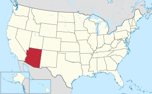
Coconino County is a county in the north-central part of the U.S. state of Arizona. Its population was 145,101 at the 2020 census. The county seat is Flagstaff. The county takes its name from Cohonino, a name applied to the Havasupai people. It is the second-largest county by area in the contiguous United States, behind San Bernardino County, California. It has 18,661 sq mi (48,300 km2), or 16.4% of Arizona's total area, and is larger than the nine smallest states in the U.S.

<span class="mw-page-title-main">Navajo County, Arizona</span> County in Arizona, United States

Navajo County is in the northern part of the U.S. state of Arizona. As of the 2020 census, its population was 106,717. The county seat is Holbrook.

<span class="mw-page-title-main">Chinle, Arizona</span> Census-designated place in Arizona, United States

Chinle is a census-designated place (CDP) in Apache County, Arizona, United States. The name in Navajo means 'flowing out' and is a reference to the location where the water flows out of the Canyon de Chelly. The population was 4,518 at the 2010 census.

<span class="mw-page-title-main">Dennehotso, Arizona</span> CDP in Apache County, Arizona

Dennehotso is a census-designated place (CDP) in Apache County, Arizona, United States. The population was 746 at the 2010 census.

<span class="mw-page-title-main">Eagar, Arizona</span> Town in Apache County, Arizona

Eagar is a town in Apache County, Arizona, United States. As of the 2010 census, the population of the town was 4,885.

<span class="mw-page-title-main">Fort Defiance, Arizona</span> CDP in Apache County, Arizona

Fort Defiance is a census-designated place (CDP) in Apache County, Arizona, United States. It is also located within the Navajo Nation. The population was 3,624 at the 2010 census.

<span class="mw-page-title-main">Lukachukai, Arizona</span> CDP in Apache County, Arizona

Lukachukai is a census-designated place (CDP) in Apache County, Arizona, United States. The population was 1,701 at the 2010 census. It is within the Navajo Nation.

<span class="mw-page-title-main">Many Farms, Arizona</span> CDP in Apache County, Arizona

Many Farms is a census-designated place (CDP) in Apache County, Arizona, United States. The population was 1,348 at the 2010 census.

<span class="mw-page-title-main">Nazlini, Arizona</span> CDP in Apache County, Arizona

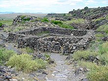
Nazlini is a census-designated place (CDP) in Apache County, Arizona, United States. The population was 489 at the 2010 census. Nearby are Nazlini Creek and Nazlini Canyon. Nazlini Canyon is the site of many Native American ruins and campsites that were abandoned when erosion made them unusable.

<span class="mw-page-title-main">Red Mesa, Arizona</span> CDP in Apache County, Arizona

Red Mesa is a census-designated place (CDP) in Apache County, Arizona, United States. The population was 480 at the 2010 census.

<span class="mw-page-title-main">Rock Point, Arizona</span> CDP in Apache County, Arizona

Rock Point is a census-designated place (CDP) in Apache County, Arizona, United States. The population was 642 at the 2010 census. Its name is descriptive of the point where Chinle Creek enters high sandstone walls.

<span class="mw-page-title-main">Rough Rock, Arizona</span> CDP in Apache County, Arizona

Rough Rock is a census-designated place (CDP) in Apache County, Arizona, United States. The population was 414 at the 2010 census.

<span class="mw-page-title-main">Round Rock, Arizona</span> CDP in Apache County, Arizona

Round Rock is a Navajo community and census-designated place (CDP) in Apache County, Arizona, United States. The population was 789 at the 2010 census. It is named after a nearby mesa.

<span class="mw-page-title-main">Sawmill, Arizona</span> CDP in Apache County, Arizona

Sawmill is a census-designated place (CDP) in Apache County, Arizona, United States. Sawmill is a part of Fort Defiance Agency, which is on the Navajo Nation. The population was 748 at the 2010 census. It is named after and developed around a sawmill. A trading post has been present since 1907.

<span class="mw-page-title-main">St. Johns, Arizona</span> City in Arizona, United States

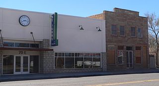
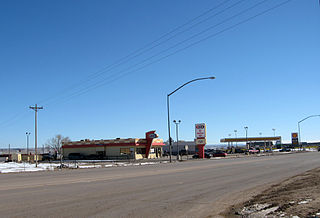
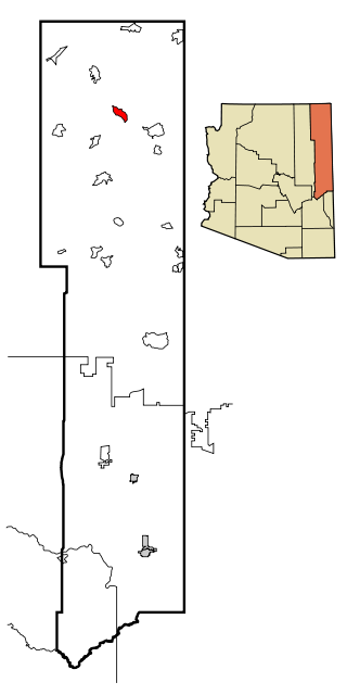
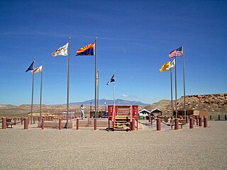
St. Johns is the county seat of Apache County, Arizona, United States. It is located along U.S. Route 180, mostly west of where that highway intersects with U.S. Route 191. As of the 2010 census, the population of the city was 3,480.

<span class="mw-page-title-main">Teec Nos Pos, Arizona</span> Census-designated place in Arizona, United States

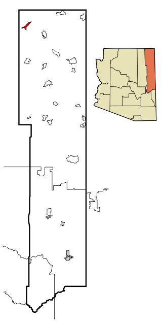
Teec Nos Pos is a census-designated place (CDP) in Apache County, Arizona, United States. The population was 507 at the 2020 census. It is the western terminus of U.S. Route 64.

<span class="mw-page-title-main">Tsaile, Arizona</span> Census-designated place in Arizona, United States

Tsaile is a census-designated place (CDP) in Apache County, Arizona, United States, on the Navajo Nation. The population was 1,205 at the 2010 census.

<span class="mw-page-title-main">Window Rock, Arizona</span> Capital of the Navajo Nation in Arizona, United States

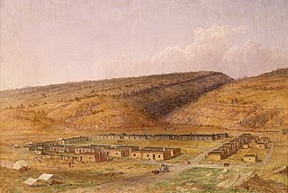
Window Rock, known in Navajo as Tségháhoodzání, is a city and census-designated place that serves as the capital of the Navajo Nation, the largest Native American tribe by both land and tribal enrollment. The capital lies within the boundaries of the St. Michaels Chapter, adjacent to the Arizona and New Mexico state line. Window Rock is the site of the Navajo Nation governmental campus, which contains the Navajo Nation Council, Navajo Nation Supreme Court, the offices of the Navajo Nation President and Vice President, and many Navajo government buildings.

<span class="mw-page-title-main">Cibecue, Arizona</span> Fort Apache Indian Reservation community

Cibecue is a census-designated place (CDP) in Navajo County, Arizona, United States, on the Fort Apache Indian Reservation. The population was 1,713 in the 2010 United States Census.

<span class="mw-page-title-main">Jeddito, Arizona</span> CDP in Navajo County, Arizona

Jeddito is a census-designated place (CDP) in Navajo County, Arizona, United States. The population was 293 at the 2010 census.

References

  1. 1 2 "State & County QuickFacts". United States Census Bureau. Retrieved September 27, 2022.
  2. "Find a County". National Association of Counties. Archived from the original on May 31, 2011. Retrieved June 7, 2011.
  3. Walker, Henry (1986). Historical Atlas of Arizona, p. 32. Norman: University of Oklahoma Press, ISBN   978-0806120249.
  4. A Historical and Biographical Record of the Territory of Arizona. Chicago: McFarland & Poole. 1896. p. 300.
  5. "Underlying Cause of Death, 1999-2015 Results". Centers for Disease Control and Prevention. Retrieved January 11, 2017.
  6. "2010 Census Gazetteer Files". United States Census Bureau. August 23, 2012. Retrieved August 23, 2015.
  7. "Annual Estimates of the Resident Population for Counties: April 1, 2020 to July 1, 2023". United States Census Bureau. Retrieved March 28, 2024.
  8. "U.S. Decennial Census". United States Census Bureau. Retrieved May 18, 2014.
  9. "Historical Census Browser". University of Virginia Library. Archived from the original on August 11, 2012. Retrieved May 18, 2014.
  10. "Population of Counties by Decennial Census: 1900 to 1990". United States Census Bureau. Retrieved May 18, 2014.
  11. "Census 2000 PHC-T-4. Ranking Tables for Counties: 1990 and 2000" (PDF). United States Census Bureau. Archived (PDF) from the original on October 9, 2022. Retrieved May 18, 2014.
  12. "Apache County, Arizona". mla.org. Archived from the original on September 30, 2007.
  13. "MLA Home". Modern Language Association.
  14. 1 2 "County Membership Reports". thearda.com. Archived from the original on September 25, 2012. Retrieved August 22, 2011.
  15. 1 2 3 "DP-1 Profile of General Population and Housing Characteristics: 2010 Demographic Profile Data". United States Census Bureau. Archived from the original on February 13, 2020. Retrieved January 20, 2016.
  16. "Population, Housing Units, Area, and Density: 2010 – County". United States Census Bureau. Archived from the original on February 13, 2020. Retrieved January 20, 2016.
  17. "DP02 Selected Social Characteristics in the United States – 2006–2010 American Community Survey 5-Year Estimates". United States Census Bureau. Archived from the original on February 13, 2020. Retrieved January 20, 2016.
  18. "DP03 Selected Economic Characteristics – 2006–2010 American Community Survey 5-Year Estimates". United States Census Bureau. Archived from the original on February 13, 2020. Retrieved January 20, 2016.
  19. Sullivan, Robert David; "How the Red and Blue Map Evolved Over the Past Century"; America Magazine in The National Catholic Review; June 29, 2016
  20. Reisner, Marc; Cadillac Desert: The American West and Its Disappearing Water ; p. 11 ISBN   0140178244
  21. "Dave Leip's Atlas of United States Presidential Elections" . Retrieved June 11, 2011.
  22. Scammon, Richard M. (compiler); America at the Polls: A Handbook of Presidential Election Statistics 1920–1964; pp. 42–44 ISBN   0405077114
  23. "2020 CENSUS - SCHOOL DISTRICT REFERENCE MAP: Apache County, AZ" (PDF). United States Census Bureau. Archived (PDF) from the original on October 9, 2022. Retrieved July 18, 2022. - Text list
  24. "Home Archived January 29, 2011, at the Wayback Machine ." Apache County Library District. Retrieved on January 30, 2011. "Apache County Library District PO Box 2760 30 South 2nd West St Johns, AZ 85936"
  25. "Alpine Public Library Archived August 13, 2010, at the Wayback Machine ." Apache County Library District. Retrieved on January 30, 2011.
  26. "Concho Public Library [ permanent dead link ]." Apache County Library District. Retrieved on January 30, 2011.
  27. "Greer Memorial Library Archived August 22, 2010, at the Wayback Machine ." Apache County Library District. Retrieved on January 30, 2011.
  28. "Round Valley Public Library [ permanent dead link ]." Apache County Library District. Retrieved on January 30, 2011.
  29. "Sanders Public Library [ permanent dead link ]." Apache County Library District. Retrieved on January 30, 2011.
  30. "St. Johns Public Library [ permanent dead link ]." Apache County Library District. Retrieved on January 30, 2011.
  31. "Vernon Public Library [ permanent dead link ]." Apache County Library District. Retrieved on January 30, 2011.
  32. "2010 U.S. Census website". United States Census Bureau . Retrieved December 6, 2015.
  33. "2010 Census Block Maps - Geography - U.S. Census Bureau". Archived from the original on December 29, 2014. Retrieved December 7, 2017.

35°25′26″N109°26′33″W / 35.42389°N 109.44250°W / 35.42389; -109.44250