Transportation in Arizona

Last updated

Transportation in Arizona
Overview
Transit type Rapid transit, commuter rail, buses, private automobile, taxicab, bicycle, pedestrian
Operation
Operator(s) Arizona Department of Transportation

The transportation system of Arizona comprises car, rail, air, bus, and bicycle transport.

Contents

Transit systems

Rail

Arizona passenger rail stations
BSicon CONTg.svg
BSicon CONTg.svg
Winslow
BSicon HST.svg
BSicon HST.svg
Benson
Flagstaff
BSicon BHF.svg
BSicon BHF.svg
Tucson
Kingman
BSicon HST.svg
BSicon HST.svg
Maricopa
BSicon CONTf.svg
BSicon HST.svg
Yuma
BSicon CONTf.svg

Amtrak operates the Southwest Chief , Sunset Limited , and Texas Eagle through Arizona. Two Amtrak routes serve Arizona communities: the Southwest Chief passes through Winslow, Flagstaff, and Kingman, while the Texas Eagle passes through Benson, Tucson, Maricopa and Yuma. Although the Texas Eagle passes much closer to Phoenix than the Southwest Chief does, Phoenix is linked to the Amtrak system via motorcoach from Flagstaff. [1]

A light rail system called Valley Metro Rail opened in December 2008, connecting Phoenix with the nearby cities of Tempe and Mesa, with plans for expansion in the future. [2]

Bus

The Phoenix and Tucson metropolitan areas are served by public bus transit systems. Yuma and Flagstaff have public bus systems. Greyhound Lines serves Phoenix, Tucson, Flagstaff, Yuma, and several smaller communities statewide. The Navajo Transit System operates bus routes throughout the Navajo Nation and connects Flagstaff to the capital of the Navajo Nation, Window Rock and connections to New Mexico. [3]

Roads and freeways

Entering Arizona on I-10 from New Mexico Entering Arizona on I-10 Westbound.jpg
Entering Arizona on I-10 from New Mexico

Main interstate routes include I-17, and I-19 traveling south–north, I-8, I-10, and I-40 traveling west–east, and a short stretch of I-15 traveling southwest–northeast through the northwestern corner of the state. In the future, I-11 travel through Arizona following US 93, it may replace I-19, and will terminate at the Mexican border in Nogales.

Phoenix is served by a combination of interstates, U.S. Highways, and state routes, many of which were funded by a ½ cent general sales tax measure approved by Maricopa County voters in 1985. New freeways are being added to the area, such as Loop 101, Loop 202, and eventually SR 24 and SR 30. Currently, two major interstates serve the area, I-10 and I-17. In the past decade, more than 100 miles (160 km) of new freeway have been constructed in the Phoenix metropolitan area by ADOT.

The Tucson metropolitan area is primarily served by I-10, I-19, and State Route 77. I-19 departs from I-10 in the southern part of Tucson, travels through southern Tucson (including an exit serving the historic Mission San Xavier) and the retirement community of Green Valley and terminates in Nogales, in Santa Cruz County, at the international border with Mexico. Destination signs on I-19 have metric distance figures in kilometers instead of standard miles. SR 77 serves North Tucson and Tucson's northern suburbs including Casas Adobes, Catalina Foothills, Oro Valley, and Catalina. SR 77 continues northward until it terminates at the Navajo Nation in northeastern Arizona.

SR 210 (Barraza–Aviation Parkway) is a limited-access parkway built in the early 1990s to connect downtown Tucson to the southeastern portion of the city. Few new limited-access roads are in the plans in Tucson due to strong community opposition to freeways. However, a large-scale reconstruction and expansion of I-10 was supported and completed in mid-2009.

Route 66 between Oatman and Kingman. Rte66btwnOatmanAndKingman.JPG
Route 66 between Oatman and Kingman.

Yuma is served by I-8, while Casa Grande served by I-8 and I-10; Flagstaff is served by I-17 and I-40. US 95 parallels the Colorado River, from Las Vegas to the Mexico–United States border near Yuma.

Historic US 66, a major route for Midwestern emigrants prior to the advent of the interstate highway system, traversed the northern part of the state, passing through Flagstaff and Kingman. US 66 in Arizona closely followed the route of what is now I-40 except for an 88 mi (142 km) stretch between Seligman and Kingman now known as SR 66, where the route veered to the north passing through Peach Springs.

Bridges and tunnels

The Deck Park Tunnel is a vehicular tunnel built underneath Downtown Phoenix as part of I-10. The tunnel extends from approximately North 3rd Avenue to North 3rd Street. At 2,887 feet (880 m), it ranks as the 42nd longest vehicular tunnel in the US.[ citation needed ] The tunnel was the last section of I-10 to be completed nationwide. There is a plaque dedicated to the commemoration of the tunnel in Margaret T. Hance Park.

Personal transportation

Pedestrians, and bicycles

Taxis

Personal vehicles

Port Infrastructure

Airports

Airports with scheduled commercial flights include: Phoenix Sky Harbor International Airport (IATA: PHX, ICAO: KPHX) in Phoenix (the largest airport and the major international airport in the state); Tucson International Airport (IATA: TUS, ICAO: KTUS) in Tucson; Phoenix-Mesa Gateway Airport (IATA: AZA, ICAO: KIWA) in Mesa; Yuma International Airport (IATA: YUM, ICAO: KYUM) in Yuma; Prescott Municipal Airport (PRC) in Prescott; Flagstaff Pulliam Airport (IATA: FLG, ICAO: KFLG) in Flagstaff, and Grand Canyon National Park Airport (GCP), a small, but busy, single-runway facility providing tourist flights, mostly from Las Vegas. Phoenix Sky Harbor is the seventh busiest airport in the world in terms of aircraft movements, and regularly in the top 15 for passengers.

Other significant airports without regularly scheduled commercial flights include Scottsdale Municipal Airport (IATA: SCF, ICAO: KSDL) in Scottsdale.

Projects

In May 2006, voters in Tucson approved a Regional Transportation Plan (a comprehensive bus transit/streetcar/roadway improvement program), and its funding via a new half-cent sales tax increment. The centerpiece of the plan is a light rail streetcar system (possibly similar to the Portland Streetcar in Oregon) that will travel through the downtown area, connecting the main University of Arizona campus with the Rio Nuevo master plan area on the western edge of downtown. [4]

See also

Related Research Articles

<span class="mw-page-title-main">Interstate 17</span> Interstate Highway in central Arizona

Interstate 17 (I-17) is a north–south Interstate Highway entirely within the US state of Arizona. I-17's southern terminus lies in Phoenix, at I-10/US 60 and its northern terminus is in Flagstaff, at Milton Road north of I-40.

<span class="mw-page-title-main">Kingman, Arizona</span> City in Arizona, United States

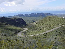
Kingman is a city in, and the county seat of, Mohave County, Arizona, United States. It is named after Lewis Kingman, an engineer for the Atlantic and Pacific Railroad. It is located 105 miles (169 km) southeast of Las Vegas, Nevada, and 180 miles (290 km) northwest of Arizona's state capital, Phoenix. The population was 32,689 at the 2020 census.

<span class="mw-page-title-main">Transportation in Salt Lake City</span>

Transportation in Salt Lake City consists of a wide network of roads, an extensive bus system, a light rail system, and a commuter rail line. Although Salt Lake City, Utah, is a traditionally car-oriented city, the rapidly growing public transit system has a high number of riders for a city of its size, and public transit is widely supported by its residents and businesses.

<span class="mw-page-title-main">Transportation in Seattle</span> Overview of transportation modes and routes in Seattle, Washington, U.S.

Transportation in Seattle is largely focused on the automobile like many other cities in western North America; however, the city is just old enough for its layout to reflect the age when railways and trolleys predominated. These older modes of transportation were made for a relatively well-defined downtown area and strong neighborhoods at the end of several former streetcar lines, now mostly bus lines.

<span class="mw-page-title-main">Transportation in Portland, Oregon</span> Overview of movement of goods and passengers in Portland

Like transportation in the rest of the United States, the primary mode of local transportation in Portland, Oregon is the automobile. Metro, the metropolitan area's regional government, has a regional master plan in which transit-oriented development plays a major role. This approach, part of the new urbanism, promotes mixed-use and high-density development around light rail stops and transit centers, and the investment of the metropolitan area's share of federal tax dollars into multiple modes of transportation. In the United States, this focus is atypical in an era when automobile use led many areas to neglect their core cities in favor of development along interstate highways, in suburbs, and satellite cities.

Portland is "an international pioneer in transit orientated developments."

<span class="mw-page-title-main">Arizona State Route 77</span> State highway in Arizona, United States

State Route 77 is a 253.93-mile (408.66-kilometre) long state highway in Arizona that traverses much of the state's length, stretching from its southern terminus at a junction with I-10 in Tucson to its northern terminus with BIA Route 6 at the Navajo Nation boundary just north of I-40.

<span class="mw-page-title-main">Interstate 40 in Arizona</span> Interstate Highway in Arizona

Interstate 40 (I-40) is an east–west Interstate Highway that has a 359.11-mile (577.93 km) section in the US state of Arizona, connecting sections in California and New Mexico. The Interstate is also referred to as the Purple Heart Trail to honor those wounded in combat who have received the Purple Heart. It enters Arizona from the west at a crossing of the Colorado River southwest of Kingman. It travels eastward across the northern portion of the state, connecting the cities of Kingman, Ash Fork, Williams, Flagstaff, Winslow, and Holbrook. I-40 continues into New Mexico, heading to Albuquerque. The highway has major junctions with U.S. Route 93 in Kingman and again approximately 22 miles (35 km) to the east and I-17 in Flagstaff.

<span class="mw-page-title-main">Cityscape of Tampa, Florida</span>

The cityscape of Tampa includes historic and architecturally noteworthy structures in its downtown and residential areas. The Seminole Heights and Hyde Park neighborhoods are two of the largest historic preservation districts in Tampa.

Located in the southeastern corner of the state, Norfolk is economically and culturally important to Virginia. A variety of transportation modes have developed around the city's importance and somewhat unusual geography.

Transportation in Florida includes a variety of options, including Interstate Highways, U.S. Highways, and Florida State Roads; Amtrak and commuter rail services; airports, public transportation, and sea ports, in a number of the state's counties and regions.

Below is a list and summary of the former state routes in Arizona, including mileage tables and maps. Between the establishment of Arizona's numbered state highway system in 1927 and the present date, several state routes have been decommissioned. Some state routes were retired as a result of the state relinquishing ownership to local authorities, while others were made extensions of or redesignated as other highways, with some former state routes being upgraded to U.S. Highway or Interstate status.

Transportation in Phoenix, Arizona is primarily via private cars. Public transport is run under the brand Valley Metro, and consists of buses, light rail, and a streetcar system.

The transportation system of Georgia is a cooperation of complex systems of infrastructure comprising over 1,200 miles (1,900 km) of interstates and more than 120 airports and airbases serving a regional population of 59,425 people.

Transportation in the Las Vegas Valley including the Nevada cities of Las Vegas, North Las Vegas and Henderson is a multi-faceted system. The street system is mostly laid out in a north–south/east–west system of roads. While most residents rely on cars, there is a network of bus routes reaching some areas of the county. The Las Vegas Valley, being the one of the largest tourist destinations in the world, has a mass transportation system which favors the Las Vegas Strip.

<span class="mw-page-title-main">Transportation in Atlanta</span>

Atlanta's transportation system is a complex multimodal system serving the city of Atlanta, Georgia, widely recognized as a key regional and global hub for passenger and freight transportation. The system facilitates inter- and intra-city travel, and includes the world's busiest airport, several major freight rail classification yards, a comprehensive network of freeways, heavy rail, light rail, local buses, and multi-use trails.

The transportation system of Oregon is a cooperation of complex systems of infrastructure.

<span class="mw-page-title-main">Transportation in Cincinnati</span>

Transportation in Cincinnati includes sidewalks, roads, public transit, bicycle paths, and regional and international airports. Most trips are made by car, with transit and bicycles having a relatively low share of total trips; in a region of just over 2 million people, less than 80,000 trips are made with transit on an average day. The city is sliced by three major interstate highways, I-71, I-74 and I-75, and circled by a beltway several miles out from the city limits. The region is served by two separate transit systems, one on each side of the river. SORTA, on the Ohio side is about six times larger than TANK on the Kentucky side.

<span class="mw-page-title-main">Timeline of Arizona</span> Timeline of the history of Arizona

The following is a timeline of the history of the area which today comprises the U.S. state of Arizona. Situated in the desert southwest, for millennia the area was home to a series of Pre-Columbian peoples. By 1 AD, the dominant groups in the area were the Hohokam, the Mogollon, and the Ancestral Puebloans. The Hohokam dominated the center of the area which is now Arizona, the Mogollon the southeast, and the Puebloans the north and northeast. As these cultures disappeared between 1000 and 1400 AD, other Indian groups settled in Arizona. These tribes included the Navajo, Apache, Southern Paiute, Hopi, Yavapai, Akimel O'odham, and the Tohono O'odham.

References

  1. "Amtrak Stations in Arizona". Amtrak Guide. 2019-08-10. Retrieved 2020-11-12.
  2. Sneider, Julie (June 2016). "Rail Insider-Valley Metro is pursuing a bold expansion plan in metropolitan Phoenix". Progressive Railroading. Retrieved 2020-11-12.
  3. "Navajo Transit System – Route Schedules". www.navajotransit.com. Retrieved 2020-11-12.
  4. "Tucson – Light Rail Streetcar Plan Wins – Light Rail Now!". www.lightrailnow.org. Retrieved 2018-03-31.