Rishangles

Last updated

Rishangles
Former Church of St Margaret, Rishangles, Suffolk - from the south.jpg
St Margaret's Rishangles: the former church, now a private residence
Suffolk UK location map.svg
Red pog.svg
Rishangles
Location within Suffolk
Population80  [1]
District
Shire county
Region
Country England
Sovereign state United Kingdom
Post town Eye
Postcode district IP23
Police Suffolk
Fire Suffolk
Ambulance East of England
EU Parliament East of England
List of places
UK
England
Suffolk
52°16′26″N1°10′05″E / 52.274°N 1.168°E / 52.274; 1.168 Coordinates: 52°16′26″N1°10′05″E / 52.274°N 1.168°E / 52.274; 1.168

Rishangles is a village and civil parish in the Mid Suffolk district of Suffolk in eastern England.

Civil parish Territorial designation and lowest tier of local government in England

In England, a civil parish is a type of administrative parish used for local government, they are a territorial designation which is the lowest tier of local government below districts and counties, or their combined form, the unitary authority. Civil parishes can trace their origin to the ancient system of ecclesiastical parishes which historically played a role in both civil and ecclesiastical administration; civil and religious parishes were formally split into two types in the 19th century and are now entirely separate. The unit was devised and rolled out across England in the 1860s.

Mid Suffolk Non-metropolitan district in England

Mid Suffolk is a local government district in Suffolk, England. Its council was based in Needham Market until late 2017, and are currently sharing offices with the Suffolk County Council at their headquarters in Ipswich. The largest town of Mid Suffolk is Stowmarket. The population of the District taken at the 2011 Census was 96,731.

Suffolk County of England

Suffolk is an East Anglian county of historic origin in England. It has borders with Norfolk to the north, Cambridgeshire to the west and Essex to the south. The North Sea lies to the east. The county town is Ipswich; other important towns include Lowestoft, Bury St Edmunds, Newmarket, and Felixstowe, one of the largest container ports in Europe.

The place-name 'Rishangles' is first attested in the Domesday Book of 1086, where it appears as Risangra. The name means 'brushwood slope', the second element being related to the word 'hanger' meaning 'hanging wood'. [2]
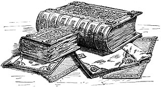
Domesday Book 11th-century survey of landholding in England as well as the surviving manuscripts of the survey

Domesday Book is a manuscript record of the "Great Survey" of much of England and parts of Wales completed in 1086 by order of King William the Conqueror. The Anglo-Saxon Chronicle states:

Then, at the midwinter [1085], was the king in Gloucester with his council .... After this had the king a large meeting, and very deep consultation with his council, about this land; how it was occupied, and by what sort of men. Then sent he his men over all England into each shire; commissioning them to find out "How many hundreds of hides were in the shire, what land the king himself had, and what stock upon the land; or, what dues he ought to have by the year from the shire."

The manor of Rishangles was held until his death in September 1478 by Edward Grimston, who also held the manor of Thorndon. They passed to his son Edward (1462-1520). Edward Grimston was well-connected, and his third marriage (1471) to Philippa, daughter of John Tiptoft, 1st Baron Tiptoft and sister of the Earl of Worcester was held in the presence of John de la Pole, 2nd Duke of Suffolk and his wife Elizabeth Plantagenet, sister of Kings Edward IV and Richard III. [3]

John Tiptoft, 1st Baron Tiptoft Speaker of the House of Commons

John Tiptoft, 1st Baron Tiptoft was a Knight of the Shire for Huntingdonshire and Somerset, Speaker of the House of Commons, Treasurer of the Household, Chief Butler of England, Treasurer of the Exchequer and Seneschal of Landes and Aquitaine.

John Tiptoft, 1st Earl of Worcester Lord High Treasurer

John Tiptoft, 1st Earl of Worcester KG was an English nobleman and scholar, Lord High Treasurer, Lord High Constable and Deputy Governor of Ireland. He was known as "the Butcher of England".

John de la Pole, 2nd Duke of Suffolk Duke of Suffolk

John de la Pole, 2nd Duke of Suffolk, KG, was a major magnate in 15th-century England. He was the son of William de la Pole, 1st Duke of Suffolk, and Alice Chaucer, the daughter of Thomas Chaucer. His youth was blighted, in 1450, by the political fall and subsequent murder of his father, who had been a favourite of the king, Henry VI, but was increasingly distrusted by the rest of the nobility. Although the first duke of Suffolk had made himself rich through trade and – particularly – royal grants, this source of income dried up on his death, so John de la Pole was among the poorest of English dukes on his accession to the title in 1463. This was a circumstance which John felt acutely; on more than one occasion, he refused to come to London due to his impoverishment being such that he could not afford the costs of maintaining a retinue.

Located around seven miles south of Diss, in 2005 its population was 80. [1] At the 2011 the population was included in the civil parish of Bedingfield. Despite its small population the village is at one time believed to have been home to three churches. Following the closure of both the Methodist church and the Grade II* listed Parish church, St Margaret's, only the Baptist Church remains open.

Diss town in Norfolk, England

Diss is an English market town and electoral ward in the East Anglian county of Norfolk, near the border with Suffolk. It had a population of 7,572 in 2011. Diss railway station is on the Great Eastern Main Line from London to Norwich. The town lies in the valley of the River Waveney, round a mere covering 6 acres (2.4 ha) and up to 18 feet (5.5 m) deep, although there is another 51 feet (16 m) of mud.

Bedingfield village in United Kingdom

Bedingfield is a village and civil parish in the Mid Suffolk district of Suffolk, England. Rishangles and Southolt were included in the population at the 2011 Census.

Related Research Articles

Thomas Ros, 9th Baron Ros English noble

Thomas Ros or Roos, 9th Baron Ros of Helmsley was a follower of the House of Lancaster during the Wars of the Roses.

Olveston village in United Kingdom

Olveston is a small village and larger parish in South Gloucestershire, England. The parish comprises the villages of Olveston and Tockington, and the hamlets of Old Down, Ingst and Awkley. The civil parish population at the 2011 census was 2,033. Alveston became a separate parish in 1846. The district has been inhabited since the Stone Age, and the salt marshes that made up almost half of the parish, were progressively drained in Roman and Saxon times. A sea wall was constructed at the same time to prevent flooding from the nearby estuary of the River Severn.

Stoke-by-Nayland village in the United Kingdom

Stoke-by-Nayland is a village and civil parish in Suffolk, England, close to the border with Essex. The village, located within Babergh district, contains many cottages and timber framed houses and all surround a large recreation field. Possibly once the site of a monastery, the population of the civil parish at the 2001 census was 703, falling to 682 at the Census 2011.

Catmore farm village in the United Kingdom

Catmore is a civil parish and small village in West Berkshire about 5 12 miles (9 km) southeast of Wantage. Catmore is in the Berkshire Downs and the centre of the village is about 575 feet (175 m) above sea level. The 2001 Census recorded a population of only 28, making Catmore the least populous parish in Berkshire.

Elsyng Palace was a Tudor palace, on a site in what are now the grounds of Forty Hall in Enfield, north London. Its exact location was lost for many years until excavations were carried out in the 1960s.

Wellow, Nottinghamshire village in the United Kingdom

Wellow is a village in Nottinghamshire, England. According to the 2001 census it had a population of 444, increasing to 470 at the 2011 census.

Benhall a village located in Suffolk Coastal, United Kingdom

Benhall is a village and civil parish in the East Suffolk district of Suffolk, England. Located to the south of Saxmundham, in 2007 its population was estimated to be 560, reducing to 521 at the 2011 Census.

Cheswardine farm village in the United Kingdom

Cheswardine is a rural village and civil parish in north east Shropshire, England. The village lies close to the border with Staffordshire and is about 8 miles north of Newport and 5 miles south east of Market Drayton. At the 2001 Census, the parish, had a population of 991 people, increasing to 1,076 at the 2011 Census.

Cockfield, Suffolk village in Suffolk, United Kingdom

Cockfield is a village and civil parish located approximately 3 12 miles (5.6 km) from Lavenham in Suffolk, England. The village consists of a central point and several outlying hamlets: Buttons Green, Colchester Green, Cross Green, Great Green, Oldhall Green, Smithwood Green and Windsor Green. Surrounded mostly by fields used for farming, and with few roads, its population was 839 in 2001, increasing to 868 at the 2011 Census.

Trimley St Martin farm village in the United Kingdom

Trimley St. Martin is a parish and village that lies between the rivers Orwell and the Deben, on the long narrow tongue of land from Ipswich to Felixstowe referred to as the Colneis Hundred.

Clifford, West Yorkshire

Clifford is a small village in West Yorkshire, England. The population at the 2011 Census was 1,662. The village is 3 miles (5 km) south of Wetherby. Many of the older buildings are built of magnesian limestone.

Poslingford village in the United Kingdom

Poslingford is a small village situated approximately 1¾ miles to the north of Clare, Suffolk, England, near to a stream that feeds the River Stour. The main part of the village follows the line of The Street, rising approximately 18 metres in height above sea level from south to north.

Sisland village in the United Kingdom

Sisland is a very small village, manor and parish in the county of Norfolk, England, about a mile west of Loddon. The Parish covers an area of 1.90 km2 (0.73 sq mi) and had a population of 44 in 16 households at the 2001 census.

Layham village in the United Kingdom

Layham is a small village and a civil parish in southern Suffolk, England, situated between the town of Hadleigh and the neighbouring village of Raydon.

Shalden village in United Kingdom

Shalden is a village and civil parish in the East Hampshire district of Hampshire, England. It is 2.3 miles (3.7 km) northwest of Alton and 1.9 miles (3.1 km) northeast of Bentworth, just off the A339 road. The parish covers an area of 1,536 acres (622 ha) and has an average elevation of 600 feet (180 m) above sea level. The nearest railway station is Alton, 2.5 miles (4.0 km) southeast of the village. According to the 2011 census, it had a population of 435.

Elmswell village in Mid Suffolk, Suffolk, England

Elmswell is a village and civil parish in the county of Suffolk, England. It is situated halfway between Bury St. Edmunds and Stowmarket and lies just to the north of the A14 road.

Wenham Magna civil parish in Babergh, Suffolk, England

Wenham Magna, also known as Great Wenham, is a village and a civil parish in the Babergh district of Suffolk in eastern England.

Nettlestead, Suffolk farm village in the United Kingdom

Nettlestead is a dispersed village and civil parish in the Mid Suffolk district of Suffolk in eastern England.The surrounding villages of Nettlestead include Somersham, Little Blakenham, Baylham, Barking, Willisham and Offton.

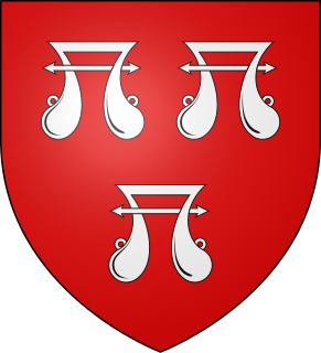
Edward Grimston, of Rishangles, Suffolk, was an English politician and comptroller of Calais.

Ipswich Greyfriars founded before 1236, virtually nothing remains

Ipswich Greyfriars was a mediaeval monastic house of Friars Minor (Franciscans) founded during the 13th century in Ipswich, Suffolk. It was said conventionally to have been founded by Sir Robert Tibetot of Nettlestead, Suffolk, but the foundation is accepted to be set back before 1236. This makes it the earliest house of mendicant friars in Suffolk, and established no more than ten years after the death of St Francis himself. It was within the Cambridge Custody. It remained active until dissolved in the late 1530s.

References

  1. 1 2 Estimates of Total Population of Areas in Suffolk Archived 2008-12-19 at the Wayback Machine Suffolk County Council
  2. Eilert Ekwall, The Concise Oxford Dictionary of English Place-names, p.389.
  3. The Visitation of Suffolk 1561, made by William Hervey, Clarenceux King of Arms, edited by Joan Corder, F.S.A., Harleian Society, London, 1984, part 2, p.406-7.

Commons-logo.svg Media related to Rishangles at Wikimedia Commons