Rockville, Minnesota

Last updated

Rockville
Fish sign on shop, Rockville, Minnesota.jpg
Motto: 
"Granite-Heart Of The City" [1]
Stearns County Minnesota Incorporated and Unincorporated areas Rockville Highlighted.svg
Location of Rockville
within Stearns County, Minnesota
Coordinates: 45°27′55″N94°19′19″W / 45.46528°N 94.32194°W / 45.46528; -94.32194
Country United States
State Minnesota
County Stearns
Area
[2]
  Total30.43 sq mi (78.82 km2)
  Land28.68 sq mi (74.29 km2)
  Water1.75 sq mi (4.53 km2)
Elevation
[3]
1,125 ft (343 m)
Population
 (2020)
  Total2,382
  Density83.05/sq mi (32.07/km2)
Time zone UTC-6 (Central (CST))
  Summer (DST) UTC-5 (CDT)
ZIP code
56369
Area code 320
FIPS code 27-55078 [4]
GNIS feature ID2396409 [3]
Website www.rockvillecity.org

Rockville is a city in Stearns County, Minnesota, United States. The population was 2,448 as of the 2010 census. [5] It is part of the St. Cloud Metropolitan Statistical Area.

Contents

History

According to the local oral tradition, a village of the Dakota people was once located to the north of the lake. [6]

The parish cemetery in nearby Jacobs Prairie, Minnesota includes the grave of early Rockville pioneer Michael Hanson, Sr. Hanson was already an elderly immigrant when he arrived with his sons and many of his grandchildren from the Luxembourgish-speaking but Prussian-ruled village of Obersgegen. Hanson was old enough, in fact, to have been a combat veteran of the French Imperial Army who had lost a leg to enemy fire during the Napoleonic Wars. As stipulated in his last request, Hanson lies buried in St. James Cemetery next to his close friend, pioneer settler, and fellow Napoleonic Wars veteran, Herr Pieck. [7]

Rockville was platted in 1856, and named for granite rock formations on nearby streams. [8] A post office has been in operation at Rockville since 1857. Levi Gaylord was selected as the first Postmaster. The Government selected Newton Smith on June 6, 1861. [9] In Rockville the Clark and McCormack Quarry and House, consisting of a quarry established in 1907 and a house built in 1924, is listed on the National Register of Historic Places. [10]

On June 1, 2002, the city of Pleasant Lake and Rockville Township were merged into the city of Rockville. [11]

Geography

According to the United States Census Bureau, the city has a total area of 30.17 square miles (78.14 km2); 28.42 square miles (73.61 km2) is land and 1.75 square miles (4.53 km2) is water. [12]

Rockville, including the former Rockville Township, is located in Township 123 North of the Arkansas Base Line and Range 29 West of the Fifth Principal Meridian.

Demographics

Historical population
CensusPop.Note
1910 127
1920 17235.4%
1930 29470.9%
1940 34517.3%
1950 288−16.5%
1960 35724.0%
1970 302−15.4%
1980 59797.7%
1990 579−3.0%
2000 74929.4%
2010 2,448226.8%
2020 2,382−2.7%
U.S. Decennial Census [13]

2010 census

As of the census [14] of 2010, there were 2,448 people, 880 households, and 703 families living in the city. The population density was 86.1 inhabitants per square mile (33.2/km2). There were 1,041 housing units at an average density of 36.6 per square mile (14.1/km2). The racial makeup of the city was 91.9% White, 0.3% African American, 0.2% Native American, 0.2% Asian, 0.5% Pacific Islander, 6.1% from other races, and 0.8% from two or more races. Hispanic or Latino of any race were 9.3% of the population.

There were 880 households, of which 37.0% had children under the age of 18 living with them, 68.8% were married couples living together, 6.5% had a female householder with no husband present, 4.7% had a male householder with no wife present, and 20.1% were non-families. 14.4% of all households were made up of individuals, and 4.8% had someone living alone who was 65 years of age or older. The average household size was 2.78 and the average family size was 3.04.

The median age in the city was 40.5 years. 25.8% of residents were under the age of 18; 8.2% were between the ages of 18 and 24; 23.5% were from 25 to 44; 31.1% were from 45 to 64; and 11.4% were 65 years of age or older. The gender makeup of the city was 51.9% male and 48.1% female.

2000 census

As of the census [4] of 2000, there were 749 people, 268 households, and 187 families living in the city. The population density was 1,140.7 inhabitants per square mile (440.4/km2). There were 281 housing units at an average density of 427.9 per square mile (165.2/km2). The racial makeup of the city was 94.53% White, 1.34% African American, 0.13% Native American, 3.20% from other races, and 0.80% from two or more races. Hispanic or Latino of any race were 6.54% of the population.

There were 268 households, out of which 44.8% had children under the age of 18 living with them, 58.2% were married couples living together, 7.1% had a female householder with no husband present, and 30.2% were non-families. 23.1% of all households were made up of individuals, and 6.3% had someone living alone who was 65 years of age or older. The average household size was 2.79 and the average family size was 3.33.

In the city, the population was spread out, with 31.5% under the age of 18, 11.1% from 18 to 24, 37.0% from 25 to 44, 13.9% from 45 to 64, and 6.5% who were 65 years of age or older. The median age was 29 years. For every 100 females, there were 106.3 males. For every 100 females age 18 and over, there were 113.8 males.

The median income for a household in the city was $43,854, and the median income for a family was $50,083. Males had a median income of $31,964 versus $22,000 for females. The per capita income for the city was $16,527. About 2.1% of families and 4.8% of the population were below the poverty line, including 3.0% of those under age 18 and none of those age 65 or over.

Infrastructure

Transportation

Minnesota State Highway 23 serves as a main route in the city, and Interstate 94 passes nearby. Also a branch line of Northern Lines Railway terminates in Rockville and serves the Wenner Gas propane terminal just north of the city boundary. The through rail line to Willmar, Minnesota was abandoned in the 1980s by Burlington Northern Railroad.

Education

Much of Rockville is in the Rocori Public School District. Portions are in the St. Cloud Area School District. [15]

Residents of the St. Cloud school district portion are zoned to Discovery Elementary School. [16] Almost all of the St. Cloud school district sections of Rockville are zoned to South Middle School, [17] and Technical Senior High School. [18] A small slice of land north of Highway 23 is zoned to North Middle School, [19] and Apollo High School. [20]

Related Research Articles

<span class="mw-page-title-main">Stearns County, Minnesota</span> County in Minnesota, United States

Stearns County is a county in the U.S. state of Minnesota. As of the 2020 census, the population was 158,292. Its county seat and largest city is St. Cloud.

<span class="mw-page-title-main">Clear Lake, Minnesota</span> City in Minnesota, United States

Clear Lake is a city in Sherburne County, Minnesota, United States. The population was 641 at the 2020 census.

<span class="mw-page-title-main">Albany, Minnesota</span> City in Minnesota, United States

Albany is a city in Stearns County, Minnesota, United States. The population was 2,561 at the 2010 census. It is part of the St. Cloud Metropolitan Statistical Area.

<span class="mw-page-title-main">Avon, Minnesota</span> City in Minnesota, United States

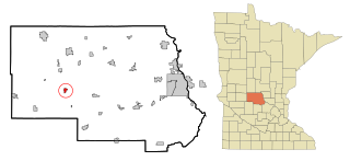
Avon is a city in Stearns County, Minnesota, United States. The population was 1,396 at the 2010 census. It is part of the St. Cloud Metropolitan Statistical Area.

<span class="mw-page-title-main">Melrose, Minnesota</span> City in Minnesota, United States

Melrose is a city in Stearns County, Minnesota, United States. The population was 3,598 at the 2010 census. It is part of the St. Cloud Metropolitan Statistical Area.

<span class="mw-page-title-main">Roscoe, Minnesota</span> City in Minnesota, United States

Roscoe is a city in Stearns County, Minnesota, United States. The population was 102 at the 2010 census. It is part of the St. Cloud Metropolitan Statistical Area. On December 7, 2016, Donald Kennith Albrecht was sworn in as mayor of Roscoe.

<span class="mw-page-title-main">St. Joseph, Minnesota</span> City in Minnesota, United States

St. Joseph or Saint Joseph is a city in Stearns County, Minnesota, United States. The population was 7,029 at the 2020 census. It is home to the College of Saint Benedict.

St. Joseph Township is a township in Stearns County, Minnesota, United States. The population was 1,924 at the 2010 census. The township borders the western side of the cities of St. Cloud and Waite Park, and completely surrounds the city of St. Joseph. All are components of the St. Cloud Metropolitan Statistical Area.

<span class="mw-page-title-main">St. Martin, Minnesota</span> City in Minnesota, United States

St. Martin or Saint Martin, Smartin to locals, is a city in Stearns County, Minnesota, United States. The population was 308 at the 2010 census. It is part of the St. Cloud Metropolitan Statistical Area.

<span class="mw-page-title-main">St. Rosa, Minnesota</span> City in Minnesota, United States

Saint Rosa is a city in Stearns County, Minnesota, United States. The population was 68 at the 2010 census. It is part of the St. Cloud Metropolitan Statistical Area.

<span class="mw-page-title-main">Waite Park, Minnesota</span> City in Minnesota, United States

Waite Park is a city in Stearns County, Minnesota, United States. The population was 8,341 at the 2020 census.

<span class="mw-page-title-main">Cold Spring, Minnesota</span> City in Minnesota, United States

Cold Spring is a city in Stearns County, Minnesota, United States, at the gateway of the Sauk River Chain of Lakes, an interconnected system of 14 bay-like lakes fed and connected by the Sauk River. Cold Spring is part of the St. Cloud Metropolitan Statistical Area. Its population was 4,025 at the 2010 census.

<span class="mw-page-title-main">Meire Grove, Minnesota</span> City in Minnesota, United States

Meire Grove is a city in Stearns County, Minnesota, United States. The population was 179 at the 2010 census. It is part of the St. Cloud Metropolitan Statistical Area.

<span class="mw-page-title-main">Spring Hill, Minnesota</span> City in Minnesota, United States

Spring Hill is a city in Stearns County, Minnesota, United States. The population was 85 at the 2010 census. It is part of the St. Cloud Metropolitan Statistical Area.

<span class="mw-page-title-main">St. Stephen, Minnesota</span> City in Minnesota, United States

Saint Stephen is a city in Stearns County, Minnesota, United States. The population was 851 at the 2010 census.

<span class="mw-page-title-main">St. Anthony, Stearns County, Minnesota</span> City in Minnesota, United States

St. Anthony or Saint Anthony is a city in Stearns County, Minnesota, United States. The population was 86 at the 2010 census. It is part of the St. Cloud Metropolitan Statistical Area. Main routes include Minnesota State Highway 238, Stearns County Road 153, and Trobec Street.

<span class="mw-page-title-main">Sartell, Minnesota</span> City in Minnesota, United States

Sartell is a city in Benton and Stearns Counties in the U.S. state of Minnesota that straddles the Mississippi River. It is part of the St. Cloud Metropolitan Statistical Area. The population was 19,351 at the 2020 census, making it St. Cloud's most populous suburb and the fourth-largest city in central Minnesota, after St. Cloud, Elk River, and Willmar.

<span class="mw-page-title-main">Brooten, Minnesota</span> City in Minnesota, United States

Brooten is a city in Stearns and Pope counties in the U.S. state of Minnesota, United States. The population was 626 as of the 2020 census. Almost the entire city is within Stearns County, with a small portion in Pope County.

<span class="mw-page-title-main">Clearwater, Minnesota</span> City in Minnesota, United States

Clearwater is a city in Stearns and Wright counties in the U.S. state of Minnesota. The population was 1,922 at the 2020 census. Most of the city lies within Wright County.

<span class="mw-page-title-main">St. Augusta, Minnesota</span> City in Minnesota, United States

Saint Augusta or St. Augusta, formerly named Ventura, is a city in Stearns County, Minnesota, United States, directly south of the city of St. Cloud. The population was 3,497 at the 2020 census.

References

  1. "City of Rockville Minnesota". City of Rockville Minnesota. Retrieved October 9, 2012.
  2. "2020 U.S. Gazetteer Files". United States Census Bureau. Retrieved July 24, 2022.
  3. 1 2 U.S. Geological Survey Geographic Names Information System: Rockville, Minnesota
  4. 1 2 "U.S. Census website". United States Census Bureau . Retrieved January 31, 2008.
  5. "2010 Census Redistricting Data (Public Law 94-171) Summary File". American FactFinder. U.S. Census Bureau, 2010 Census. Retrieved April 23, 2011.[ dead link ]
  6. Pierre T. Hanson taped oral history interviews, Stearns County History Museum, St. Cloud, Minnesota.
  7. Michael Hanson, Sr. biographical file & Pierre T. Hanson oral history interviews, Stearns County History Museum, St. Cloud, Minnesota.
  8. Upham, Warren (1920). Minnesota Geographic Names: Their Origin and Historic Significance. Minnesota Historical Society. p.  526.
  9. "Stearns County". Jim Forte Postal History. Retrieved August 8, 2015.
  10. "Minnesota National Register Properties Database". Minnesota Historical Society. 2009. Retrieved June 12, 2018.
  11. Population Estimates Geographic Change Notes: Minnesota Archived 2008-05-02 at the Wayback Machine , 2006-05-19. Accessed 2008-05-28.
  12. "US Gazetteer files 2010". United States Census Bureau. Archived from the original on July 2, 2012. Retrieved November 13, 2012.
  13. "Census of Population and Housing". Census.gov. Retrieved June 4, 2015.
  14. "U.S. Census website". United States Census Bureau . Retrieved November 13, 2012.
  15. "2020 CENSUS - SCHOOL DISTRICT REFERENCE MAP: Stearns County, MN" (PDF). U.S. Census Bureau . Retrieved November 7, 2022.
  16. "Elementary Attendance Areas" (PDF). St. Cloud Area School District . Retrieved November 8, 2022. - Detail map which is linked from here - Compare to census maps.
  17. "SOUTH Versatrans Base Map" (PDF). St. Cloud Area School District . Retrieved November 8, 2022. - linked from here - Compare to census maps.
  18. "TECH Versatrans Base Map" (PDF). St. Cloud Area School District . Retrieved November 8, 2022. - linked from here - Compare to census maps.
  19. "NORTH Versatrans Base Map" (PDF). St. Cloud Area School District . Retrieved November 8, 2022. - Linked from here - Compare to census maps.
  20. "APOLLO Versatrans Base Map" (PDF). St. Cloud Area School District . Retrieved November 8, 2022. - Linked from here - Compare to census maps.