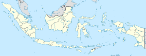
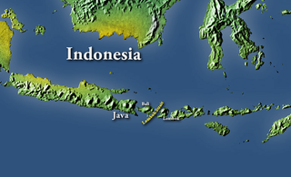
Lombok is an island in West Nusa Tenggara province, Indonesia. It forms part of the chain of the Lesser Sunda Islands, with the Lombok Strait separating it from Bali to the west and the Alas Strait between it and Sumbawa to the east. It is roughly circular, with a "tail" to the southwest, about 70 kilometres across and a total area of about 4,738.65 square kilometres including smaller offshore islands. The provincial capital and largest city on the island is Mataram.

Sumbawa is an Indonesian island, located in the middle of the Lesser Sunda Islands chain, with Lombok to the west, Flores to the east, and Sumba further to the southeast. Along with Lombok, it forms the province of West Nusa Tenggara, but there have been plans by the Indonesian government to split the island off into a separate province. Traditionally, the island is known as the source of sappanwood, as well as honey and sandalwood. Its savanna-like climate and vast grasslands are used to breed horses and cattle, as well as to hunt deer.
The Lombok Strait, is a strait connecting the Java Sea to the Indian Ocean, and is located between the islands of Bali and Lombok in Indonesia. The Gili Islands are on the Lombok side.

West Nusa Tenggara is a province of Indonesia. It comprises the western portion of the Lesser Sunda Islands, with the exception of Bali which is its own province. Mataram, on Lombok, is the capital and largest city of the province. The 2010 census recorded the population at 4,500,212; the total rose to 4,830,118 at the 2015 census and 5,320,092 at the 2020 census; the official estimate as at mid 2021 was 5,390,000. The province's area is 20,153.15 km2. The two largest islands by far in the province are Lombok in the west and the larger Sumbawa island in the east.
Mataram is a city and the capital of the Indonesian province of West Nusa Tenggara. The city is surrounded on all the landward sides by West Lombok Regency and lies on the western side of the island of Lombok, Indonesia. It is also the largest city of the province, and had a population of 402,843 at the 2010 Census and 429,651 at the 2020 Census.

The Gili Islands are an archipelago of three small islands or Gili island triplets — Gili Trawangan, Gili Meno and Gili Air — just off the northwest coast of Lombok, Indonesia.

Bima is a city on the eastern coast of the island of Sumbawa in central Indonesia's province West Nusa Tenggara. It is the largest city on the island of Sumbawa, with a population of 142,443 at the 2010 census and 155,140 at the 2020 census; the official estimate as at mid 2021 was 156,224. It is separate from the adjoining Regency of Bima which had a population of 520,444 according to the mid 2021 official estimates..
The climate of Indonesia is almost entirely tropical. The uniformly warm waters that make up 81% of Indonesia's area ensure that temperatures on land remain fairly constant, with the coastal plains averaging 28 °C (82 °F), the inland and mountain areas averaging 26 °C (79 °F), and the higher mountain regions, 23 °C (73 °F). Temperature varies little from season to season, and Indonesia experiences relatively little change in the length of daylight hours from one season to the next; the difference between the longest day and the shortest day of the year is only forty-eight minutes. This allows crops to be grown all year round.

Sumbawa Besar is a town on the Indonesian island of Sumbawa, and is the second-biggest settlement on the island after Bima. It is the administrative capital of the Sumbawa Regency within the province of West Nusa Tenggara, and has a population of 56,337 inhabitants as of the 2010 census and 62,753 at the 2020 Census.

East Lombok Regency is a regency of the Indonesian Province of West Nusa Tenggara. It is located on the island of Lombok, of which it comprises the eastern third ; the administrative capital is the town of Selong. The Regency covers an area of 1,605.55 km2 and had a population of 1,105,582 at the 2010 Census and 1,325,240 at the 2020 Census; the official estimate as at mid 2021 was 1,343,901.

Central Lombok Regency is a regency of the Indonesian Province of West Nusa Tenggara. It is located on the island of Lombok and the capital is Praya. It covers an area of 1,208.39 km2, and had a population of 859,309 at the 2010 census and 1,034,859 at the 2020 census; the official estimate as at mid 2021 was 1,049,710.

Praya is the capital town of Central Lombok Regency on Lombok Island in the province of West Nusa Tenggara, Indonesia. It has an area of 61.26 square kilometres (23.65 sq mi) and a population of 125,890 people at the 2020 Census. It is a predominantly Muslim town, with minorities of Balinese inhabitants following Hinduism and Chinese inhabitants following Buddhism or Christianity.

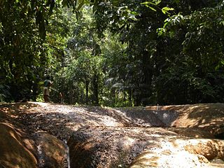
The Lesser Sundas deciduous forests is a tropical dry forest ecoregion in Indonesia. The ecoregion includes the islands of Lombok, Sumbawa, Komodo, Flores, and Alor, along with the many adjacent smaller islands.

Lombok International Airport,, also known as Zainuddin Abdul Madjid International Airport, is an international airport on the island of Lombok in Indonesia. It is the island's only fully operational airport.

Gendang beleq is a dance and music performance from Lombok island, Indonesia. It is a popular performance among the native Sasak people.
Gerung is a town on the island of Lombok and is also the capital of the West Lombok Regency in the Indonesian province West Nusa Tenggara.

Introduced to Indonesia in 1930s, surfing now attracts both Indonesian and foreign surfers to numerous locations across the nation.
The Telaga Waja is a river which is situated in eastern Bali, Indonesia. It rises on the slope of Mount Abang and passes through towns and wilderness slopes along the region of Rendang Village, reaching the sea in Klungkung Regency.

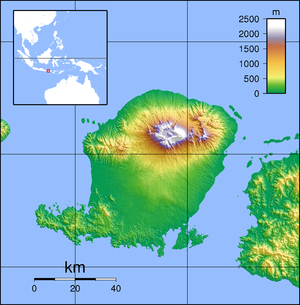
In 1257, a catastrophic eruption occurred at the Samalas volcano on the Indonesian island of Lombok. The event had a probable Volcanic Explosivity Index of 7, making it one of the largest volcanic eruptions during the current Holocene epoch. It left behind a large caldera that contains Lake Segara Anak. Later volcanic activity created more volcanic centres in the caldera, including the Barujari cone, which remains active.

Gendang Beleq dance is a sacred folk dance tradition of Sasak people of Lombok in West Nusa Tenggara, Indonesia. This dance demonstrates dance performance with big drums, called gendang beleq.