In 1901 the population of the civil parish was 527,[1] decreasing to 473 in 2001,[2] and decreasing further to 434 at the 2011 census.[3] The parish is surrounded clockwise from the north by the parishes of Blackawton, Strete, Stokenham and East Allington.[4]
History
Slapton was recorded in the Domesday Book of 1086 as Sladone.[5] The Collegiate Chantry of St Mary was founded in 1372 or 1373 by Sir Guy de Brian.[6] The Tower Inn and West tower remain and the tower has been designated by English Heritage as a grade I listed building.[7] The Church of St James dates from the late 13th or early 14th century, and is also grade I listed.[8]
A gold quarter noble coin of Edward III, dating from c.1363– c.1369, found in Slapton in 2015
The nearby beach is a coastal bar (see below), known as Slapton Sands. After Lalla Rookh, a tea clipper, was wrecked at Prawle Point in March 1873, some of her cargo of tea and tobacco,[10] heaped up to 11 feet (3.4m) high in places, as well as pieces of wreckage, were washed up on Slapton Sands.[11] The beach itself is not sand, but consists of small smooth pebbles ranging in size from ¼ inch to several inches.
In 1944, during World War II, it was part of the site of Exercise Tiger, a rehearsal for the Invasion of Normandy which was attacked by German E-Boats and also saw a large number of friendly fire deaths. An M4A1 Sherman tank that was sunk in this action has been recovered and now stands on the road behind the beach at nearby Torcross.[12] A stone memorial presented by the United States Army to the residents of South Hams also commemorates those who participated in the practice area for the Invasion of Normandy.[13] The monument is accompanied by two flag poles either side.[14] Part of Exercise Fabius took place a week after Exercise Tiger on Slapton Sands.
The stone memorial at Slapton Sands, presented by the US Army
Geography and environmental importance
Aerial view of Slapton Sands, showing the car park and Slapton Ley.
Behind Slapton Sands is Slapton Ley, a nature reserve and example of serial or ecological succession— the process whereby open water becomes reed bed and eventually, as silt and leaf litter builds up, woodland. The beach itself is a bar: the material that makes up the beach was pushed up by the rising sea levels during the Flandriantransgression after the last glacial period (from 10,000 to 5,000 years ago). A similar process formed Chesil Beach.[15]
Beaches formed like this are reworked by coastal processes now but are not supplied by enough material to recreate them, should material be removed. This had terrible consequences nearby at Hallsands where most of the beach was removed as building material for Devonport dockyards, leaving the village exposed to storms. It was struck by a storm in 1917 and most of the village was washed away, although no villagers were killed.[16]
Further north, the beach is known as Strete Gate and at the northernmost end is Pilchard Cove. The southern end of the beach is known as Torcross Sands. A length of beach about 100 metres (110yd) south of Pilchard Cove is regularly used by naturists.[17][lower-alpha 1]
↑ Clarkson, Steve (June 2016). "Start Point Project"(PDF). Retrieved 28 January 2021. This Start Point project documents the research carried out by the teamon the inshore shipwrecks on the South Devon coast. It covers the area between Start Point and Prawle Point
The South West Coast Path is England's longest waymarked long-distance footpath and a National Trail. It stretches for 630 miles (1,014 km), running from Minehead in Somerset, along the coasts of Devon and Cornwall, to Poole Harbour in Dorset. Because it rises and falls with every river mouth, it is also one of the more challenging trails. The total height climbed has been calculated to be 114,931 ft (35,031 m), almost four times the height of Mount Everest. It has been voted 'Britain's Best Walking route' twice in a row by readers of The Ramblers' Walk magazine, and regularly features in lists of the world's best walks.
South Hams is a local government district on the south coast of Devon, England. Its council is based in the town of Totnes, although the largest town is Ivybridge. The district also contains the towns of Dartmouth, Kingsbridge and Salcombe and numerous villages and surrounding rural areas.
Exercise Tiger, or Operation Tiger, was one of a series of large-scale rehearsals for the D-Day invasion of Normandy, which took place in April 1944 on Slapton Sands in Devon. Coordination and communication problems resulted in friendly fire injuries during the exercise, and an Allied convoy positioning itself for the landing was attacked by E-boats of Nazi Germany's Kriegsmarine, resulting in the deaths of at least 749 American servicemen.
South Pool is a village, parish and former manor in South Hams, Devon, England. It is situated 3 1/2 miles south-east of the town of Kingsbridge and 2 1/2 miles north-east of Salcombe. It is administered by the South Hams local authority. Historically it formed part of Coleridge Hundred. It falls within Woodleigh Deanery for ecclesiastical purposes. The village is in an area of outstanding natural beauty at the head of South Pool creek.
Hallsands is a village and beach in south Devon, England, in a precarious position between cliffs and the sea, between Beesands to the north and Start Point to the south.
Braunton Burrows is a sand dune system on the North Devon coast. It is privately owned and forms part of the Christie Devon Estates Trust. Braunton Burrows is a prime British sand dune site, the largest sand dune system (psammosere) in England. It is particularly important ecologically because it includes the complete successional range of dune plant communities, with over 470 vascular plant species. The short turf communities are very rich in lichens and herbs, and the dune slacks are also rich. The many rare plants and animals include 14 with UK Biodiversity Action Plans. For example, this is one of only two sites in the UK for the Amber Sandbowl Snail Catinella arenaria, which is found on the wet dune slacks.
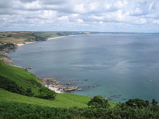
Start Bay is a sub-bay of the nautical definition of Lyme Bay in the English Channel in south-east Devon, England. The southernmost of three substantial Devon bays facing east it is between the Mew Stone which sits east of the River Dart's estuary and Start Point near the southernmost point of the county, Prawle Point. Along it, from south to north, are Hallsands, Beesands, Torcross, Slapton Sands, Strete, Blackpool Sands and Stoke Fleming. The South West Coast Path is above much of the bay. Its north end is 1.5 miles (2.4 km) south of Dartmouth; its middle is 4 miles (6.4 km) east of Kingsbridge.
Gunwalloe is a coastal civil parish in Cornwall, England, United Kingdom. It is situated on the Lizard Peninsula three miles (4.8 km) south of Helston and partly contains The Loe, the largest natural freshwater lake in Cornwall. The parish population including Berepper at the 2011 census was 219. The hamlets in the parish are Chyanvounder, Berepper and Chyvarloe. To the east are the Halzephron cliffs and further east the parish church.
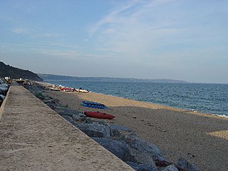
Portreath is a civil parish, village and fishing port on the north coast of Cornwall, England, United Kingdom. The village is about three miles (5 km) west-north-west of Redruth. The village extends along both sides of a stream valley and is centred on the harbour and beach. West of the harbour entrance and breakwater are two sandy beaches that are popular with holidaymakers, surfers and naturists.
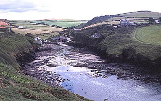
Slapton Ley is a lake on the south coast of Devon, England, separated from Start Bay by a shingle beach, known as Slapton Sands.
Torcross is a seaside village in the South Hams district of south Devon in England. It stands at grid reference SX822420 at the southern end of Slapton Sands, a narrow strip of land and shingle beach which separates the freshwater lake of Slapton Ley from Start Bay and carries the A379 coastal road north to Dartmouth.
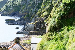
Port Quin grid reference SW971805 is a small cove and hamlet between Port Isaac and Polzeath in north Cornwall, England.
East Allington is a village and civil parish in the South Hams district of Devon, England, three miles (5 km) south of Halwell and just off the A381 road. It lies about three miles (5 km) from Kingsbridge and about ten miles (16 km) from Totnes. The coast at Slapton Sands is about five miles (8 km) to the south-east. Also in the parish is the hamlet of The Mounts, about one mile (1.6 km) away.
Beesands is a small settlement located midway between Hallsands and Torcross on the coast of Start Bay in South Devon, England. It is best known as a tourist destination, but is still a fishing village that concentrates mainly on crab and lobster fishing through Britannia Fisheries. There is an Anglican chapel dedicated to St Andrew in the village. Behind the beach, north of the settlement is a freshwater lake known as Beesands Ley, smaller but similar in ecology to Slapton Ley about a kilometre to the north.
Stokenham is a village and civil parish in the South Hams district, in the county of Devon, England. The population of the parish at the 2011 census was 1,895.
East Prawle is a village in Chivelstone parish in the South Hams district of Devon, England. It is situated on the coast south east of Salcombe, near the most southerly tip of Devon, Prawle Point.
Strete is a coastal village and civil parish in the South Hams district of Devon, England, on the coast of Start Bay, within the South Devon Area of Outstanding Natural Beauty.
Chivelstone is a village and civil parish in Devon, England. The parish contains the villages of East Prawle and South Allington as well as the hamlets of Ford and Lannacombe. The population of the parish taken at the 2011 census was 280.
This page is based on this Wikipedia article Text is available under the CC BY-SA 4.0 license; additional terms may apply. Images, videos and audio are available under their respective licenses.