
Forsyth County is located in the northwest Piedmont of the U.S. state of North Carolina. As of the 2020 census, the population was 382,590, making it the fourth-most populous county in North Carolina. Its county seat is Winston-Salem. Forsyth County is part of the Winston-Salem, NC, Metropolitan Statistical Area, which is also included in the Greensboro–Winston-Salem–High Point, NC, Combined Statistical Area. Portions of Forsyth County are in the Yadkin Valley wine region.

Rural Hall is a town in Forsyth County, North Carolina, United States. It is a part of the Piedmont Triad. The population was 3,360 at the 2020 census. The town has one public park: Covington Memorial Park.
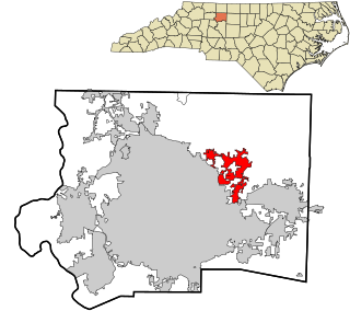
Walkertown is a town in Forsyth County, North Carolina, United States and a rural area outside of Winston-Salem. It is part of the Piedmont Triad. The population was 5,695 at the 2020 census.
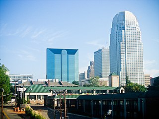
Winston-Salem is a city in and the county seat of Forsyth County, North Carolina, United States. In the 2020 census, the population was 249,545, making it the second-largest municipality in the Piedmont Triad region, the fifth-most populous city in North Carolina, and the 90th-most populous city in the United States. Winston-Salem is home to the tallest office building in the region, 100 North Main Street, formerly known as the Wachovia Building and now known locally as the Wells Fargo Center.

The Piedmont Triad is a metropolitan region in the north-central part of the U.S. state of North Carolina anchored by three cities: Greensboro, Winston-Salem, and High Point. This close group of cities lies in the Piedmont geographical region of the United States and forms the basis of the Greensboro–Winston-Salem–High Point, NC Combined Statistical Area. As of 2012, the Piedmont Triad has an estimated population of 1,611,243 making it the 33rd largest combined statistical area in the United States.
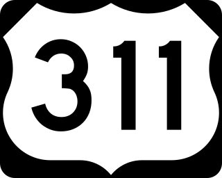
U.S. Route 311 is a United States highway that runs for 62 mi (100 km) from Winston-Salem, North Carolina to near Danville, Virginia. It connects the cities of Winston-Salem, Madison, and Eden. The route runs northeast from Winston-Salem to Danville. By the numbering convention, it is an auxiliary route of US 11, however except for a brief period shortly after the route was established, it has not connected to its parent route.

U.S. Route 421 is a diagonal northwest–southeast United States Numbered Highway in the states of North Carolina, Tennessee, Virginia, Kentucky, and Indiana. The highway runs for 941 miles (1,514 km) from Fort Fisher, North Carolina, to US 20 in Michigan City, Indiana. Along its routing, US 421 serves several cities including Wilmington, North Carolina; Greensboro, North Carolina; Bristol, Tennessee and Virginia; Lexington, Kentucky; and Indianapolis, Indiana. US 421 is a spur route of US 21, which it meets west of Yadkinville, North Carolina.

Interstate 285 (I-285) is a 23.49 mile long auxilary interstate highway connecting the cities of Lexington and Winston-Salem, in the U.S state of North Carolina. The route was approved in February 2018 and was first signed in November 2018. An auxiliary route of I-85, it branches off of its parent route and runs northeast, bypassing central Lexington, before turning due north and heading toward Winston-Salem, terminating at an interchange with I-40. I-285 is cosigned with US Highway 52 (US 52) for its entire route, and as of November 2018, still uses US 52 milemarkers and exit numbers. Other routes cosigned along parts of the route include I-85 Business, US 29, US 70, and North Carolina Highway 8 (NC 8). I-285 has been approved for an extension along the US 52 freeway through Winston-Salem to meet the future Winston-Salem Northern Beltway.
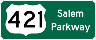
The Salem Parkway is an 18.5-mile-long (29.8 km) freeway in the U.S. state of North Carolina, serving the city of Winston-Salem and the town of Kernersville. It is signed as U.S. Route 421 (US 421) for its entire length, though it is also concurrent with US 158 in downtown Winston-Salem and North Carolina Highway 150 (NC 150) between Winston-Salem and Kernersville. Originally known as the East–West Expressway, it was designated as part of Interstate 40 (I-40) and opened in 1958, becoming the first section of Interstate Highway in the state. I-40 was rerouted onto a new alignment bypassing Winston-Salem and Kernersville in 1992, at which time the road was designated Interstate 40 Business, nicknamed Business 40.
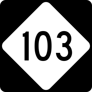
North Carolina Highway 103 (NC 103) is a primary state highway in the U.S. state of North Carolina. It runs entirely in Surry County. It connects the city of Mount Airy with the northern end of Surry County and Virginia State Route 103 (SR 103). A 6-mile (9.7 km) segment of the highway is known as the Donna Fargo Highway, named to honor a local country music star.

North Carolina Highway 67 (NC 67) is a 40.9-mile-long (65.8 km) primary state highway in the U.S. state of North Carolina. The highway travels through Yadkin and Forsyth Counties between its western terminus at U.S. Route 21 Business in Jonesville and NC 150 in Winston-Salem. NC 67 primarily follows an east–west alignment and connects the towns of Jonesville, Boonville, and East Bend, along with the city of Winston-Salem.

North Carolina Highway 8 (NC 8) is a primary state highway in the U.S. state of North Carolina. The route connects the cities of Lexington and Winston-Salem to various recreational and natural sites including Uwharrie National Forest, High Rock Lake and Hanging Rock State Park.
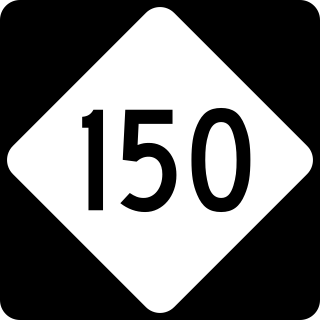
North Carolina Highway 150 (NC 150) is a primary state highway in the U.S. state of North Carolina. It serves the Foothills and Piedmont Triad areas of the state, connecting the cities of Shelby, Mooresville, Salisbury and Winston-Salem.
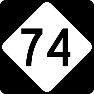
The Winston-Salem Northern Beltway is a partially completed freeway loop around the city of Winston-Salem in North Carolina. The western section has been designated as North Carolina Highway 452 (NC 452), which will become I-274 when completed, and the eastern section of the beltway will be designated as North Carolina Highway 74 (NC 74), which will become part of I-74 when completed. The entire route is in Forsyth County.
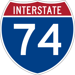
Interstate 74 (I-74) is a partially completed part of the Interstate Highway System that is planned to run from Davenport, Iowa, to Myrtle Beach, South Carolina. In the US state of North Carolina, I-74 currently exists in three distinct segments; from I-77 at the Virginia state line to US Highway 52 (US 52) near Mount Airy, from I-40 in Winston-Salem to US 220 near Ellerbe, and from US 74 and US 74 Business near Maxton to US 74/North Carolina Highway 41 (NC 41) near Lumberton. I-74 has an extensive concurrency with I-73 from Randleman to Ellerbe in the Piedmont. When completed, I-74 will link the cities of Mount Airy, Winston-Salem, High Point, Rockingham, Laurinburg, and Lumberton.
U.S. Route 421 (US 421) is part of the United States Numbered Highway System that runs from Fort Fisher, North Carolina to Michigan City, Indiana. In the U.S. state of North Carolina, US 421 travels 328 miles (528 km) from its southern terminus at Fort Fisher to the Tennessee state line near the community of Zionville, North Carolina. US 421 traverses the state from east to west travelling from the coastal plains to Appalachian Mountains. It provides an important connection between the cities of Wilmington, Sanford, Greensboro, Winston-Salem, and Boone. Despite being signed as north–south, much of the routing of US 421 in North Carolina runs in an east–west direction, particularly between Greensboro and the Tennessee state line. Portions of US 421 have been upgraded to freeway standards including the majority of its routing between Sanford and North Wilkesboro.

U.S. Route 52 (US 52) is a north–south United States highway that runs for 150 miles (240 km) from the South Carolina state line, near McFarlan, to the Virginia state line, near Mount Airy. It serves as a strategic highway through the central North Carolina Piedmont. Because of its alignment in the state, US 52 does not follow the standard convention of an even U.S. route number going east–west.
North Carolina Highway 210 is a 192-mile-long (309 km) primary state highway in the U.S. state of North Carolina that connects settlements in the Atlantic Coastal Plain region. Due to its meandering route NC 210 changes directional orientation twice, changing from east-west to north-south at Old Stage Road east of Angier, then changing from north-south to west-east at the Bladen–Pender county line. The route traverses through central Fayetteville and the Fort Liberty Army installation and crosses both Topsail Island access bridges over the Atlantic Intracoastal Waterway. Owing primarily to its meandering route, NC 210 is the sixth longest state highway in North Carolina.

North Carolina Highway 65 (NC 65) is a primary state highway in the U.S. state of North Carolina. Traveling east–west within the Piedmont Triad, it connects the towns of Rural Hall, Walnut Cove, Stokesdale and Wentworth with the city of Reidsville.
North Carolina Highway 66 (NC 66) is a 47.0-mile (75.6 km) North Carolina state highway that travels from Horneytown to Johnstown, connecting the towns and communities of eastern Forsyth and Stokes counties.

