Rural Hall, North Carolina

Last updated

Rural Hall, North Carolina
Rural Hall, North Carolina.jpg
Motto: 
"Garden Spot of the World"
Forsyth County North Carolina incorporated and unincorporated areas Rural Hall highlighted.svg
Location in Forsyth County and the state of North Carolina.
Coordinates: 36°13′31″N80°17′50″W / 36.22528°N 80.29722°W / 36.22528; -80.29722
Country United States
State North Carolina
County Forsyth
Area
[1]
  Total2.86 sq mi (7.41 km2)
  Land2.85 sq mi (7.39 km2)
  Water0.01 sq mi (0.02 km2)
Elevation
[2]
965 ft (294 m)
Population
 (2020)
  Total3,351
  Density1,174.96/sq mi (453.70/km2)
Time zone UTC-5 (Eastern (EST))
  Summer (DST) UTC-4 (EDT)
ZIP codes
27045
Area code 336
FIPS code 37-58360 [3]
GNIS feature ID2407257 [2]
Website www.ruralhall.com

Rural Hall is a town in Forsyth County, North Carolina, United States. It is a part of the Piedmont Triad. The population was 3,360 at the 2020 census. [4] The town has one public park: Covington Memorial Park.

Contents

Geography

Rural Hall is located in northern Forsyth County. It is bordered to the south by the city of Winston-Salem, and the village of Tobaccoville is to the west. Downtown Winston-Salem is 12 miles (19 km) to the south via North Carolina Highway 66 and U.S. Route 52.

According to the United States Census Bureau, the town of Rural Hall has a total area of 2.9 square miles (7.4 km2), of which 0.01 square miles (0.02 km2), or 0.32%, is water. [5]

Demographics

Historical population
CensusPop.Note
1980 1,336
1990 1,65223.7%
2000 2,46449.2%
2010 2,93719.2%
2020 3,36014.4%
2021 (est.)3,413 [4] 1.6%
U.S. Decennial Census [6]

2020 census

Rural Hall racial composition [7]
RaceNumberPercentage
White (non-Hispanic)2,01760.19%
Black or African American (non-Hispanic)67820.23%
Native American 140.42%
Asian 190.57%
Pacific Islander 20.06%
Other/Mixed 1885.61%
Hispanic or Latino 43312.92%

As of the 2020 United States census, there were 3,351 people, 1,360 households, and 857 families residing in the town.

2000 census

As of the census [3] of 2000, there were 2,464 people, 1,081 households, and 705 families residing in the town. The population density was 892.0 inhabitants per square mile (344.4/km2). There were 1,160 housing units at an average density of 420.0 per square mile (162.2/km2). The racial makeup of the town was 79.38% White, 12.26% African American, 0.20% Native American, 0.32% Asian, 0.12% Pacific Islander, 6.82% from other races, and 0.89% from two or more races. Hispanic or Latino of any race were 8.32% of the population.

There were 1,081 households, out of which 27.8% had children under the age of 18 living with them, 49.5% were married couples living together, 12.1% had a female householder with no husband present, and 34.7% were non-families. 30.5% of all households were made up of individuals, and 12.0% had someone living alone who was 65 years of age or older. The average household size was 2.28 and the average family size was 2.83.

In the town, the population was spread out, with 22.6% under the age of 18, 8.4% from 18 to 24, 29.9% from 25 to 44, 23.8% from 45 to 64, and 15.4% who were 65 years of age or older. The median age was 39 years. For every 100 females, there were 92.3 males. For every 100 females age 18 and over, there were 88.2 males.

The median income for a household in the town was $36,477, and the median income for a family was $46,116. Males had a median income of $31,939 versus $26,435 for females. The per capita income for the town was $19,593. About 6.6% of families and 8.9% of the population were below the poverty line, including 10.9% of those under age 18 and 9.8% of those age 65 or over.

History

The earliest settler was Anthony Bitting (1738-1804), who was born in Pennsylvania to a German American family. In the 1770s he moved from Bucks County to Maryland, then to southern Virginia. He supplied material to the Continental Army and may have participated in the battle of Guilford Court House. His descendants still live in the county. His grandson, Benjamin Lewis Bitting (1832-1922), built the house that gave Rural Hall its name.

Another early settler was Johann Adam Geiger (Kiger) who donated 102 acres (0.41 km2) to the Nazareth Evangelical Lutheran Church, which still serves the community today. The town developed after the Cape Fear & Yadkin Valley Railroad erected a station in 1887. [8]

Rural Hall now is the operational center of the Yadkin Valley Railroad, and many of the Yadkin Valley locomotives can be found idling there when not working.

The Rural Hall Depot was listed on the National Register of Historic Places in 1983. [9]

Related Research Articles

<span class="mw-page-title-main">Yadkin County, North Carolina</span> County in North Carolina, United States

Yadkin County is located in the U.S. state of North Carolina. As of the 2020 census, the population was 37,214. Its county seat is Yadkinville. Yadkin County is included in the Winston-Salem, NC Metropolitan Statistical Area, which is also included in the Greensboro–Winston-Salem–High Point, NC Combined Statistical Area.

<span class="mw-page-title-main">Stokes County, North Carolina</span> County in North Carolina, United States

Stokes County is a county located in the U.S. state of North Carolina. As of the 2020 census, the population was 44,520. Its county seat is Danbury.

<span class="mw-page-title-main">Forsyth County, North Carolina</span> County in North Carolina, United States

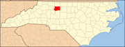
Forsyth County is located in the northwest Piedmont of the U.S. state of North Carolina. As of the 2020 census, the population was 382,590, making it the fourth-most populous county in North Carolina. Its county seat is Winston-Salem. Forsyth County is part of the Winston-Salem, NC, Metropolitan Statistical Area, which is also included in the Greensboro–Winston-Salem–High Point, NC, Combined Statistical Area. Portions of Forsyth County are in the Yadkin Valley wine region.

<span class="mw-page-title-main">Davie County, North Carolina</span> County in North Carolina, United States

Davie County is a county located in the U.S. state of North Carolina. As of the 2020 census, the population was 42,712. Its county seat is Mocksville.

<span class="mw-page-title-main">Goldston, North Carolina</span> Town in North Carolina, United States

Goldston is a town in Chatham County, North Carolina, United States, south of Pittsboro. The population was 268 at the 2010 census.

Bermuda Run is a town in Davie County, North Carolina, United States. As of the 2020 census, the population of the town was 3,120. It was incorporated in 1999 as a fully gated residential community near country clubs and golf courses like the Bermuda Run Country Club, Oak Valley Golf Club, and Tanglewood Park. In 2000, the town annexed into neighboring Hillsdale, picking up a commercial district. The town rests on the western bank of the Yadkin River along U.S. Route 158 and North Carolina Highway 801. Interstate 40 provides express access to Winston-Salem, the town's nearest urban center. In 2012, Kinderton Village was voluntarily annexed by the town of Bermuda Run. Bermuda Run is considered by the locals to be a mid-high class community and the second-most influential, behind nearby Oak Valley.

<span class="mw-page-title-main">Bethania, North Carolina</span> Town in North Carolina, United States

Bethania is the oldest municipality in Forsyth County, North Carolina, United States, and was most recently incorporated in 1995, upon the reactivation of the original 1838/1839 town charter. In 2009, Bethania celebrated the 250th anniversary of its establishment in 1759. As of the 2020 census, the town population was 341.

<span class="mw-page-title-main">Clemmons, North Carolina</span> Village in North Carolina

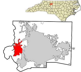
Clemmons is a village in Forsyth County, North Carolina, United States and a suburb of Winston-Salem. The population was 21,177 at the 2020 census, with an estimated population of 21,517 in 2021.

<span class="mw-page-title-main">Lewisville, North Carolina</span> Town in North Carolina, United States

Lewisville is a town in Forsyth County, North Carolina, United States. The population was 13,388 at the 2020 census, up from 12,639 in 2010. It is a Piedmont Triad community.

<span class="mw-page-title-main">Walkertown, North Carolina</span> Town in North Carolina, United States

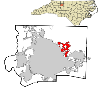
Walkertown is a town in Forsyth County, North Carolina, United States and a rural area outside of Winston-Salem. It is part of the Piedmont Triad. The population was 5,695 at the 2020 census.

<span class="mw-page-title-main">Stokesdale, North Carolina</span> Town in North Carolina, United States

Stokesdale is a town in Guilford County, North Carolina, United States with small parts in the counties of Rockingham, Forsyth, and Stokes. The population was 5,924 at the 2020 census. Belews Lake is located nearby, and North Carolina Highway 68 and North Carolina Highway 65 both intersect U.S. Route 158 near the town's center.

<span class="mw-page-title-main">Roseboro, North Carolina</span> Town in North Carolina, United States

Roseboro is a town in Sampson County, North Carolina, United States. The population was 1,163 at the 2020 census.

<span class="mw-page-title-main">Badin, North Carolina</span> Town in North Carolina, United States

Badin is a town located in Stanly County, North Carolina, United States. At the 2010 census, the town had a total population of 1,974.

<span class="mw-page-title-main">Dobson, North Carolina</span> Town in North Carolina, United States

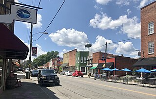
Dobson is a town in Dobson Township, Surry County, North Carolina, United States. As of the 2020 census, the town population was 1,396. It is the county seat of Surry County. Dobson is the home of the Shelton Vineyards, the largest winery in North Carolina. It is also home to a significant Latino population due to the large number of farms in the area. The main crops in the area are corn, tobacco and soy beans.

<span class="mw-page-title-main">Pilot Mountain, North Carolina</span> Town in North Carolina, United States

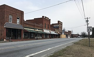
Pilot Mountain is a town in Surry County, North Carolina, United States. The population was 1,443 at the 2020 census. It is named for the nearby landmark of Pilot Mountain, a distinctive geological formation.

<span class="mw-page-title-main">Ronda, North Carolina</span> Town in North Carolina, United States

Ronda is a town in Wilkes County, North Carolina, United States. The population was 417 at the 2010 census, and 413 at the 2020 census. Ronda was named after a nearby estate called "Roundabout", which was the residence of Benjamin Cleveland, a locally prominent planter and a colonel in the North Carolina militia during the Revolutionary War. The town is home to East Wilkes High School, one of Wilkes County's five public high schools.

<span class="mw-page-title-main">Boonville, North Carolina</span> Town in North Carolina, United States

Boonville is a town in Yadkin County, North Carolina, United States. The population was 1,222 at the 2010 census.

<span class="mw-page-title-main">East Bend, North Carolina</span> Town in North Carolina, United States

East Bend is a town in northeastern Yadkin County, North Carolina, United States. The population is 634 at the 2020 census. It is a Piedmont Triad community.

<span class="mw-page-title-main">Yadkinville, North Carolina</span> Town in North Carolina, United States

Yadkinville is a town in Yadkin County, North Carolina, United States. The population was 2,995 at the 2020 census. Located in the Piedmont Triad, it is the county seat and most populous city of Yadkin County.

<span class="mw-page-title-main">Tobaccoville, North Carolina</span> Village in North Carolina, United States

Tobaccoville is a village in Forsyth and Stokes counties in the U.S. state of North Carolina. The population was 2,209 at the 2020 census. While a Tobaccoville post office was established in 1879, the village was not incorporated until 1991, as a defense against forced annexation of the area by the nearby city of King.

References

  1. "ArcGIS REST Services Directory". United States Census Bureau. Retrieved September 20, 2022.
  2. 1 2 U.S. Geological Survey Geographic Names Information System: Rural Hall, North Carolina
  3. 1 2 "U.S. Census website". United States Census Bureau . Retrieved January 31, 2008.
  4. 1 2 Bureau, US Census. "City and Town Population Totals: 2020-2021". Census.gov. US Census Bureau. Retrieved July 9, 2022.
  5. "Geographic Identifiers: 2010 Census Summary File 1 (G001), Rural Hall town, North Carolina". American FactFinder. U.S. Census Bureau. Archived from the original on February 13, 2020. Retrieved June 27, 2016.
  6. "Census of Population and Housing". Census.gov. Retrieved June 4, 2016.
  7. "Explore Census Data". data.census.gov. Retrieved December 20, 2021.
  8. Powell, William S. The North Carolina Gazetteer: A Dictionary of Tar Heel Places, Chapel Hill, NC: The University of North Carolina Press, 1968.
  9. "National Register Information System". National Register of Historic Places . National Park Service. July 9, 2010.