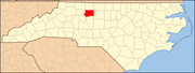
Forsyth County is located in the northwest Piedmont of the U.S. state of North Carolina. As of the 2020 census, the population was 382,590, making it the fourth-most populous county in North Carolina. Its county seat is Winston-Salem. Forsyth County is part of the Winston-Salem, NC, Metropolitan Statistical Area, which is also included in the Greensboro-Winston-Salem-High Point, NC, Combined Statistical Area. Portions of Forsyth County are in the Yadkin Valley wine region.
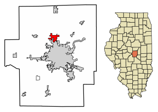
Forsyth is a village in Macon County, Illinois, United States whose population was 3,490 at the 2010 census, and 3,496 in 2018. It is included in the Decatur, Illinois Metropolitan Statistical Area pop. 109,456.

Red Oak is a city in, and the county seat of, Montgomery County, Iowa, United States, located along the East Nishnabotna River. The population was 5,362 in the 2020 census, a decline from the 6,197 population in 2000.

Murphy is a town in and the county seat of Cherokee County, North Carolina, United States. It is situated at the confluence of the Hiwassee and Valley rivers. It is the westernmost county seat in the state of North Carolina, approximately 360 miles (580 km) from the state capital in Raleigh. The population of Murphy was 1,627 at the 2010 census.

Rural Hall is a town in Forsyth County, North Carolina, United States. It is a part of the Piedmont Triad. The population was 3,360 at the 2020 census. The town has one public park: Covington Memorial Park.

Winston-Salem is a city and the county seat of Forsyth County, North Carolina, United States. In the 2020 census, the population was 249,545, making it the second-largest municipality in the Piedmont Triad region, the 5th most populous city in North Carolina, the third-largest urban area in North Carolina, and the 90th most populous city in the United States. With a metropolitan population of 679,948 it is the fourth largest metropolitan area in North Carolina. Winston-Salem is home to the tallest office building in the region, 100 North Main Street, formerly known as the Wachovia Building and now known locally as the Wells Fargo Center.

Selma is a town in Johnston County, North Carolina, United States. In 2010, the population was 6,073, and as of 2018 the estimated population was 6,913. Selma is part of the Raleigh-Durham-Cary Combined Statistical Area. The area has a population over 1.7 million residents, though the town of Selma is able to maintain its rural character. The Everitt P. Stevens House, located in Selma, was the site of the last Grand Review of the Confederate Army held on April 6, 1865, after its defeat at the Battle of Bentonville.

Old Fort is a town in McDowell County, North Carolina, United States. The population was 811 people in the 2020 U.S. Census.

Apex is a town in Wake County, North Carolina, United States. At its southern border, Apex encompasses the community of Friendship. In 1994, the downtown area was designated a historic district, and the Apex train depot, built in 1867, is designated a Wake County landmark. The depot location marks the highest point on the old Chatham Railroad, hence the town's name. The town motto is "The Peak of Good Living".
Wake Forest is a town in Franklin, Granville and Wake counties in the U.S. state of North Carolina; located almost entirely in Wake County, it lies just north of the state capital, Raleigh. At the 2020 census, the population was 47,601. That is up from 30,117 in 2010, up from 12,588 in 2000. The U.S. Census Bureau estimates the city's population to be 47,601 as of April 1, 2020. In 2007, the town was listed by Forbes magazine as the 20th fastest growing suburb in America, with a 73.2 percent increase in population between 2000 and 2006. Wake Forest was the original home of Wake Forest University for 122 years before it moved to Winston-Salem in 1956.

Gibsonville is a town in both Alamance and Guilford counties in the U.S. state of North Carolina. Most of Gibsonville is situated in the Greensboro-Winston-Salem-High Point Combined Statistical Area and the eastern portion is in the Burlington, North Carolina Metropolitan Statistical Area, encompassing all of Alamance County. According to the 2020 Census, the population of Gibsonville was 8,971.
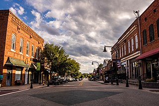
Thomasville is a city in Davidson County, North Carolina, United States. The population was 27,183 at the 2020 census. The city was once notable for its furniture industry, as were its neighbors High Point and Lexington. This Piedmont Triad community was established in 1852 and hosts the state's oldest festival, "Everybody's Day". Built around the local railway system, Thomasville is home to the oldest railroad depot in the state, just a few hundred feet from the city's most notable landmark, "The Big Chair".

Kernersville is a town in Forsyth County and the largest suburb of Winston-Salem. The town is located in the U.S. state of North Carolina. A small portion of the town is also in Guilford County. The population was 26,481 at the 2020 census, up from 23,123 in 2010. Kernersville is located at the center of the Piedmont Triad metropolitan area, between Greensboro to the east, High Point to the south, and Winston-Salem to the west. Some of the farmland surrounding the town has been sold and turned into large middle-to-upper-class housing developments.

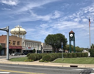
King is a city in Stokes and Forsyth counties, North Carolina, United States. The population was 7,096 at the 2020 census. King is part of the Piedmont Triad metropolitan area, located 15 miles northwest of Winston-Salem.

Lee Hall is an unincorporated town located in the extreme western portion of the independent city of Newport News in the Commonwealth of Virginia in the United States.
The Piedmont & Northern Railway was a heavy electric interurban company operating over two disconnected divisions in North and South Carolina. Tracks spanned 128 miles (206 km) total between the two segments, with the northern division running 24 miles (39 km) from Charlotte, to Gastonia, North Carolina, including a three-mile (5 km) spur to Belmont. The southern division main line ran 89 miles (143 km) from Greenwood to Spartanburg, South Carolina, with a 12 mi (19 km) spur to Anderson. Initially the railroad was electrified at 1500 volts DC, however, much of the electrification was abandoned when dieselisation was completed in 1954.

Barnesville is an unincorporated community in Ryan Township, Schuylkill County, Pennsylvania, United States. Originally built to support nearby rust belt industries, the hamlet is between the center and eastern thirds of the Southern Anthracite Coal Region. The community is part of a wide-ranging township and is situated atop a summit and drainage divide flanked by two long climbs that are traversed by local transport infrastructure, railways with an important switching junction within the village, and Pennsylvania Route 54, which collects towns like beads on a string along a particular combination of connected valleys in the Ridge-and-Valley Appalachians.

Santa Susana Depot is a train station building located near the Santa Susana Pass in Simi Valley, California. Originally located on Los Angeles Avenue at Tapo Street, the depot opened in 1903. The station was named after the Santa Susana Mountains at the east end of the Simi Valley. The Southern Pacific Railroad used the double-"N" spelling of Susanna on the depot sign facing west, and the single-"N" spelling of Susana on the sign facing east. The Santa Susana Tunnel opened the next year, reducing the distance and transit time between Montalvo and Burbank on the Coast Route linking Los Angeles and San Francisco. Plans and construction for the building were based on Southern Pacific Railroad standard design Two Story Combination Depot No. 22. The depot served the community of Rancho Simi as a passenger station, telegraph office, and freight depot where farmers could deliver crops for shipping and pick up farming equipment delivered by the railroad.
Lambsburg is an unincorporated community in Carroll County, Virginia, United States. Lambsburg is 10.4 miles (16.7 km) east-southeast of Galax. Lambsburg has a post office with ZIP code 24351. The community of Lambsburg Virginia has been around for a couple of hundred years. It was there when Hardin Taliaferro, pronounced "Tolliver" was growing up on Little Fish River in the 1820s: just across the state line in Surry County, North Carolina. Lambsburg was then called "The Hawks Settlement": later called Rocksburg, and still, later, it became Lambsburg.