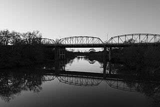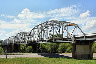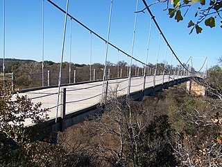
Llano County is a county located on the Edwards Plateau in the U.S. state of Texas. As of the 2020 census, its population was 21,243. Its county seat is Llano, and the county is named for the Llano River.

Burnet County is a county located on the Edwards Plateau in the U.S. state of Texas. As of the 2020 census, its population was 49,130. Its county seat is Burnet. The county was founded in 1852 and later organized in 1854. It is named for David Gouverneur Burnet, the first (provisional) president of the Republic of Texas. The name of the county is pronounced with the emphasis or accent on the first syllable, just as is the case with its namesake.

Burnet is a city in and the county seat of Burnet County, Texas, United States. Its population was 6,436 at the 2020 census.

Buchanan Dam is a census-designated place (CDP) in Llano County, Texas, United States. The population was 1,519 at the 2010 census, down from 1,688 at the 2000 census.

Llano is a city in Llano County, Texas, United States. As of 2010, the city population was 3,232. It is the county seat of Llano County. Llano has been described as the "deer capital of Texas", with the single highest density of white-tailed deer in the United States.

The Colorado River is an approximately 862-mile (1,387 km) long river in the U.S. state of Texas. It is the 11th longest river in the United States and the longest river with both its source and its mouth within Texas.

Lake Lyndon B. Johnson is a reservoir on the Colorado River in the Texas Hill Country about 45 miles northwest of Austin. The reservoir was formed in 1950 by the construction of Granite Shoals Dam by the Lower Colorado River Authority (LCRA). The Colorado River and the Llano River meet in the northern portion of the lake at Kingsland.

Lake Buchanan was formed by the construction of Buchanan Dam by the Lower Colorado River Authority to provide a water supply for the region and to provide hydroelectric power. Buchanan Dam, a structure over 2 mi (3.2 km) in length, was completed in 1939. Lake Buchanan was the first of the Texas Highland Lakes to be formed, and with 22,333 acres of surface water, it is also the largest. The surface of the lake includes area in both Burnet and Llano Counties. The lake is west of the city of Burnet, Texas.

The following is an alphabetical list of articles related to the U.S. state of Texas.

The Rainbow Bridge is a through truss bridge crossing the Neches River in Southeast Texas just upstream from Sabine Lake. It allows State Highway 87 and State Highway 73 to connect Port Arthur in Jefferson County on the southwest bank of the river. Bridge City in Orange County is on the northeast bank.
These historic properties and districts in the state of Texas are listed in the National Register of Historic Places. Properties and/or districts are listed in most of Texas's 254 counties.

The Colorado River Bridge at Bastrop is a 1,285-foot (392 m)-long bridge with three steel truss spans and concrete piers that crosses the Colorado River as part of Loop 150 through Bastrop, Texas. The three bridge spans over the river consist of identical Parker through trusses, each 192 feet (59 m) in length, supported on concrete piers. The bridge is one of the earliest surviving uses of the Parker truss in Texas.

The Austin–Round Rock–San Marcos metropolitan statistical area, or Greater Austin, is a five-county metropolitan area in the U.S. state of Texas, as defined by the Office of Management and Budget. The metropolitan area is situated in Central Texas on the western edge of the American South and on the eastern edge of the American Southwest, and borders Greater San Antonio to the south.

The Lamar Boulevard Bridge is a historic arch bridge carrying Texas State Highway Loop 343 over Lady Bird Lake in downtown Austin, Texas, United States. The bridge features six open-spandrel concrete arches spanning 659 feet (201 m) and carries tens of thousands of vehicles daily across the lake. Completed in 1942, the Lamar Boulevard Bridge was the second permanent bridge to cross the Colorado River, and one of the last Art Deco-style open-spandrel concrete arch bridges built in Texas. The bridge was named an Austin Landmark in 1993 and added to the National Register of Historic Places in 1994.

The Antlers Hotel is a hotel and resort built in 1901 by the Austin and Northwestern Railroad on the Colorado River in Kingsland in Llano County in Central Texas. After a brief heyday, The Antlers closed in 1923 and fell into disrepair. It was eventually resurrected by a couple from Austin and reopened in 1996. It was listed on the National Register of Historic Places in 1997 as part of the Austin and Northwestern Railroad Historic District-Fairland to Llano historic district.

The Southern Hotel in Llano, Texas was erected circa 1881 by stonemasons J. K. Finlay and John Goodman in the Second Empire style for owner J.W. Owen. The hotel was built as a stagecoach stop between Mason and Burnet, later serving as a hotel and a boarding house. Originally only a two-story building, a third floor was added when Colonel W.A.H. Miller bought the hotel in 1883. It was later renamed the Colonial Inn and ceased operations in the 1950s.

The Montopolis Bridge is a historic Parker through truss bridge in Austin, Texas. It is located in the Montopolis neighborhood where a bicycle and pedestrian walkway crosses the Colorado River in southeastern Travis County. The bridge consists of five 200-foot Parker through truss spans and four 52-foot steel I-beam approach spans resting on reinforced concrete abutments. It was added to the National Register of Historic Places on October 10, 1996.

The Pittsburgh-Des Moines Steel Company, and often referred to as Pitt-Des Moines Steel or PDM was an American steel fabrication company. It operated from 1892 until approximately 2002 when its assets were sold to other companies, including Chicago Bridge & Iron Company. The company began as a builder of steel water tanks and bridges. It also later fabricated the "forked" columns for the World Trade Center in the 1960s, and was the steel fabricator and erector for the Gateway Arch in St. Louis. A number of its works are listed on the National Register of Historic Places.

Park Road 4 (PR 4) is a 15.5-mile-long (24.9 km) park road in western Burnet County, Texas that travels through and provides access to Longhorn Cavern State Park and Inks Lake State Park. The highway connects State Highway 29 (SH 29) to U.S. Route 281 (US 281). The highway was constructed between 1934 and 1942 by the Civilian Conservation Corps (CCC), Works Progress Administration (WPA) and Texas State Highway Department (TSHD).

Austin Bridge Company was a bridge company based in Dallas, Texas. It fabricated and built a number of bridges that are listed on the U.S. National Register of Historic Places. It eventually became part of Austin Industries.


