Surathkal

Last updated

Surathkal
ಸುರತ್ಕಲ್
Neighbourhood/Suburb
Surathkal.JPG
Surathkal Railway Station
India Karnataka location map.svg
Red pog.svg
Surathkal
Location in Karnataka, India
Coordinates: 12°58′10″N74°46′45″E / 12.96932°N 74.77915°E / 12.96932; 74.77915
CountryFlag of India.svg  India
State Karnataka
District Dakshina Kannada
City Mangalore
Region Tulu Nadu
Elevation
24 m (79 ft)
Population
  Total61,259
Languages
  Official Kannada
  RegionalKannada, Tulu, Beary, Konkani
Time zone UTC+5:30 (IST)
PIN
575014
Telephone code0824

Surathkal is one of the major localities [1] in the northern part of Mangalore city located on National highway 66 (previously as NH-17) in the Dakshina Kannada district, Karnataka state, India on the shore of Arabian sea. It is a municipality merged with Mangalore City Corporation. It lies between Gurupura (Phalguni) and Pavanje (Nandini) rivers. It is the northern suburb and can be considered as the northernmost area of Mangalore City until Mukka. Surathkal has a railway station on Konkan railway route which connects cities of Mumbai to Mangaluru. Surathkal is 8 km north of New Mangalore seaport, 4 km west of Mangalore Refinery and Petrochemicals Limited and 16 km west of Mangalore International Airport This region has developed educationally, industrially and commercially can be regarded as one of the crucial localities in Mangaluru and coastal Karnataka. The only NIT of Karnataka is situated here which is adjacent to the national highway NH 66. Mukka a popular name in Indian surfing is also situated close to Surathkal. Surathkal beach is well known for its cleanliness and well maintained like other beaches in Mangalore.

Contents

Etymology

According to legend, the name Surathkal is derived from "shiradakal" meaning "headstone" in both Kannada and Tulu. The famous Sadashiva Mahaganapathi temple on the shores of Arabian Sea (Lakshadweepa Samudra) is said to be built around the linga that a Rakshasa by name Kharasura carried on his head. Another legend is that when Ravana threw in fit of rage the atma shivalinga, some of the pieces from shivalinga fell at place where Sadashiva temple is situated at present. Noted historian Padoor Gururaj Bhat is of opinion the temple might have been constructed around 11 C.E. (11 A.D).

Administration

Surathkal was once a Grama panchayat, then town panchayat, municipality vide Government notification No.S.O. 2658 dated 31 December 1974 [2] now merged with Mangalore City Corporation.Zonal office of Mangaluru City Corporation was opened on 6 March 2017 at Surathkal (Zone 1) which covers Surathkal (West), Surathkal (East), Katipalla (West), Katipalla-Krishnapura, Katipalla (North), Idya (East), Idya (West), Hosabettu, Kulai, Baikampady, Panambur and Bengre wards of MCC. [3] Surathkal was once a separate constituency of Karnataka Legislative Assembly.The Suratkal legislative assembly constituency was part of Udupi (Lok Sabha constituency) till the year 2009. [4] Now it has been renamed as Mangalore City North (Vidhan Sabha constituency) after change in its geographical limits and it comes under Dakshina Kannada (Lok Sabha constituency) at present.

Surathkal is Hobli under Mangaluru taluk as per Karnataka state Revenue Department. [5] It has "Nada Katcheri" near Suratkal market which provides property details and other matters related to Revenue department. Surathkal Police station comes under the jurisdiction of Commissioner of Mangaluru city police.

Junction of NH-17 and Bajpe road at Suratkal Suratkal1.jpg
Junction of NH-17 and Bajpe road at Suratkal

There is Veterinary Hospital run by Karnataka state government at Suratkal. [6]

Education

Surathkal is home to one of India's premier technical institutes - The National Institute of Technology Karnataka (NITK), formerly known as Karnataka Regional Engineering College (KREC). [7] Surathkal also houses Vidyadayanee High School and Govindadasa College run by Hindu Vidyadayanee Sangha, Surathkal. [8] Other notable educational institutes include Sri Mahalingeshwara English Medium school, NITK English Medium School, Holy Family School and Anjuman English Medium High School, Mukka. The Srinivas Institute of Medical Science and Research Centre's Hospital is located at Srinivasnagar, Mukka, Surathkal. [9]

NITK Surathkal NITK mangalore.jpg
NITK Surathkal

Travel

National Highway 66 ( previously NH 17) passes through Surathkal [10] [11] Surathkal can be easily accessed by various bus services from Statebank by both city buses and the Mangalore-Udupi Express buses. The nearest airport is Mangalore International Airport (Bajpe), 16 kilometres from Surathkal that connects Mangalore with major cities in southern and western India as well as many major cities in the Middle East, with direct flights available to Dubai, Doha, Muscat and Abu Dhabi. Surathkal railway station, which is located 2 km away from the National Institute of Technology campus and half kilometre from national highway NH-66 falls on the famed Konkan railway route on which Rajdhani, Duronto, and other express trains ply regularly from Mangaluru to Mumbai, Thane, Ernakulam, Gujarat and New Delhi. The nearest metropolitan cities, Mumbai and Chennai, are 16 hours away by train. The New Mangalore Sea Port (NMPT) is situated 8 km away from this town on the Arabian Sea and primarily used for importing and exporting goods all over the world. [12]

Places Of Interest

Sunset at Surathkal Beach Sunset at Surathkal Beach.jpg
Sunset at Surathkal Beach

Surathkal Beach. [13] [14] There is a lighthouse at Suratkal beach which was commissioned in 1972 A.D.(C.E) [15] [16]

Lighthouse, alongside Surathkal Beach Surathkal Lighthouse1.jpg
Lighthouse, alongside Surathkal Beach

National Institute of Technology Karnataka.

NITK Beach.

Surathkal Lighthouse.

Krishnapura matha [17]

Shri Sadashiva Mahaganapati Temple.

Iddya Shri Mahalingeshwara Temple. [18]

Shri Ganesha Bhajana Mandira (R.) at Janatha Colony, Surathkal Shri Ganesha Bhajana Mandira (R.).jpg
Shri Ganesha Bhajana Mandira (R.) at Janatha Colony, Surathkal

Padre Shree Dhoomavati Temple, Padre.

Shri Ganesha Bhajana Mandira (R.) Janatha Colony.

Geography

Surathkal is located at 12°58'60 N 74° 46' 60E. [19] The maximum and minimum temperature in a year varies between 37 °C and 25 °C. But ambient temperature occasionally touches 40 °C during summer season (usually March, April, May)

Industry

Some of the major industries in and around Surathkal are MRPL, BASF an MCF. The Baikampady Industrial Estate is located at around 6 kilometres from Surathkal and houses many small and medium-sized industries. The raw materials to these industries are imported through the NMPT and goods produced here are exported to several places in India and abroad through this port.

See also

Related Research Articles

<span class="mw-page-title-main">Mangalore</span> City in Karnataka, India

Mangalore, officially known as Mangaluru, is a major industrial port city in the Indian state of Karnataka and on the west coast of India. It is located between the Laccadive Sea and the Western Ghats about 352 km (219 mi) west of Bangalore, the state capital, 14 km north of Karnataka–Kerala border and 297 km south of Goa. Mangalore is the state's only city to have all four modes of transport—air, road, rail and sea. The population of the urban agglomeration was 619,664 according to the 2011 national census of India. It is known for being one of the locations of the Indian strategic petroleum reserves.

<span class="mw-page-title-main">Dakshina Kannada</span> District of Karnataka in India

Dakshina Kannada district is located in the state of Karnataka in India, with its headquarters in the coastal city of Mangalore. It is part of the larger Tulu Nadu region. The district covers an area nestled in between the Western Ghats to its east and the Arabian Sea to its west. Dakshina Kannada receives abundant rainfall during the Indian monsoon. It is bordered by Udupi district to the north, Chikmagalur district to the northeast, Hassan district to the east, Kodagu to the southeast and Kasaragod district of Kerala to the south. According to the 2011 census of India, Dakshina Kannada district had a population of 2,083,625. It is the only district in Karnataka state to have all modes of transport like road, rail, water and air due to the presence of a major hub, Mangalore. This financial district is also known as the Cradle of Indian banking.

<span class="mw-page-title-main">Kadri Park</span> Park in Karnataka, India

Kadri Park is a park located in Kadri Gudde. It is the largest park in Mangalore. This park contains a musical fountain and has hosted the Karavali Utsav. The park is famous for flower shows in Mangalore.

Katipalla is a small town, five km from Surathkal in the Dakshina Kannada district of Karnataka state, India. Residents primarily speak Tulu, while Muslims in Katipalla often speak Byari.

Spelt in many ways Vidyadayanee (Vidyadayinee), High School is situated in the Surathkal locality of Mangalore city of Karnataka State in India. It was established by Hindu Vidyadayanee Sangha in 1944. It is one of the largest high schools in Dakshina Kannada and Udupi districts with more than 1000 students studying in classes 8, 9 and 10 (SSLC). It is affiliated to SSLC board of Karnataka. The school is located to east of NH-17 now renumbered as NH-66 adjoining Govindadasa College. The school has its own building, large playground, library and laboratories. The Vidyadayanee High School has provided education to thousands of poor people from rural areas.

<span class="mw-page-title-main">Panambur</span> Locality in Karnataka, India

Panambur is one of the localities in Mangalore famous as a tourist spot. It is also a major industrial area and the site of Karnataka's main port, New Mangalore Port. Major industrial plants, such as Mangalore Chemicals & Fertilizers and KIOCL, are located here. Panambur lies north of the Gurupura River's confluence with the Arabian Sea about 10 kilometres (6.2 mi) north of Mangalore city centre, Dakshina Kannada district of Karnataka state, India. Panambur along with Baikampady and Jokatte are the main industrial areas of Mangalore and one of the major industrial areas of Karnataka.

<span class="mw-page-title-main">Deralakatte</span> Place in Karnataka, India

Deralakatte is a major educational, healthcare, commercial and residential locality in the south-eastern part of Mangalore City in the Dakshina Kannada district of Karnataka state. It is 9 km (5.6 mi) away from the Karnataka-Kerala state border. It is popularly known as the University Town owing to its student population and universities. The stretch from Thokottu junction to Konaje is known as the Medical corridor road due to the presence of many premium educational institutions and healthcare facilities. It is close to Mangalore University, Konaje, Mudipu Infosys, Soorya Infratech Park, Thokottu and Ullal. Ullal beach, Someshwar Beach, Pilikula Nisargadhama are some of the nearest tourist destinations. This locality houses the NITTE University, Yenepoya University, Father Muller Charitable Institutions, Fathers Mullers Homeopathic Medical college Hospital and Kanachur Groups of Institutions and Hospital. It is a largest University locality in Mangalore after Manipal university in terms of students from all over the country and other parts of the world.

<span class="mw-page-title-main">Pavanje</span> Village in Karnataka, India

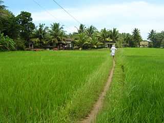
Pavanje is a village in Dakshina Kannada district of Karnataka state, India. It is sited on the north bank of the Nandini River, adjoining National Highway 66 between Udupi and Mangaluru. It lies just outside of Mangalore city and close to Mukka from where the Mangaluru city northern limits start. Pavanje bridge is the entrance to Mangalore city from north. Pavanje lies to south of Haleangadi. The Arabian sea is on west of this village. The village has lush green paddy fields and coconut plantations.

Incident is the annual cultural festival of the National Institute of Technology Karnataka (NITK) in Surathkal, Karnataka, India. The fest is a four-day-long event held in March in the even semester of the NITK Calendar. The fest brings together students from different colleges all over India, attracting an estimated annual footfall of about 45,000 people, and boasts a number of competitive events, workshops, competitions and performances as well as pro-shows by widely known and popular artists including the likes of Sunidhi Chauhan, Salim–Sulaiman, Amaal Malik, Benny Dayal, the duo of Vishal–Shekhar and Javed Ali among many others.

<span class="mw-page-title-main">Mangalore City Corporation</span> Local civic body in Mangalore, Karnataka, India

The Mangalore City Corporation is the municipal corporation responsible for overseeing the local administration of the Indian city of Mangalore and it's suburbs, which are a major urban area and the most important port city of Karnataka state. The mechanism of municipal corporation was introduced in British India, with formation of the municipal corporation in Madras (Chennai) in 1688, followed by municipal corporations in Bombay (Mumbai) and Calcutta (Kolkata) in 1762. It consists of a legislative and an executive body. The legislative body is headed by the Mayor, while the executive body is headed by a Chief Commissioner.

<span class="mw-page-title-main">Ullal beach</span> Beach in Mangalore, Ullal

Ullal Beach is situated on the southwestern seaboard of the Indian sub-continent, adjacent to Ullal town, 10 km south of the city of Mangalore, Karnataka, India. Attractions are its picturesque stretch of Coconut trees, fishermen's lane, the ruined fort of Abbakka Devi and 16th century Jain temples. A resort is also situated nearby.

<span class="mw-page-title-main">Bondel</span> Area of Mangalore in Karnataka, India

Bondel is a residential locality in Mangalore city, Karnataka, India. It is one of the upscale residential localities of Mangalore. Bondel along with Maryhill houses many highrise buildings and also developing rapidly as a commercial center. It lies in Airport road, which originates in KPT Junction and extends till Mangalore International Airport. Kavoor, one of the major localities of Mangalore is located nearby. This locality is close to the airport too.

Maryhill is a locality in Mangalore city, Karnataka, India. It is one of the upscale residential localities of Mangalore. Maryhill, along with Bondel houses many highrise buildings and is also developing rapidly as a commercial center. Tulu is the main language which is spoken and understood by everyone in this locality. Konkani, Kannada are the other languages that is commonly used. Maryhill is predominantly a residential area and famous for Helipad. Many people use the Helipad daily for morning and evening walk. There are around 10 to 15 youth who enthusiastically gather at Maryhill helipad every Sunday at 8 am to fly their radio controlled aircraft. Instructors in the group train their pupils to fly these aircraft and also to operate radio-controlled motor cars.

<span class="mw-page-title-main">Panambur Beach</span> Beach in Mangalore, Panambur

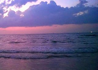
Panambur Beach is a beach on the shores of the Arabian Sea in the city of Mangalore in the Indian state of Karnataka.

<span class="mw-page-title-main">Surathkal railway station</span> Railway station in Karnataka, India

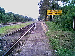
Surathkal railway station is one of the main railway stations of Mangalore city along with Mangalore Central railway station and Mangalore Junction railway station and is located in north Mangaluru on Konkan Railway route. Twenty-two trains stop here.KRCL operates RO-RO services from Suratkal to Verna, Kolad, and Karembeli. As per the Konkan railway map, Surathkal railway station is at a distance of 733.825 kilometers from the northern starting point of the Konkan railway line at Roha and 4.615 kilometers from Thokur which is the southern endpoint of Konkan railway jurisdiction. The Surathkal railway station is at distance of 26.285 Kilometre from Mangaluru Central(MAQ) railway station.

<span class="mw-page-title-main">NITK Beach</span> Beach in Mangalore, Surathkal

NITK Beach also known as Surathkal beach is on the Arabian Sea coast at Surathkal, 16 km (9.9 mi) north of the centre of Mangalore city, in the Dakshina Kannada district of Karnataka, India. It is a private beach that was later named after the nearby NITK.

Sasihithlu beach also known as Daibittil beach is located in Sasihithlu village, which is situated north of Mangalore city, in the state of Karnataka, in India. Sasihithlu Beach is situated approximately 6 km to the west of NH 66, and surrounded by the backwaters of the Pavanje and Shambhavi rivers. The two rivers meet at the beach. It is close to Mukka, one of the fastest developing localities of Mangalore. This beach hosted the Indian Open of Surfing in 2016 and 2017.

<span class="mw-page-title-main">Kavoor, Mangalore</span> Suburb of Mangalore in Karnataka, India

Kavoor is a suburban area and the name of a ward in the city of Mangalore in the Mysore division of the Indian state of Karnataka. Kannada and Tulu are the two most commonly spoken languages in Kavoor. This place got the name as "Kavoor" because of the Saint "Kuvera Maharshi" who had visited this place. It connects major cities like Surathkal, Kankanady, Kinnigoli, and Bajpe.

References

  1. "MCC will open zonal office at Surathkal tomorrow". The Times of India . 5 March 2017. Retrieved 6 October 2018.
  2. "Karnataka Town Directory,Census of India 1981 Page 14". Office of Registar General and Census Commissioner, India. Retrieved 6 January 2021.
  3. "MCC zonal office to open in Surathkal today". Deccan Herald, English Newsdaily. Retrieved 2 April 2024.
  4. "Surathkal Assembly Constituency Election Result". Result university. Retrieved 31 July 2023.
  5. "Nadakacheri Address". Karnataka state government. Retrieved 31 July 2023.
  6. "Veterinary". Karnataka state government. Retrieved 31 July 2023.
  7. "Know NITK Better About Us". NITK,Surathkal. Retrieved 31 July 2023.
  8. "About College". H.V.Sangha. Retrieved 31 July 2023.
  9. "Contact Us". Srinivas group. Retrieved 31 July 2023.
  10. "Surathkal toll gate to be closed permanently from Nov 30". The Print. Retrieved 2 April 2024.
  11. "nagarika samiti moves supreme court against surathkal toll-gate". Coastal Digest. Retrieved 2 April 2024.
  12. "Dredger beached near Surathkal to prevent problems". Deccan Herald. Retrieved 2 April 2024.
  13. "Surathkal Beach". www.mapsofindia.com. Retrieved 11 September 2011.
  14. "Surathkal Beach – Stretch Your Legs in Surathkal!". www.karnataka.com. 2 December 2011. Retrieved 3 August 2012.
  15. "Indian Lighthouses An overview, Page 119" (PDF). Directorate General of Lighthouses and Lightships. Retrieved 27 November 2019.
  16. "Surathkal Lighthouse and D.G.P.S Station". Directorate General of Lighthouses and Light ships. Retrieved 2 April 2024.
  17. "Welcome to Shri Krishnapura Matha" . Retrieved 2 April 2024.
  18. "Idya Shree Mahalingeshwara Temple". rcmysore-portal.kar.nic.in. Retrieved 19 December 2015.
  19. Falling Rain Genomics, Inc - Surathkal