A dam is a barrier that stops or restricts the flow of surface water or underground streams. Reservoirs created by dams not only suppress floods but also provide water for activities such as irrigation, human consumption, industrial use, aquaculture, and navigability. Hydropower is often used in conjunction with dams to generate electricity. A dam can also be used to collect or store water which can be evenly distributed between locations. Dams generally serve the primary purpose of retaining water, while other structures such as floodgates or levees are used to manage or prevent water flow into specific land regions. The earliest known dam is the Jawa Dam in Jordan, dating to 3,000 BC.

A weir or low head dam is a barrier across the width of a river that alters the flow characteristics of water and usually results in a change in the height of the river level. Weirs are also used to control the flow of water for outlets of lakes, ponds, and reservoirs. There are many weir designs, but commonly water flows freely over the top of the weir crest before cascading down to a lower level.

The Price River is a 137-mile-long (220 km) southeastward flowing river in Carbon, Utah and Emery counties in eastern Utah. It is a tributary to the Green River, itself a tributary to the Colorado River.

Flaming Gorge Dam is a concrete thin-arch dam on the Green River, a major tributary of the Colorado River, in northern Utah in the United States. Flaming Gorge Dam forms the Flaming Gorge Reservoir, which extends 91 miles (146 km) into southern Wyoming, submerging four distinct gorges of the Green River. The dam is a major component of the Colorado River Storage Project, which stores and distributes upper Colorado River Basin water.
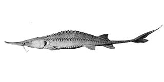
The pallid sturgeon is an endangered species of ray-finned fish, endemic to the waters of the Missouri and lower Mississippi river basins of the United States. It may have even reached the St. Croix River before colonization.
The Eklutna River is approximately 11.8 miles long and is located in the Southcentral region of the U.S. state of Alaska. A portion of the river flows through a canyon up to 400 feet (122 m) deep, emptying into the Knik Arm of Cook Inlet approximately 17 miles (27 km) northeast of Anchorage. This degraded anadromous stream historically originated from Eklutna Lake, which itself is fed by Eklutna Glacier. Eklutna River is now fed primarily by groundwater before being joined by Thunderbird Creek. Thunderbird Creek, which enters the south bank about 1 km (0.6 mi) upstream from where the river exits the canyon and forms an alluvial fan. Due to water impoundments on the Eklutna River for power generation, Thunderbird Creek is currently the main source of water in the lower portion of the Eklutna River. The river is located entirely within the limits of the Municipality of Anchorage.

Freshwater fish are those that spend some or all of their lives in fresh water, such as rivers and lakes, with a salinity of less than 1.05%. These environments differ from marine conditions in many ways, especially the difference in levels of salinity. To survive fresh water, the fish need a range of physiological adaptations.

The Elwha Dam was a 108-ft high dam located in the United States, in the state of Washington, on the Elwha River approximately 4.9 miles (7.9 km) upstream from the mouth of the river on the Strait of Juan de Fuca.

The northern hogsucker is a freshwater ray-finned fish belonging to the family Catostomidae, the suckers. It is native to the United States and Canada where it is found in streams and rivers. It prefers clear, fast-flowing water, where it can forage on the riverbed for crustaceans, mollusks, aquatic insects, algae and detritus. It turns over small pebbles and scrapes materials off rocks and sucks up the particles, and other species of fish sometimes station themselves downstream from its activities so as to garner disturbed food fragments. Breeding takes place on gravel bottoms in shallow riffles in late spring. This fish is susceptible to such man-made disturbances as channelization, sedimentation, pollution, and dam construction. However, it has a wide range and is a common species so the International Union for Conservation of Nature has rated its conservation status as being of "least concern".
The Provo River is located in Utah County and Wasatch County, Utah, in the United States. It rises in the Uinta Mountains at Wall Lake and flows about 71 miles (114 km) southwest to Utah Lake at the city of Provo, Utah.

Douglas Dam is a hydroelectric dam on the French Broad River in Sevier County, Tennessee, in the southeastern United States. The dam is operated by the Tennessee Valley Authority (TVA), which built the dam in record time in the early 1940s to meet emergency energy demands at the height of World War II. Douglas Dam is a straight reinforced concrete gravity-type dam 1705 feet long and 202 feet high, impounding the 28,420-acre (11,500 ha) Douglas Lake. The dam was named for Douglas Bluff, a cliff overlooking the dam site prior to construction.

The American gizzard shad, also known as the mud shad, is a member of the herring family of fish, and is native to large swaths of fresh and brackish waters of the United States of America. The adult has a deep body, with a silvery-green coloration above fading to plain silver below. The gizzard shad commonly resides in freshwater lakes, reservoirs, rivers, and streams, but can reside in brackish waters, as it does on the Atlantic coast of the United States. Their range is across most of the continental United States, although they typically go no further north than New York and no further west than New Mexico. They are a large part of many of the ecosystems they inhabit, and can drive changes in phyto- and zooplankton, thereby indirectly affecting other planktivorous fishes. The gizzard shad has been widely used as a food source for game fish, with varied success in management and effectiveness.
The Colorado pikeminnow is the largest cyprinid fish of North America and one of the largest in the world, with reports of individuals up to 6 ft (1.8 m) long and weighing over 100 pounds (45 kg). Native to the Colorado River Basin of the southwestern United States and adjacent Mexico, it was formerly an important food fish for both Native Americans and European settlers. Once abundant and widespread in the basin, its numbers have declined to the point where it has been extirpated from the Mexican part of its range and was listed as endangered in the US part in 1967, a fate shared by the three other large Colorado Basin endemic fish species: bonytail chub, humpback chub, and razorback sucker. The Colorado pikeminnow is currently listed as vulnerable by the IUCN, while its NatureServe conservation status is "critically imperiled".

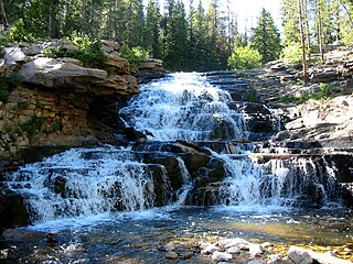
A riffle is a shallow landform in a flowing channel. Colloquially, it is a shallow place in a river where water flows quickly past rocks. However, in geology a riffle has specific characteristics.

The common logperch, sometimes simply known as the logperch, is a species of freshwater ray-finned fish, a darter from the subfamily Etheostomatinae, part of the family Percidae, which also contains the perches, ruffes and pikeperches. Like other logperches, it has the typical vertical barring along the flank and a subterminal mouth.
Galaxias fontanus, the Swan galaxias, is a species of fish in the family Galaxiidae. It is endemic to eastern Tasmania, Australia.

Dam removal is the process of demolishing a dam, returning water flow to the river. Arguments for dam removal consider whether their negative effects outweigh their benefits. The benefits of dams include hydropower production, flood control, irrigation, and navigation. Negative effects of dams include environmental degradation, such as reduced primary productivity, loss of biodiversity, and declines in native species; some negative effects worsen as dams age, like structural weakness, reduced safety, sediment accumulation, and high maintenance expense. The rate of dam removals in the United States has increased over time, in part driven by dam age. As of 1996, 5,000 large dams around the world were more than 50 years old. In 2020, 85% percent of dams in the United States are more than 50 years old. In the United States roughly 900 dams were removed between 1990 and 2015, and by 2015, the rate was 50 to 60 per year. France and Canada have also completed significant removal projects. Japan's first removal, of the Arase Dam on the Kuma River, began in 2012 and was completed in 2017. A number of major dam removal projects have been motivated by environmental goals, particularly restoration of river habitat, native fish, and unique geomorphological features. For example, fish restoration motivated the Elwha Ecosystem Restoration and the dam removal on the river Allier, while recovery of both native fish and of travertine deposition motivated the restoration of Fossil Creek.

Catostomus latipinnis is a North American fish identified by its enlarged lower lips. It belongs to the genus Catostomus, commonly known as suckers. Historically, the flannelmouth sucker ranged in the Colorado River Basin, including parts of Wyoming, Utah, Colorado, New Mexico, Nevada, California, and Arizona; however, this species has been entirely extirpated from the Gila River Basin in Arizona.
The olive darter is a species of freshwater ray-finned fish, a darter from the subfamily Etheostomatinae, part of the family Percidae, which also contains the perches, ruffes and pikeperches. It is native to Tennessee, Kentucky, North Carolina, and Georgia, in the United States. It is found in the headwaters of Tennessee River system and the middle reaches of the Cumberland River system, its ideal habitat being clear, cold water over rocky substrates. It grows to a length of about 5 in (13 cm) and is an insectivore, feeding mainly on insect larvae on the riverbed. The fish matures at age two and lives till about age four. Up to 1500 eggs are spawned which fall to the riverbed and get lodged among gravel. The olive darter is classified as a "vulnerable species", being affected by habitat destruction and siltation, often resulting from damming and impoundment of the rivers or the creation of weirs. It is also affected by the change in the forest riparian habitat resulting from the killing of trees by the hemlock woolly adelgid.

The Turtle-Flambeau Flowage is a 12,942 acres (52.37 km2) lake in Iron County, Wisconsin. It has a maximum depth of 15 meters and is the seventh largest lake in the state of Wisconsin by surface area. The flowage is home to unique wetland patterns and plant species as well as several species of sport and game fish, including Musky, Panfish, Largemouth Bass, Smallmouth Bass, Northern Pike, Walleye and Sturgeon. The lake's water clarity is low, but can vary in different locations in the lake. Fishing, camping, boating, and hunting are popular activities on the flowage, and Ojibwe people traditionally harvest fish and game on the lake. Environmental concerns on the flowage include mercury contamination, algal blooms, and several types of invasive species.