
A ring road is a road or a series of connected roads encircling a town, city, or country. The most common purpose of a ring road is to assist in reducing traffic volumes in the urban centre, such as by offering an alternate route around the city for drivers who do not need to stop in the city core. Ring roads can also serve to connect suburbs to each other, allowing efficient travel between them.
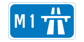
The M1 motorway is a motorway in Ireland. It forms the large majority of the N1 national primary road connecting Dublin towards Belfast along the east of the island of Ireland. The route heads north via Swords, Drogheda and Dundalk to the Northern Irish border just south of Newry in County Armagh, where it joins the A1 road and further on, the M1 motorway in Northern Ireland. It also forms a significant part of the road connection between Dublin and the Northern Irish cities of Newry, and Lisburn. The route is part of European route E01.

The island of Ireland, comprising Northern Ireland and the Republic of Ireland, has an extensive network of tens of thousands of kilometres of public roads, usually surfaced. These roads have been developed and modernised over centuries, from trackways suitable only for walkers and horses, to surfaced roads including modern motorways. The major routes were established before Irish independence and consequently take little cognisance of the border other than a change of identification number and street furniture. Northern Ireland has had motorways since 1962, and has a well-developed network of primary, secondary and local routes. The Republic started work on its motorway network in the early 1980s; and historically, the road network there was once somewhat less well developed. However, the Celtic Tiger economic boom and an influx of European Union structural funding, saw national roads and regional roads in the Republic come up to international standard quite quickly. In the mid-1990s, for example, the Republic went from having only a few short sections of motorway to a network of motorways, dual carriageways and other improvements on most major routes as part of a National Development Plan. Road construction in Northern Ireland now tends to proceed at a slower pace than in the Republic, although a number of important bypasses and upgrades to dual carriageway have recently been completed or are about to begin.

Controlled-access highways in Poland are part of the national roads network and they are divided into motorways and expressways. Both types of highways feature grade-separated interchanges with all other roads, emergency lanes, feeder lanes, wildlife protection measures and dedicated roadside rest areas. Motorways differ from expressways in their technical parameters, like designated speed, permitted road curvature, lane widths or minimal distances between interchanges. Moreover, expressways might have single carriageway sections in case of low traffic densities.

A dual carriageway (BE) or divided highway (AE) is a class of highway with carriageways for traffic travelling in opposite directions separated by a central reservation (BrE) or median (AmE). Roads with two or more carriageways which are designed to higher standards with controlled access are generally classed as motorways, freeways, etc., rather than dual carriageways.

A limited-access road, known by various terms worldwide, including limited-access highway, dual-carriageway, expressway, and partial controlled access highway, is a highway or arterial road for high-speed traffic which has many or most characteristics of a controlled-access highway, including limited or no access to adjacent property, some degree of separation of opposing traffic flow, use of grade separated interchanges to some extent, prohibition of slow modes of transport, such as bicycles, (draught) horses, or self-propelled agricultural machines; and very few or no intersecting cross-streets or level crossings. The degree of isolation from local traffic allowed varies between countries and regions. The precise definition of these terms varies by jurisdiction.

The Autostrade are roads forming the Italian national system of motorways. The total length of the system is about 6,758 kilometres (4,199 mi). In North and Central Italy, the Autostrade mainly consists of tollways managed by Autostrade per l'Italia, a holding company controlled by Cassa Depositi e Prestiti. Other operators include ASTM, ATP, and Autostrade Lombarde in the north-west; Autostrada del Brennero, A4 Holding, Concessioni Autostradali Venete, and Autovie Venete in the north-east; Strada dei Parchi, SALT, SAT, and Autocisa in the center; and CAS in the south.

A controlled-access highway is a type of highway that has been designed for high-speed vehicular traffic, with all traffic flow—ingress and egress—regulated. Common English terms are freeway, motorway, expressway and speedway. Other similar terms include throughway and parkway. Some of these may be limited-access highways, although this term can also refer to a class of highways with somewhat less isolation from other traffic.

The autostrada A1, officially named Amber Highway in Poland is a north–south motorway, partly under construction, that runs through central Poland, from Gdańsk through Łódź and the Upper Silesian Industry Area to the Polish-Czech border in Gorzyczki/Věřňovice, where it is connected with the Czech motorway D1. Except for its southernmost section, the motorway is a part of European route E75.

Road speed limits in Ireland apply on all public roads in the state. These are signposted and legislated for in kilometres per hour. Speed limits are demarcated by regulatory road signs. These consist of white circular signs with a red outline. Speed limits are marked in black with "km/h" below the speed limit. Smaller "repeater" speed limit signs are used along stretches of road where there is no change in speed limit, in order to remind motorists currently on the road and to inform traffic merging from junctions that a certain speed limit applies.

The Autostrada A56, more commonly known as the Tangenziale di Napoli, is a controlled access toll road bypassing the urban center and suburban developments of Naples, Italy — connecting the SS7 near Arco Felice/Pozzuoli at the west to the A1 Autostrade at the east, with a total length of 20.2 km. The most eastward section, from Junction 3 at Doganella to the A1, is toll-free.
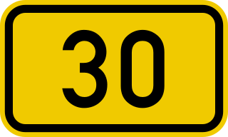
The Bundesstraße 30 is a highly frequented federal highway in Germany running through Upper Swabia in Baden-Württemberg from Ulm to Friedrichshafen on Lake Constance. It has a length of approximately 105 km.
The Autostrada A4, or Serenissima, is a motorway which connects Turin and Trieste via Milan and Venice. The city of Venice originally formed a bottleneck on the A4, but is now bypassed by the Passante di Mestre. The A4 passes just north of the city of Milan, where it is toll-free.
Autostrada A13 is an Italian motorway which connects Bologna to Padua, passing through Ferrara and Rovigo. It is 116.7 km long. Near the two extremities of the track are situated two of the biggest Italian freight villages, in Bologna and Padua. Snow tyres are compulsory from 15 November to 15 April on the whole highway track, according to the Italian directives.

The A15 is an Italian autostrada (motorway) connecting Parma and La Spezia through the valleys of the Taro and Magra Rivers. The road is also known as Autostrada della Cisa because it crosses the Northern Apennines at the Cisa pass. The main 101-km expanse of the motorway connects the A1 with the A12, thus directly linking the Po Valley with the Italian Riviera and the Versilia region.
The GRAP is the orbital motorway surrounding Padua, northern Italy. It is also called Tangenziale di Padova.

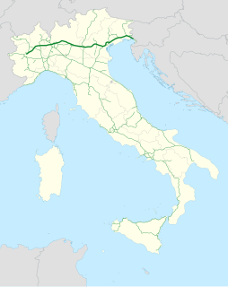
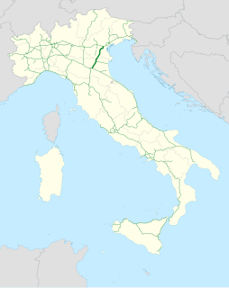
The Autostrada A22 is one of the most important motorways in Italy, as it connects Pianura padana, the city of Modena and the A1 motorway to Austria through the Brenner Pass, located in the municipality of Brenner.
Impresa di Costruzioni Ing. E. Mantovani known as Ing. E. Mantovani is an Italian construction company based in Padua, Veneto. The company was found by engineer Enzo Mantovani, but was purchased by Serenissima Holding, a holding company for Chiarotto family. Serenissima Holding also owned FIP Group, which FIP Industriale supplied 8 viscous dampers for the tuned mass damper of Taipei 101.
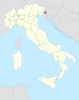
The Autostrada A34 is an Italian motorway that branches off of the A4 motorway at the Villesse junction going towards Gorizia. The motorway ends after 17 kilometers in Sant'Andrea / Vertoiba, where it continues as the H4 expressway in Slovenia. The highway is managed by Autovie Venete.


