Beaverton is a city in Washington County, in the U.S. state of Oregon with a small portion bordering Portland in the Tualatin Valley. The city is among the main cities that make up the Portland metropolitan area. Its population was 97,494 at the 2020 census, making it the second-largest city in the county and the seventh-largest city in Oregon. Beaverton is an economic center for Washington County along with neighboring Hillsboro. It is home to the world headquarters of Nike, Inc., although it sits outside of city limits on unincorporated county land.

Tigard is a city in Washington County, Oregon, United States. The population was 48,035 at the 2010 census. As of 2007, Tigard was the state's 12th largest city. Incorporated in 1961, the city is located south of Beaverton and north of Tualatin, and is part of the Portland metropolitan area. Interstate 5 and Oregon Route 217 are the main freeways in the city, with Oregon Route 99W and Oregon Route 210 serving as other major highways. Public transit service is provided by TriMet, via several bus routes and the WES Commuter Rail line.

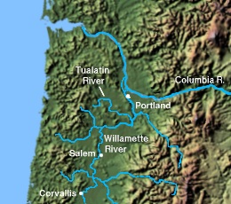
Washington County is one of 36 counties in the U.S. state of Oregon and part of the Portland metropolitan area. The 2020 census recorded the population as 600,372, making it the second most populous county in the state and most populous "Washington County" in the United States. Hillsboro is the county seat and largest city, while other major cities include Beaverton, Tigard, Cornelius, Banks, Gaston, Sherwood, North Plains, and Forest Grove, the county's oldest city. Originally named Twality when created in 1843, the Oregon Territorial Legislature renamed it for the nation's first president in 1849 and included the entire northwest corner of Oregon before new counties were created in 1854. The Tualatin River and its drainage basin lie almost entirely within the county, which shares its boundaries with the Tualatin Valley. It is bordered on the west and north by the Northern Oregon Coast Range, on the south by the Chehalem Mountains, and on the north and east by the Tualatin Mountains, or West Hills.
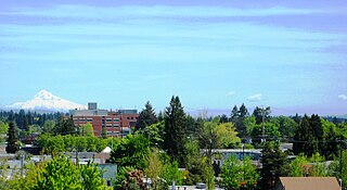
Hillsboro is the fifth-largest city in the U.S. state of Oregon and is the county seat of Washington County. Situated in the Tualatin Valley on the west side of the Portland metropolitan area, the city hosts many high-technology companies, such as Intel, locally known as the Silicon Forest. At the 2020 census, the city's population was 106,447.

The Tualatin River is a tributary of the Willamette River in Oregon in the United States. The river is about 83 miles (134 km) long, and it drains a fertile farming region called the Tualatin Valley southwest and west of Portland at the northwest corner of the Willamette Valley. There are approximately 500,000 people residing on 15 percent of the land in the river's watershed.
Northern Kalapuyan is an extinct Kalapuyan language indigenous to northwestern Oregon in the United States. It was spoken by Kalapuya groups in the northern Willamette Valley southwest of present-day Portland.

The AtfalatiIPA: [aˈtɸalati], also known as the Tualatin or Wapato Lake Indians are a tribe of the Kalapuya Native Americans who originally inhabited and continue to steward some 24 villages on the Tualatin Plains in the northwest part of the U.S. state of Oregon; the Atfalati also live in the hills around Forest Grove, along Wapato Lake and the north fork of the Yamhill River, and into areas of Southern Portland.
The state of Oregon in the United States has established an international reputation for its production of wine, ranking fourth in the country behind California, Washington, and New York. Oregon has several different growing regions within the state's borders that are well-suited to the cultivation of grapes; additional regions straddle the border between Oregon and the states of Washington and Idaho. Wine making dates back to pioneer times in the 1840s, with commercial production beginning in the 1960s.
The history of Oregon wine production stretches back to before the state was incorporated. Settlers to the Oregon Territory planted grapes as early as the 1840s, however the production of wine has only been a significant industry in Oregon since the 1960s. Oregon wines first achieved significant critical notice in the late 1970s; in 2005, the industry sold 1.6 million cases of Oregon vintages with a retail value of US$184.7 million. In 2015, there were 702 wineries and 28,034 acres of vitis vinifera planted.

The Willamette Valley AVA is an American Viticultural Area which lies in the Willamette Valley of Oregon. The AVA is the wine growing region which encompasses the drainage basin of the Willamette River. It stretches from the Columbia River in the north to just south of Eugene in the south, where the Willamette Valley ends; and from the Oregon Coast Range in the west to the Cascade Mountains in the east. At 5,360 square miles (13,900 km2), it is the largest AVA in the state, and contains most of the state's wineries; approximately 908 as of 2021.

Willamette Valley Vineyards is an American winery located in Turner, Oregon. Named after Oregon's Willamette Valley, the winery is the leading producer of Willamette Valley-appellated Pinot Noir in Oregon, and also produces Chardonnay and Pinot Gris. In 2016, the winery was the largest producer of Riesling wine in the Willamette Valley.

Oak Knoll Winery is a privately held winery located in the Tualatin Valley near Hillsboro, Oregon, United States. Established in 1970, it is the oldest winery in Washington County, and produces Pinot noir, Pinot gris, and Chardonnay. The winery also known for producing Frambosia, a red raspberry wine.

The Chehalem Mountains AVA is an American Viticultural Area {AVA) located in the Yamhill and Washington counties of northwestern Oregon. It contains two sub-regions, Laurelwood District AVA and Ribbon Ridge AVA.

The Tualatin Plains are a prairie area in central Washington County, Oregon, United States. Located around the Hillsboro and Forest Grove areas, the plains were first inhabited by the Atfalati band of the Kalapuya group of Native Americans. Euro-American settlement began in the 1840s.
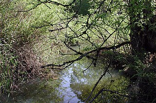
Fanno Creek is a 15-mile (24 km) tributary of the Tualatin River in the U.S. state of Oregon. Part of the drainage basin of the Columbia River, its watershed covers about 32 square miles (83 km2) in Multnomah, Washington, and Clackamas counties, including about 7 square miles (18 km2) within the Portland city limits.

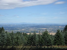
The Willamette Valley is a 150-mile (240 km) long valley in Oregon, in the Pacific Northwest region of the United States. The Willamette River flows the entire length of the valley and is surrounded by mountains on three sides: the Cascade Range to the east, the Oregon Coast Range to the west, and the Calapooya Mountains to the south.

Dick Ponzi is an American winemaker, a pioneer of the Oregon wine industry and the Oregon brewing industry, and the founder of Ponzi Vineyards, one of the Willamette Valley's founding wineries. He also had a successful career as a structural engineer. Ponzi is regarded as an enological and viticultural innovator. He was a founding member and the first president of the Oregon Winegrowers Association and a founding director of the Oregon Wine Board. He and his wife also established Oregon's first craft brewery, Bridgeport Brewing Company.
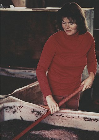
Nancy Ponzi is a pioneer of the Oregon wine industry and the Oregon brewing industry, and the founder of Ponzi Vineyards, one of the Willamette Valley's founding wineries. She and her husband Dick Ponzi also established Oregon's first craft brewery, Bridgeport Brewing Company.
Laurelwood District is an American Viticultural Area (AVA) located west of the city of Portland and lies entirely within the northern end of Willamette Valley AVA with the Chehalem Mountains AVA covering its northern slopes including the towns of Cornelius, Scholls and Sherwood in Washington County. The district was established on May 13, 2020, by the Alcohol and Tobacco Tax and Trade Bureau (TTB). Its coverage is approximately 33,600 acres (13,597 ha) and contains 25 wineries and approximately 70 commercially-producing vineyards that plant approximately 975 acres (395 ha). The distinguishing feature of the Laurelwood District is the predominance of the Laurelwood soil that predominates in the area. The district contains the highest concentration of the namesake soil in Oregon.
Tualatin Hills is an American Viticultural Area (AVA) located due west of Portland and just east from the Oregon Coast Range in the upland hills of the Tualatin River watershed and encompasses elevations between 200 and 1,000 feet. It was established on May 13, 2020 by the Alcohol and Tobacco Tax and Trade Bureau (TTB). It lies entirely within the northern most location of the Willamette Valley AVA in and around towns like Gaston, Forest Grove, Sherwood and Cornelius. To the south and southeast are the Chehalem Mountains with elevations of over 1,000 feet (300 m) and considered to be a separate, distinct landform from the uplands within Tualatin Hills. The region stretches over approximately 144,000 acres (225 sq mi) and contains 21 wineries with 33 commercially-producing vineyards that covers approximately 860.5 acres (348 ha). The distinguishing features of Tualatin Hills are its soils, elevation, and climate.