United States Army Corps of Topographical Engineers

Last updated
U.S. Army Corps of Topographical Engineers
Active1838–1863
Country. Flag of the United States.svg United States of America
AllegianceUnited States Department of the Army Seal.svg United States Army
Branch Regular Army
Commanders
Notable
commanders
John James Abert (1838–61)
Stephen Harriman Long (1861–63)
The headquarters for the Corps of Topographical Engineers, ca. 1860-1865 Headquarters, Military Topographical Engineers, Chattanooga, Tennessee. - NARA - 530442.jpg
The headquarters for the Corps of Topographical Engineers, ca. 1860-1865

The U.S. Army Corps of Topographical Engineers was a branch of the United States Army authorized on 4 July 1838. It consisted only of officers who were handpicked from West Point [1] and was used for mapping and the design and construction of federal civil works such as lighthouses and other coastal fortifications and navigational routes. Members included such officers as George Meade, John C. Frémont, Thomas J. Cram and Stephen Long. It was merged with the United States Army Corps of Engineers on 31 March 1863, at which point the Corps of Engineers also assumed the Lakes Survey for the Great Lakes. [2] In the mid-19th century, Corps of Engineers' officers ran Lighthouse Districts in tandem with U.S. Naval officers.

Contents

In 1841, Congress created the Lake Survey. The Survey, based in Detroit, Mich., was charged with conducting a hydrographical survey of the Northern and Northwestern Lakes and preparing and publishing nautical charts and other navigation aids. The Lake Survey published its first charts in 1852. [3]

Significance

William Goetzmann has written:

From the year 1838 down to the Civil War, there existed a small but highly significant branch of the Army called the Corps of Topographical Engineers. ... The Engineers were concerned with recording all of the western phenomena as accurately as possible, whether main-traveled roads or uncharted wilderness. As Army officers they represented the direct concern of the national government the settling of the West. The Corps of Topographical Engineers was a central institution of Manifest Destiny, and in the years before the Civil War its officers made explorations which resulted in the first scientific mapping of the West. They laid out national boundaries and directly promoted the advance of settlement by locating and constructing wagon roads, improving rivers and harbors, even performing experiments for the location of subsurface water in the arid regions. In short, they functioned as a department of public works for the West - and indeed for the whole nation, since the operations of the Corps extended to every state and territory of the United States. The work of the Corps in the West had still broader significance. Since a major part of its work was to assemble scientific information in the form of maps, pictures, statistics, and narrative reports about the West, it contributed importantly to the compilation of scientific knowledge about the interior of the North American continent. The Topographical Engineers were sophisticated men of their time who worked closely with the foremost scholars in American and European centers of learning. Scientists and artists of all nationalities accompanied their expeditions as partners and co-workers. The Army Topographer considered himself by schooling and profession as one of a company of savants. By virtue of his West Point training and status he was an engineer, something above the ordinary field officer, whose duties were confined usually to strictly military tasks. As a Topographical Engineer he on occasion might address the American Association for the Advancement of Science. He probably subscribed to Silliman's American Journal of Science and he was a pillar of the Smithsonian Institution. [4]

Major expeditions prior to the Corps' creation

In all, there were six major expeditions into the Louisiana Purchase, the first being the best known Corps of Discovery led by Lewis and Clark in 1804–1806. A second expedition in 1804 included astronomer and naturalist John Dunbar and prominent Philadelphia chemist William Hunter. This expedition attempted to follow the Red River to its source in Texas, then controlled by Spain, but turned back after three months.

In April 1806 a second Red River Expedition was led by Captain Richard Sparks and included astronomer and surveyor Thomas Freeman and Peter Custis, a University of Pennsylvania medical student who served as the expedition's botanist. The group of 24 traveled 615 miles up the Red River before being turned back by Spanish authorities. President Thomas Jefferson hoped that this expedition would be nearly as important as the one led by Lewis and Clark, but the interruption by Spanish authorities prevented this hope from being realized.

In 1805–1806, Lieutenant Zebulon Pike was ordered by General James Wilkinson, Governor of the Upper Louisiana Territory, to find the source of the Mississippi River.

In 1806–1807, President Jefferson ordered Lieutenant Pike, on another expedition, to find the headwaters of the Arkansas River and Red River. This is better known as the Pike Expedition. Spanish forces arrested Pike and confiscated his papers, but assigned a translator and cartographer to translate Pike's documents.

In 1817 Major Stephen H. Long explored the upper Mississippi River, selecting sites for Fort Smith on the Arkansas River and Fort St. Anthony at the confluence of the Minnesota and Mississippi.

In 1819, President James Monroe and Secretary of War John C. Calhoun ordered General Henry Atkinson to lead what became known as the Yellowstone Expedition. One objective was to eliminate British influence among the Native American tribes in the region. Nearly 1,000 soldiers were transported by five steamboats up the Missouri River to the Mandan villages at the mouth of the Yellowstone, where they built a fort. This was the first known use of steam propulsion in the west.

Major expeditions by the Corps

Topographical Engineers at work during the Yorktown campaign, May 1862. The photographic history of the Civil War - thousands of scenes photographed 1861-65, with text by many special authorities (1911) (14739935416).jpg
Topographical Engineers at work during the Yorktown campaign, May 1862.

See also

Army Geospatial Center

Further reading

Related Research Articles

<span class="mw-page-title-main">John Parke</span> Union Army officer in the American Civil War

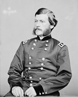
John Grubb Parke was a United States Army engineer and a Union general in the American Civil War. Parke's Civil War service was closely associated with Ambrose E. Burnside, often serving him as chief of staff in major engagements such as Antietam, Fredericksburg and the Overland Campaign. Parke also held significant field commands during Burnside's North Carolina Expedition, Vicksburg and the battle of Fort Stedman as well as brief stints in command of the Army of the Potomac.

<span class="mw-page-title-main">John Williams Gunnison</span> 19th-century American explorer

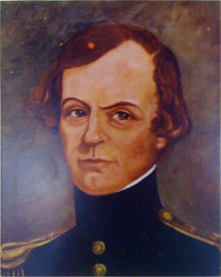
John Williams Gunnison was an American military officer and explorer.

<span class="mw-page-title-main">Pacific Railroad Surveys</span> Explorations of the American West, 1853–1855

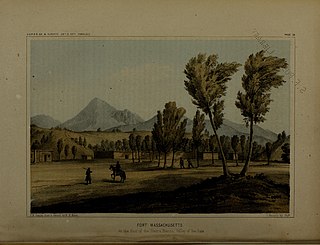
The Pacific Railroad Surveys (1853–1855) were a series of explorations of the American West designed to find and document possible routes for a transcontinental railroad across North America. The expeditions included surveyors, scientists, and artists and resulted in an immense body of data covering at least 400,000 square miles (1,000,000 km2) on the American West. "These volumes... constitute probably the most important single contemporary source of knowledge on Western geography and history and their value is greatly enhanced by the inclusion of many beautiful plates in color of scenery, native inhabitants, fauna and flora of the Western country." Published by the United States War Department from 1855 to 1860, the surveys contained significant material on natural history, including many illustrations of reptiles, amphibians, birds, and mammals. In addition to describing the route, these surveys also reported on the geology, zoology, botany, paleontology of the land as well as provided ethnographic descriptions of the Native peoples encountered during the surveys.

<span class="mw-page-title-main">Marias Pass</span> Mountain pass in Montana

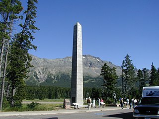
Marias Pass is a mountain pass in the Rocky Mountains in the western US state of Montana. Lying on the southern border of Glacier National Park, it is traversed by US Highway 2 and by the BNSF Hi-Line Subdivision. The pass is the lowest crossing of the Continental Divide between Canada and central New Mexico , and is the northernmost pass in the US open to automobile traffic year-round.

Adhesive weight is the weight on the driving wheels of a locomotive, which determines the frictional grip between wheels and rail, and hence the drawbar pull which a locomotive can exert.

<span class="mw-page-title-main">Charles Preuss</span>

George Karl Ludwig Preuss (1803–1854), anglicized as Charles Preuss, was a surveyor and cartographer who accompanied John C. Fremont on three of his five exploratory expeditions of the American west, including the expedition where he and Fremont were the first to record seeing Lake Tahoe from a mountaintop vantage point as they traversed what is now Carson Pass in February 1844. Preuss drew two important maps based on his records from Fremont's first two expeditions.

<i>Hulsea</i> Genus of flowering plants

Hulsea is a small genus of North American flowering plants in the family Asteraceae known commonly as alpinegold.

<i>Allium amplectens</i> Species of flowering plant

Allium amplectens, the narrowleaf onion, is a species of flowering plant. It is a onion native to the west coast of the United States, in Oregon, Washington State and California, also British Columbia in Canada. It grows in woods and especially in clay and serpentine soils.

<span class="mw-page-title-main">Cochetopa Pass</span> Mountain pass in Colorado, US

Cochetopa Pass is a mountain pass in the Rocky Mountains of south-central Colorado. It lies on the Continental Divide between the city of Gunnison to the northwest and the town of Saguache to the southeast. It also lies on the boundary between the Gunnison and Rio Grande National Forests. Its name is taken from the Cochetopa Hills that it lies within, Cochetopa being the Ute Indian word for "pass of the buffalo". The original pass is traversed by Saguache County Road NN14, a maintained gravel road. Another crossing, sometimes called North Cochetopa Pass and more often simply North Pass, is located nearby on State Highway 114, which is paved and reaches a slightly higher elevation.

<i>Hesperevax</i> Genus of flowering plants

Hesperevax is a small genus of flowering plants in the tribe Gnaphalieae of the family Asteraceae.

<i>Allium tribracteatum</i> Species of flowering plant

Allium tribracteatum, known by the common name Threebract onion, is a species of wild onion found in California.

Indian Wells is a former settlement in Imperial County, California. It was located 8 miles (13 km) south-southwest of Seeley.

Howard Stansbury was a major in the U.S. Army Corps of Topographical Engineers. His most notable achievement was leading a two-year expedition (1849–1851) to survey the Great Salt Lake and its surroundings. The expedition report entitled Exploration and survey of the valley of the Great Salt Lake of Utah, including a reconnaissance of a new route through the Rocky Mountains was published in 1852 providing the first serious scientific exploration of the flora and fauna of the Great Salt Lake Valley as well as a favorable impression of the members of the Church of Jesus Christ of Latter-day Saints, who had settled there beginning in 1847.

Joseph Christmas Ives was an American soldier, botanist, and an explorer of the Colorado River in 1858.

Stickneys Ferry was a settlement established in what became Tulare County. The ferry proper was where the Stockton - Los Angeles Stagecoach Road crossed the White River. The settlement was on Telegraph Flat, just below the confluence of the White River and Tyler Gulch, about 4.66 miles west of Tailholt.

Dragoon Wash, a stream tributary to the San Pedro River, in Cochise County, Arizona. It has its source just southwest of the town of Dragoon. 32°01′21″N110°02′46″W It runs southwesterly to meet the San Pedro River.

Explorer was a small, custom-made stern-wheel steamboat built for Second lieutenant Joseph Christmas Ives and used by him to carry the U. S. Army Corps of Topographical Engineers expedition to explore the Colorado River above Fort Yuma in 1858.

<span class="mw-page-title-main">Whipple Expedition</span>

The Whipple Expedition (1853–1854) was led by Lieutenant Amiel Weeks Whipple and tasked with conducting a survey from Fort Smith, Arkansas, to Los Angeles, California, along the 35th parallel north. The expedition lasted for nine months and traveled 1,800 miles (2,900 km).

Cadotte Pass, known in the mid to late 1800s as Cadotte's Pass, is a pass in the Rocky Mountains located on the Continental Divide in the U.S. state of Montana. Pierre Cadotte, a white settler at Fort Benton, Montana, explored the pass in 1851. Prior to his exploration Tribal people utilized the pass while migrating to the buffalo hunting plains around the Sun River. Isaac Stevens, Governor of Washington Territory, named the pass after Cadotte in 1853. The pass is 6,073 feet (1,851 m) above sea level.

Railroad Pass is a mountain pass in Cochise County, Arizona. It divides the Dos Cabezas Mountains and the Pinaleno Mountains at an elevation of 4,403 feet / 1,342 meters, and lies between the Sulphur Springs Valley and San Simon Valley.

References

  1. Trimble, Marshall (2016-04-18). "Army Corps of Topographical Engineers". True West Magazine. Retrieved 2019-07-23.
  2. Charting the Inland Seas: A History of the U.S. Lake Survey, Arthur M. Woodford, 1991
  3. Lake Survey
    • Goetzmann, William H. Army Exploration in the American West 1803-1863 (Yale University Press, 1959; University of Nebraska Press, 1979
  4. "General Map to Accompany the Report of Capt T.J. Cram on the Boundary Between Michigan and Wiskonsin [sic]". www.americanhistory.si.edu. National Museum of American History. Retrieved 28 January 2021.
  5. James D. Graham
  6. "James Duncan Graham". U.S. Corps of Topographical Engineers. Archived from the original on April 19, 2017.
  7. Columbia Daily Spectator, Volume XXX, Number 1, 18 February 1892, p5.4-5 Professor William G. Peck
  8. William Guy Peck, Cullums_Register 1206 Class of 1844
  9. RECONNAISSANCE BY LIEUT. JAMES W. ABERT, TOPOGRAPHICAL ENGINEERS, 1845; Reports of Explorations and Surveys to Ascertain the Most Practicable and Economical Route for a Railroad from the Mississippi River to the Pacific Ocean, Volume 11, BEVERLEY TUCKER, PRINTER, WASHINGTON, 1855, p.52
  10. Notes of a Military Reconnaissance from Fort Leavenworth in Missouri to San Diego in California, Including Part Of The Arkansas, Del Norte, and Gila Rivers. By Lieut. Col. W. H. Emory, made in 1846-7, With the Advanced Guard of the "Army of the West", Wendell and Van Benthuysen, Washington, 1848
  11. United States Department of the Interior (1857–59). Report on the United States and Mexican Boundary Survey, made under the direction of the Secretary of the Interior by William H. Emory Washington, D.C.: C. Wendell, printer. Three volumes, bound in two.
  12. Byrd H. Granger (1960). Arizona Place Names . University of Arizona Press. p.  21 . Retrieved 9 December 2011.
  13. Report of an Expedition Down the Zuñi and Colorado Rivers, Captain L. Sitgreaves, Corps Topographical Engineers, Robert Armstrong, Public Printer, Washington, 1853
  14. Pacific Railroad Survey from cprr.org accessed July 17, 2016
  15. Report of Explorations for a Route for the Pacific Railroad near the 47th and 49th Parallels of North Latitude, from St. Paul, Minnesota, to Puget Sound, Vol. XII, Book 1, Thomas H. Ford, printer, Washington, 1860
  16. Reports of Explorations and Surveys, to ascertain the most practicable and economical route for a railroad from the Mississippi River to the Pacific Ocean, made under the direction of the Secretary of War, in 1853-4. Volume II, Government Printing Office, Washington, 1855. Report of Explorations for a Route for the Pacific Railroad, by Captain J. W. Gunnison, Corps Topographical Engineers, near The Thirty-Eighth and Thirty-Ninth Parallels of Latitude, from The Mouth of the Kansas River, Mo., To The Seiver Lake, In The Great Basin, Report, by Lieutenant E. G. Beckwith, Third Artillery
  17. Reports of Explorations and Surveys, to ascertain the most practicable and economical route for a railroad from the Mississippi River to the Pacific Ocean, made under the direction of the Secretary of War, in 1853-4. Volume II, Government Printing Office, Washington, 1855. Report of Explorations for a Route for the Pacific Railroad, On The Line Of The Forty-First Parallel Of North Latitude, by Lieutenant E. G. Beckwith, Third Artillery, upon the Route near the Forty-First Parallel, 1854.
  18. Reports of Explorations and Surveys, to ascertain the most practicable and economical route for a railroad from the Mississippi River to the Pacific Ocean, made under the direction of the Secretary of War, in 1853-4, Volume III, Washington; Government Printing Office: 1856, Report. Explorations for a Railway Route, near the Thirty-Fifth Parallel of North Latitude, from the Mississippi River to the Pacific Ocean: By Lieutenant A. W. Whipple, Corps Of Topographical Engineers Assisted by Lieutenant J. C. Ives, Corps of Topographical Engineers.
  19. Joseph C. Ives, Report upon the Colorado river of the West, Washington, Government Printing Office, 1861.
  20. Reports of Explorations and Surveys, to ascertain the most practicable and economical route for a railroad from the Mississippi River to the Pacific Ocean, made under the direction of the Secretary of War, in 1853-4, Vol. VII, Part 1. Report of Explorations for Railroad Routes San Francisco Bay to Los Angeles, West of the Coast Range, and from the Pimas Villages on the Gila to the Rio Grande, near the 32d Parallel of North Latitude, Lieutenant John G. Parke, Corps of Topographical Engineers, Assisted by Albert H. Campbell, Civil Engineer.
  21. Reports of Explorations and Surveys, to ascertain the most practicable and economical route for a railroad from the Mississippi River to the Pacific Ocean, made under the direction of the Secretary of War, in 1853-4, Volume II, Government Printing Office, Washington, 1855. Report of Lieutenant John G. Parke, Corps Topographical Engineers, upon the Portion of the Route near the Thirty-Second Parallel, Lying Between the Rio Grande and Pimas Village, on the Gila.
  22. Reports of Explorations and Surveys, to ascertain the most practicable and economical route for a railroad from the Mississippi River to the Pacific Ocean, made under the direction of the Secretary of War, in 1853-4, Volume II, Government Printing Office, Washington, 1855. Report of Explorations for a Route for the Pacific Railroad, Near The Thirty-Second Parallel Of North Latitude, From the Red River to The Rio Grande, by Brevet Captain John Pope, Corps Topographical Engineers, 1854
  23. Reports of Explorations and Surveys, to ascertain the most practicable and economical route for a railroad from the Mississippi River to the Pacific Ocean, made under the direction of the Secretary of War, in 1853-4, Volume V, Government Printing Office, Washington, 1856; . Report. Explorations In California for Railroad Routes, to Connect with the Routes near the 35th and 32nd Parallels of North Latitude by Lieutenant R. S. Williamson, Corps of Topographical Engineers.
  24. Reports of Explorations and Surveys, to ascertain the most practicable and economical route for a railroad from the Mississippi River to the Pacific Ocean, made under the direction of the Secretary of War, in 1853-4, Volume VI, Government Printing Office, Washington, 1857; Report of Lieut. Henry L. Abbot, Corps of Topographical Engineers upon Explorations for a Railroad Route, the Sacramento Valley to the Columbia River, Made by Lieut. R. S. Williamson, Corps of Topographical Engineers, Assisted by Lieut. Henry L. Abbot, Corps of Topographical Engineers.
  25. Reports of Explorations and Surveys, to ascertain the most practicable and economical route for a railroad from the Mississippi River to the Pacific Ocean, made under the direction of the Secretary of War, in 1853-4, Volume VII, Government Printing Office, Washington, 1857; . Report of Explorations for Railroad Routes San Francisco Bay to Los Angeles, West of the Coast Range, and from the Pimas Villages on the Gila to the Rio Grande, near the 32d Parallel of North Latitude, Lieutenant John G. Parke, Corps of Topographical Engineers, Assisted by Albert H. Campbell, Civil Engineer.
  26. Joseph C. Ives, REPORT UPON THE COLORADO RIVER OF THE WEST, EXPLORED IN 1857 AND 1858 BY LIEUTENANT JOSEPH C. IVES, CORPS OF TOPOGRAPHICAL ENGINEERS, UNDER THE DIRECTION OP THE OFFICE OF EXPLORATIONS AND SURVEYS, A. A. HUMPHREYS, CAPTAIN TOPOGRAPHICAL ENGINEERS, IN CHARGE. BY ORDER OF THE SECRETARY OF WAR, GOVERNMENT PRINTING OFFICE, WASHINGTON, 1861; PART I. GENERAL REPORT.
  27. Marcus Baker, Survey of the Northwest Border of the United States 1857–1861, Government Printing Office, Washington, 1900.
Attribution