One Tree Hill is a town on the outskirts of Adelaide, South Australia. It is located in the City of Playford.
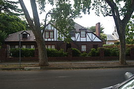
Torrens Park is a mainly residential large inner-southern suburb of Adelaide, incorporating some of the foothills and adjacent to the original "Mitcham Village". It was named after Sir Robert Richard Torrens, the instigator of the Torrens title system of land registration and transfer, who built a large home in the area which he named Torrens Park.

Prospect is the seat of the City of Prospect and an inner northern suburb of greater Adelaide. It is located 5 km (3.1 mi) north of Adelaide's centre.

Unley is an inner-southern suburb of Adelaide, South Australia, within the City of Unley. The suburb is the home of the Sturt Football Club in the South Australian National Football League (SANFL). Unley neighbours Adelaide Park Lands, Fullarton, Hyde Park, Malvern, Parkside and Wayville.
Westbourne Park is an inner southern suburb of Adelaide, the State capital of South Australia. The suburb was named after Westbourne, a village in Sussex, England, and was laid out in 1881.
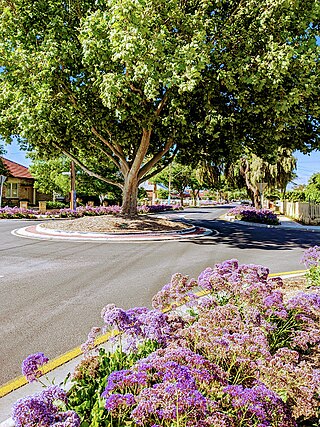
Surrey Downs is a northeastern suburb of Adelaide, South Australia. It is located in the City of Tea Tree Gully local government area, and is adjacent to Wynn Vale, Golden Grove, Fairview Park and Redwood Park.
West Croydon is an inner western suburb of Adelaide, South Australia.

Parkside is an inner southern suburb of Adelaide, South Australia. It is located in the City of Unley.

Wayville is an inner-southern suburb of Adelaide in the City of Unley. It is most notable for hosting of the Royal Adelaide Show at the Adelaide Showgrounds.

Clarence Park is an inner southern suburb of Adelaide, South Australia in the City of Unley. Its borders are Mills Street (north), Goodwood Road (east), Cross Road (south) and the Seaford railway line (north-west).

Black Forest is an inner southern suburb of Adelaide, South Australia. It is located in the City of Unley, bounded by the Glenelg tram line (north-west), the Seaford railway line (south-east), South Road (west) and East Avenue (east).
Hyde Park is an inner-southern suburb of Adelaide in the City of Unley.

Millswood is an inner-southern mainly residential suburb of Adelaide in the City of Unley. It was named after Scotsman Samuel Mills, who arrived in the colony in 1839.
Plympton is an inner south-western suburb of Adelaide, South Australia. The name is believed to have been given by Henry Mooringe Boswarva to a private subdivision in the area, naming after his home town in Devon, England. It was accepted as an official name for the suburb in 1944.
Oaklands Park is a southern suburb of Adelaide, South Australia in the City of Marion. The Marion Shopping Centre is a major feature of the suburb.

Park Holme is a south-western suburb of Adelaide in the City of Marion, South Australia, located about 8 km (5 mi) from the Adelaide city centre. It is bordered to the east by Marion Road, to the west by Hendrie Street, to the south by Oaklands Road, and to the north by Tarranna Ave, which is just south of Bray Street. It is adjacent to Ascot Park, Edwardstown, South Plympton, Mitchell Park, Clovelly Park, Glengowrie, Morphettville and Oaklands Park. Park Holme covers 115 hectares, (1.15 sq km).

Plympton Park is an inner south-western suburb of Adelaide 8 km from the CBD, in the state of South Australia and falls under the City of Marion. The post code for Plympton Park is 5038. It is adjacent to Park Holme, Plympton, South Plympton, and Morphettville. It is bordered to the east by Marion Road, to the west by Park Terrace, to the south by Taranna Avenue and to the north by the Glenelg tram line.
Cumberland Park is an inner-southern suburb of Adelaide, South Australia in the City of Mitcham.
Salisbury Downs is a suburb located in the City of Salisbury, Adelaide, South Australia. The suburb is bordered by Kings Road, the Little Para River, Burton Road, Spains Road and the Gawler railway line.
Catherine Maria Thornber was the founder of a school for girls in Unley Park, South Australia.