The New Jersey Turnpike (NJTP) is a system of controlled-access highways in the U.S. state of New Jersey. The turnpike is maintained by the New Jersey Turnpike Authority (NJTA). The 117.20-mile (188.62 km) mainline's southern terminus is at a complex interchange with Interstate 295 (I-295), U.S. Route 40 (US 40), US 130, and Route 49 near the border of Pennsville and Carneys Point townships in Salem County, one mile (1.6 km) east of the Delaware Memorial Bridge. Its northern terminus is at an interchange with I-80 and US 46 in Ridgefield Park. Construction of the mainline from concept to completion took 22 months, from 1950 to 1951. It was opened to traffic on November 5, 1951, between its southern terminus and exit 10.

Route 18 is a 42.8-mile-long (68.9 km) state highway in the central part of the US state of New Jersey. It begins at an intersection with Route 138 in Wall Township, Monmouth County and ends at Interstate 287 (I-287) in Piscataway Township, Middlesex County. Route 18 is a major route through central New Jersey that connects the Jersey Shore to the Raritan Valley region, connecting the county seats of Monmouth (Freehold) and Middlesex respectively. The route runs through Ocean Township, Marlboro Township, East Brunswick, and is the main thoroughfare for Rutgers University. Much of the route is a freeway. The remainder of the route is an arterial road with traffic lights in the East Brunswick and Old Bridge areas, and a boulevard in the remainder of Piscataway. Route 18 was designated in 1939 as a proposed freeway from Old Bridge to Eatontown. The section west of Old Bridge was formerly designated as part Route S28, a prefixed spur of State Highway Route 28 from Middlesex to Matawan. The designation, assigned in the 1927 renumbering, remained until a second renumbering in 1953. At that point, Route S28 was redesignated as Route 18, though the section from Old Bridge to Matawan was signed as TEMP 18, as this section would be decommissioned when the Route 18 freeway was built.

Route 35 is a state highway in the U.S. state of New Jersey, primarily traveling through the easternmost parts of Middlesex, Monmouth, and Ocean counties. It runs 58.11 mi (93.52 km) from the entrance to Island Beach State Park in Berkeley Township, Ocean County to an intersection with Route 27 in Rahway, Union County. Between Seaside Park and Mantoloking, Route 35 follows the right-of-way of the former Pennsylvania Railroad along the Jersey Shore. The route heads through Point Pleasant Beach and crosses the Manasquan River on the Brielle Bridge, meeting Route 34 and Route 70 at the former Brielle Circle in Wall Township. From there, Route 35 heads north and intersects Route 138, an extension of Interstate 195, continuing north through Monmouth County before crossing the Victory Bridge over the Raritan River into Perth Amboy, where the route continues north to Rahway.

Middlesex County is located in the north-central part of the U.S. state of New Jersey, extending inland from the Raritan Valley region to the northern portion of the Jersey Shore. As of the 2020 United States census, the county was the state's third-most populous county with a population of 863,162, its highest decennial count ever and an increase of 53,304 (+6.6%) from the 2010 census count of 809,858, which in turn reflected an increase of 59,696 (8.0%) from the 750,162 counted in the 2000 census. Middlesex is part of the New York metropolitan area. Many communities within the county serve as commuter towns to and from New York City and other points north. The county is part of the Central Jersey region of the state.

Route 29 is a state highway in the U.S. state of New Jersey. Signed north-south, it runs 34.76 mi (55.94 km) from an interchange with Interstate 295 (I-295) in Hamilton Township in Mercer County, where the road continues east as I-195, northwest to Route 12 in Frenchtown, Hunterdon County. Between the southern terminus and I-295 in Ewing Township, the route is a mix of freeway and expressway that runs along the Delaware River through Trenton. This section includes a truck-restricted tunnel that was built along the river near historic houses and Riverview Cemetery. North of I-295, Route 29 turns into a scenic and mostly two-lane highway. North of the South Trenton Tunnel, it is designated the Delaware River Scenic Byway, a New Jersey Scenic Byway and National Scenic Byway, that follows the Delaware River in mostly rural sections of Mercer County and Hunterdon County. The obsolete Delaware & Raritan Canal usually stands between the river and the highway. Most sections of this portion of Route 29 are completely shaded due to the tree canopy. Route 29 also has a spur, Route 129, which connects Route 29 to U.S. Route 1 (US 1) in Trenton.

Route 33 is a state highway in the central part of the US state of New Jersey. The highway extends 42.03 miles (67.64 km), from an interchange with U.S. Route 1 (US 1) in Trenton, Mercer County, east to an intersection with Route 71 in Neptune, Monmouth County. Route 33 is a major route through central New Jersey, as it runs from the greater state capital area in the Delaware Valley region, through a mixture of farmland, housing, and commercial developments in the lower Raritan Valley region, en route to the greater Asbury Park area on the Jersey Shore. The route traverses through historic towns such as Hightstown, Monroe, Manalapan, Freehold, and Tinton Falls. There are several intersections on Route 33 with future developments.

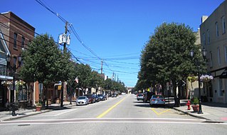
Perth Amboy is a city in northeastern Middlesex County, in the U.S. state of New Jersey, within the New York metropolitan area. As of the 2020 United States census, the city's population was 55,436. Perth Amboy is known as the "City by the Bay", referring to its location adjoining Raritan Bay.

Sayreville is a borough in Middlesex County, in the U.S. state of New Jersey. Sayreville is within the heart of the Raritan Valley region, located on the south banks of the Raritan River, and also located on the Raritan Bay. As of the 2020 United States census, the borough's population was 45,345, an increase of 2,641 (+6.2%) from the 2010 census count of 42,704, which in turn reflected an increase of 2,327 (+5.8%) from the 40,377 counted in the 2000 census.
South Amboy is a suburban city in Middlesex County, in the U.S. state of New Jersey, located on Raritan Bay. As of the 2020 United States census, the city's population was 9,411, an increase of 780 (+9.0%) from the 2010 census count of 8,631, which in turn reflected an increase of 718 (+9.1%) from the 7,913 counted in the 2000 census.

The Raritan River is a major river of New Jersey. Its watershed drains much of the mountainous area of the central part of the state, emptying into the Raritan Bay on the Atlantic Ocean.

The Garden State Parkway (GSP) is a controlled-access toll road that stretches the north–south length of eastern New Jersey from the state's southernmost tip near Cape May north to the New York state line at Montvale. Its name refers to New Jersey's nickname, the "Garden State". The parkway has an unsigned reference number of Route 444 by the New Jersey Department of Transportation (NJDOT). At its north end, the road becomes the Garden State Parkway Connector, a component of the New York State Thruway system that connects to the Thruway mainline in Ramapo.
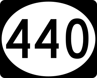
Route 440 is a state highway in New Jersey, United States. It comprises two segments, a 5.15-mile (8.29 km) freeway in Middlesex County linking Interstate 287 (I-287) and the New Jersey Turnpike (I-95), in Edison to the Outerbridge Crossing in Perth Amboy and an 8.18-mile (13.16 km) four-lane divided highway in Hudson County running from the Bayonne Bridge in Bayonne to U.S. Route 1/9 Truck in Jersey City. These two segments are connected by New York State Route 440 (NY 440), which runs across Staten Island. The freeway portion in Middlesex County is six lanes wide and interchanges with the Garden State Parkway and US 9 in Woodbridge.

The Pulaski Skyway is a four-lane bridge-causeway in the northeastern part of the U.S. state of New Jersey, carrying a freeway designated U.S. Route 1/9 (US 1/9) for most of its length. The structure has a total length of 3.502 miles (5.636 km). Its longest bridge spans 550 feet (168 m). Traveling between Newark and Jersey City, the roadway crosses the Passaic and Hackensack rivers, Kearny Point, the peninsula between them, and the New Jersey Meadowlands.
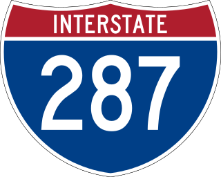
Interstate 287 (I-287) is an auxiliary Interstate Highway in the US states of New Jersey and New York. It is a partial beltway around New York City, serving northern New Jersey and the counties of Rockland and Westchester in New York. I-287, which is signed north–south in New Jersey and east–west in New York, follows a roughly horseshoe-shaped route from the New Jersey Turnpike (I-95) in Edison, New Jersey, clockwise to the New England Thruway (I-95) in Rye, New York, for 98.72 miles (158.87 km). Through New Jersey, I-287 runs west from its southern terminus in Edison through suburban areas. In Bridgewater Township, the freeway takes a more northeasterly course, paralleled by US Route 202 (US 202). The northernmost part of I-287 in New Jersey passes through mountainous surroundings. After crossing into New York at Suffern, I-287 turns east on the New York State Thruway (I-87) and runs through Rockland County. After crossing the Hudson River on the Tappan Zee Bridge, I-287 splits from I-87 near Tarrytown and continues east through Westchester County on the Cross-Westchester Expressway until it reaches the New England Thruway. Within New Jersey, I-287 is maintained by the New Jersey Department of Transportation (NJDOT), and, within New York, it is maintained by the New York State Thruway Authority (NYSTA).

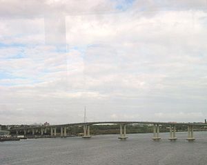
The Edison Bridge and the Vieser bridge are a pair of bridges that carry U.S. Route 9 in the state of New Jersey, spanning the Raritan River near its mouth in Raritan Bay. The bridge, which connects Woodbridge on the north with Sayreville on the south, was opened to weekend traffic starting on October 11, 1940, and was opened permanently on November 15, 1940. As of 2003, the bridge carries more than 82,000 vehicles daily and is owned and operated by the New Jersey Department of Transportation. It also runs directly parallel to the Driscoll Bridge, which carries the Garden State Parkway.

U.S. Route 9 (US 9) is a United States Numbered Highway in the Mid-Atlantic region of the United States, running from Laurel, Delaware, to Champlain, New York. In New Jersey, the route runs 166.80 miles (268.44 km) from the Cape May–Lewes Ferry terminal in North Cape May, Cape May County, where the ferry carries US 9 across the Delaware Bay to Lewes, Delaware, north to the George Washington Bridge in Fort Lee, Bergen County, where the route along with Interstate 95 (I-95) and US 1 continue into New York City. US 9 is the longest U.S. Highway in the state.

The Raritan Bay Drawbridge, also known as River-Draw, Raritan Bay Swing Bridge, and Raritan River Railroad Bridge, is a railroad swing bridge crossing the Raritan River 0.5 miles (0.8 km) from where it empties into the Raritan Bay in Middlesex County, New Jersey, United States. It connects Perth Amboy to the north and South Amboy to the south.

The Beesley's Point Bridge was a bridge in New Jersey, United States, that was built privately by the Ocean City Automobile Club in 1927. Completed in 1928, control of the bridge was acquired by the Beesley's Point Bridge Company. It was a toll bridge from its opening. Prior to its closing, it was best known for carrying U.S. Route 9 (US 9) over the Great Egg Harbor Bay, connecting Upper Township, in Cape May County to Somers Point in Atlantic County. Route 9 and the Garden State Parkway temporally concurred over the Beesley's Point Bridge from the Parkway's opening in 1954 until a separate bridge over the bay for the Parkway, the Great Egg Harbor Bridge, opened in 1955.
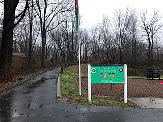
The Middlesex Greenway is a 3.5 miles (5.6 km) rail trail in New Jersey Metuchen, Edison and Woodbridge. It is part of the Middlesex County Park System. It makes up a portion of the East Coast Greenway.
Morris Goodkind was chief bridge engineer for the New Jersey State Highway Department from 1925 to 1955, and was responsible for the construction of numerous bridges during that period. Goodkind emphasized the integration of architecture and aesthetics in bridge design and received awards from the American Society of Civil Engineers and the American Institute of Steel Construction for his designs.