Meramec State Park is a public recreation area located near Sullivan, Missouri, about 60 miles from St. Louis, along the Meramec River. The park has diverse ecosystems such as hardwood forests and glades. There are over 40 caves located throughout the park, the bedrock is dolomite. The most famous is Fisher Cave, located near the campgrounds. The park borders the Meramec Conservation Area.

First Landing State Park offers recreational opportunities at Cape Henry in the independent city of Virginia Beach, Virginia. As the first planned state park of Virginia, First Landing is listed on the National Register of Historic Places as Seashore State Park Historic District. A portion of the park is listed as a National Natural Landmark as part of the Seashore Natural Area.

Maramec Spring is located on the Meramec River near St. James in the east-central Ozarks of Missouri. The fifth largest spring in the state with an average discharge of 153 cubic feet (4.3 m3) of water per second, it is part of a Karst topographical area, with many springs and caves. The spring and 1800 acres (7.28 km²) are owned by the James Foundation, which maintains the area as a public park, donated by Lucy Wortham James. The Missouri Department of Conservation operates a trout hatchery and fishery at the spring. Ruins of the Maramec Iron Works are still visible at the site; its machinery was partly powered by the spring's waterflow. The spring was declared a National Natural Landmark in October 1971.

Fort Churchill State Historic Park is a state park of Nevada, United States, preserving the remains of a United States Army fort and a waystation on the Pony Express and Central Overland Routes dating back to the 1860s. The site is one end of the historic Fort Churchill and Sand Springs Toll Road. The park is in Lyon County south of the town of Silver Springs, on U.S. Route 95 Alternate, eight miles (13 km) south of U.S. Route 50. Fort Churchill was designated a National Historic Landmark in 1961. A 1994 park addition forms a corridor along the Carson River.

Montauk State Park is a public recreation area occupying nearly 3,000 acres (1,200 ha) at the headwaters of the Current River, fifteen miles (24 km) southwest of Salem, Missouri. The state park contains a fish hatchery and is noted for its rainbow and brown trout angling. It was acquired in 1926. The park has several natural springs including Montauk Spring with a daily average flow of 53 million gallons of water.

Washington State Park is a public recreation area covering 2,147 acres (869 ha) in Washington County in the central eastern part of the state of Missouri. It is located on Highway 21 about 14 miles (23 km) northeast of Potosi or 7 miles (11 km) southwest of DeSoto on the eastern edge of the Ozarks. The state park is noted for its Native American rock carvings and for its finely crafted stonework from the 1930s.
Bennett Spring State Park is a public recreation area located in Bennett Springs, Missouri, twelve miles (19 km) west of Lebanon on Highway 64 in Dallas and Laclede counties. It is centered on the spring that flows into the Niangua River and gives the park its name. The spring averages 100 million gallons of daily flow. The park offers fly fishing, camping, canoeing, hiking, and other activities.

The Thomas Hart Benton Home and Studio State Historic Site is a state-owned property located at 3616 Belleview, Kansas City, Missouri, that preserves the house and studio of Missouri artist Thomas Hart Benton. The historic site was established in 1977 and is managed by the Missouri Department of Natural Resources. Tours are provided that show the furnished house and studio as Benton left it when he died on January 19, 1975. The site was listed on the National Register of Historic Places in 1980.

The Bollinger Mill State Historic Site is a state-owned property preserving a mill and covered bridge that pre-date the American Civil War in Burfordville, Cape Girardeau County, Missouri. The park was established in 1967 and offers mill tours and picnicking. It is managed by the Missouri Department of Natural Resources. It includes the Burfordville Covered Bridge, which is listed on the National Register of Historic Places.

Harrisville Historic District is a well-preserved historic New England mill village located in the southwest part of New Hampshire. It consists of about 200 acres (0.81 km2) and about 135 structures. It was declared a National Historic Landmark in 1977.

The Casselman Bridge is an historic transportation structure on the Casselman River, located immediately east of Grantsville in Garrett County, Maryland. The bridge was built in 1813-1814 as part of the National Road. Historic markers posted at each end read:
Erected 1813 by David Shriver, Jr.,
Sup't of the "Cumberland Road". This 80 foot span
was the largest stone arch in America
at the time. It was continuously
used from 1813 to 1933.

The Ste. Genevieve National Historical Park, established in 2020, consists of part or the whole of the area of the Ste. Genevieve Historic District, which is a historic district encompassing much of the built environment of Ste. Genevieve, Missouri, United States. The city was in the late 18th century the capital of Spanish Louisiana, and, at its original location a few miles south, capital of French Louisiana as well. A large area of the city, including fields along the Mississippi River, is a National Historic Landmark District designated in 1960, for its historically French architecture and land-use patterns, while a smaller area, encompassing the parts of the city historically important between about 1790 and 1950, was named separately to the National Register of Historic Places in 2002.

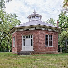
The Glebe House, built in 1854–1857, is a historic house with an octagon-shaped wing in Arlington County, Virginia. The Northern Virginia Conservation Trust holds a conservation easement to help protect and preserve it. The name of the house comes from the property's history as a glebe, an area of land within an ecclesiastical parish used to support a parish priest. In this case, the glebe was established by the Church of England before the American Revolutionary War.

Graham Cave is a Native American archeological site near Mineola, Missouri in Montgomery County in the hills above the Loutre River. It is located in the 356 acre Graham Cave State Park. The entrance of the sandstone cave forms a broad arch 120 feet (37 m) wide and 16 feet (5 m) high. Extending about 100 feet (30 m) into the hillside, the cave protects an historically important Pre-Columbian archaeological site from the ancient Dalton and Archaic period dating back to as early as 10,000 years ago.

The Dillard Mill State Historic Site is a privately owned, state-administered property on Huzzah Creek in Crawford County, Missouri, that preserves a water-powered gristmill. The 132-acre (53 ha) site has been operated as a state historic site by the Missouri Department of Natural Resources under a lease agreement with the L-A-D Foundation since 1975. The site was listed on the National Register of Historic Places in 2015.

Gen. John J. Pershing Boyhood Home State Historic Site in Laclede, Missouri, is maintained by the Missouri Department of Natural Resources as a state historic site. General John Joseph "Jack" Pershing lead the American Expeditionary Forces in World War I and attained the rank of General of the Armies. Pershing was born on a farm outside Laclede, but lived in the home from age six to adulthood. The historic site preserves and interprets the boyhood home and the one-room Prairie Mound School at which he taught for a year before attending West Point Military Academy. The home has been listed on the National Register of Historic Places since 1969, and was designated a National Historic Landmark in 1976.

The Osage Village State Historic Site is a publicly owned property in Vernon County, Missouri, maintained by the Missouri Department of Natural Resources. The historic site preserves the archaeological site of a major Osage village, that once had some 200 lodges housing 2,000 to 3,000 people. The site, designated by the Smithsonian trinomial 23VE01, was also known for many years as the Carrington Osage Village Site, under which name it was designated a National Historic Landmark in 1964.
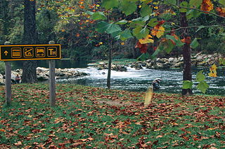
Roaring River State Park is a public recreation area covering of 4,294 acres (1,738 ha) eight miles (13 km) south of Cassville in Barry County, Missouri. The state park offers trout fishing on the Roaring River, hiking on seven different trails, and the seasonally open Ozark Chinquapin Nature Center.

The Scott Joplin House State Historic Site is located at 2658 Delmar Boulevard in St. Louis, Missouri. It preserves the Scott Joplin Residence, the home of composer Scott Joplin from 1901 to 1903. The house and its surroundings are maintained by the Missouri Department of Natural Resources as a state historic site. The house was added to the National Register of Historic Places and designated a U.S. National Historic Landmark in 1976.