List of bridges on the National Register of Historic Places in Missouri

Last updated

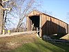
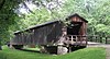
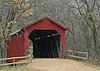
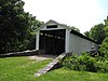
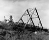
This is a list of bridges and tunnels on the National Register of Historic Places in the U.S. state of Missouri. [1]

NameImageBuiltListedLocationCountyType
Arrow Rock State Historic Site Bridge ca. 19371985-03-04 Arrow Rock
39°4′6″N92°56′39″W / 39.06833°N 92.94417°W / 39.06833; -92.94417 (Arrow Rock State Historic Site Bridge)
Saline
Barretts Tunnels Barretts Tunnel 1.jpg 1851, 18531978-12-08 Kirkwood
38°34′21″N90°27′18″W / 38.57250°N 90.45500°W / 38.57250; -90.45500 (Barretts Tunnels)
St. Louis
Boeckman Bridge 19261979-03-19 St. Elizabeth
38°13′35″N92°14′23″W / 38.22639°N 92.23972°W / 38.22639; -92.23972 (Boeckman Bridge)
Miller
Brownville Bridge Brownville-bridge.jpg 19391993-06-17 Phelps City
40°23′57″N95°39′6″W / 40.39917°N 95.65167°W / 40.39917; -95.65167 (Brownville Bridge)
Atchison
Burfordville Covered Bridge Bollinger mill dec29-07 (37).JPG 18581970-05-19 Burfordville
37°22′2″N89°48′9″W / 37.36722°N 89.80250°W / 37.36722; -89.80250 (Burfordville Covered Bridge)
Cape Girardeau Howe truss
Chain of Rocks Bridge ChainOfRocksBridge StLouisMO.jpg 1929, 19362006-12-01 St. Louis St. Louis City Warrant Truss
Crowder State Park Vehicle Bridge ca. 19391985-03-04 Trenton
40°5′31″N93°39′51″W / 40.09194°N 93.66417°W / 40.09194; -93.66417 (Crowder State Park Vehicle Bridge)
Grundy Rustic arch
Eads Bridge Eads Bridge, St. Louis Missouri.jpg 1867, 18741966-10-15 St. Louis
38°37′45″N90°11′8″W / 38.62917°N 90.18556°W / 38.62917; -90.18556 (Eads Bridge)
St. Louis City Cantilever deck arch
Grand Auglaize Bridge 1931-312020-10-08vic. of Brumley Miller A suspension and swinging bridge designed and built by Dice.
Hargrove Pivot Bridge 19171985-10-15 Poplar Bluff
36°38′50″N90°18′0″W / 36.64722°N 90.30000°W / 36.64722; -90.30000 (Hargrove Pivot Bridge)
Butler Wichert and Warren Truss
Jefferson Street Footbridge Jefferson Avenue footbridge.jpg 2003-09-02 Springfield
37°13′58″N93°17′21″W / 37.23278°N 93.28917°W / 37.23278; -93.28917 (Jefferson Street Footbridge)
Greene Cantilever Through Truss
Locust Creek Covered Bridge Locust Creek Covered Bridge 1.jpg 18681970-05-19 Laclede
39°47′30″N93°14′3″W / 39.79167°N 93.23417°W / 39.79167; -93.23417 (Locust Creek Covered Bridge)
Linn
Meramec River U.S. 66 Bridge - J421 Meramec River Route 66 bridge J421.jpg 2009-9-16 Eureka 38°30′20″N90°35′31.19″W / 38.50556°N 90.5919972°W / 38.50556; -90.5919972 (Meramec River U.S. Bridge - J421) St. Louis Warren deck truss
Montserrat Recreation Demonstration Area Bridge 19371985-03-04 Knob Noster
38°45′13″N93°34′36″W / 38.75361°N 93.57667°W / 38.75361; -93.57667 (Montserrat Recreation Demonstration Area Bridge)
Johnson
Papinville Marais des Cygnes River Bridge 18842002-10-22 Papinville
38°4′6″N94°13′54″W / 38.06833°N 94.23167°W / 38.06833; -94.23167 (Papinville Marais des Cygnes River Bridge)
Bates Pinned Pratt through truss
Pin Oak Hollow Bridge 1934, 19381985-09-13 Pin Oak Hollow
38°6′50″N92°36′43″W / 38.11389°N 92.61194°W / 38.11389; -92.61194 (Pin Oak Hollow Bridge)
Camden Single-arch
Powell Bridge PowellBridgeMO2.JPG 19152011-4-20 Powell vicinity
36°36′57″N94°10′56″W / 36.61583°N 94.18222°W / 36.61583; -94.18222 (Powell Bridge)
McDonald Pinned Pratt through truss
Rulo Bridge Rulo-bridge.jpg 1938, 19391993-01-04 Fortescue
40°3′14″N95°25′14″W / 40.05389°N 95.42056°W / 40.05389; -95.42056 (Rulo Bridge)
Holt Pennsylvania through truss
Sandy Creek Covered Bridge Sandy creek covered bridge 02.jpg 18721970-07-08 Hillsboro
38°17′38″N90°31′5″W / 38.29389°N 90.51806°W / 38.29389; -90.51806 (Sandy Creek Covered Bridge)
Jefferson Howe Truss
Swan Creek Bridge 1914, 19321983-09-08 Forsyth
36°42′2″N93°5′8″W / 36.70056°N 93.08556°W / 36.70056; -93.08556 (Swan Creek Bridge)
Taney
Union Covered Bridge Union Covered Bridge SHS from northeast 1.jpg 1870, 18711970-06-15 Paris
39°25′58″N92°6′9″W / 39.43278°N 92.10250°W / 39.43278; -92.10250 (Union Covered Bridge)
Monroe
Upper Bridge 19281999-09-17 Warsaw
38°14′39″N93°23′16″W / 38.24417°N 93.38778°W / 38.24417; -93.38778 (Upper Bridge)
Benton
Waddell "A" Truss Bridge Waddell "A" Truss Bridge, Spanning Lin Branch Creek, Missouri cropped.jpg 1898, 1980, 19871991-01-25 Parkville
39°11′9″N94°40′55″W / 39.18583°N 94.68194°W / 39.18583; -94.68194 (Waddell "A" Truss Bridge)
Platte Waddell "A" truss
Waverly Bridge
Windsor Harbor Road Bridge Windsor Harbor Road Bridge.jpg 1874, 18751983-09-08 Kimmswick
38°21′50″N90°21′44″W / 38.36389°N 90.36222°W / 38.36389; -90.36222 (Windsor Harbor Road Bridge)
Jefferson
Y Bridge Y-Bridge 1.JPG 1926, 19271991-05-23 Galena
36°48′18″N93°27′41″W / 36.80500°N 93.46139°W / 36.80500; -93.46139 (Y Bridge)
Stone Open spandrel arch Y bridge

Related Research Articles

<span class="mw-page-title-main">National Register of Historic Places listings in Cheboygan County, Michigan</span>

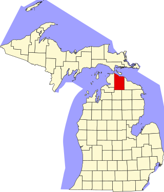
This is a list of the National Register of Historic Places listings in Cheboygan County, Michigan.

<span class="mw-page-title-main">National Register of Historic Places listings in Delaware County, New York</span>

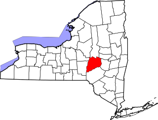
List of the National Register of Historic Places listings in Delaware County, New York

<span class="mw-page-title-main">National Register of Historic Places listings in Genesee County, New York</span>

List of the National Register of Historic Places listings in Genesee County, New York

<span class="mw-page-title-main">National Register of Historic Places listings in Niagara County, New York</span>

This is a list of the National Register of Historic Places listings in Erie County, New York.

<span class="mw-page-title-main">National Register of Historic Places listings in Ontario County, New York</span>

List of the National Register of Historic Places listings in Ontario County, New York

<span class="mw-page-title-main">National Register of Historic Places listings in Otsego County, New York</span>

List of the National Register of Historic Places listings in Otsego County, New York

<span class="mw-page-title-main">National Register of Historic Places listings in Putnam County, New York</span>

List of the National Register of Historic Places listings in Putnam County, New York

<span class="mw-page-title-main">National Register of Historic Places listings in Staten Island</span>

List of the National Register of Historic Places listings in Richmond County, New York.

<span class="mw-page-title-main">National Register of Historic Places listings in Warren County, New York</span>

List of Registered Historic Places in Warren County, New York

<span class="mw-page-title-main">National Register of Historic Places listings in Tompkins County, New York</span>

List of the National Register of Historic Places listings in Tompkins County, New York

<span class="mw-page-title-main">National Register of Historic Places listings in Frederick County, Maryland</span>

This is a list of the National Register of Historic Places listings in Frederick County, Maryland.

<span class="mw-page-title-main">National Register of Historic Places listings in Ashe County, North Carolina</span>

This list includes properties and districts listed on the National Register of Historic Places in Ashe County, North Carolina. Click the "Map of all coordinates" link to the right to view an online map of all properties and districts with latitude and longitude coordinates in the table below.

<span class="mw-page-title-main">National Register of Historic Places listings in Watauga County, North Carolina</span>

This list includes properties and districts listed on the National Register of Historic Places in Watauga County, North Carolina. Click the "Map of all coordinates" link to the right to view an online map of all properties and districts with latitude and longitude coordinates in the table below.

<span class="mw-page-title-main">National Register of Historic Places listings in Beaufort County, North Carolina</span>

This list includes properties and districts listed on the National Register of Historic Places in Beaufort County, North Carolina. Click the "Map of all coordinates" link to the right to view an online map of all properties and districts with latitude and longitude coordinates in the table below.

<span class="mw-page-title-main">National Register of Historic Places listings in Madison County, North Carolina</span>

This list includes properties and districts listed on the National Register of Historic Places in Madison County, North Carolina. Click the "Map of all coordinates" link to the right to view an online map of all properties and districts with latitude and longitude coordinates in the table below.

<span class="mw-page-title-main">National Register of Historic Places listings in Graham County, North Carolina</span>

This list includes properties and districts listed on the National Register of Historic Places in Graham County, North Carolina. Click the "Map of all coordinates" link to the right to view an online map of all properties and districts with latitude and longitude coordinates in the table below.

There are 291 properties and historic districts on the National Register of Historic Places in Worcester, Massachusetts. Of these, 81 are west of I-190 and the north-south section of I-290 and south of Massachusetts Route 122, and are listed below. One listing, the Blackstone Canal Historic District, overlaps into other parts of the city. Another listing has been removed.

References

  1. "National Register Information System". National Register of Historic Places . National Park Service. July 9, 2010.