List of bridges on the National Register of Historic Places in West Virginia

Last updated

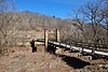
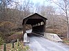
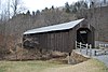
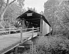
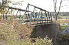
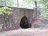
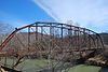
This is a list of bridges and tunnels on the National Register of Historic Places in the U.S. state of West Virginia. [1]

NameImageBuiltListedLocationCountyType
Alderson Bridge Alderson Memorial Bridge in West Virginia.jpg 19141991-12-04 Alderson
37°43′29″N80°38′36″W / 37.72472°N 80.64333°W / 37.72472; -80.64333 (Alderson Bridge)
Greenbrier, Monroe Concrete arch bridge
B & O Railroad Potomac River Crossing Harpers ferry air photo nps.jpg 1894, 19311978-02-14 Harpers Ferry, West Virginia
39°19′27″N77°43′43″W / 39.32417°N 77.72861°W / 39.32417; -77.72861 (B & O Railroad Potomac River Crossing)
Jefferson
Barrackville Covered Bridge Barrackville Covered Bridge - Side in Winter.jpg 18531973-03-30 Barrackville
39°30′21″N80°10′5″W / 39.50583°N 80.16806°W / 39.50583; -80.16806 (Barrackville Covered Bridge)
Marion Covered Burr truss
Bridgeport Lamp Chimney Company Bowstring Concrete Arch Bridge 19241997-01-27 Bridgeport
39°17′3″N80°15′22″W / 39.28417°N 80.25611°W / 39.28417; -80.25611 (Bridgeport Lamp Chimney Company Bowstring Concrete Arch Bridge)
Harrison Concrete Arch Bridge
Burnsville Bridge Burnsville Bridge.jpg 18931995-03-17 Burnsville
38°51′19″N80°39′25″W / 38.85528°N 80.65694°W / 38.85528; -80.65694 (Burnsville Bridge)
Braxton Pratt-Through Truss
Capon Lake Whipple Truss Bridge Capon Lake Whipple Truss Bridge Capon Lake WV 2009 07 19 11.jpg 2011-12-11 Capon Lake
39°9′28″N78°32′13″W / 39.15778°N 78.53694°W / 39.15778; -78.53694 (Capon Lake Whipple Truss Bridge)
Hampshire formerly South Branch Bridge
Carrollton Covered Bridge Carrollton Covered Bridge.jpg 18561981-06-04 Carrollton
39°5′24″N80°5′12″W / 39.09000°N 80.08667°W / 39.09000; -80.08667 (Carrollton Covered Bridge)
Barbour Covered Burr Arch
Center Point Covered Bridge Center Point Covered Bridge - Side View.jpg 1983-08-29 Center Point
39°23′22″N80°38′4″W / 39.38944°N 80.63444°W / 39.38944; -80.63444 (Center Point Covered Bridge)
Doddridge Covered bridge
Dents Run Covered Bridge Dents Run Covered Bridge.jpg 18891981-06-04 Laurel Point
39°37′26″N80°2′24″W / 39.62389°N 80.04000°W / 39.62389; -80.04000 (Dents Run Covered Bridge)
Monongalia Covered Kingpost Truss
Duck Run Cable Suspension Bridge Duck Run Suspension Bridge.jpg 19221997-07-09 Trubada
38°55′38″N80°47′28″W / 38.92722°N 80.79111°W / 38.92722; -80.79111 (Duck Run Cable Suspension Bridge)
Gilmer cable suspension bridge
Elm Grove Stone Arch Bridge Elm Grove Stone Arch Bridge.jpg 18171981-08-21 Wheeling
40°2′37″N80°39′32″W / 40.04361°N 80.65889°W / 40.04361; -80.65889 (Elm Grove Stone Arch Bridge)
Ohio Stone Arch
Fish Creek Covered Bridge Fish Creek Covered Bridge - Side View.jpg ca. 18811981-06-04 Hundred
39°40′20″N80°27′9″W / 39.67222°N 80.45250°W / 39.67222; -80.45250 (Fish Creek Covered Bridge)
Wetzel Covered King Post truss
Fletcher Covered Bridge 18911981-06-04 Maken
39°18′20″N80°28′49″W / 39.30556°N 80.48028°W / 39.30556; -80.48028 (Fletcher Covered Bridge)
Harrison Covered Kingpost Truss
Glenville Truss Bridge Glenville Truss Bridge.jpg 18851998-12-04 Glenville
38°55′58″N80°50′20″W / 38.93278°N 80.83889°W / 38.93278; -80.83889 (Glenville Truss Bridge)
Gilmer Pratt Through Truss
Herns Mill Covered Bridge Herns Mill Covered Bridge.jpg 18841981-06-04 Lewisburg
37°49′57″N80°30′18″W / 37.83250°N 80.50500°W / 37.83250; -80.50500 (Herns Mill Covered Bridge)
Greenbrier Covered Queen Post Truss
High Level Bridge Fairmont High Level Bridge.jpg 19211991-12-04 Fairmont
39°28′57″N80°8′27″W / 39.48250°N 80.14083°W / 39.48250; -80.14083 (High Level Bridge)
Marion
Hokes Mill Covered Bridge Hokes Mill Covered Bridge - Through View.jpg ca. 18991981-06-04 Lewisburg
37°41′50″N80°31′30″W / 37.69722°N 80.52500°W / 37.69722; -80.52500 (Hokes Mill Covered Bridge)
Greenbrier Covered Long Truss
Indian Creek Covered Bridge Indian Creek Covered Bridge - Side View.jpg ca. 18981975-04-01 Salt Sulphur Springs
37°32′50″N80°34′22″W / 37.54722°N 80.57278°W / 37.54722; -80.57278 (Indian Creek Covered Bridge)
Monroe Covered Howe truss
Laurel Creek Covered Bridge Laurel Creek Covered Bridge - Night.jpg 1910, 19111981-06-04 Lillydale
37°33′40″N80°37′36″W / 37.56111°N 80.62667°W / 37.56111; -80.62667 (Laurel Creek Covered Bridge)
Monroe Covered
Locust Creek Covered Bridge Locust Creek Covered Bridge.jpg 18701981-06-04 Hillsboro
38°4′46″N80°15′1″W / 38.07944°N 80.25028°W / 38.07944; -80.25028 (Locust Creek Covered Bridge)
Pocahontas Covered Warren Truss
Mud River Covered Bridge Mud River Covered Bridge.jpg ca. 18751975-06-10 Milton
38°25′51″N82°8′22″W / 38.43083°N 82.13944°W / 38.43083; -82.13944 (Mud River Covered Bridge)
Cabell Covered Modified Howe truss
New River Gorge Bridge New River Gorge Bridge.jpg 19772013-08-14near Fayetteville Fayette Steel arch
Parks's Gap Bridge ParkssGapBridge.JPG 18921994-11-04 Martinsburg
39°30′45″N78°2′11″W / 39.51250°N 78.03639°W / 39.51250; -78.03639 (Parks's Gap Bridge)
Berkeley Modified Howe Truss
Philippi Covered Bridge PhilippiCoveredBridge.jpg 18521972-09-14 Philippi
39°9′11″N80°2′37″W / 39.15306°N 80.04361°W / 39.15306; -80.04361 (Philippi Covered Bridge)
Barbour Covered
Rotary Park Bridge Rotary Park Bridge 2013-09-19 01-34-02.jpg 1929, 19302002-12-12 Huntington
38°25′7″N82°23′39″W / 38.41861°N 82.39417°W / 38.41861; -82.39417 (Rotary Park Bridge)
Cabell Rustic
Sarvis Fork Covered Bridge Sarvis Fork Covered Bridge.jpg 1889, 18901981-06-04 Sandyville
38°55′17″N81°38′41″W / 38.92139°N 81.64472°W / 38.92139; -81.64472 (Sarvis Fork Covered Bridge)
Jackson Covered Long Truss
Simpson Creek Covered Bridge 18811981-06-04 Bridgeport
39°18′31″N80°16′47″W / 39.30861°N 80.27972°W / 39.30861; -80.27972 (Simpson Creek Covered Bridge)
Harrison Covered Multiple Kingpost
Sixth Street Railroad Bridge Sixth Street Railroad Bridge.jpg 1869, 1871, 19141982-12-10 Parkersburg
39°16′2″N81°33′32″W / 39.26722°N 81.55889°W / 39.26722; -81.55889 (Sixth Street Railroad Bridge)
Wood
Staats Mill Covered Bridge Staats Mill Covered Bridge2.jpg 18871979-05-29 Staats Mill
38°44′34″N81°37′34″W / 38.74278°N 81.62611°W / 38.74278; -81.62611 (Staats Mill Covered Bridge)
Jackson Covered Long truss
Stouts Mill Bridge Stouts Mill Bridge.jpg 18971998-12-04 Stouts Mill
38°53′47″N80°43′54″W / 38.89639°N 80.73167°W / 38.89639; -80.73167 (Stouts Mill Bridge)
Gilmer camel-back through truss
Van Metre Ford Stone Bridge Opequon-Creek-WV.jpg 18321977-08-22 Martinsburg
39°26′42″N77°55′40″W / 39.44500°N 77.92778°W / 39.44500; -77.92778 (Van Metre Ford Stone Bridge)
Berkeley Stone Arch
Walkersville Covered Bridge Walkersville Covered Bridge.jpg 19031981-06-04 Walkersville
38°51′30″N80°27′39″W / 38.85833°N 80.46083°W / 38.85833; -80.46083 (Walkersville Covered Bridge)
Lewis Covered Queenpost Truss
Wheeling Suspension Bridge Wheeling Suspension Bridge 100 0243 cropped.jpg 18491970-01-26 Wheeling
40°4′13″N80°43′38″W / 40.07028°N 80.72722°W / 40.07028; -80.72722 (Wheeling Suspension Bridge)
Ohio Suspension;Howe truss
Winfield Toll Bridge 2011-12-15 Winfield
38°32′4″N81°53′53″W / 38.53444°N 81.89806°W / 38.53444; -81.89806 (Winfield Toll Bridge)
Putnam

Related Research Articles

<span class="mw-page-title-main">National Register of Historic Places listings in Cheboygan County, Michigan</span>

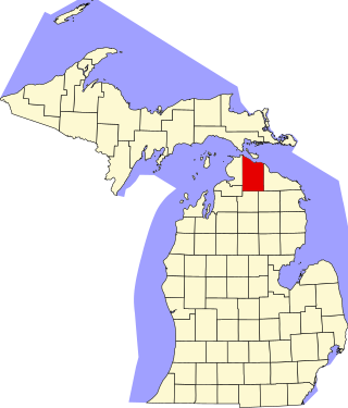
This is a list of the National Register of Historic Places listings in Cheboygan County, Michigan.

The following is a list of Registered Historic Places in Ottawa County, Michigan.
     This National Park Service list is complete through NPS recent listings posted May 10, 2024.

<span class="mw-page-title-main">National Register of Historic Places listings in Genesee County, New York</span>

List of the National Register of Historic Places listings in Genesee County, New York

<span class="mw-page-title-main">National Register of Historic Places listings in Lewis County, New York</span>

List of the National Register of Historic Places listings in Lewis County, New York

<span class="mw-page-title-main">National Register of Historic Places listings in Niagara County, New York</span>

This is a list of the National Register of Historic Places listings in Erie County, New York.

<span class="mw-page-title-main">National Register of Historic Places listings in Ontario County, New York</span>

List of the National Register of Historic Places listings in Ontario County, New York

<span class="mw-page-title-main">National Register of Historic Places listings in Schuyler County, New York</span>

List of the National Register of Historic Places listings in Schuyler County, New York

<span class="mw-page-title-main">National Register of Historic Places listings in Seneca County, New York</span>

List of Registered Historic Places in Seneca County, New York

<span class="mw-page-title-main">National Register of Historic Places listings in Washington County, New York</span>

List of the National Register of Historic Places listings in Washington County, New York

<span class="mw-page-title-main">National Register of Historic Places listings in Tompkins County, New York</span>

List of the National Register of Historic Places listings in Tompkins County, New York

<span class="mw-page-title-main">National Register of Historic Places listings in Madison County, New York</span>

List of the National Register of Historic Places listings in Madison County, New York

<span class="mw-page-title-main">National Register of Historic Places listings in Somerville, Massachusetts</span>

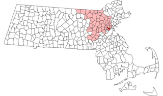
This is a list of properties and historic districts in Somerville, Massachusetts, that have been listed on the National Register of Historic Places.

This is a list of properties and historic districts in Wakefield, Massachusetts, that are listed on the National Register of Historic Places.

This is a list of properties and historic districts in Waltham, Massachusetts, that are listed on the National Register of Historic Places.

This is a list of properties and historic districts listed on the National Register of Historic Places in Sherborn, Massachusetts.

<span class="mw-page-title-main">National Register of Historic Places listings in Frederick County, Maryland</span>

This is a list of the National Register of Historic Places listings in Frederick County, Maryland.

References

  1. "National Register Information System". National Register of Historic Places . National Park Service. July 9, 2010.