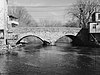
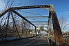
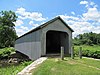
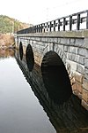
This is a list of bridges and tunnels on the National Register of Historic Places in the U.S. state of Massachusetts. [1]
This is a list of bridges and tunnels on the National Register of Historic Places in the U.S. state of Massachusetts. [1]
The National Register of Historic Places (NRHP) is the United States federal government's official list of districts, sites, buildings, structures, and objects deemed worthy of preservation for their historical significance or "great artistic value". A property listed in the National Register, or located within a National Register Historic District, may qualify for tax incentives derived from the total value of expenses incurred in preserving the property.
This is a list of properties and historic districts that are listed on the National Register of Historic Places (NRHP) in Puerto Rico. There are 368 NRHP listings in Puerto Rico, with one or more NRHP listings in each of Puerto Rico's 78 municipalities.

This is a list of sites in Minnesota which are included in the National Register of Historic Places. There are more than 1,700 properties and historic districts listed on the NRHP; each of Minnesota's 87 counties has at least 2 listings. Twenty-two sites are also National Historic Landmarks.

There are more than 1,800 properties and districts listed on the National Register of Historic Places in Florida. They are distributed through 66 of the state's 67 counties. Of these, 42 are National Historic Landmarks.
This National Park Service list is complete through NPS recent listings posted August 4, 2023.

Buildings, sites, districts, and objects in California listed on the National Register of Historic Places:
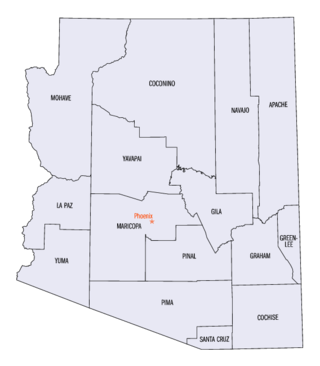
This is a directory of properties and districts listed on the National Register of Historic Places in Arizona. There are about fourteen hundred listed sites in the state, and each of its fifteen counties has at least ten listings on the National Register. Forty-seven of the state's sites are further designated as National Historic Landmarks.
This is a list of properties and districts listed on the National Register of Historic Places in Alaska. There are approximately 400 listed sites in Alaska. Each of the state's 30 boroughs and census areas has at least two listings on the National Register, except for the Kusilvak Census Area, which has none.

This is a list of properties and historic districts in Arkansas that are listed on the National Register of Historic Places. There are more than 2,600 listings in the state, including at least 8 listings in each of Arkansas's 75 counties.

This is a list of properties and districts in Illinois that are on the National Register of Historic Places. There are over 1,900 in total. Of these, 85 are National Historic Landmarks. There are listings in all of the state's 102 counties.
This National Park Service list is complete through NPS recent listings posted August 4, 2023.

This is a list of properties and districts in Indiana that are listed on the National Register of Historic Places. There are over 1,900 in total. Of these, 39 are National Historic Landmarks. Each of Indiana's 92 counties has at least two listings.

There are approximately 1,600 properties and districts listed on the National Register of Historic Places in the U.S. State of Maine. Each of the state's 16 counties has more than forty listings on the National Register.
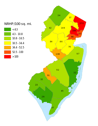
This is a list of properties and districts listed on the National Register of Historic Places in New Jersey. There are more than 1,700 listed sites in New Jersey. Of these, 58 are further designated as National Historic Landmarks. All 21 counties in New Jersey have listings on the National Register.
This National Park Service list is complete through NPS recent listings posted August 4, 2023.

This is a directory of properties and districts listed on the National Register of Historic Places in New Hampshire. There are more than 800 listed sites in New Hampshire. Each of the 10 counties in New Hampshire has at least 30 listings on the National Register.
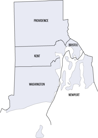
This is a list of properties and districts listed on the National Register of Historic Places in Rhode Island. As of May 29, 2015, there are more than 750 listed sites in Rhode Island. All 5 of the counties in Rhode Island have listings on the National Register.
This is a list of properties on the National Register of Historic Places in the U.S. state of Vermont.

List of the National Register of Historic Places listings in Franklin County, New York
There are 577 properties and districts listed on the National Register of Historic Places in New York County, New York, which consists of Manhattan Island, the Marble Hill neighborhood on the mainland north of the Harlem River Ship Canal, and adjacent smaller islands around it. One listing, appears on more than one of the lists described below.
The National Register of Historic Places listings in Syracuse, New York are described below. There are 116 listed properties and districts in the city of Syracuse, including 19 business or public buildings, 13 historic districts, 6 churches, four school or university buildings, three parks, six apartment buildings, and 43 houses. Twenty-nine of the listed houses were designed by architect Ward Wellington Ward; 25 of these were listed as a group in 1996.
| Topics |  | ||||||||||||||||
|---|---|---|---|---|---|---|---|---|---|---|---|---|---|---|---|---|---|
| Lists by county | |||||||||||||||||
| Lists by city |
| ||||||||||||||||
| Other lists | |||||||||||||||||