List of bridges on the National Register of Historic Places in Wisconsin

Last updated

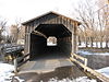
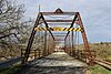
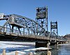
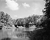
This is a list of bridges and tunnels on the National Register of Historic Places in the U.S. state of Wisconsin. [1]

NameImageBuiltListedLocationCountyType
Armstrong Creek Bridge 2011-11-18 Armstrong Creek
45°38′29″N88°26′47″W / 45.64139°N 88.44639°W / 45.64139; -88.44639 (Armstrong Creek Bridge)
Forest
Barteau Bridge BarteauBridgeShioctonWisconsinWIS187.jpg 19062002-03-28 Bovina
44°27′56″N88°34′0″W / 44.46556°N 88.56667°W / 44.46556; -88.56667 (Barteau Bridge)
Outagamie Stone arch Bridge
Bridge No. 1 McGilvray Road Bridge No. 1, Van Loon Wildlife Area, La Crosse vicinity (La Crosse County, Wisconsin).jpg 1892, 19021980-02-27 La Crosse
44°1′15″N91°18′28″W / 44.02083°N 91.30778°W / 44.02083; -91.30778 (Bridge No. 1)
La Crosse Bowstring Arch Truss Bridge
Bridge No. 2 McGilvray Road Bridge No. 2, Van Loon Wildlife Area, La Crosse vicinity (La Crosse County, Wisconsin).jpg 1892, 19021980-02-27 La Crosse
44°1′16″N91°18′38″W / 44.02111°N 91.31056°W / 44.02111; -91.31056 (Bridge No. 2)
La Crosse Bowstring Arch Truss Bridge
Bridge No. 3 McGilvray Road Bridge No. 3, Van Loon Wildlife Area, La Crosse vicinity (La Crosse County, Wisconsin).jpg 18921980-02-27 La Crosse
44°1′17″N91°18′51″W / 44.02139°N 91.31417°W / 44.02139; -91.31417 (Bridge No. 3)
La Crosse Bowstring Arch Truss Bridge
Bridge No. 4 McGilvray Road Bridge No. 4, Van Loon Wildlife Area, La Crosse vicinity (La Crosse County, Wisconsin).jpg 1892, 19021980-02-27 La Crosse
44°1′24″N91°19′14″W / 44.02333°N 91.32056°W / 44.02333; -91.32056 (Bridge No. 4)
La Crosse Bowstring Arch Truss Bridge
Bridge No. 5 1892, 19021980-02-27 La Crosse
44°1′24″N91°19′44″W / 44.02333°N 91.32889°W / 44.02333; -91.32889 (Bridge No. 5)
La Crosse King post Bridge
Bridge No. 6 McGilvray Road Bridge No. 6, Van Loon Wildlife Area, La Crosse vicinity (La Crosse County, Wisconsin).jpg 1892, 19021980-02-27 La Crosse
44°1′27″N91°20′8″W / 44.02417°N 91.33556°W / 44.02417; -91.33556 (Bridge No. 6)
La Crosse Bowstring Arch Truss Bridge
Covered Bridge Covered Bridge, Cedarburg, Wisconsin - end view in 2008.JPG 18761973-03-14 Cedarburg (town)
43°20′16″N88°0′16″W / 43.33778°N 88.00444°W / 43.33778; -88.00444 (Covered Bridge)
Ozaukee latticed timber truss
Cunningham Lane Bridge 18951996-07-05 Rockbridge
43°23′40″N90°24′45″W / 43.39444°N 90.41250°W / 43.39444; -90.41250 (Cunningham Lane Bridge)
Richland Pratt full-slope pony truss
First Street Bridge First Street Bridge Merrill Wisconsin Top.jpg 19041996-09-12 Merrill
45°10′44″N89°42′12″W / 45.17889°N 89.70333°W / 45.17889; -89.70333 (First Street Bridge)
Lincoln stone-arch
Green Bay Road Bridge GreenBayRoadBridgeManitowocWisconsinUS141.jpg 18871998-08-03 Manitowoc Rapids
44°5′46″N87°42′6″W / 44.09611°N 87.70167°W / 44.09611; -87.70167 (Green Bay Road Bridge)
Manitowoc Pratt through truss
Manchester Street Bridge Manchester Street Bridge, Spanning Baraboo River on Manchester Street, Baraboo (Sauk County, Wisconsin).jpg 1884, 19871988-10-13 Baraboo
43°28′13″N89°45′21″W / 43.47028°N 89.75583°W / 43.47028; -89.75583 (Manchester Street Bridge)
Sauk Camelback through truss
Marsh Rainbow Arch Bridge Aka Spring Street Bridge.JPG 19161982-06-25 Chippewa Falls
44°56′11″N91°23′26″W / 44.93639°N 91.39056°W / 44.93639; -91.39056 (Marsh Rainbow Arch Bridge)
Chippewa
Smyth Road Bridge Smyth Road Bridge.jpg 19281996-09-12 Lakewood
45°18′54″N88°24′54″W / 45.31500°N 88.41500°W / 45.31500; -88.41500 (Smyth Road Bridge)
Oconto overhead pratt truss
Soo Line High Bridge Soo Line High Bridge 7.jpg 1910, 19111977-08-22 Somerset St. Croix Five Arch Span
Sprague Bridge Sprague Bridge, Over Yellow River between Armenia & Necedah, Armenia & Necedah (Juneau County, Wisconsin).jpg 19131995-01-23 Finley
44°11′11″N90°6′15″W / 44.18639°N 90.10417°W / 44.18639; -90.10417 (Sprague Bridge)
Juneau Pratt half-hip pony truss
Stillwater Bridge Stillwater Minnesota.jpg 19311989-05-25 Houlton
45°3′27″N92°48′0″W / 45.05750°N 92.80000°W / 45.05750; -92.80000 (Stillwater Bridge)
St. Croix Vertical lift bridge
Sturgeon Bay Bridge Sturgeon Bay Bridge.jpg 19312008-01-17 Sturgeon Bay
44°49′55″N87°22′52″W / 44.83194°N 87.38111°W / 44.83194; -87.38111 (Sturgeon Bay Bridge)
Door Truss bridge with bascule drawspan
Tayco Street Bridge 1928, 19291986-05-30 Menasha
44°11′54″N88°27′9″W / 44.19833°N 88.45250°W / 44.19833; -88.45250 (Tayco Street Bridge)
Winnebago Strauss Trunion Bascule
Third Street Bridge 18991988-09-21 Menomonee Falls
43°10′55″N88°6′52″W / 43.18194°N 88.11444°W / 43.18194; -88.11444 (Third Street Bridge)
Waukesha Stone Arch Bridge
Turtleville Iron Bridge Turtleville Iron Bridge, Spanning Turtle Creek, on Lathers Road, Beloit vicinity (Rock County, Wisconsin).jpg 18871977-09-15 Beloit
42°33′56″N88°57′52″W / 42.56556°N 88.96444°W / 42.56556; -88.96444 (Turtleville Iron Bridge)
Rock Pratt Truss Design
Upper Twin Falls Bridge Upper Twin Falls Bridge 1911.jpg 2012-12-12 Florence
45°52′39″N88°04′43″W / 45.87750°N 88.07861°W / 45.87750; -88.07861 (Upper Twin Falls Bridge)
Florence
Wakely Road Bridge 18922001-04-05 Saratoga
44°18′0″N89°53′19″W / 44.30000°N 89.88861°W / 44.30000; -89.88861 (Wakely Road Bridge)
Wood stone arch bridge
Grand Avenue Bridge Grand Avenue Bridge, Spanning O'Neil Creek at Grand Avenue, Neillsville (Clark County, Wisconsin).jpg 1894
removed 1987-02-18
Neillsville Clark Overhead Pratt Truss
Leedle Mill Truss Bridge Leedle Mill Truss Bridge.jpg ca. 19161980-09-17
removed 2013-1-9
Evansville
42°50′37″N89°15′8″W / 42.84361°N 89.25222°W / 42.84361; -89.25222 (Leedle Mill Truss Bridge)
Rock Pratt Truss
Second Street Bridge
removed 1987-05-18
Galesville Trempealeau
Sock Road Bridge Sock Road Bridge, Spanning Beaver Dam River, Lowell (Dodge County, Wisconsin).jpg 1893
removed 1982-03-04
Lowell Dodge Pinned Pratt truss

Related Research Articles

This is a list of properties and districts in Mississippi that are listed on the National Register of Historic Places. There are more than 1,400 sites distributed among all of Mississippi's 82 counties.

<span class="mw-page-title-main">National Register of Historic Places listings in Rhode Island</span>

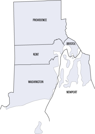
This is a list of properties and districts listed on the National Register of Historic Places in Rhode Island. As of May 29, 2015, there are more than 750 listed sites in Rhode Island. All 5 of the counties in Rhode Island have listings on the National Register.

The following is a list of Registered Historic Places in Midland County, Michigan.
     This National Park Service list is complete through NPS recent listings posted May 10, 2024.

<span class="mw-page-title-main">National Register of Historic Places listings in Lincoln County, Wisconsin</span>

This is a list of the National Register of Historic Places listings in Lincoln County, Wisconsin. It is intended to provide a comprehensive listing of entries in the National Register of Historic Places that are located in Lincoln County, Wisconsin. The locations of National Register properties for which the latitude and longitude coordinates are included below may be seen in a map.

<span class="mw-page-title-main">National Register of Historic Places listings in Juneau County, Wisconsin</span>

This is a list of the National Register of Historic Places listings in Juneau County, Wisconsin. It is intended to provide a comprehensive listing of entries in the National Register of Historic Places that are located in Juneau County, Wisconsin. The locations of National Register properties for which the latitude and longitude coordinates are included below may be seen in a map.

References

  1. "National Register Information System". National Register of Historic Places . National Park Service. July 9, 2010.